
Elidir Trail walk guide including how to reach Sgwd Einion Gam

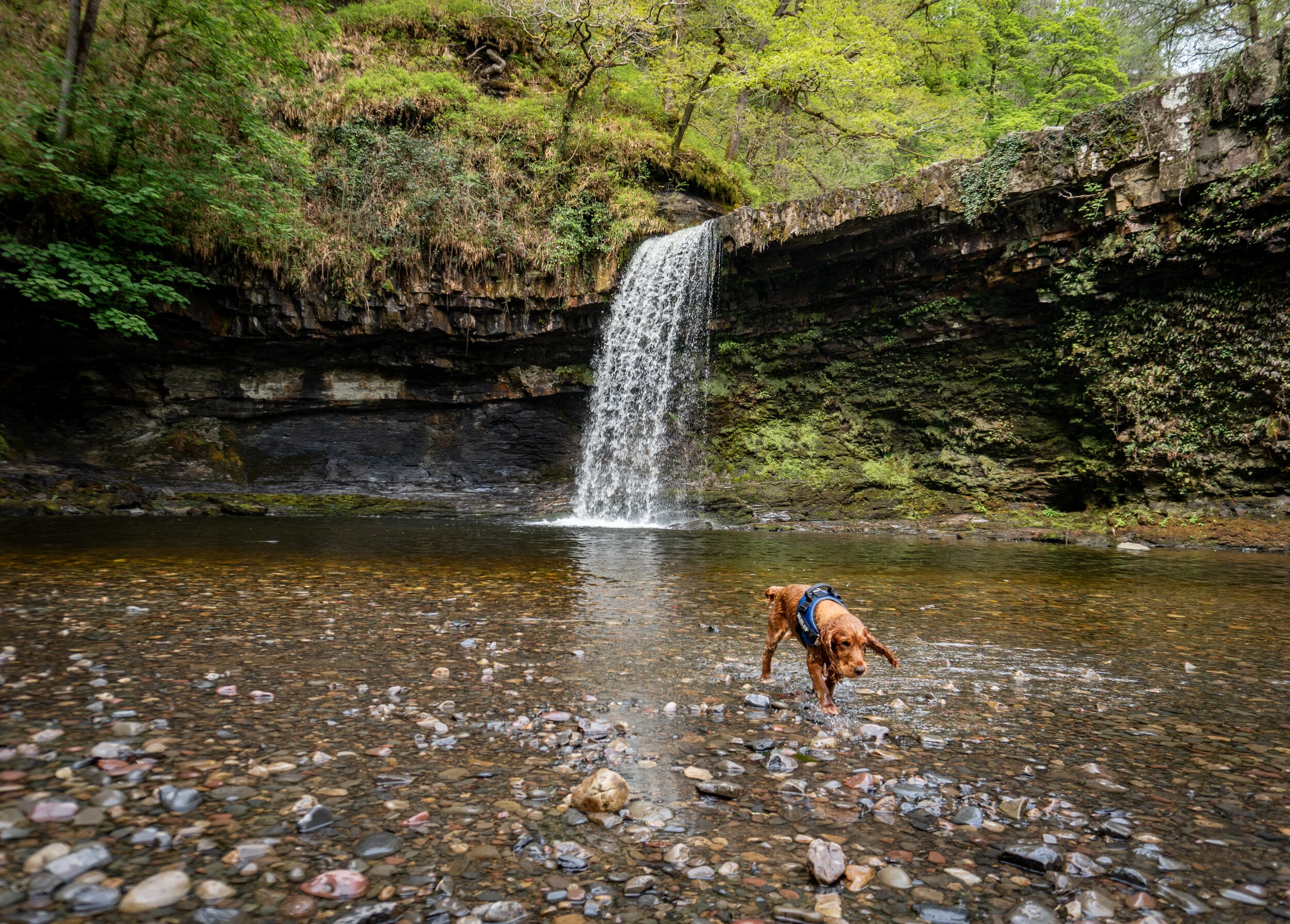
The 70ft Sgwd Einion Gam, aka ‘the fall of the crooked anvil’, is the second-highest waterfall in South Wales and is located deep in the heart of Waterfall Country.
Its imposing and encircling cliffs and lower set of falls make this waterfall one of the most impressive and mysterious within the Brecon Beacons.
Many don’t know this waterfall actually exists despite it being located half a mile upstream from the extremely popular Sgwd Gwaldys, which is part of the Elidir trail, a majestical woodland walk in the heart of waterfall country.
Despite its short distance from its popular neighbour, reaching it is actually a bit of a mission. The trail virtually disappears shortly after Sgwd Gwaldus and alongside crossing the river several times you also have to navigate a precarious river bank.
In fact, the first time I attempted to find it I turned around as I wasn’t even sure this place actually existed.
So to help you avoid turning back I have written this detailed blog which firstly outlines the Elidir Trail and secondly gives you a detailed description on how to reach the magical Sgwd Einion Gam.
The reward for trekking onwards to find this spot will hopefully be that you have this majestic waterfall all to yourself which will be the polar opposite from Sgwd Gwladys.
Key Information
Hike distance: 4.6 miles
Hike Difficulty: Easy/Moderate
Hike duration: 2-3 hours
Elevation gain: 235m
Car park and start point: Waterfall Centre Pontneddfechan
What Three Words: drag.sponge.depth
Where to park for the Elidir Trail
Free parking is available in Pontneddfechan.
There are numerous places to park in the village with the most obvious being in the purpose built laybys on the side of Pontneathvaughan Rd, in front of the Angel Hotel.
Although there’s plenty of places to park, spaces do fill up quickly in the busy summer months.
The Elidir Trail Route
From the Angel Inn head through the metal gate branded with the words Waterfall country.
From there follow the wide path which runs on the left hand side of the river Afon Nedd upstream. After 2km you will reach a wooden footbridge where the Afon Pyrddin joins the Afon Nedd Fechan.
Once you cross over the bridge to the north bank of the river you have two choices.
If you head left you will quickly reach Sgwd Gwladus in less than five minutes.
However because the route is an out and back walk, I would recommend heading right and following the river upstream, visiting the other three waterfalls first.
This is because you can finish your walk at Sgwd Gwladus, or if you plan on extending the walk, Sgwd Einion Gam.
These are two of the most impressive waterfalls and would be based saved until last.
Waterfall #1 Sgwd-y-Bedol
After around 1km of following the well maintained path upstream from the wooden bridge you will reach Sgwd-y-Bedol.
Translated to The Horseshoe Falls, this is a small (2m) but wide set of double falls located next to a small wooden footbridge. Looking back upstream you can see Sgwd Ddwli Isaf in the background.
You can also go swimming the deep plunge pool which sits beneath the lower section of the falls.
From the viewpoint in front of the falls continue upstream cross over the wooden footbridge and view the falls from the rocky ledge in front of them.

Waterfall #2 Sgwd Ddwli Isaf
Translated to ‘lower gushing falls’, you will first see this waterfall from in front of Sgwd-y-Bedol.
Now if you can I would recommend trying to reach the waterfalls base.
Caution is advised as the river bed is extremely slippery especially if it has been raining Honestly its fractured hip or broken arm waiting to happen.
To reach the waterfalls base follow the rocky riverbed upstream, Trying to hug the tree lined riverbank as much as you can.
To re-join the path from the base of Sgwd Ddwli Isaf, head back down stream towards Sgwd-y-Bedol and either clamber up the left hand side of the river bank, or walk all the way back to the wooden footbridge.
Once back on the path, the route steadily climbs for around 200m before flattening off. After around 700m you will reach the highest waterfall on the Elidir Trail.

Waterfall #3 Sgwd Ddwli Uchaf
Translated to ‘Upper gushing falls’, this waterfall is wider than it is tall, falling five meters in a beautiful curtain-like fashion.
You’ll first approach the waterfall from below, however you can climb up and view the waterfall from the ledge above. To reach the top you can either climb up the rocky bank to the left of the waterfall or double back on yourself and follow the upper trail.
Again you can go swimming in the plunge pool beneath this waterfall. As it is the quietest of the waterfalls (aside from Sgwd Einion Gam) this would be my choice of swimming location if was looking for privacy.
This is the highest waterfall on the Elidir trail and continuing upstream will only take you to the car park at Pont Melin Fach.
From Sgwd Ddwli Uchaf turn around and retrace your route back downstream for 2km to the initial wooden footbridge.

Waterfall #4 Sgwd Gwladys
Once back at the wooden footbridge where the Afon Pyrddin joins the Afon Nedd Fechan, do not cross back over it.
Instead stay on the north bank of the river and follow the path upstream as it bends round to the right, sticking to the right-hand river bank for around 300m until you reach the base of Sgwd Gwladys.
The white lady falls is a spectacular cascade of water which flows 10m over a lip of sandstone.
As well as being able to peer over the edge of the sandstone lip, you are able to walk behind the waterfall but you do run the risk of slipping and falling in.
You can also go swimming beneath the falls, however, whatever you don’t jump off the lip into the water. People have been airlifted away from the site after injuring themselves attempting to tombstone off the edge.
The water depth and what's beneath it is constantly changing, with all the fallen trees and deforestation in the area there could easily be a large branch lurking beneath the water.
The reason why I have advised you to visit this waterfall last is because it is not only the most impressive of the four waterfalls on the Elidir Trail. But because it is also the start location of an optional walk extension to find the elusive Sgwd Einion Gam
How to reach Waterfall #5 - Sgwd Einion Gam

From the sandstone lip of Sgwd Gwladys follow the river upstream, sticking to the right of the bank. There will be a clear path to begin with which ventures slightly away from the river at times.
After about 300 meter t you will reach a large overhanging cliff face which will prevent you from continuing on the right-hand side of the river.
This cliff face signals the first river crossing. There is no designated place to cross so you will have to use your own judgement to find the shallowest and safest route which may require walking back downstream.

The first crossing point marked by the cliffs directly ahead. I was lucky this day that the water levels were so low.
Upon reaching the other side, either continue to follow the riverbank upstream as it curves around the corner or cut through the woodland.
Either way you will quickly reach another rocky cliff face which will force you to cross the river.
Again there is no designated place to cross so it’s down to your own judgement. I would recommned picking up two large sticks and using them as walking poles to help with balance.
Once across the river, follow the faint path into the woodland as it ventures slightly away from the river bank. After about 100m the path will begin to rise, continue to follow the precarious goat-like track up and alongside the right-hand bank of the river, taking care on the narrow and sloping sections.
Once navigated and down the other side, Sgwd Einion Gam should have come into view. From here continue to weave and climb your way along the river bank for around 150m until you reach the set of lower falls.

To access the main falls you will have to scramble up the muddy bank to the right of the lower falls then follow the path down back towards them. You will then be able to walk up to the pool of the main falls on the right-hand side of the river.
Unfortunately, due to the sheer cliff face that surrounds the waterfall, there is no way to access the top of the falls. In order to see the falls from above you would have to take a completely separate route starting from the upper access point.
Take your time to enjoy the falls before retracing your steps back to Sgwd Gwaldys and then back up to the car park.
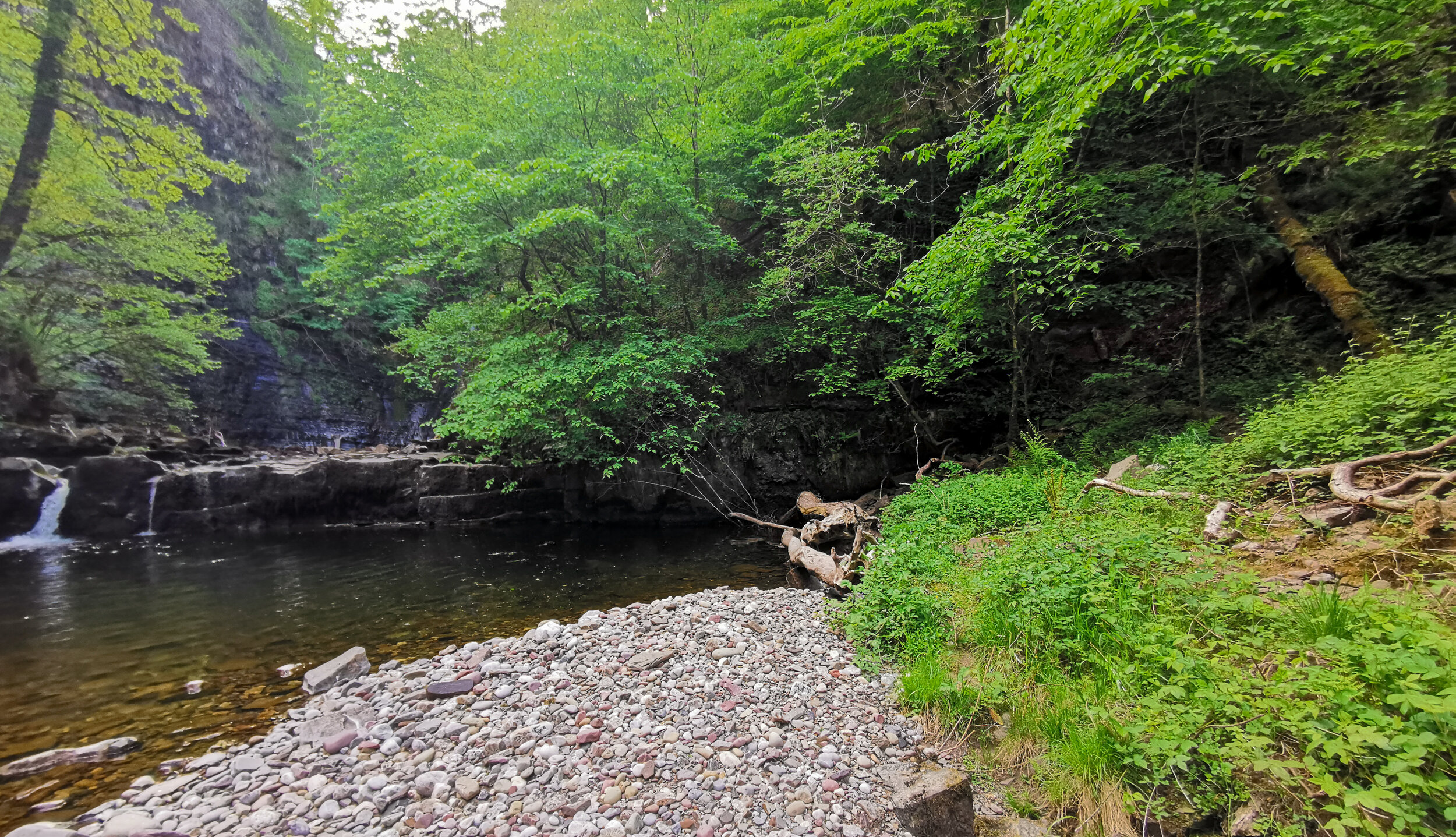
The bank you have to clamber up to reach the base of the waterfall is just to the left of the fallen tree (far right of the image)

Find me on Instagram


Help support my website
So there we have it, my guide to the Elidir Trail. Did you find the blog useful and will you be wanting to tackle this hike in the future? Let me know your thoughts in the comments below.
I created and run this website in order to help inform, amaze, inspire people (for free) to get outside and explore the adventurous side of the UK.
Although I do run some google ads, I have limited them in order to make your experience on this website far more enjoyable.
If you’d like to support this website, you can use the affiliate links below to book your accommodation or transport. These come at no extra cost to you, but help keep this site running.
Book your vehicle using Discover Cars
Book your accommodation using Booking.com and Sykes Cottages
If you are feeling generous you can also Buy me a Coffee to say thank you, and give me a follow on social media.
Thank you, and if you have any questions, leave them in the comments below or drop me an email!
For more hiking inspiration check out my other guides to the Brecon Beacons below.
Central Brecon Beacons
Western Brecon Beacons
Waterfall Country
Eastern Brecon Beacons
You can find more Welsh hiking inspiration in the following blogs
For more travel, & photography inspiration around Wales check out my in-depth guides to each of my favourite regions below.