
Hiking the Welsh 3000s | A solo attempt at Wales’ toughest day hike

Within this blog post I recount my successful second attempt of the Welsh 3000s challenge.
After a failed attempt in 2021, where I pulled the plug on the side of the A5 in the Ogwen valley, I was back with a clean slate and unwavering determination
My attempt was undertaken solo on the 28th August 2022, setting off from the Pen-y-pass at 4:30am with my wonderful partner and dog providing support.
I started on Crib Goch and despite vlogging the entirety of the challenge, I still managed to complete the 42.67km route in a respectable 14 hours 42 minutes.
However after factoring in the hike in and out, I had walked over 50km in just over 17 hours!
I will clarify that this is not a guide to the Welsh 3000s, but more of a recount of my journey and the experience of the challenge.
That being said there are details and key information on the sections of route I took. In addition to help those with navigation I have also included hyperlinks to the What Three Words locations of key landmarks or places.
If you are looking for a detailed guide to the Welsh 3000s, I have written a separate blog post outlining what the challenge is, how to prepare for it, and hopefully complete it.

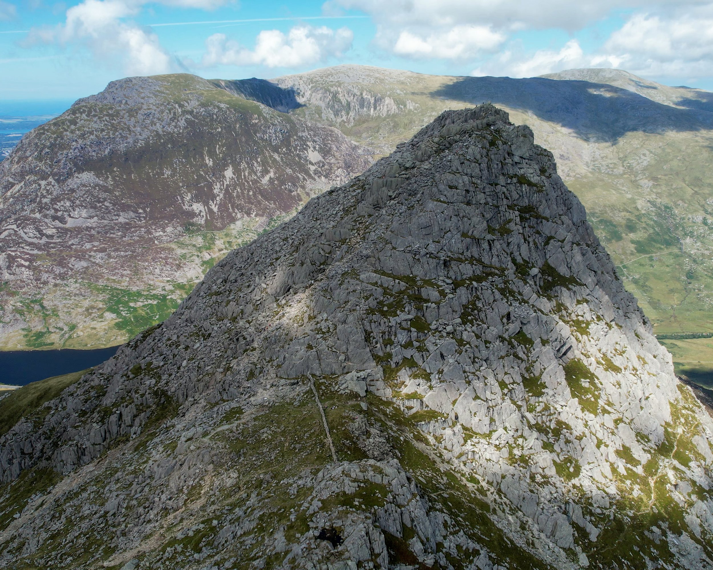
A drone panorama of the Glyderau
Context and Introduction
After a failed attempt in 2021, I had been eying up the Welsh 3000s challenge all summer, waiting patiently for the right weather window which matched up with both mine and my partners line of work.
Originally I had planning to do it with a friend who lived in London, however the effort of getting up to Snowdonia from London was too much hassle so he pulled the plug the weekend before the attempt.
In a way I’m glad he did.
Although I would have preferred to have tackled it with him, we were planning a one car strategy. This would have been a logistical nightmare involving trying booking two nights’ accommodation for an August Bank holiday last minute alongside trying to sort a taxi back to our car.
Instead my partner agreed to come and support me, and alongside the challenge we would spend the bank holiday exploring the Llyn Peninsula.
I had initially planned to take on the Welsh 3,000s on Friday 27th August to avoid the bank holiday crowds and was monitoring the weather forecast throughout the week on MWIS and the Met Office.
At the start of the week the predicted forecast for Friday was sunshine. However the fickle nature of the mountains meant that it quickly changed to a bank of low cloud, patches of rain, and 40% of visibility on the summits.
With the weather looking significantly better on the Saturday (an 80% chance of cloud free summits) and having the flexibility of being in North Wales until Sunday, I pushed the challenge back a day.
And boy I’m glad I did.
We made the four hour drive up from Swansea on Thursday afternoon and spent the night in our VW Transporter at Trefor Sea stacks.
We awoke in the morning to a persistent drizzle which continued until mid-day, alongside a bank of low cloud which covered the peaks until later that evening.
After a day exploring the Llyn peninsula (which I’d thoroughly recommend) we headed into Snowdonia, had a delightful evening meal at the Bryn Tyrch Inn and settled down for the night in the van.
We parked in a small layby off the A4086 between Moel Siabod and the Glyders.
Having stayed there before, I knew it was very quiet and only a five minute drive to the start point of the challenge at the Pen-y-Pass.

The 4:30am start
After a relatively good five and a half hours sleep, the alarm went off just before 4am.
With my bag all packed and ready, I got changed, ate a breakfast of overnight oats and a banana, drunk 750ml of electrolytes, cleaned my teeth and I was ready to go.
My partner dropped me off at the Pen-y-pass at 4:20am and after trying to force out a nervous poo to no avail, I set off up the Pyg Track at 4:25am.
it’s a 3km hike which involves 540m of elevation gain from the Pen-y-pass to the start of the Crib Goch ridge. With sunrise at 6:15am, I had aimed to be up there shortly before 6am to catch sunrise from the ridge.
The pace was steady but nothing silly, it was a marathon not a sprint and didn’t want to pay the price later-on in the challenge.
15 minutes into the hike I was caught up by a lad named Joe, after a good chin wag we joined forces making the scramble up to Crib together.
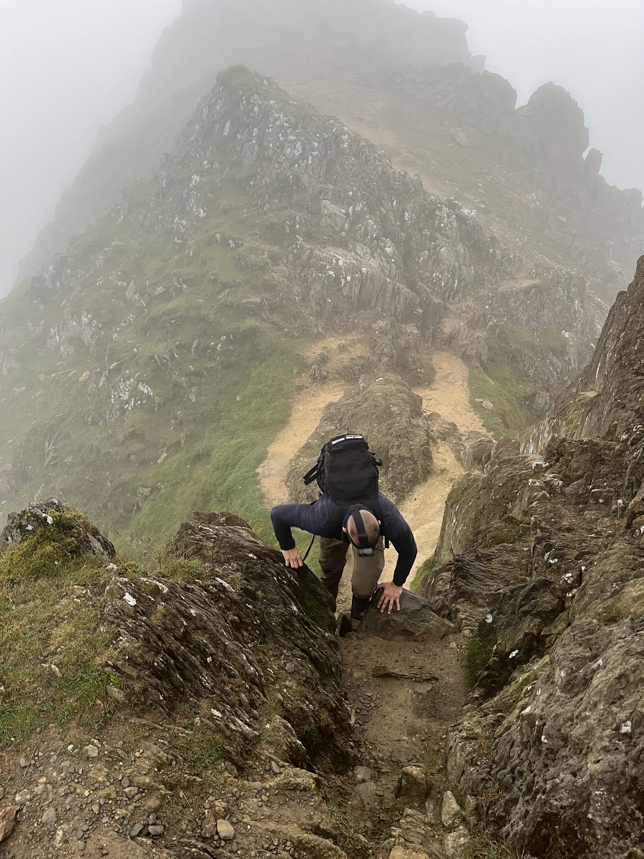
Despite the darkness, visibility was very good until we got two thirds of the way up Crib Goch. Within an instant a bank of cloud rolled in and visibility was reduced to about 20m.
Feeling good we cracked on at a steady pace reached the ridge shortly before 5:30am.
The Pyg Track
5:30am - Peak 1, Crib Goch, 3028ft
At this point I was 30 minutes ahead of my planned schedule.
We had a quick 5-minute break on the summit, during which I put on my waterproof coat and a gobbled down a cliff bar.
Visibility was still at 20m and with no sign of the clouds lifting to reveal the epic sunrise I had hoped for, we saw no point on hanging around and began the traverse of the ridge.
Having hiked Crib Goch six times, including in very poor visibility, the combination of darkness and cloud cover didn’t bother me in the slightest.
The main thing was that ridge was dry and there was very little wind. Illuminated by my headtorch, I focused on the ridge itself, rather than the non existent views and the deadly drop to my right-hand side.
After around 100m of scrambling we reached the highest point of the ridge. This indicated the first peak and the start of my challenge.
I started my Garmin and the journey officially began.

Crib Goch in all its glory

Ascending Crib on my failed attempt 2021
6:20am - Peak 2, Garnedd Ugain, 3494ft
Although the light improved, the poor visibility persisted all the way to Garnedd Ugain.
Joe and I stuck together and he even helped me film some of the sections of the ridge for my vlog which I was very grateful for.
We hit the second peak at 6:20am and after a quick selfie we dropped down to the saddle where the paths leading up to Snowdon converge.
It was here were the clouds bean to clear and Wales highest peak mysteriously revealed itself in magician like fashion.
I’ve hiked this mountain on countless occasion but its sheer magnitude and sensational views never ceases to amaze me.
Climbing Garnedd Ugain
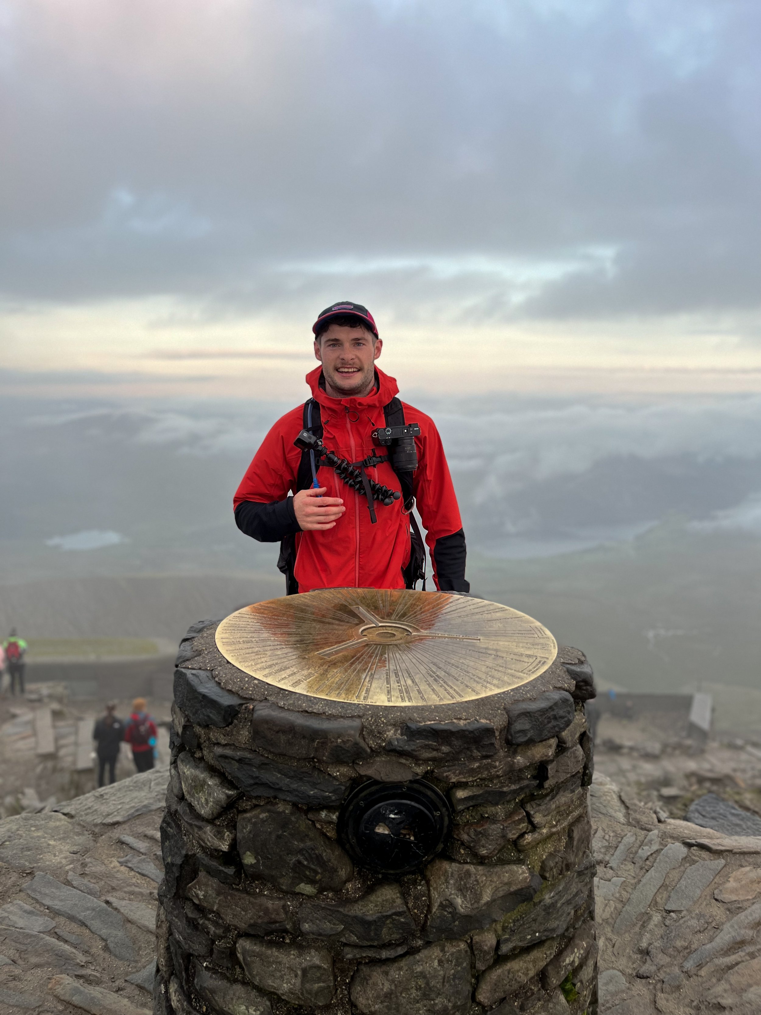
6:40am - Peak 3, Snowdon, 3,559ft
Passing the confluence of trails, the flow of early morning walkers was steady, but the summit of Wales highest mountain was surprisingly quiet for a bank holiday Saturday.
There were only around 20 people on the summit at any one time, which was a stark contrast to the 70 people who were up there at 4:30am when I tackled the Welsh 3 peaks challenge in July.
After a short two-minute queue at the summit, me and Joe got our photos before stopping for a 20 minute break.
In this time I saw off a banana and pack of Haribo before sticking the drone up to capture some moody shots of the Snowdon massif enveloped in cloud.
The drone revealed that the remainder of my route was completely covered in cloud. Although an ominous sign, I didn’t panic as I was confident that it would burn off as the day progressed.


7:00am - The descent to Nant peris
Me and Joe parted ways and I began descending through the mist, initially following the railway line before branching off and following what I thought was the Llanberis path…
With my focus on capturing the majestical cloud covered mountains for my vlog, I quickly realised that I was actually descending the Ranger path down to the opposite side of the mountain.
Fortunately I hadn’t strayed too far and after a brief 5-minute re-tour I was back on the railway track.
*If taking this route, don’t make the mistake I made and simply descend alongside the railway line from the summit*
After passing Clogwyn and the Rocky Valley stations stops, I branched off the tracks and continued straight on towards the ridgeline.
Following the faint path which an alongside the wire fence for several hundred meters, I eventually reached a wooden stile which indicated the start of my descent down to Nant Peris.

Looking back up the ridgeline towards Snowdon
After 200m of descending down the very steep but obvious trail, the path became faint and hard to follow.
When taking this route 2021, I headed diagonally back towards the Pen-y-Pass before climbing down the remnants of a former stream.
On this occasion I simply zig zagged my way straight down towards the slate wall which sat in the valley below.
Because of the steepness of the slope and the damp grass I actually found it quicker and easier to slide down on my arse. However this bum sledding left me with a nasty graze and a soaking pair of shorts.
Once at the stone wall, the gradient eased significantly and I was back up on two feet. After crossing the stile, I descended diagonally down to a second path, crossing another stile over a stone wall before following the path as it drops down to a stone bridge which crosses the river.

The initial descent towards Nant Peris
Looking towards Elidir Fawr on the rather steep descent down to Nant Peris
8:20am - Pitstop in Nant peris
Three hours and 9km into the challenge the first mountain range was completed.
Despite being 40 minutes ahead of my planned schedule my partner was already stationed up and cooking me some breakfast. What a wonderful woman.
I had planned a 20-30 minute stop but instead of rushing took my time.
I changed the entirety of my lower half which were soaked from the descent before smashing two sausage and egg baps, and refilling my supplies.
I was surprised to find out I had only drunk half of my 1.5 litres of water which I took up Snowdon, despite this I only drank a little bit of water before filling my hydro pack back up to its 2litre capacity and adding some carb powder.
Not consuming any extra fluid at Nant peris was probably the only mistake I made across the challenge and one that nearly proved costly, as I will go onto explain!

Peachy
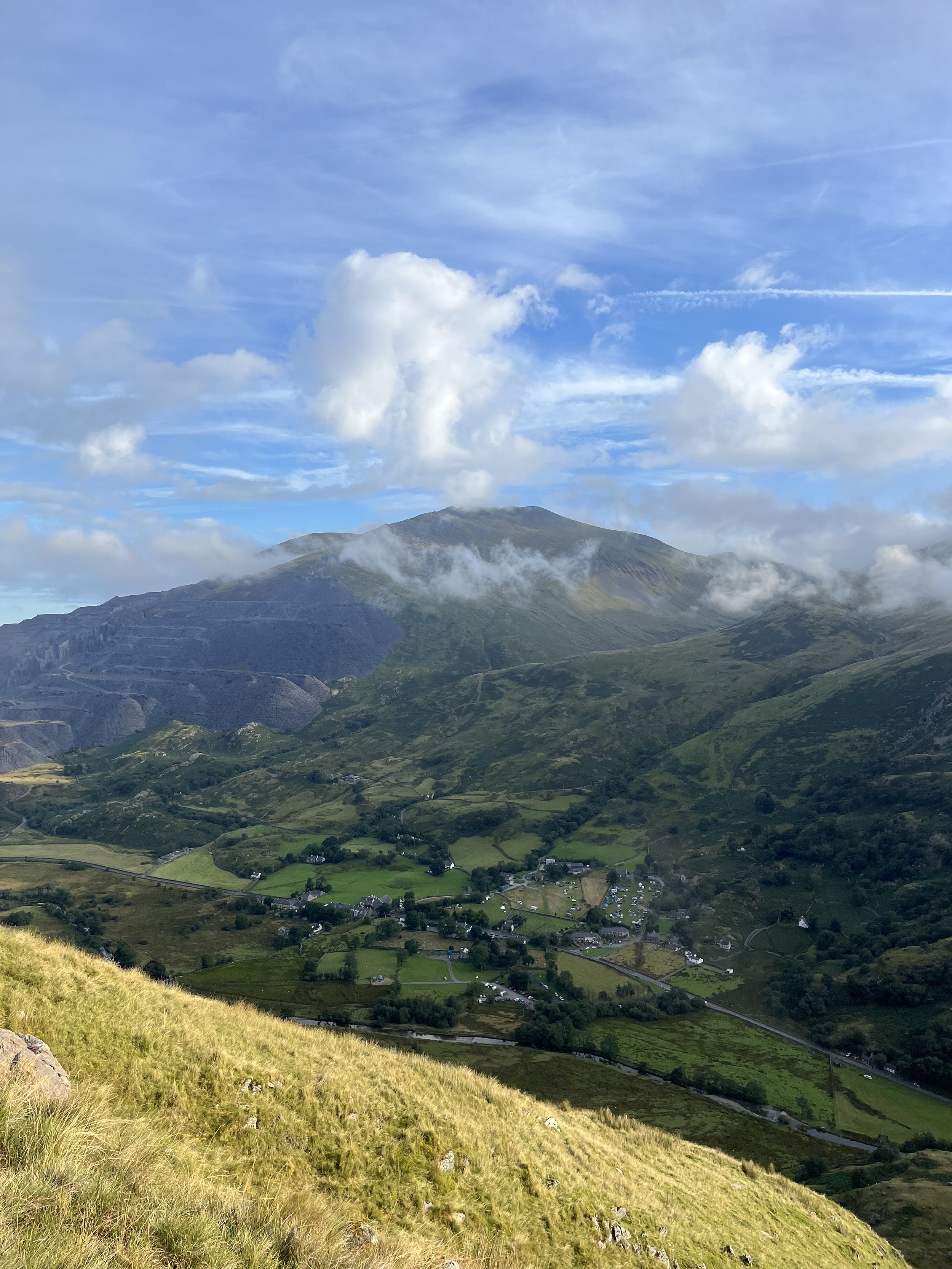
9:05am - Ascent up Elidir Fawr
After a 45 minute stop I was back on my way despite being full to the brim with sausages.
There’s no beating around the bush, Elidir Fawr is a bastard of a climb.
A steep grassy wall with no rest bite, the path climbs relentlessly for 800m over 3.5km.
To add insult to injury the majority of the route is constantly in view, so the nature of the beast just stares you down for the duration of the climb.
From Nant Peris the route initially follows a road past t Tŷ Isaf Campsite, a place where you can refill water, for 700m before branching off onto the trail. After a further 800m you’ll cross a wooden footbridge over the Afon Dudodyn before beginning the final 2km slog to the summit.
After crossing the bridge I had two trail runners, who I found out were also tackling the 3,000s, around 50m behind me. They power walked the climb but in my competitive and stubborn nature I refused to let them catch up with me.
This was a bit of a mistake as the sun was out and beating down in full force. I sweated profusely and having not taken on much water at Nant peris, I ended up pillaging over half of my water supplies.


10:30am- Peak 4, Elidir Fawr, 3031ft
After 80 minutes of slog I reached the summit ahead of the trail runners.
Upon arrival the views were terrific, but within two minutes a bank of cloud rolled in and smothered the summit.
My back and head were wetter than an otters pocket so I threw on my waterproof to keep the body temperature up. I consumed a snickers, a Welsh cake and an energy gel, before hanging about waiting for the cloud to clear to capture some drone footage.
10 minutes tuned into 25 and after some distinctly average footage which was impeded by low cloud, I pushed on towards Y Garn.

Frustrated by the time wasted on the summit of Elidir Fawr, I decided to get a bit of a plod on down the gentle descent which follows the ridge south towards Y Garn.
The path splits shortly after swinging south, take the higher of the two tracks but don’t make the mistake of making the steep climb up to Foel Goch as it isn’t one of the Welsh 3000s
After passing the lonely stile which is no longer attached to a fence (I instinctively climbed over it during my first attempt of the 3,000s, much to the amusement of the others). I began the short but steep, zig zagging climb to Y Garn.
The path is loose underfoot and has several false summit which put a few dents into my morale back in 2021 when visibility was poor.

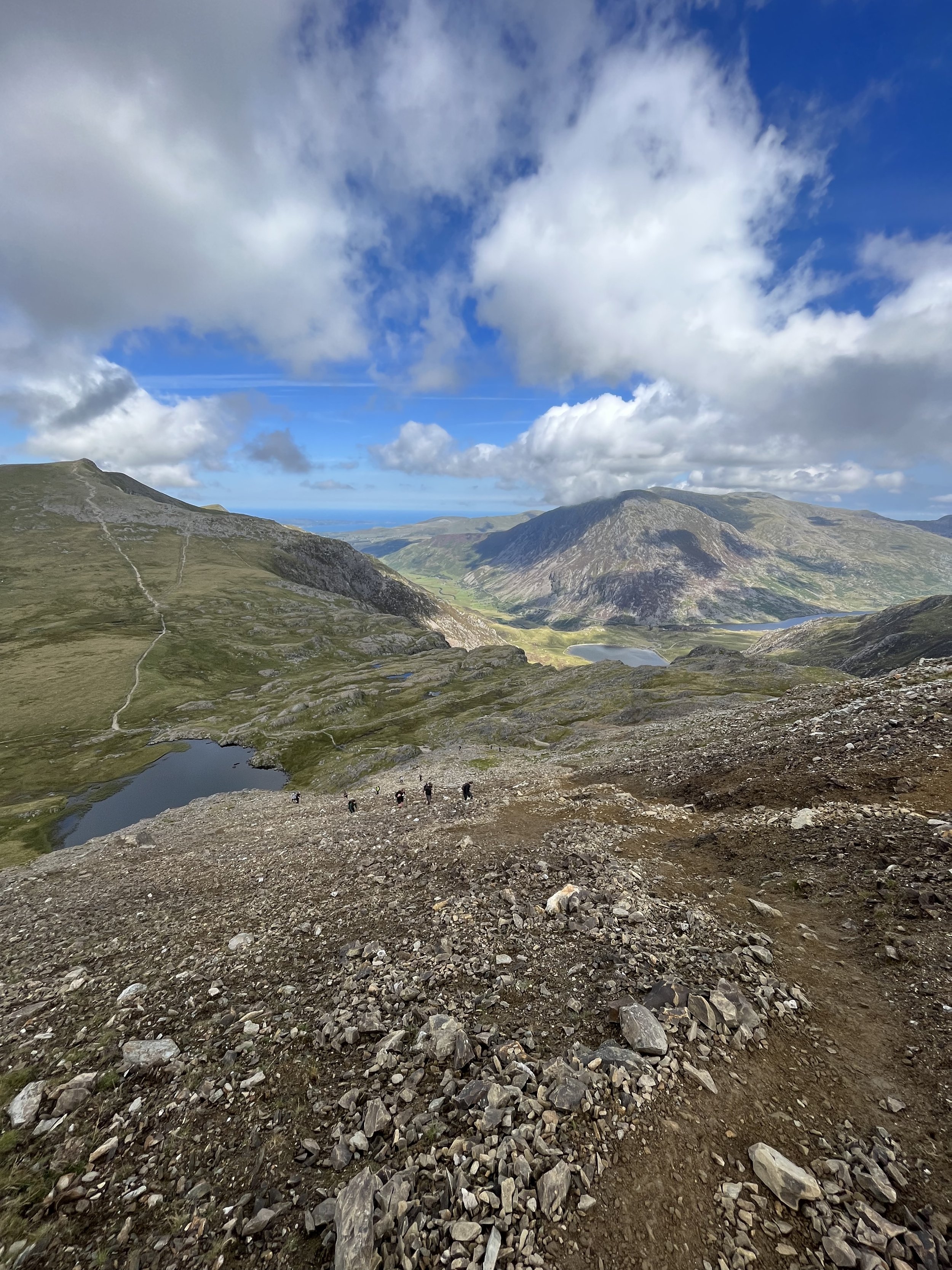
11:45am - Peak 5, Y Garn, 3106ft
Y Garn is easily one of my favourite summits in Snowdonia.
Easily accessible from the Ogwen valley, the 3,106ft summit has magnificent panoramic views over Snowdonia and is a great spot for both sunset and sunrise.
By this point the mist was clearing and the the summit was being occupied by 15 or so people.
After consuming a cliff bar and some sausage rolls, I had a quick chat to the GoPro and put the drone up for 360-degree loop of the summit, before descending down to the saddle above Devils Kitchen.
I was six and a half hours in at this point and both the body and mind felt good.

Although not very long, the climb up to Glyder Fawr is extremely steep and consists of horrendously loose scree.
it’s a real energy sapper when you’re 20km into the challenge and one you just must batten down the hatches for.
Once the scree is out of the way, the path levels off and the alien -like landscape of the Glyders becomes evident, with the path slowly navigating its way through a massive boulder field of jagged rocks. of colossal sized boulders.
Despite feeling good I was conscious that I was already running low on water despite only being half way into the Glyderau range.
The only thing which kept my mind at ease was the can of Fanta lemon in my bag. I had been promising myself I would drink it at the next summit ever since I left Nant Peris
Although I could make it to Ogwen valley on what water I had left, I was worried that the knock effect of being temporarily dehydrated would compromise the final section of the challenge.
Fortunately the kindness of strangers came to the rescue.
After giving two hikers advice on which route they should take down from Glyder Fawr they kindly donated me some of their water.
Information for water, it seemed like a fair trade to me.

The descent from Y Garn
The climb up to Glyder Fawr. Steep and Scree’y
12:40pm - Peak 6, Glyder Fawr, 3284ft
Upon reaching the summit, I downed the can of Fanta like I was a University rugby fresher on their initiation.
Whilst taking the time to recover from the scree, I soaked in the views whilst putting away a few more sausage rolls, another snickers bar, and a Welsh cake (awfully dry).
By this point the summits were cloud free and the views were breath-taking.
After being a slight trough climbing up to Glyder Fawr, I was now riding a wave of euphoria fuelled by the incredible mountain views and knowing the toughest sections of the Glyderau were out of the way.
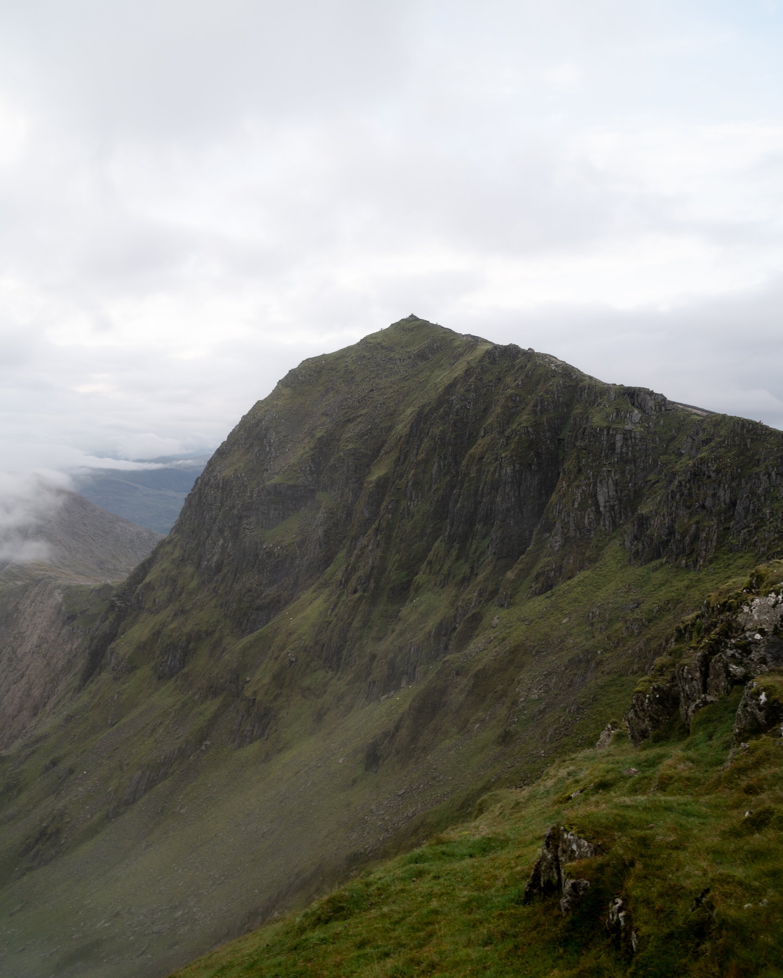
The enjoyment was dimmed slightly as my gaze swung north.
The ominous monolith which is Pen yr Ole Wen and the towering hills of the Carneddau were a humbling reminder that I was just over half way into my challenge and there were plenty more mountain miles to come.


After a brief 10-minute chat about the 3,000s challenge with two curious couples on the summit, I was kindly donated a little more water before I quickly put my drone up and got on my way.
Although relatively flat, the boulder strewn surface of the Glyderau requires plenty of concentration. Not want to risk rolling an ankle I broke into a bit of a speed march rather than jog.
On the way over to Glyder Fach, I decided to climb the minor summit of Castell y Gwynt (3,189 ft) as I was unsure if it was one of the 3,000s.
With a prominence of 15m, it’s the only Welsh summit above 3,000ft to classed as a Nuttall, which meant it wasnt actually an official peak in the Welsh 3,000s
It was better to be safe than sorry.
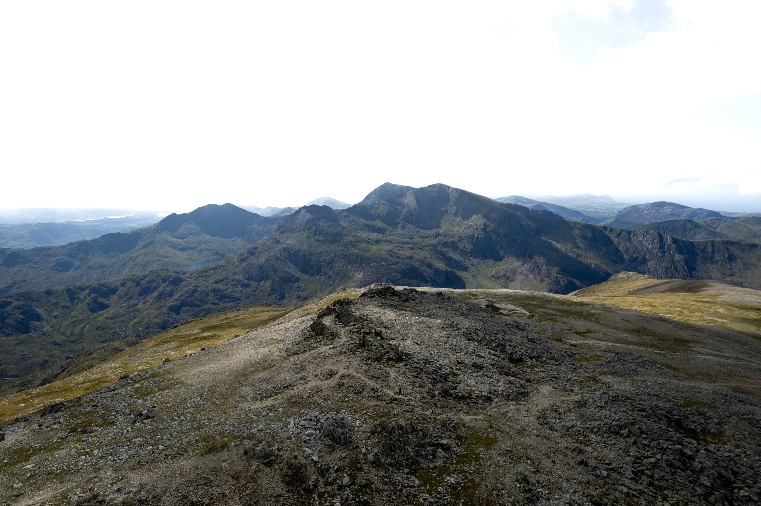
Looking back over Glyder Fawr towards Snowdon

Looking Towards Glyder Fach and Tryfan from Glyder Fawr
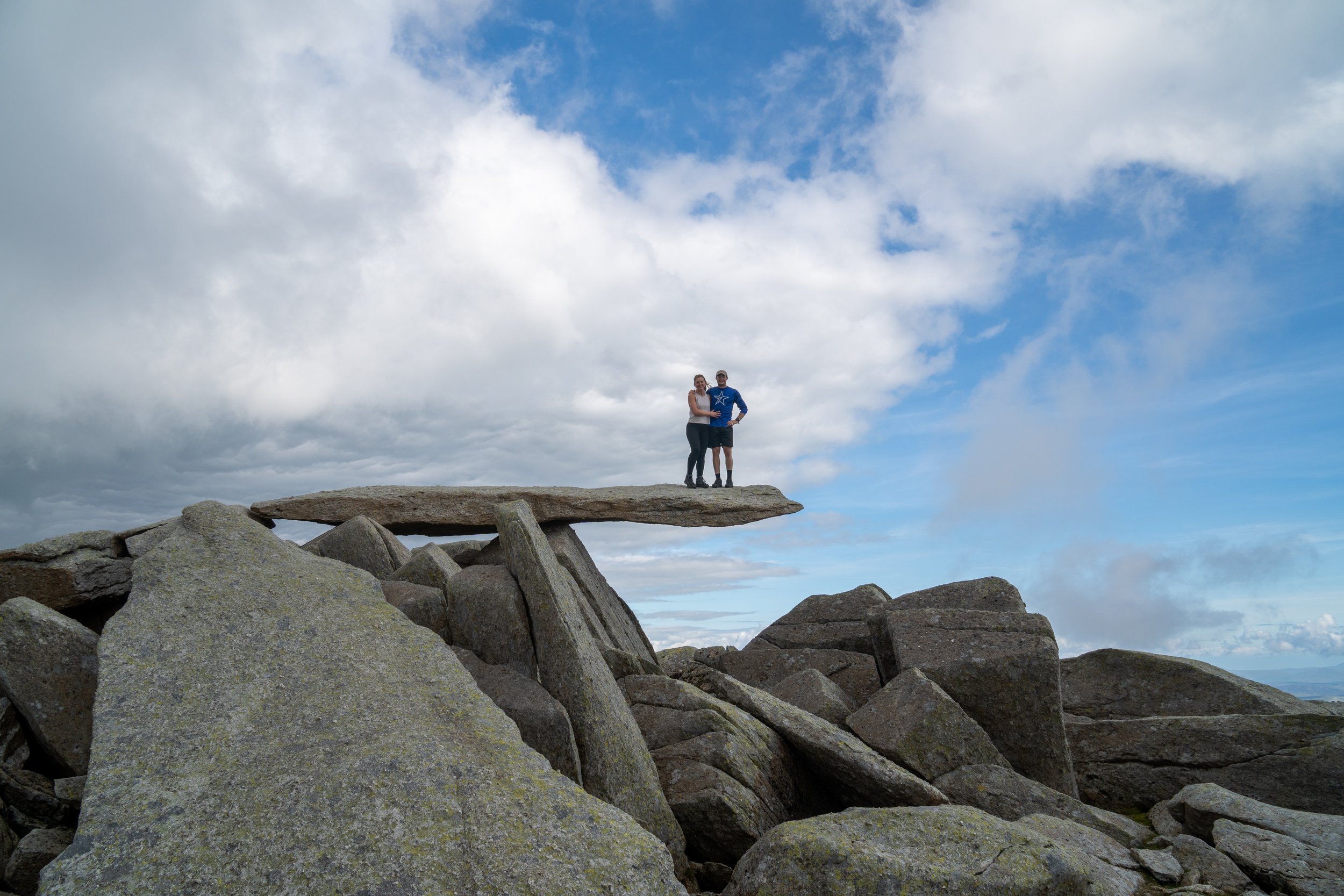
Peak 7 - Glyder Fach, 3,261ft – 13:25
From Castell y Gwynt, it was a short stroll pass a herd of mountain goats to the massive pile of boulders which is Glyder Fach.
Coincidently the word Glyder derives from the Welsh word "Gludair", meaning a heap of stones.
Despite it appearing taller, the summit is only 23 ft shorter than Glyder Fawr, hence why ‘Fach’ is means small and ‘Fawr’ means big.
As this peak was quite busy, I didn’t hang around to grab a photo on the iconic Cantilever stone (see below) or put the drone up.

The cantilever Stone, taken on my failed attempt in 2021
Instead I consumed another welsh cake and sausage roll and pushed on towards Tryfan, descending the horribly steep path that runs alongside Bristly ridge.
Not only is the path outrageously steep. it’s made up of very loose rocks and scree.
Picking your way down this route is an art form and takes both patience and a keen eye. I tend to stick to the edges of the trail when the ground is made up of more stable rock and grass.
Take your time on this descent and be careful not to dislodge a loose boulder which will end up cascading down the mountain.
Please don’t try and climb down bristly ridge. This is a serious grade 1 & 2 scramble which requires specialist equipment alongside a high level of skill and experience.

14:10pm - Peak 8, Tryfan
The ascent up Tryfan’s south face was a steep but enjoyable one.
Starting off as a walk, it quickly becomes more of a climb/scramble as I picked and weaved your way up the boulders. By this point it was nice to get the upper body involved and give the legs a little bit of rest.
At 918 metres high, Tryfan is by no means the highest mountain in Wales, but it is arguably the most dramatic.
Its iconic shark tooth like appearance and angular, rocky and intimidation nature make a photographer and scarmbler’s dream, with people flocking from far and wide to experience its magnificence.
After eating a few more sausage rolls, a cliff bar, and the rest of the Haribo on the summit, I did the compulsory jump between Adam and Eve to gain the ‘freedom of Tryfan’, before briefly putting my drone up.
I was currently 25km in this point. Energy levels were good and the legs didn’t feel too heavy. The water I had been kindly donated had allowed me to wee again, and the fear of becoming dehydrated had long passed.
My original route down from Tryfan to the Ogwen Valley was meant to be via its more simpler western face.
However due to the busyness of the bank holiday, my partner could only parked at Gwern Gof Uchaf campsite which was located to the north east of the mountain.
Because the campsite was located 500m past the starting point for Pen yr Ole Wen, it meant the shortest way to get there was via Tryfan’s notorious North ridge.
Although this route was almost half the distance, 1.8km as opposed to 3km if I went down the western slopes, the difficulty of the ridge meant it wasn’t going to be a straightforward descent
The decision to descend the North ridge was one I immediately regretted, it was unforgiving on the knees and extremely slow going.
Hindsight is a wonderful thing.

3:15pm - Pitstop in the Ogwen Valley
By this point I was back to my original time schedule.
Conscious I might have been slightly dehydrated, I sunk 750ml of electrolytes and another can of Fanta lemon. Delicious.
I also put down me a King Pot Noodle, a pack of cooked prawns, a hazelnut donut, and a protein bar.
My poignant body odour prompted a T-shirt change and I re-stocked my snacks, batteries, and water. Filling up my 2 litre hydropack alongside a 750ml collapsible water bottle.
The Carneddau and the hike down to the final car park was the longest of the three sections (20km total), so I made sure I had more than enough water to get me to the end.
I also packed an extra layer, a beanie, and two torches for the descent alongside a can of Thatcher’s Haze (Gods juice) to celebrate finishing ,
Confident or cocky, I will let you be the judge!
4:05pm - The ascent up Pen yr Ole Wen
After a 45 minute break, I was re-hydrated, fuelled, and ready to tackle the final section of the challenge and the last significant climb.
Having pulled the plug in the Ogwen valley during my first attempt of the Welsh 3,000s, I was now in uncharted territory.
That being said, I was in a great place both physically and mentally.
Not once had I considered pulling out of the challenge, and the only uncertainty I faced was around what time I would reach the final of summit of Foel-Fras.
With sunset at 8:15pm I had a target and 4 hours 15 minutes to complete it in. Game on
Much like Elidir Fawr, the ascent up Pen yr Ole Wen is a right bastard.
Even though I had never actually climbed it from the east before, having only ascended its heinously steep southwest face, I knew the 660m of elevation gain over 3km wouldn’t be a pleasurable one.
A set a good but sustainable pace, put my head down and got to work.

Tryfan on the ascent up to Pen yr Ole Wen
5:20pm - Peak 9, Pen yr Ole Wen, 3208ft
After 80 minutes of flogging myself, only slowed down by some unnecessary scrambling (somehow I went off course half way up) and vlogging, I reached the summit.
Given the intensity of the sun and the above average pace I maintained up the climb, it was safe to say I felt a little drained.
However after a 10 minute pit stop, during which I put away another Cliff bar and got the drone up. I was quickly full to the brim energy and enthusiasm.
The sensational panoramic views including being able to see the majority of Anglesey views, alongside knowing that the last significant climb was out of the way, had flipped a switch in my head and I was ready to crack on.
3 hours till sunset and 12km to go…
A drone Panorama of the Glyderau

The view from Pen yr Ole Wen towards Carnedd Daffyd and Llewellyn
6:00pm - Peak 10 - Carnedd Dafydd, 3425ft
The journey from Pen yr Ole wen was a gentle one, with the wide rocky path gently rising for 120m over one mile.
I took my time here, chatting to a man who’s 18 year old Staffie was still climbing mountains. Humphrey Bear (the dogs name, not the owner) also had the talent of carry rocks bigger than my fist, which I found hilarious.

The view from Carnedd Daffyd looking towards Tryfan
From Carnedd Daffyd I pushed onto Yr Elen, following the wide and obvious path which runs east alongside the Ridgeline for 2.4km.
All the energy I had at this point was quickly sucked out of me upon realising I would have to walk around Carnedd Llewllyn (peak 12) to the summit of Yr Elen, before doubling back on myself.
I sucked down another energy gel and plodded onto to the summit.
The path which branches left and skirts around Carnedd Llewllyn starts of obvious but soon fades out. Keep a high line and climbing gently towards the large pile of rocks. Once round the corner, the path up to Yr Elen will once again become obvious.

Yr Elen & Carnedd Llewellyn.
6:55pm - Peak 11, Yr Elen, 3156ft
I can only describe this peak as the adopted child of the Welsh 3,000s. It’s an inconvenient detour which sucks the morale right out of you.
The only silver ling was the sensational mountain views I could see from its summit as I looked back south towards Elidir Fawr. There were more layers than your nans Viennetta.
After putting the drone up, I put away another protein bar and with 80 minutes to sunset, I got a bit of a jog on.
On the way up to yr Elen, I had crossed paths with two lads who were also doing the 3,000s. By the time I was on my way back down, they were two small figures closing in on the summit of Llewellyn.
From that point on I made it my challenge to catch them.
With the climb up to Carnedd Llewellyn being short but painfully steep, I got the phone out, put on Fortunate Son by Creedence Clearwater Revival and went to the well.


Yr Elen
7:20pm - Peak 12, Carnedd Llewelyn, 3490ft
It was a day of peaks a troughs and thankfully I was back on another peak, both literally and metaphorically.
As the mist rolled in, I gazed back over the Carneddau towards the Glyderau and Snowdon knowing that the hard yards were all done.
From here on in the path was easy underfoot and mostly downhill with the occasional gentle incline up to each peak. Another wave of adrenaline washed over me as I put the drone up and set about catching the two lads.


Looking south towards Carnedd Gwenllian

Yr Elen and the northern slopes of Llewelyn
7:57pm- Peak 14, Carnedd Gwenllian, 3038ft
I had broken out into a bit of a jog at this point and in my haste to get to the finish I completely forgot to grab a photo on Foel Grach (3202ft), instead I just run straight up and over peak 13 and onwards to Carnedd Gwenllian.
Carnedd Gwenllian, formerly Carnedd Uchaf, is a small crown of shattered rocks which sits on a wide plateau.
At this point I was absolutely buzzing and the sun was begging to set below a bank of low cloud which sat on the horizon. A quick chat to the go pro and I was back on my way.
The finish was 1.7km away and I had less than 20 minutes to reach it.
1km from the finish I jogged past the two lads who I passed at Yr Elen, making me feel like a more muscular but significantly slower Killian Jornet.
with the stone wall now my right hand side I knew the summit was minutes away.

7:12pm - Peak 15, Foel-Fras, 3090ft
Challenge completed and redemption achieved.
Since starting the watch on Crib Goch I had hiked 42.67 km in 14 hours and 42 minutes.
I was absolutely buzzing with euphoria and ecstatic that I had achieved my target of sub 15 hours alongside of the added bonus of making it to Foel-Fras before sunset.
Shortly after arriving I was joined by the two other lads at the summit. They set off at 3am with Snowdon being there first peak.
After we snapped a shot of each other on the summit they began their descent before took the time to soak it all in.
Not even the empty can of Thatcher’s haze and a completely ruined drone battery could affect the beaming smile across my face. It turns out I accidently pierced the can whilst dropping my rucksack at the final peak and the liquid just sat in the bottom of bag.
I clambered up on the trig point and put the drone up for one final time as the sun set on one unforgettable day in the mountains.


8:40pm - The final descent down to the car park
The most sadistic thing about the Welsh 3,000s is that despite finishing, you still have to find your way off the Carneddau.
Of the two finishing points available, my partner was parked at Aber Falls which was just under 6km away.
Having never hiked past Carnedd Llewellyn before the only understanding of the route I had was from online blogs and by looking at maps.
With the adrenaline still pumping I got my skates on and began my descent off Foel Fras.
The super soft and almost bouncy ground added an extra spring to my step as I strided down the mountain, once again trying to catch back up with the two lads who had left the summit 10 minutes earlier.
When Llyn Anafaon quickly came into view on my left hand side the descent immediately seemed far easier and quicker than I imagined.
I had thought I would have had to climb up to Y Drum before dropping down to the lake so the reduction in elevation gain was an extra bonus
I slowed down my jog as passed the two lads wishing them a safe descent, before continuing onwards at a rather uncontrollable pace.
The grass had transitioned into a spongy and more dense bracken and given the undulating surface of the ground I took the occasional theatrical tumble as I hurtled down the mountainside.
I honestly must have looked like those people who chase a wheel of cheese down a hill in Somerset.
I reached the lake shortly after 9pm and was greeted by my wonderful partner and dog, who were both very happy to see that I was alive and my ankles were still in tact.
I had chosen the car park above Aber falls because once you reach Llyn Anafon the descent is via a very wide bridleway. From here I was able to mentally switch off, knowing I simply had to follow the very obvious path for 4km and I would be back at the car park.
I reached the car park shortly before 9:45pm
Alongside my Garmin which I had running for the duration of the challenge, I had also started strava on my second mobile, which i use to operate my drone, at the Pen-y-pass car park.
In total I had hiked just over 50km in 17 hours and 12 minutes.
After a naked wash in a river, I felt like a new human being.
From Aber falls we headed straight to McDonalds in Caernarfon and I ate my bodyweight in food.

Final Thoughts
Firstly, I want to say a huge thank you to my wonderful partner Becky.
She’s incredibly supportive of my weird and wonderful challenges and I’m lucky to have her as my other half. Without her selflessness and unwavering support, I wouldn’t have been able to complete the Welsh 3000s.
Even if she did put me on the back foot after she left my hiking boots behind the van at the Bryn Tyrch Inn the night before the challenge.
I was chuffed to have come under the 15 hour mark which I had set out to achieve. Especially when I vlogged the entirety off it.
I genuinely think with all the walking back and forth to the camera I did I must added a couple of extra kilometres to the route. I would love to have another crack at the challenge, this time from North to south, and try and shave 2-4 hours off my time.
I had two forty minute stops between the mountain ranges and spent up to 30 minutes filming on some summits. When combined with all the extra camera gear I carried and the extra walking I did back and forth between my camera, completing the challenge around the 11 hour mark wouldn’t be unrealistic
Although I didn’t get one blister, the amount of descending certainly took its toll. My quads and the tips of my toes were in absolute pieces the next day
For those who are interested I have listed all the gear I used and food I ate below. In addition I have also written a detailed blog post on how to prepare and tackle the Welsh 3,000s with information around the routes, parking and logistics.
You can also download my route which I plotted in OS Maps here.
Where to Stay for the Welsh 3000s challnege?
Now unless you live in Snowdonia you are going to have to factor in two nights’ accommodation to complete this challenge.
Where you sleep is down to a few factors including; personal preference, what options you have available, what time you plan on starting the challenge and when you think you will finish.
I would recommend this Miners cottage at the base of Snowdon in Nant Peris.
Located in Nant Peris at the base of Elidir Fawr, you will actually pass this cottage on the route, meaning you can pop in and grab some resupplies, change, or even have breakfast!
It sleeps 6, and has a sauna. I have used it for the Welsh Three Peaks challenge and I loved it.
Alternatively you could consider the YHA Hostel at the Pen y Pass or If you’d like to support this website, you can Book your accommodation using Booking.com and Sykes Cottages. These come at no extra cost to you, but help keep this site running.
-
I tried to eat a variety of calorie dense foods, which have good mixture of carbohydrate sources alongside some protein. I was aiming for around 60-80 grams of carbs and around 250 calories an hour.
Overnight oats with protein - before I stared at 4am
3 bananas
4 snickers bars
3 cliff bars
2 battle bites protein bars
A pack of Haribo giant strawbs
A pack of Haribo tangfastics
2 SIS energy gels
A pack of Welsh cakes
2 cans of Fanta
2 double sausage and egg baps – At Nant Peris
A king Pot Noodle and a pack of cooked prawns – At Ogwen valley
Bag of sausage rolls
Lidl hazelnut doughnut
High 5 carb powder – 4 servings = 200g of carbs
-
Plan and understand the Route: Make sure you know all the key Information (Distance, Elevation Gain, Route Profile, Terrain, Technical Aspects, Where to park) and that the hike is suitable for you and any other members of your group
Check the weather: Always check the weather forecast for the specific peaks and mountain ranges you are planning on hiking. I use MWIS and Met Office and focus on the four following factors; Feels like temperature, Chance of Rain, Visibility, and Wind speed
Download the route & Use proper hiking app: I use and recommend OS Maps and have the route downloaded for offline use
Let someone know your plans: What route or mountains you are hiking, where you are parking, and roughly how long the hike will take
Give yourself more time than you need
Group Up: If possible, hike with others or consider hiring a local guide for extra safety
Know Your Limits: If the hike is too difficult, technical, you aren’t feeling up for it, or if the weather changes don’t be afraid to stop or change your plans.
Wear and carry the correct kit: see below
-
Sturdy and comfortable hiking shoes with good grip
Waterproofs: I always carry a waterproof jacket and packable over trousers
layering system: wear/carry a minimum of 3 top half layers, with a 4th in winter)
Synthetic or Merino base layer (T-shirt)
Mid layer (Fleece or hoodie)
Outer shell (Wind breaker or waterproof)
Fourth layer in winter (Insulated jacket)
A Hiking/ Navigation app with the route downloaded for offline use: I use and recommend OS Maps
GPS device with the route downloaded (or Map and compass)
Power bank and charging cable
Headtorch + First aid kit
Plenty of fluids and high-energy snacks
Gloves, hat, and face buff for cooler conditions
Hiking poles to help with both the ascents and descents
-
Below is a list of all the hiking gear (clothes, footwear, and accessories) I currently use and recommend.
I have also included links to all of the products where possible. Some of these are affiliate links, which means I receive a small commission if you purchase an item after clicking on one of the links. This comes at no additional cost to yourself and helps to support my website and my ability to continue to create content.
Base layers
The purpose of a base layer is to wick sweat away from your skin to keep you dry alongside offering protection from the elements. The type of base layer I wear will depend on the season and temperature. I will usually wear merino wool or a synthetic material (polyester), avoiding cotton.
Columbia Zero Rules Technical T-Shirt - A great cheap options for day hikes
Icebreaker Merino Long Sleeved hoodie - My go to base layer for spring, summer, and autumn hiking. It’s lightweight, quick drying, breathable, and because it is made of merino, has odour control. I have worn this hiking multiple days in a row in summer in Canada, Madeira, The Dolomites, and UK and it is yet to let me down.
Mid layers
The purpose of a mid layer is to provide warmth and insulation. Even if I dont wear them while I am hiking, I will always carry them in my bag as an extra layer. They often come out when I reach a summit or if the conditions get colder
Simond Merino Wool Zip Hoodie - A great value merino mid layer which is comfortable, lightweight, stretchy, and wont smell. It also has elasticated thumb loops, a close-fitting hood, and three zip pockets.
Decathlon Forclaz MT500 Down Jacket - Essential for the colder months, wildcamping, and when you are soaking in the views up on the summit. It is £85, lightweight, non-bulky, easily packable, and thanks to its 700 FP down fill, is rated to -10 degrees Celsius.
Outer shell
The purpose of an outer shell is to protect you from the wind and the rain. No matter the season and weather I will always carry one just in case. I recommend getting a outer shell which has a hydrostatic head rating of at least 10,000mm.
Columbia Ampli-Dry II Shell Jacket - Waterproof, lightweight, functional, and packs down well, so I can easily stuff it into my bag if I get too hot. It also has breathable stretch shell fabric with underarm zipped ventilation.
Quechua Lightweight Waterproof Jacket MH500 - Unbelievable value at £80 and has a hydrostatic head rating of 25,000mm
Columbia Loop Trail II Windbreaker - My go to choice in the summer and for trail running
Lower half
Columbia Colour Block Hiking Shorts - They are lightweight, quick drying, stretchy, and have zipped pockets.
Patagonia Terrebonne Joggers - I take these on through hikes & wild camps, they are super light, comfortable, quick drying, & great for the evenings.
Montane Tenacity Hiking Pants - Lightweight, comfortable, water resistant softshell hiking trousers with 4-way stretch
Rab Men's Downpour Eco Pants - Lightweight (225g) over trousers which pack down super small.
Footwear
Darn Tough Vermont Merino Micro Crew Socks - Moisture wicking, odour control, breathable, well cushioned and have a lifetime warranty.
Columbia Montrail Trinity Ag II - The comfiest summer hiking and trail running shoes I have ever worn. The break in period is non-existent. I wore them for my 6 day through hike through the Dolomites, Snowdon 6 challenge, all around Madeira, and for 190km of hiking around the Canadian Rockies.
Adidas Terrex Free Hiker 2 GTX - My go to for wetter conditions. They are very comfortable, durable, offer great grip and stability, are waterproof, and also light enough that I could even trail run in them if needed. I also wore them for my eight day trek up to Kilimanjaro.
Backpacks
Deuter Unisex Ascender 13 Trail Running Backpack – My go to for trail running and hiking challenges
Deuter Speed light Pro 25 - My go to for summer hiking. It’s comfortable, extremely lightweight (630g), and big enough to fit all my gear.
Deuter Speed Lite Pro 30 - My go to for winter hiking or if I need more space. I wore this for my 6 day through hike across the Dolomites.
Deuter Air contact Ultra 50+ 5 - My go to for wildcamping, backpacking. It is very lightweight (1.3kg), comfortable, functional, and supportive.
Equipment & Accessories
PETZL Swift RL Headlamp - Essential for hiking, especially around sunrise or sunset, alongside wildcamping & astrophotography. This provides 900 lumens of brightness at only 100 g and is rechargeable. The Everbeam H6 Pro is a great cheap option at £15,
OS Maps Premium Subscription - My go to app for hiking. I use this for planning and following hikes on my phone. the premium subscription allows me to download & use maps offline, alongside the ability to print off to-scale paper maps to use as a backup.
Silva Walking Poles - Lightweight, collapsible, quick locking, and comfortable on the hands.
Portable Power bank – Essential for any hiker, especially if you rely on your phone for navigation. I recommend one with at least 10,000 mAh of power.
Forclaz MT500 stretch gloves - Lightweight, practical, functional, and warm. They are also stretchy, clip together when not being used, and you can use your phone with them. At £13 they are bargain.
Forclaz Foam Seat Pad – Weighs 60g, can fit in the side of your bag and doubles up as mat to stand on when getting changed after wild swimming
Mini Crampons/ Micro spikes – The best investment I’ve made for winter walking. These are a set of chains with 18 small spikes connected to a thick elastic rubber which can be pulled over any footwear. They are perfect for hiking in snowy and icy conditions when crampons would be overkill as they are much easier to walk in, and are far lighter and easier to carry.

Help support my website
I created and run this website in order to help inform, amaze, inspire people (for free) to get outside and explore the adventurous side of the UK.
Although I do run some google ads, I have limited them in order to make your experience on this website far more enjoyable.
If you’d like to support this website, you can use the affiliate links below to book your accommodation or transport. These come at no extra cost to you, but help keep this site running.
Book your vehicle using Discover Cars
Book your accommodation using Booking.com and Sykes Cottages
If you are feeling generous you can also Buy me a Coffee to say thank you, and give me a follow on social media.
Thank you, and if you have any questions, leave them in the comments below or drop me an email!
For more travel, hiking, & photography inspiration around Wales check out my in-depth guides to each of my favourite Welsh regions below.
