
Llyn-y-Fan Fawr hike guide via the Nant-y-Llyn | Brecon Beacons National Park

An adventurous hike which passes several magnificent waterfalls on the way up to the beautiful glacial lake Llyn-y-Fan Fawr.
From here you can continue the ascent up to the highest peak of the Black Mountain, Fan Brycheiniog (802m). The summit boasts phenomenal views across the western range of the Brecon Beacons.
Because of the hikes ‘unofficial’ route (I discovered it by spotting the waterfalls on an OS map) it’s highly unlikely you’ll see anyone for the first section of the hike making it a perfect hike for escaping the crowds.
Parking is situated on a small layby off a country road and is at a premium so unless you arrive early you may struggle to find a spot to park.

Where to Park
There is no postcode for this location but GPS Co-ordinates for this location are: 51°52'11.1"N 3°40'01.8"W.
The nearest postcode I could find is Tafarn-y-Garreg Pub and Camping, Pen-y-Cae, Swansea, SA9 1GS which is located on the east side of the A4067. If heading northbound on the A4067 the turnoff for the country lane will around 500m past the pub on the westbound side of the road. From the turn off its 2 miles to the car parking spot.
The start of this hike is a small grassy lay-by marked by a stone wall on the side of a single lane country road. It is easily driven past so keep on the lookout for the Nant-y-Llyn river which will be on the left-hand side.
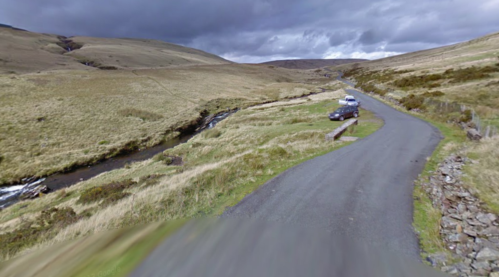
The start point for the hike which is marked by a stone wall. The nant-y-llyn can be seen to the left.
The Route
From the layby, cross the River Tawe which runs parallel to the road via the shallowest and most convenient means necessary. (Be warned this may involve you having to walk up or downstream or even getting your feet slightly wet)
Once across the Tawe, reconnect with Nant-y-Llyn river and the follow the faint path alongside it’s right-hand bank. On route, you’ll pass several beautiful waterfalls of varying in height from 1 to 10 metres, many of which you can take a dip in.
After around 2km the path will begin to flatten off and the river will fork in two, stick to the right-hand river and you’ll eventually be lead up to Llyn-y-Fan Fawr.

The Nant Y Llyn. You can see a faint path to the right of the river

Llyn Y Fan Fawr, The faint path up to Fan Brycheiniog can be seen on the left of the image
Take some time here to admire the lake and catch you breath, before beginning to follow the steep, zig-zagging path which runs up the side of the mountain which stands behind Llyn y Fan Fach.
Once the steps end, you’ll find yourself in a small saddle between two peaks, take a right and follow the path which runs along the ridgeline towards the summit of Fan Brycheiniog. This will be marked by a trig point and large circular shelter of stones.

Llyn-y-fan Fawr & the central Beacons from the summit of Fan Foel
From Fan Brycheiniog continue along the ridge-line until you reach the nearby summit of Fan Foel and gain fantastic views both towards the central Brecon Beacons
From the summit of Fan Foel you have two options. You can either follow the ridgeline around the edge of the mountains, or cut across the plateau towards Picws Du. Either way the path will begin to slowly drop down into a saddle before once again rising steeply up to the summit of Picws Du.

Picws Du

Looking Towards Picws Du from the plateau behind Fan Foel
Once up at the summit of Picws Du, you’ll be greeted by spectacular views over Llyn Y Fan Fach and across the western Brecon Beacons. Take the time to enjoy it before retracing your steps back to Fan Brechiniog, down to Llyn Y Fan Fawr then back down the Nant-y-Llyn to your car.

Picws Du with Llyn-y-fan Fach in the background

The view of Llyn-y-Fan Fach from Picws Du
If you have a bit more energy in the legs you can extend this walk to loop around Llyn-y-Fan Fach and return back to Llyn y fan Fawr by walking beneath the peaks.
From Picws Du simply follow the ridgeline westwards alongside Llyn-y-Fan Fach to Waun Lefrith before looping around and down to the lake. Once at the shore of Llyn y fan Fach follow the path that runs beneath the ridgeline of the mountains back east for 3.5km until you reach Llyn-y-Fan Fawr.
The map for this hike is below, the route 15km in length and should take around 5-6 hours to complete.

Find me on Instagram


Did you find the blog useful and will you be wanting to tackle this hike in the future? Let me know your thoughts in the comments below.
If you did find it helpful, I’d appreciate you giving it a share or giving me a follow on social media, every bit of support goes a long way.
You can find more Welsh hiking inspiration in the following blogs
For more travel, & photography inspiration around Wales check out my in-depth guides to each of my favourite regions below.