
Sugar Loaf Hike Guide, Brecon Beacons National park

Situated in the east of the National Park, the 565m Sugar Loaf may not be the highest or the most dramatic of peaks in the Brecon Beacons, but its ease of access and wonderful panoramic views make it a mountain which is definitely worth hiking.
Alongside being a great choice for families, It’s also a hike which you can do if you are short on time, and one which is great for both sunset and sunrise.
Within this hike guide to the Sugar Loaf, I outline the shortest and easiest route to the summit.
Key Information
Type: Out & Back
Distance: 5.3Km
Elevation Gain: 265m
Difficulty: Easy to Moderate
Parking & Start point: Sugar Loaf National Trust car park
Facilities: None
What should I wear to hike Sugar Loaf?
That will depend on the weather, which you should always check before departing. I use MWIS and Met Office and look at;
Feels like temperature at the summit
Chance of rain
Visibility/ Chance of cloud free peaks
Wind speed
These four things will dictate what you wear and carry. While it is only a short hike, it will be colder and windier at the top than at the car park, so it’s better to carry extra layers/waterproofs just in case.
Essentials
Grippy and stable footwear
I recommend Walking boots from Adidas, my favourite being the Freehiker 2 GTX
Layering system: 2-4 layers for your top half, depending on the feels like temperature at the summit
Synthetic Base layer (T-shirt, avoid cotton)
Mid layer (hoodie)
Outer shell (Wind breaker or waterproof)
Fourth layer in winter (Insulated jacket)
A navigation app with the route downloaded for offline use: I use and recommend OS Maps
Other things
Water + snacks
Backpack to carry your spare layers, water, and snacks
Gloves and hat (colder conditions)
Headtorch (If heading up at sunrise or sunset)

Where to Park for Sugar Loaf?
There is a large free car park which has space for around 20 -30 cars on the southern side of the mountain above the A40.
Being located over half way up the mountain, the car park offers great views and would be a great spot for sunset. If the car park is full there is another un-tarmaced section located around 200m back down the road.
A word of warning. the road up to the car park is very steep and narrow, and it almost feels like you are driving to the summit at times.


Sugar Loaf Route
Although the route is very straight forward, there are a few similar looking paths at the start of the walk which can be confusing. Fortunately most of the paths link up, and the summit comes into view relatively quickly so it becomes obvious which path to take.
From the car park, head north-west and follow the wide path as it heads up the hill, after 500m you will reach a stone wall.
You can either bear right and follow the path up to the brow of the hill, or carry on straight and follow it parallel to the wall. Once on the brow of the hill, Sugar Loaf will come into view and the numerous paths to the summit will become clear.
The path will gently drop down before steadily climbing up and around to the summit. The path is wide grassy and easy underfoot. You might even pass a few wild horses on the way.
As you get closer to the summit the path will gradually become steeper, with the final 200m is the hardest and is also quite rocky.


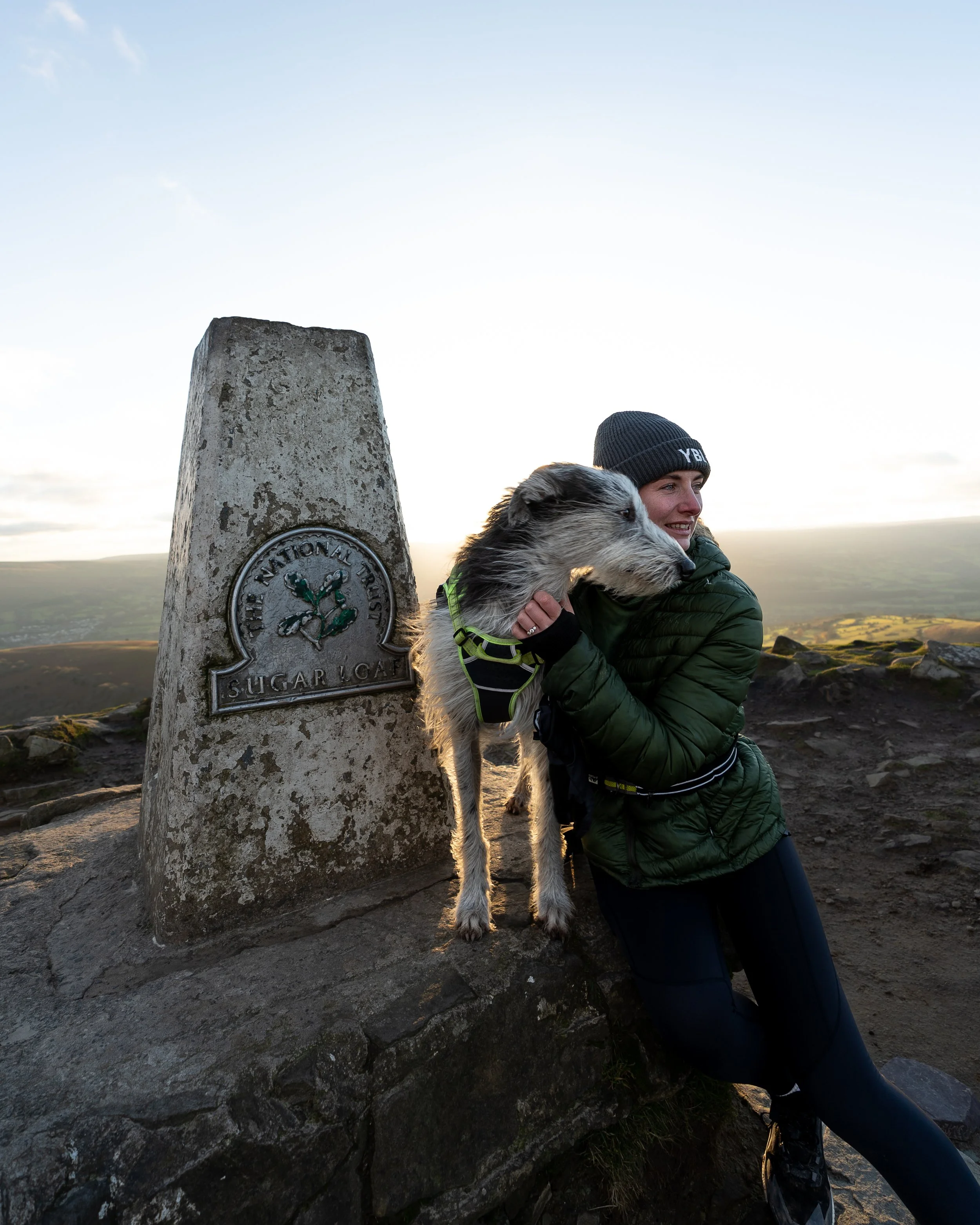
The summit of Sugar Loaf
From the roadside, Sugar Loafs conical shape is reminiscent of a volcano, however the mountains 596m (1,955ft) summit is actually long, flat, and narrow.
Made of the same red sandstone as the rest of the Black Mountains, Sugar Loaf is marked by a trig point and offers terrific panoramic views over the national park.
The prominent Skirrid Fawr dominates the view to the east and, if the day is clear, you may see all the way south-east to the River Severn and east to the Forest of Dean, while to the west the central Brecon Beacons, including Pen y Fan and Cribyn, are visible.
To get back down to your car, simply retrace your steps.


Where to stay in the Brecon Beacons
In terms of locations, Brecon is a great central choice and is the most developed town in the National Park. Abergavenny is also a great option for accessing both the central and eastern Brecon Beacons. If you have a car, I would consider looking at accommodation options in the cities of Cardiff or Swansea. Alongside being more lively in the evenings you can reach the main locations in the Brecon Beacons in under an hour.
If you’d like to support this website, you can use the affiliate links below to book your accommodation. These come at no extra cost to you, but help keep this site running.
Book your accommodation using Booking.com and Sykes Holiday Cottages.
Sykes Cottages has a huge range of properties across the national park to cater for those with dogs and larger groups.
I have stayed in Pentre Court Cottage outside Abergavenny and I found it to be the perfect base for exploring the Brecon Beacons. It sleeps 8, is very modern yet cosy, is dog friendly, has plenty of parking, is located opposite a pub, and is within a short driving distance of most of the popular hikes in the national park.


Help support what I do
I created and run this website in order to help inform, amaze, inspire people (for free) to get outside and explore the adventurous side of the UK.
Although I do run some google ads, I have limited them in order to make your experience on this website far more enjoyable.
If you’d like to support this website, you can use the affiliate links below to book your accommodation or transport. These come at no extra cost to you, but help keep this site running.
Book your car using Discover Cars
Book your accommodation using Booking.com and Sykes Cottages
If you are feeling generous you can also Buy me a Coffee to say thank you, and give me a follow on social media.
For more hiking inspiration check out my other guides to the Brecon Beacons below.
Central Brecon Beacons
Cwm Llwch Horseshoe
Western Brecon Beacons
Waterfall Country
Eastern Brecon Beacons
