
Ysgyryd Fawr (Skirrid Fawr) Hike guide, Brecon Beacons National Park

Ysgyryd Fawr, also known as Skirrid Fawr, is one of the most iconic short hikes in the Brecon Beacons National Park.
This distinctive hill sits on the eastern edge of the park, near Abergavenny, and is a popular choice for walkers looking for a manageable but rewarding climb in South Wales.
Thanks to its isolated position, the “Holy Mountain” rises sharply from the landscape, offering a trail that’s short yet steep enough to get the heart pumping. From the summit, hikers are treated to breathtaking 360° panoramic views over the Black Mountains, the Usk Valley, and even as far as the Bristol Channel on a clear day.
Key Information
Type: Out & Back
Distance: 4.3Km
Elevation Gain: 294m
Difficulty: Moderate
Estimated Time: 1.5-3 hours
Terrain: Stony path, mud and gravel
Parking & start point: narrates.florists.fine
Where to park for Ysgyryd Fawr?
There is a large gravel National Trust car park located off the B5421 just outside Abergavenny. It is pay and display but for members it is free.
What should I wear to hike Ysgryd Fawr?
That will depend on the weather, which you should always check before departing. I use MWIS and Met Office and look at;
Feels like temperature at the summit
Chance of Rain
Visibility/ Chance of cloud free peaks
Wind speed
These four things will dictate what you wear and carry. While it is only a short hike, it will be colder and windier at the top than at the car park, so it’s better to carry extra layers/waterproofs just in case.
Essentials
Grippy and stable footwear
I recommend Walking boots from Adidas, My favourite being the Freehiker 2 GTX
Layering system: 2-4 layers for your top half depending on the feels like temperature at the summit )
Base layer (T-shirt)
Mid layer (hoodie)
Outer shell (Wind breaker or waterproof)
Fourth layer in Winter (Insulated jacket)
A Hiking/ Navigation app with the route downloaded for offline use: I use and recommend OS Maps
Other things
Water + snacks
Backpack to carry your spare layers, water, and snacks
Gloves and hat (colder conditions)
Headtorch (If heading up at sunrise or sunset)
Powerbank and charging cable

The route
Head to the bottom of the western end of car park and turn right, heading up a wide path between two fields . After around 300m you will enter Caer Wood and the path will begin to climbs and snake its way up through the woodland.
There are some steep sections and the path can be muddy underfoot however it isn’t at all technical.


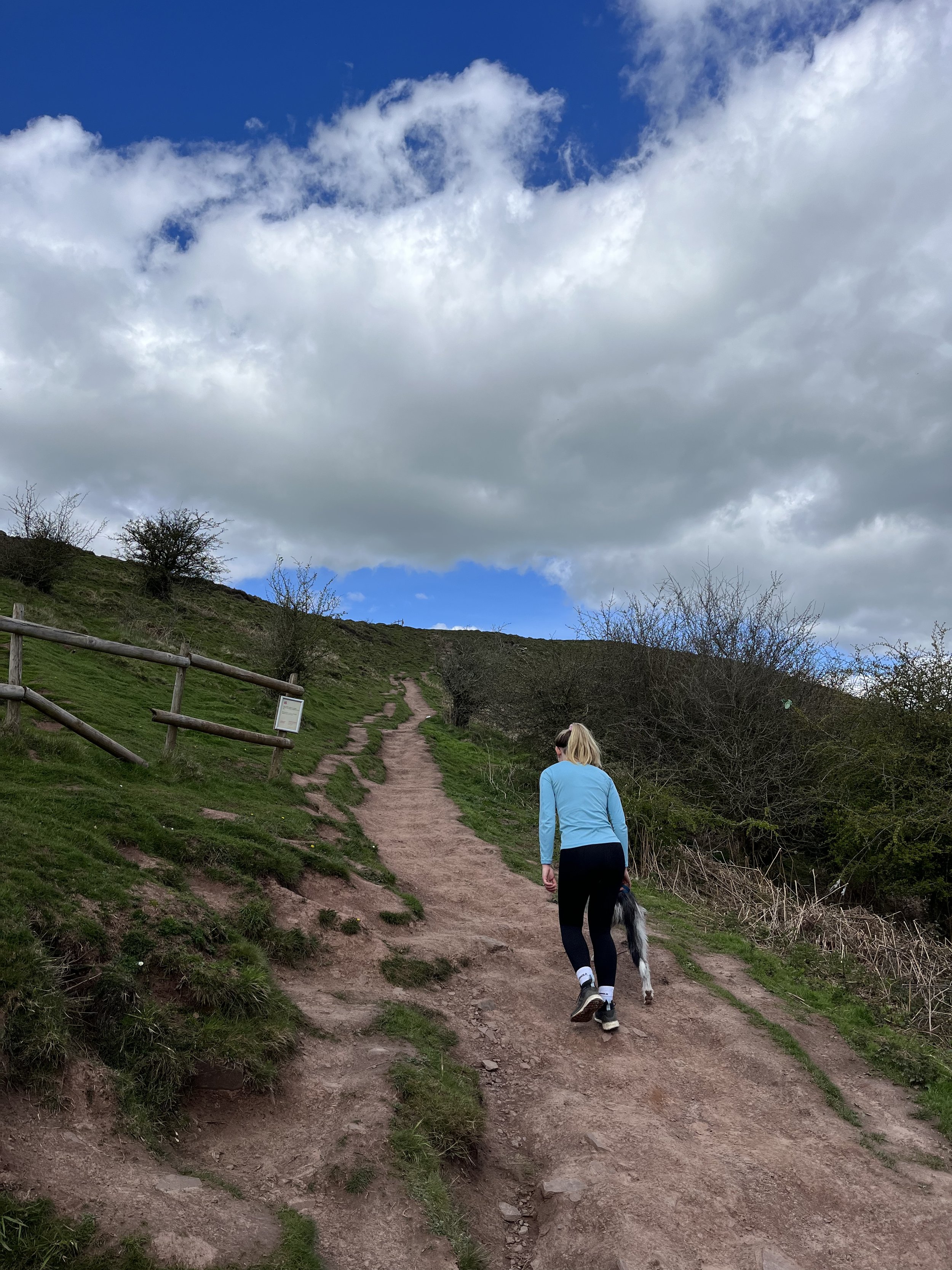
After around 600m of hiking you will break though from the forest and be granted a first glimpse of the beautiful views down over the valley below. From here its one final punchy climb up onto the rocky ridge like plateau of Skirrid Fawr.
Once up on the plateau the path will climb gently up to the summit which is marked by a National Trust trig point.
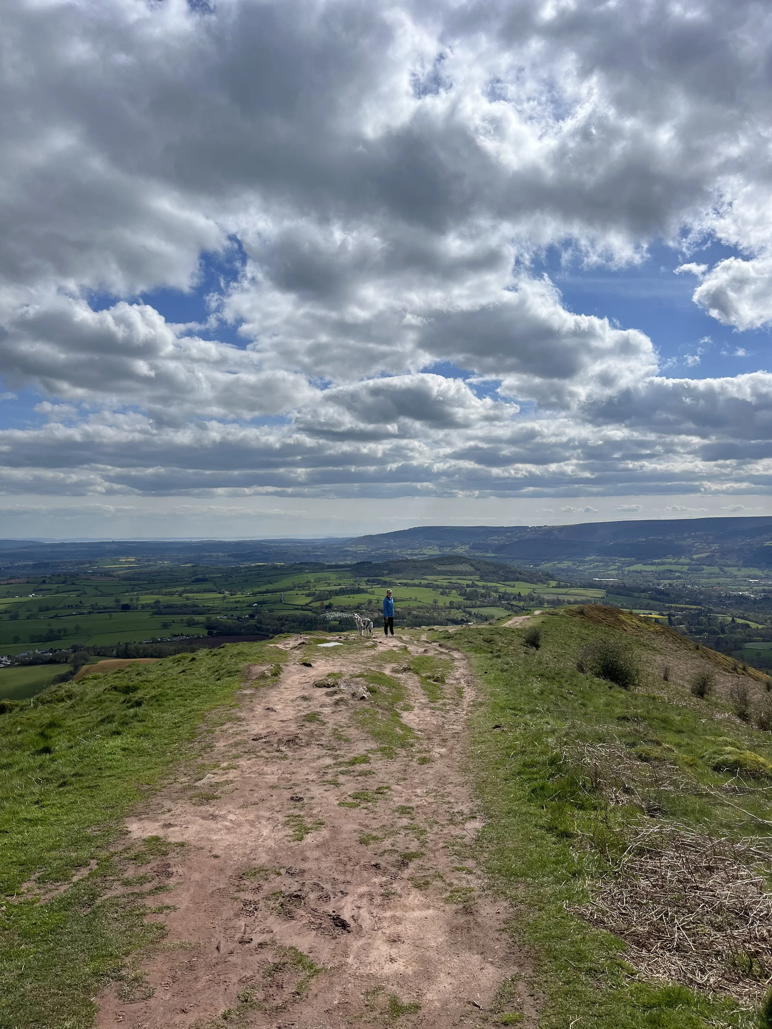
Ysgyryd Fawr summit
Despite peak being a moderate 486m in height, its isolated location means it rises dramatically out of the landscape and offers sensational panoramic views.
On a clear day you can see the Black Mountains, Abergavenny, the Malvern and Herefordshire hills, the Wye and Usk Valley's, the Forest of Dean, the Bristol Channel and even Somerset.
You also have the iconic Sugar Loaf located directly to the west, with the distance between both summits being approximately 6km.
The Skirrids distinct shape is due to a massive landslide which occurred on on the north west side of the mountain. Its also where the mountain gets its name from. With the name ‘Skirrid’ being derived from the Welsh word ‘Ysgyryd’, which means to shake or tremble.
To get down to your car you can either retrace your steps, or follow one of the many steep paths down the eastern and western sides of the mountain, before circling back to the car park.


Brecon Beacons FAQ’s
-
In terms of locations, Brecon is a great central choice and is the most developed town in the National Park. Abergavenny is also a great option for accessing both the central and eastern Brecon Beacons. If you have a car, I would consider looking at accommodation options in the cities of Cardiff or Swansea. Alongside being more lively in the evenings you can reach the main locations in the Brecon Beacons in under an hour.
If you’d like to support this website, you can use the affiliate links below to book your accommodation. These come at no extra cost to you, but help keep this site running.
Book your accommodation usingBooking.com and Sykes Holiday Cottages.
Sykes Cottages has a huge range of properties across the national park to cater for those with dogs and larger groups.
I have stayed in Pentre Court Cottage outside Abergavenny and I found it to be the perfect base for exploring the Brecon Beacons. It sleeps 8, is very modern yet cosy, is dog friendly, has plenty of parking, is located opposite a pub, and is within a short driving distance of most of the popular hikes in the national park.
-
There are numerous highly rated pubs and cafes dotted throughout the park with several of them being located in the town of Brecon. I have listed several below which I can recommend.
Hills Brecon - Situated just outside the town of Brecon this is a family run burger restaurant which has gained legendary status in the national park. You will have to book in advance to avoid disappointment.
Brecon Tap - Homely café & pub offering a wide range of savoury pies alongside local & international beers.
Cat Soup Kitchen - A small café with lots of outdoor seating situated on the banks of the River Usk in Brecon. Serves lunch, breakfast, and dinner
Latte Da Tea Room - Situated in Crickhowell, Latte Da serves great coffee, homemade cakes, gourmet sourdough sandwiches, award winning gelato alongside wide variety of breakfast options.
Casa Brecon - Lovely little café with friendly staff, delicious wraps, sandwiches and bagels
Proper Pizza - A Local pizza company offering a wide variety of handmade, locally sourced stone baked pizzas.
The Dugout CafèBar, Abergavenny: local beer, coffee, pastries and homemade pizza.
K&K Kitchen – Abergavenny, a lovely little café which serves delicious Thai Food
-
The Brecon Beacons is glorious year-round. Spring and summer offer longer days but are busy; autumn is quieter, while winter brings short dark days and the possibility of snow and ice.
The waterfalls are most impressive after periods of heavy rain, making Spring a great choice to visit in Late September early October is a great choice as the tress change colour
rain is common throughout the year and you should always check the weather forecast for the specific peaks and mountain ranges you are planning on hiking. I use MWIS and Met Office
-
You need at least on full day to visit the Brecon Beacons.
I think the optimum amount of time is 2-4 days. This would allow you to see the three main and most impressive regions of the national park (Central Beacons, Waterfall County, and the Carmarthenshire Fans).
A fit and adventurous individual could easily visit both the central beacons and waterfall country in a day, however visiting all three would require a lot of effort, light and driving.
As there are plenty of things to see and do and you could easily spend a week or longer exploring the Brecon Beacons. However, I think you would be better off using your time to explore other areas of Wales such as The Gower Peninsula, Pembrokeshire, or Snowdonia National Park.
-
I would recommend visiting the following three regions
Central Brecon Beacons to hike up Pen y Fan.
Waterfall County to see Henrhyd Falls and Four Falls Trail
Western Brecon Beacons to explore the Carmarthenshire fans and Llyn-y-fan Fach
For my suggestions on the best things to see and do, check out my blog post below
-
By car: You can easily reach the park via the M4, M50 and A40.
By Train: There are train stations available in Abergavenny, Llandeilo, Llandovery, and Merthyr Tydfil. From Cardiff, you can get hourly direct trains to Abergavenny on the Cardiff-Manchester line, and you can get trains to Merthyr Tydfil every half hour which take around one hour.
By Bus: Regular services run into the park from South Wales and Hereford.
The T4 runs from Cardiff to Newtown via Brecon.
The T6 runs from Swansea to Brecon.
The X55 Cymru Clipper service from Swansea and Neath now runs to the Angel Inn in Pontneddfechan, which provides easy access to Waterfall Country.
If you are looking for a combined package then the Explore Wales Pass offers unlimited travel on all rail services and most local bus services in Wales. It can be used on all local bus services (except services 1, 2, 442, T2 and X75) in and around the Brecon Beacons National Park. The pass is valid for a period of eight consecutive days. Trains can be used on four of these days and buses can be used on all eight days.
-
The most popular hikes in the park include Pen y Fan, Four Falls Trail in Waterfalls Country and the Carmarthenshire Fans. For my recommendation on the best hikes, check out my blog post below:
Help support what I do
I created and I run this website in order to help inform, amaze, inspire people (for free) to get outside and explore the adventurous side of the UK.
Although I do run some google ads, I have limited them in order to make your experience on this website far more enjoyable.
If you’d like to support this website, you can use the affiliate links below to book your accommodation or transport. These come at no extra cost to you, but help keep this site running.
Book your car using Discover Cars
Book your accommodation using Booking.com and Sykes Cottages
If you are feeling generous you can also Buy me a Coffee to say thank you, and give me a follow on social media.
Thank you, and if you have any questions, leave them in the comments below or drop me an email!
For more hiking inspiration check out my other guides to the Brecon Beacons below.
Central Brecon Beacons
Western Brecon Beacons
Waterfall Country
Eastern Brecon Beacons

Find me on Instagram


