
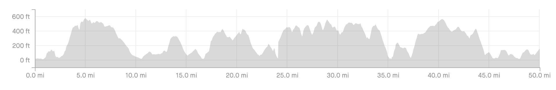
Welsh Coastal Path Cycle - One man, one bike, one 850 mile journey along the edge of Wales.
One man, one bike, one 850 mile journey along the edge of Wales.

Wales may only be a small country, but what it lacks in size it certainly makes up for in natural beauty and adrenaline-fuelled adventure.
It also happens to be the only country in the world that has a continuous waymarked path around its entire coastline.
The Welsh Coast Path was launched in 2012 and consists of 870 miles (1,400 km) of unbroken coastal path spanning from Chester in the North to Chepstow in the South.
Scattered across the 870 miles you will find some of the best beaches in the world, thousands of years of ancient history, cultural hotspots, and a wonderfully diverse array of wildlife.
In July 2019, I attempted to bike-pack (a term for cycling and camping) the entire length of the coastal path in under three weeks.
Although I failed in my attempt to ride every mile of the official coastal path, I did manage to straddle the entire coastline of Wales from north to south, cycling 860 clip-free miles across 15 adventure-filled days.
The journey was an experience comparable to no other.
I pushed myself outside my comfort zone, created memories that will last a lifetime, all whilst witnessing the true, unspoilt beauty of the Welsh coastline.
Within this blog post, I have outlined the reasons why I undertook this slightly batshit crazy journey, alongside listing my gear and documenting each day.
Hopefully, this post will either inspire you to undertake your own adventure or the images will at least tempt you into visiting a section of Wales’s magnificent coastal path.

Why did I undertake the cycle ?
The challenge stems from my premature retirement from the game of professional rugby, alongside having the mentality that “life is too short to be boring”.
My brief four-year professional rugby career ground to an abrupt halt in 2017, when I unknowingly slipped a disc in my spine whilst at the gym. A loss of power in my right leg, alongside crippling sciatic nerve pain, left me little choice but to retire from the sport I loved aged just 26.
Having managed to rehabilitate myself back to being pain-free, I set about planning a unique challenge that would test me both physically and mentally. This challenge would also help provide me with a sense of purpose, which I had been devoid of since I stopped playing, alongside a major goal to aim towards.
Most importantly, the challenge provided me with an opportunity to raise some money for charity.
I chose to collect for Restart Rugby, a charity that provides financial, practical and emotional support to rugby players and their families during difficult times, often when they forced to retire through injury and illness.
Fortunately, Restart Rugby was on hand to offer me help, support, and counselling at a time when I was at my lowest, helping with my transition out of the professional game.
As I was extremely grateful for the support I received, I wanted to repay this amazing charity by helping to raise money for them so they can continue to help others the same way that they have helped me.
Finally, this challenge offered me the chance to experience the captivating beauty of the Welsh coastline in a way that perhaps no one has ever done before.
Success or failure, rain or shine, the journey would end up being a half-decent story I could one day tell the grandkids.

What was my route and how was I going to tackle it?
I chose to tackle the route from North to South.
This was because I wanted to undertake the last few days of the cycle closer to my home town of Swansea, where I was both familiar with the coastline alongside having more support.
I then had to try and break down the 870 miles of the coastal path into manageable days and plan (roughly) where I was going to stay.
Having tackled the entire Gower coastal path on a mountain bike in 2018, I knew first hand how unforgiving, varied, and rough sections of the coastal path would be. With the 55 miles around the Gower taking me roughly 10 hours, 8 of which were moving, I knew progress would be leisurely at best.
I wanted to make the ride enjoyable but challenging.
Hard enough that it tested me both physically and mentally but not so tough that I would be dragged into a complete suffer-fest and could not enjoy the experience.
Using google maps alongside the interactive map and distance tables on the Welsh coastal path website, I managed to break the cycle into 16 manageable days.
I aimed to cover around 50 miles per day, with his number varying in accordance with how well maintained the coastal path was.
Instead of staying in hotels, I opted to take my tent and wildcamp around the coastline. This was partly to save costs but was mainly due to the fact that I wanted to fully immerse myself in the journey alongside experiencing Wales raw beauty first-hand.
I also had several friends dotted along sections of the coast in Bangor, Aberystwyth, Cardigan, and Cardiff. When I combined with the two nights I planned on spending at home, I knew I had a hot shower and warm bed for at least seven of the 16 nights.

The 9 stages of the welsh coastal path: North Wales, Anglesey, Llyn Peninsula, Snowdonia, Mid Wales, Pembrokeshire, Carmarthen, The Gower & South Wales
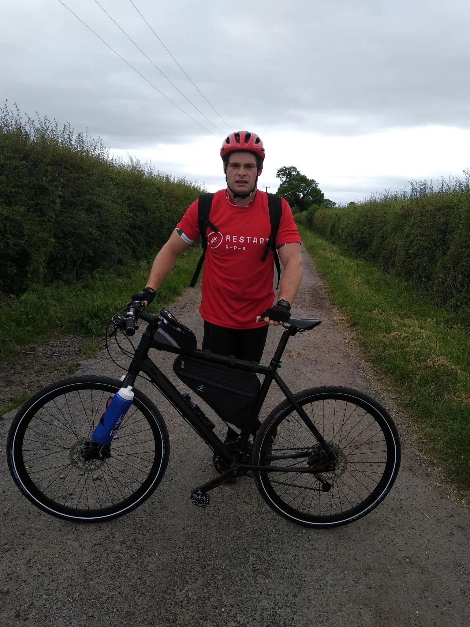
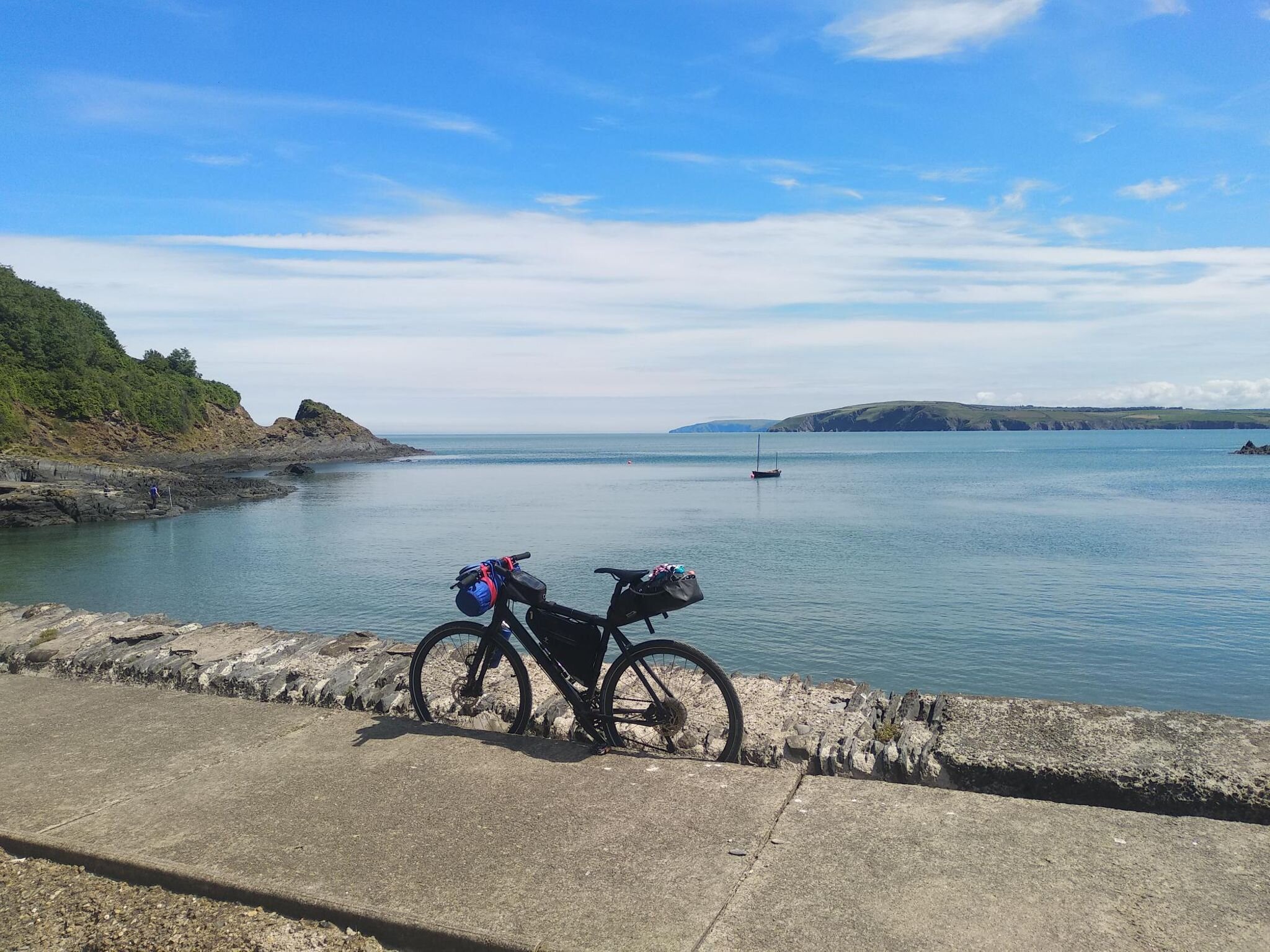
My noble steed
Unfortunately, both bikes I owned weren’t suitable for the challenge I had planned.
My road bike, well, is a road bike, and my full suspension mountain bike firstly, didn’t have enough space for a frame bag , and would have been too heavy for how much “bike carrying” I had forecasted on doing.
Without wanting to fork out several hundred quid for a new bike just for this trip, I tried to approach companies for sponsorship.
After a zero % response rate, I reached out to friends and family and luckily I was offered a “Cannondale quick” hybrid bike. It didn’t have suspension (something in hindsight I wish I had) but did have an 11-32, 11-speed drive train with hydraulic disc brakes.
I upgraded the tyres to a wider profile and attached water bottle holders to the front forks to make room for the frame bag. I also decided on not using clip-in pedals mostly due to the fact that I was going to be getting on and off my bike, a lot.

The final bike set up: Three frame bags, snack pouch and a backpack

Equipment & Gear
Because I was bikepacking and carrying all my equipment with me, I had to justify every single item I took , making sure it was both small and light enough to be carried for the duration of the journey.
An image of the all the gear I took is shown below. This all fitted into three frame bags and a backpack.
My handlebar bag was a dry bag which housed my sleeping and cooking kit
My frame bag housed all my toiletries, energy gels, electrical items and repair kit.
My saddlebag housed my cooking gas, supplements and spare clothes.
My Backpack housed a 2-litre water bladder, my camera gear, waterproof coat, alongside my food for the day.
My list of clothes for the entire trip included;
2 pairs of pants and 2 pairs of socks,
2 pairs of cycling shorts
1 x cycling jersey, 1 x t-shirt, 1 x vest, 1 x long-sleeved mid layer
1 x shorts and long thermal bottoms
microfibre towel and buddy smugglers
Waterproof shell jacket
1 pair of trainers & 1 pair of sliders

Food & Nutrition
To save weight I had planned on picking up lunch, dinner, and snacks on the go. However because I was wild camping and starting each morning early, I made the decision to pre-package and carry my breakfast.
The concoction I made up consisted of a zip-lock food bag containing fine ground porridge oats, milk powder, desiccated coconut, walnuts and chocolate protein powder.
This could be quickly and easily heated on the camping stove by adding water, eliminated the need to find a shop in the early hours, and allowed for a nutritious and calorific start to each day.
In addition to my breakfast, I also decided to take some supplements to help me recover and replenish all the calories I would burn each day.
I was lucky enough to have MSC Nutrition sponsor me for the trip. They provided me with sachets which included; whey protein, recovery shakes, carbohydrate powders, electrolytes and energy gels.
Rather than carry all 15 breakfasts and my supplements with me from the start, I stashed food drops at my friend’s houses in Bangor, Aberystwyth and Cardigan alongside leaving some at home from when I eventually reached the Gower.

Training and preparation
None, Zero, Zip, Zilch.
I didn’t actually train and I had ridden less than 150 miles in the last nine months.
In fact, the furthest I had ever cycled in one day was 60 miles, I had never cycled back to back days, and I had never bikepacked before….
So why on earth would I tackle this challenge without any training?
Well, I decided to take on the challenge with around two months notice, officially putting it out to the world at the end of April.
Prior to this I had spent the majority of the previous nine months travelling the world, only arriving home 10 days before I started my cycle.
Despite not actually having much training under my belt, I wasn’t too worried about my fitness levels.
Although they had dropped off since I played professionally, I was still extremely active, training 4-5 times a week and spending plenty of time hiking.
Mentally I felt in a good place too. Although I hadn’t taken on a challenge of this scale before, my several years as a professional 7’s player and the training it encompassed had helped me build up my mental resilience, something I knew I could bank on when times got tough.
Finally, unless I became seriously injured my pride wasn’t going to stop me from finishing.
Day 1: North Wales - Chester to Bangor
Day 1 began with a 5am start, I loaded my parent’s car and began the four-hour drive from Swansea on the south coast of Wales to the start point in Chester.
Having studied the coastal path I knew large sections of the North Wales coast were flat and cycle-friendly.
With a set of fresh legs, a positive attitude, and a friend living in Bangor who I planned on spending the first night with, I decided to go big on day one.
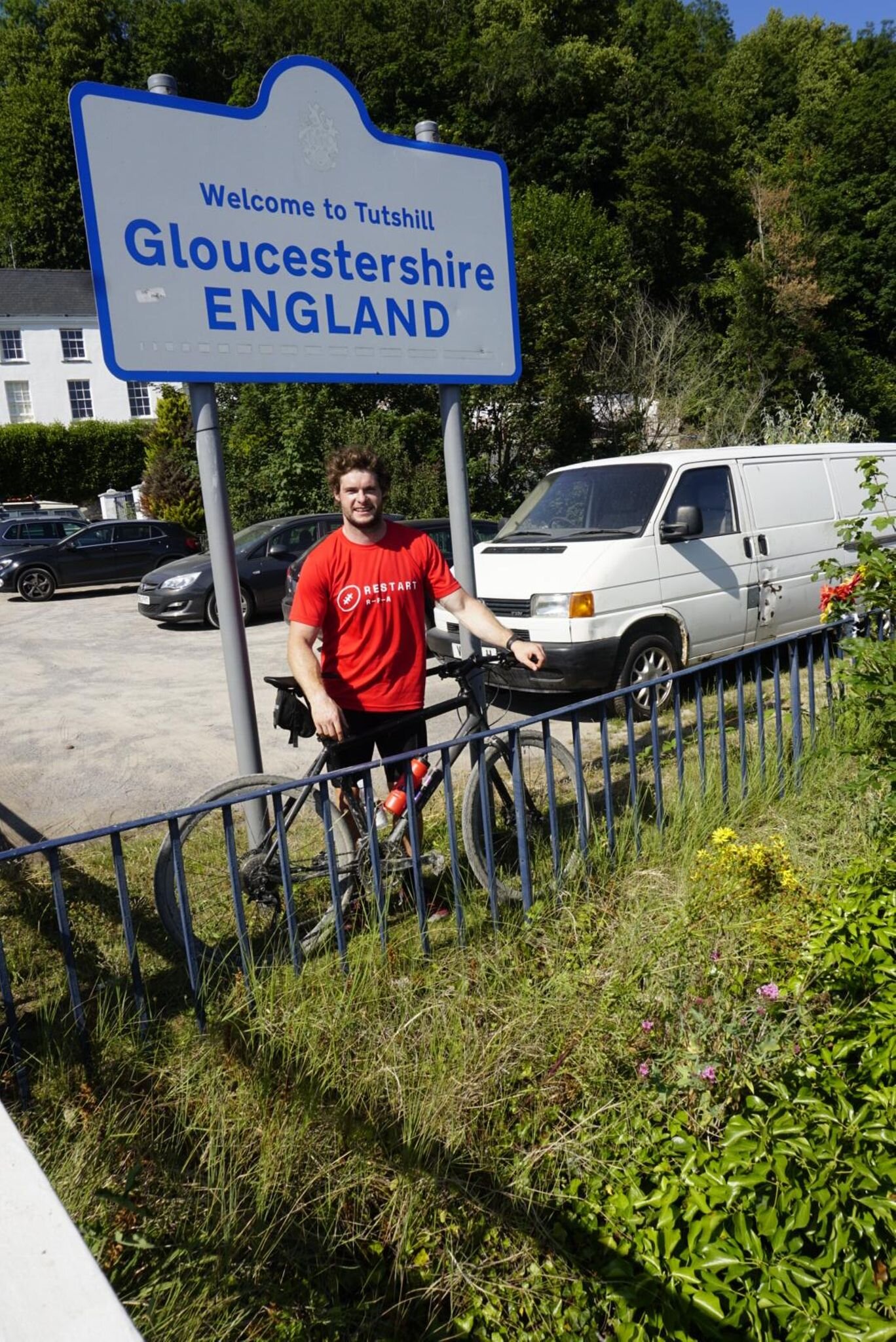
Illegally parked in a narrow lane on the England-Wales border I loaded my bike up, said my farewells and off I cycled.
My first task was finding the start point of the Welsh Coastal path so I could officially begin my cycle.
Marker point found and the obligatory photo taken, my journey began by following the bank of the river Dee northwards, along the edge of the estuary towards the most northerly point on mainland Wales, Talacre nature reserve.
At the start of my journey: I think I realised what I had actually set out to to.

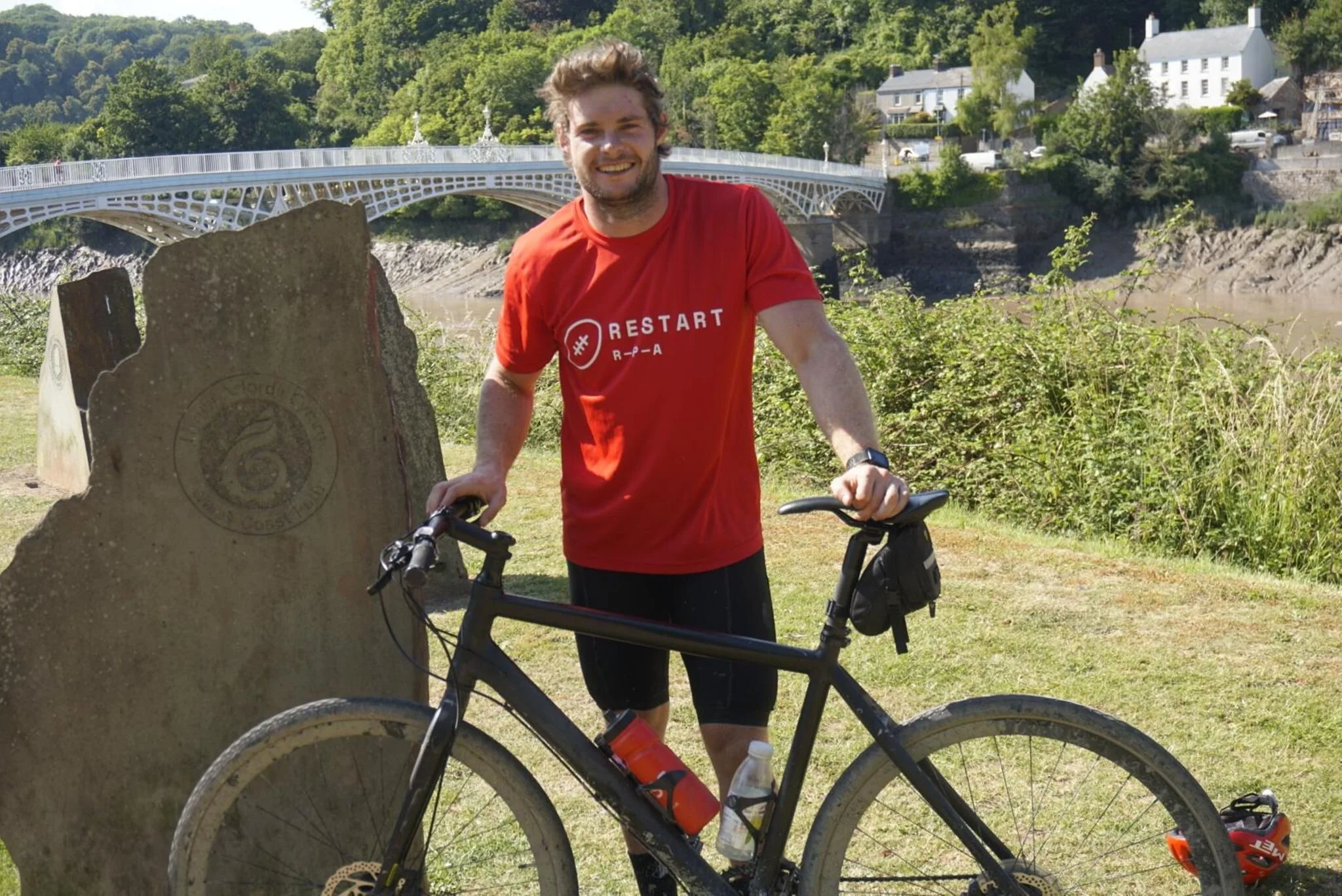
The stones which mark the start of Wales 870 mile Coastal path from Chester to Chepstow
Alone, on this rather grey, uninspiring section of the coastal path, 870 miles from my destination, the scale of my journey actually began to sink in.
Unease and uncertainty had already begun to creep in as i though to myself “What on earth was I doing?”
I had done zero training, never bikepacked before, never cycled more than 60 miles in one go, and never done back to back days on a bike.
Now i was staring down the barrel of 870 miles over 14-21 days
After a brief wobble in confidence, I had a quiet word with myself. Taking inspiration from a quote by adventurer Ross Edgley, “Be stupid enough to start but stubborn enough to finish” , I began to think rationally and break the journey down.
Although Flintshire may have felt like it, I wasn’t cycling through a war-torn, third world country, far away from civilisation.
I was in my home country of Wales, I had constant access to clean water, there would probably be a Tesco express every 20 miles and if something did go horribly wrong I was only one phone call and a couple of hours wait away from help.
The first 22 miles towards the most northerly point of mainland Wales were relatively problem-free. Apart from a few early navigational issues I hugged the coastal path alongside the banks of the estuary, tackling road, country lanes and single track paths. The initial worry had eased off and I began to settle into the saddle, feeling more confident with every passing mile.
My mood quickly changed upon turning west and heading along the North Wales Coastal path. Despite it being predominantly tarmac, I was faced with a horrific headwind which felt like I was cycling in a wind tunnel. The people windsurfing were enjoying themselves but I certainly wasn’t.
20 miles later I reached Colwyn Bay and after a brief pit stop I pushed onto Llandudno where the scenery began to change and my mood began to lift.
The Great Orme marked my first real ascent of the trip. Nearly 50 miles in the legs were begging to tire, however, the impressive coastal landscape and the mountainous backdrop of Snowdonia served to remind me why I was doing this silly cycle.
On top of the Orme, I was not only greeted with terrific views but also my first problem. An inspection of my chain showed a link was damaged and needed replacing. Without the appropriate tools for the job (great prep), I had to find a bike shop that could help me fix it.
I looped around the Orme and may my way back into Llandudno to seek out the local Halfords. £15 and half an hour later I was back on my way ready to tackle the last section of my day. Aside from cycling past the 700-year-old magnificent medieval fortress of Conway castle, the remainder of my journey was an uneventful 20 or so miles towards Bangor.
Unfortunately for me, my friend lived in one of the higher parts of Bangor and google maps decided to take me via the steepest road possible. Tackling a 15% gradient after 8 hours and 80 miles in the saddle wasn’t the most enjoyable end to the day and I’m not ashamed to say I pushed my bike up the majority of that hill.
Finally, after a brief interaction with the youth of Bangor who politely frowned upon my lack of any attempts to pull a wheelie for them, I reached my destination for the night. One day down 14 more to go.
81 miles cycled, 3000 ft climbed, 4500 calories burned,

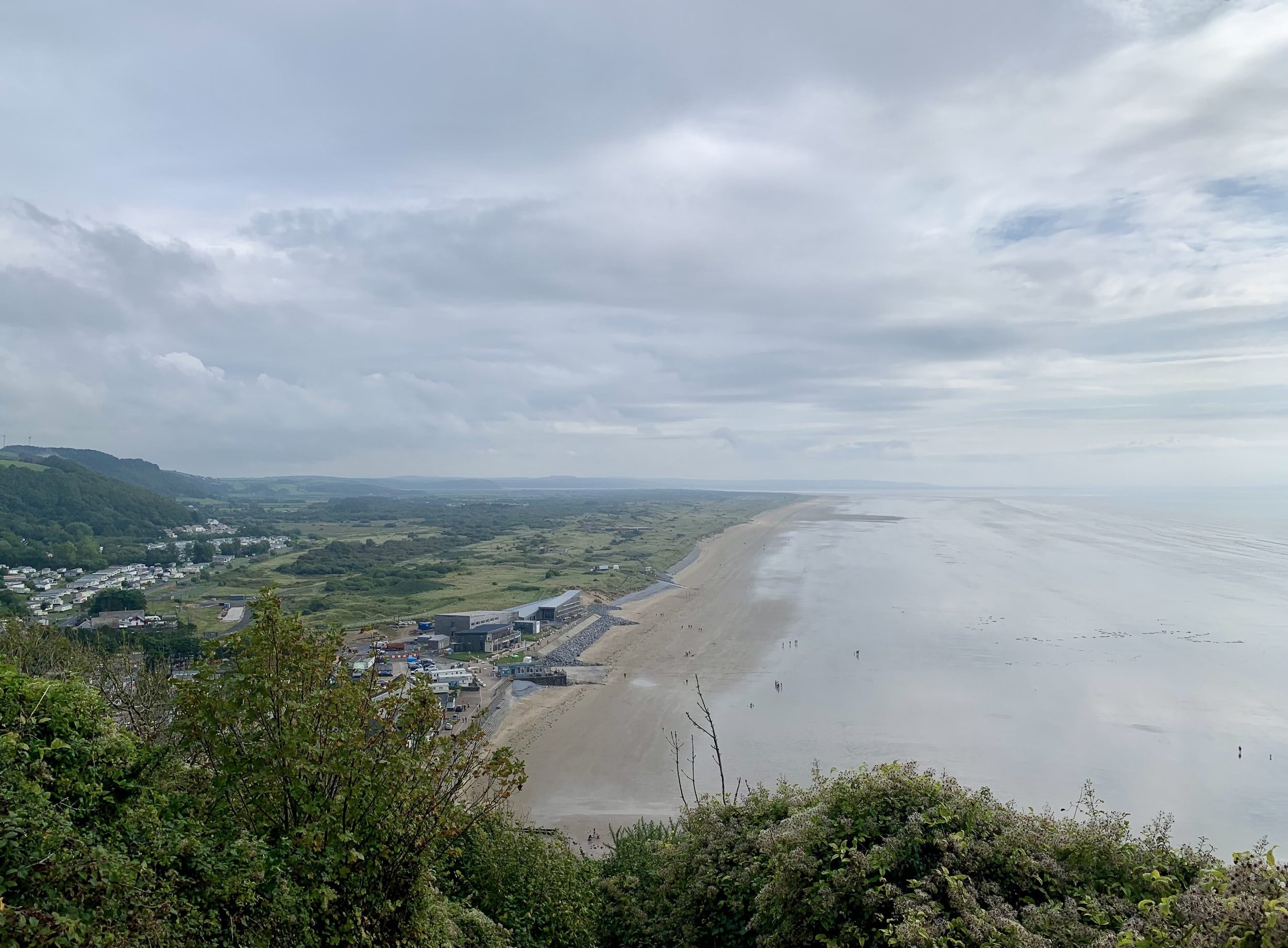
Day 2: Anglesey - Bangor to Cemaes
The plan was to tackle the 130 miles (which included 13,695ft of ascent) of the Anglesey coastal path in three days and return back to Bangor before pushing on down the Llyn Peninsula.
I hadn’t yet decided where I was going to spend my first night on Anglesey as I wasn’t sure how tough going the coastal path actually was. Fortunately, a rugby player I once coached lived on Anglesey, saw my challenge on social media and offered to put me up for the night.
Well rested, well-fed and safe in the knowledge I wouldn’t have to wild camp on a north Walians farmland, I started my second day in good spirits.
I began by crossing the impressive bridge over the Menai straight. From here I bared right, deciding to tackle the island in an anti-clockwise direction. The scenery was stunning as I passed by several idyllic fishing villages, including Beaumaris, on the way to my first stop of the day at Penmon Point.

As I pushed northwards from the lighthouse I got my first taste of how tough and brutal the coastal the Anglesey coastal path actually was. Up until this point, I had been blessed with large sections of concrete path and relatively flat trails. The next serval miles were extremely hard going. Rocky steep, narrow single-track paths replaced wide open bridleways and flat tarmacked paths. I was constantly on and off my bike, with all momentum and flow reduced to snail’s pace.
I realised pretty early on that sticking to the official coastal path, which passes through a varying landscape that includes a mixture of farmland, coastal heath, dunes, cliffs and woodland, was going to be torturous and extremely slow going, especially in 20-degree heat.
Lugging my bike and all my gear along the undulating, unstable terrain and not even being able to fully enjoy any descents due to my bike not having suspension made me re-evaluate my plan.
This cycle was more about the journey than the route. As I wasn’t attempting to break any records I decided from here on in to pick and choose what sections of the coastal path I cycled upon depending on how bike-friendly they were alongside what physical and mental state was in. This way I could enjoy the experience and not be pulled into a complete suffer-fest.
The rest of the day was slow going, I dipped on and off the coastal path, sticking to gravel bridleways and ploughing through farmer fields when available.
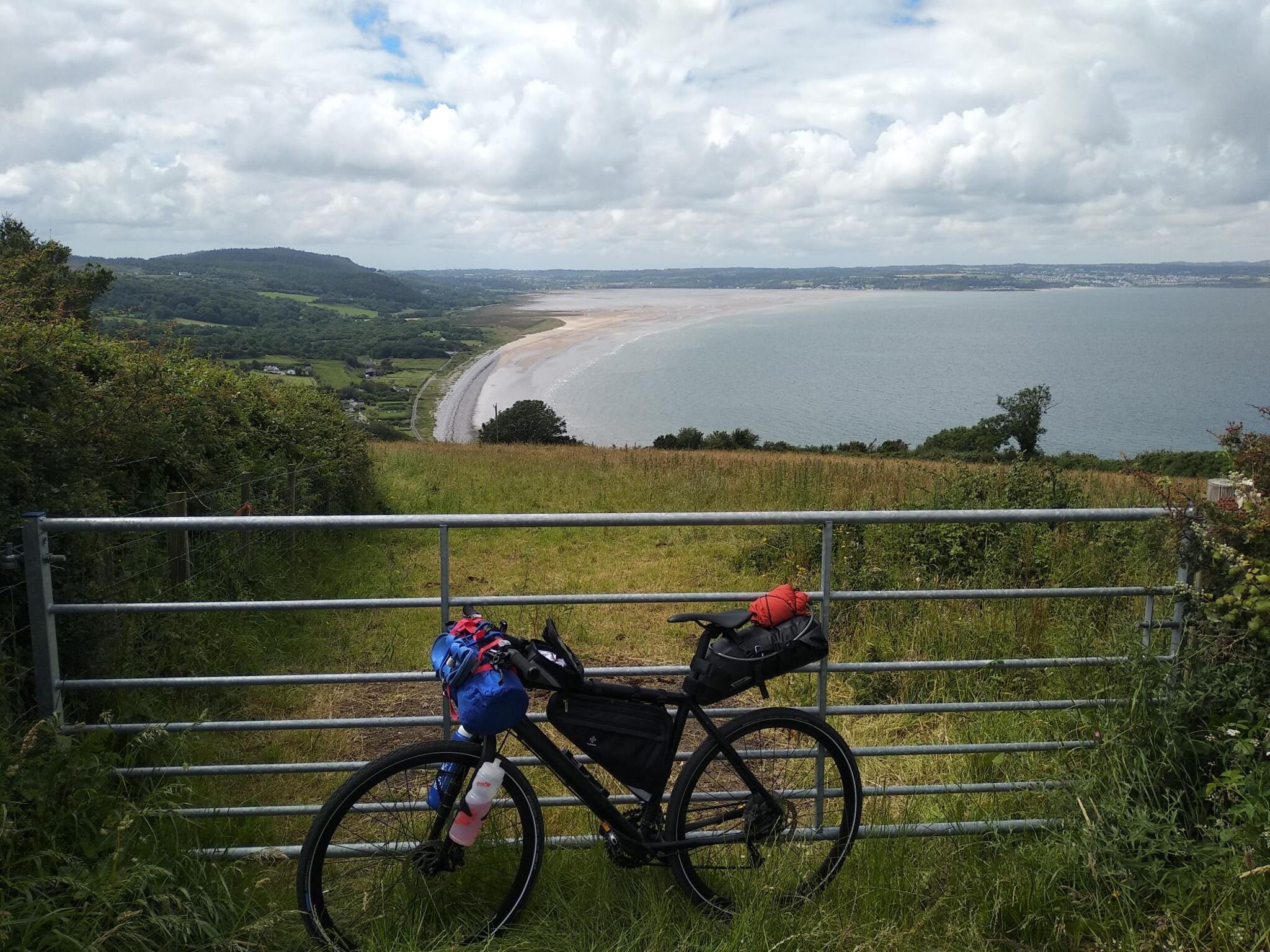
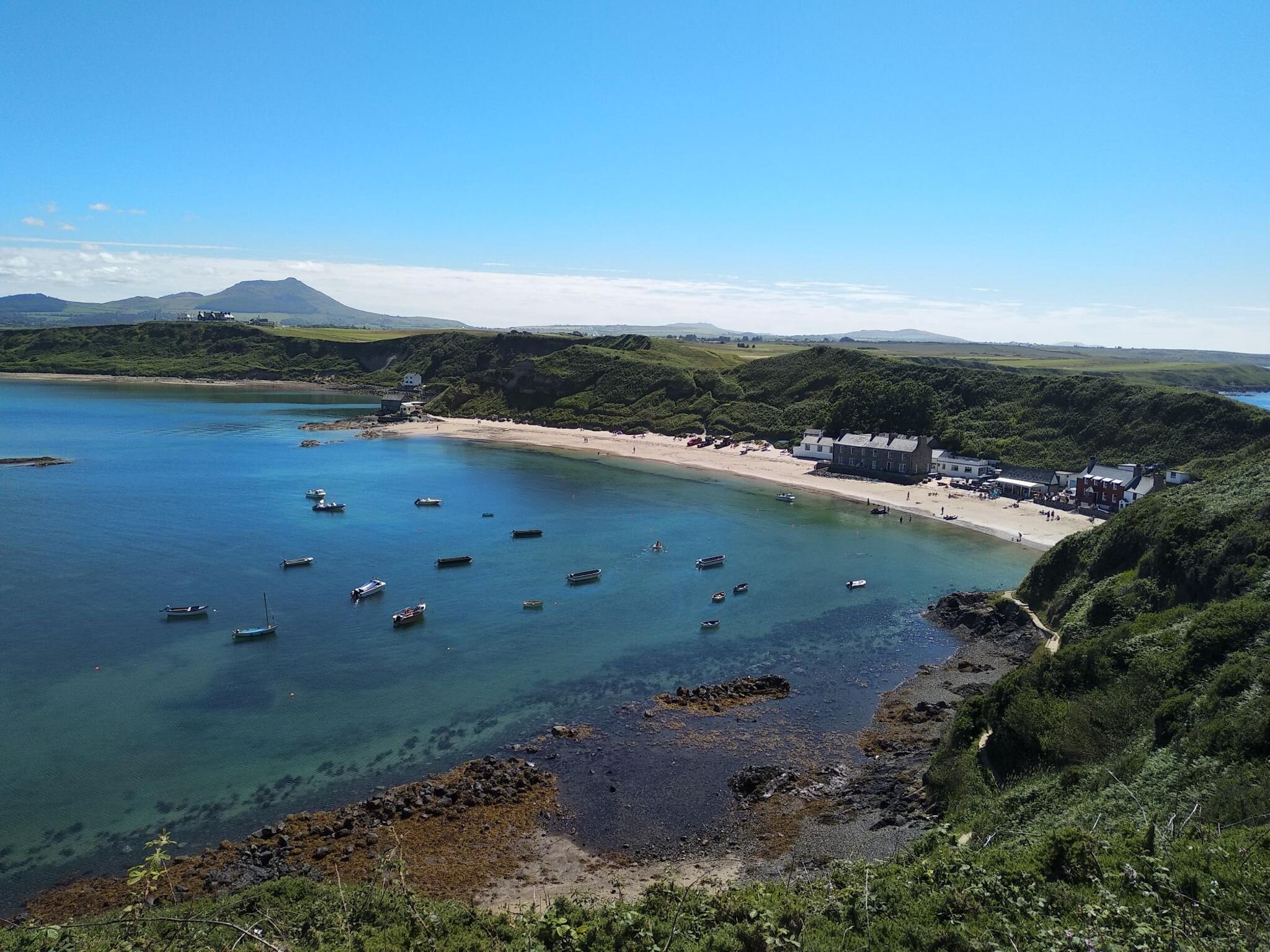
One positive was the spectacular coastal scenery my eyes were feasting upon. The Isle of Anglesey Coastal Path falls within an Area of Outstanding Natural Beauty (AONB) which covers 95% of the coast. Hidden away amongst the miles of rugged, unspoilt coastline were beautiful sandy coves and a huge array of historic and cultural sites. Having never really ventured onto Anglesey before I was taken back by how beautiful this part of Wales was, especially the northern coastline.
Day two finished at Cemaes bay with an inland ride to my friend’s farm, where he was kindly hosting me for the evening. Highlights included Penmon point, Porth Wen Brickworks and Llanlleiana Porcelain works , which is situated just off the most northerly point of Wales.
128 miles cycled, 6,700ft climbed, 8,200 calories burned


Day 3: Anglesey - Cemaes to Four Mile Bridge
Refreshed and replenished, and with the invitation of spending another night at my friend’s house, I shed my heavy saddle and handlebar bags and started the day by re-joining the coastal path at Cemlyn bay.
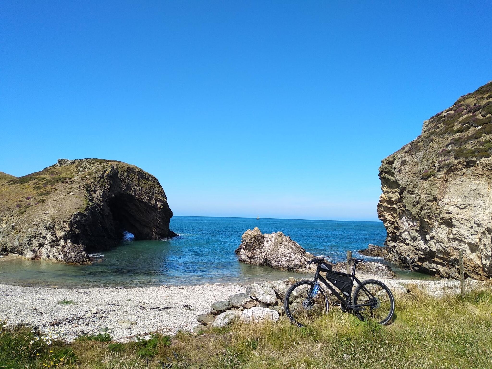
Within five miles I was quickly reminded how brutal and unforgiving the coastal path is. I pretty much carried my bike for serval miles until I reached the spectacular Ynys y Fydlyn Beach (images below).
A quick pitstop which included an encounter with an inquisitive seal, followed by a conversation with a rambler, revealed that the next several miles were just as un-cyclable as the last.
Dejected and frustrated, having taken serval chunks out of my shin after bashing them against the pedals, I swallowed my pride and ventured onto the coastal road for the next five miles. From here I dipped on and off the coastal path until I crossed over onto Holyhead.
After a gourmet lunch stop in Aldi, which I then ate in the car park. I pushed on towards the highest point on Anglesey, Holyhead mountain.
Knowing I would be rewarded with terrific views and I could push onto the spectacular South Stack lighthouse from the summit, I decided to lump the bike on my back and begin the slow slog to the summit. One and a half arduous miles and 500ft of elevation gain later I reached the summit and was instantly vindicated for my hiking mission. I was greeted by panoramic views across the entire island and back towards Snowdonia.
From here, the coastal path flowed downhill towards one of the highlights of the island, South Stack lighthouse and sea cliffs. The lighthouse acts as a waymark for coastal traffic crossing the Irish Sea and is one of the most impressive features on the island. I didn’t have it in my legs to venture down the 400 steps onto the island, however, I did take the time to enjoy the impressive views of the coastal cliffs.

The view towards south stack from half way up Holyhead mountain

South Stack Lighthouse
From South Stack, I hugged the coastal road past Treaddur bay before re-joining the coastal path along the clifftop around Rhoscolyn to Silver Bay. The stretch of coastline was up there with my favourite in Wales. Behind every small headland lay another golden sanded, unoccupied cove being lapped upon by crystal clear waters. I stopped at the magnificent Silver Bay for a quick dip, before heading up to Four Mile bridge where I called it a day.
Instead of cycling back to my friend’s house on the north of the island, he kindly offered to pick me up and take me for a well earned McDonalds. Three double cheeseburgers, five chicken selects and a Mcflurry later I had replenished all 3,000 odd calories I had burnt.
175 miles ridden, 9,600ft climbed, 11,800 calories burned
The summit of Holyhead mountain
Day 4: Anglesey - Four Mile Bridge to Bangor
Having already cycled 2/3rds of the Anglesey coastline, Day four promised to be one of the shortest of my entire cycle.
To save the legs I was kindly dropped at the same spot I was picked up 14 hours previously. It was another blue-skied, cloud-free day (I was now four from four on the trip so far) and again I set off in good spirits.
Less than five miles in, I reached Anglesey Military airport and was faced with a dilemma on how I reached Rhosneigr.
Option 1. Stay on the official coastal route and try and cycle my bike across 1.5 miles of beach
or
Option 2: Take an 8-mile detour inland on the roads around the RAF base
Being absolutely awful at decision making I pondered over this dilemma for a while. It was only when I saw a topless bloke cycling across the beach I thought, well how hard can it be?
It turns out, very hard.
Especially when you have a bike full of luggage and awfully thin tyres. I could barely ride two meters without grinding to a halt. So I ended up pushing my bike for a good 45 minutes through soft sand in 20-degree heat. The perfect start to any day.
Already fed up by 11 am, I emptied my shoes of sand in the charming seaside village of Rhosneigr and cracked on, following the official coastal path for a further four miles until I reached the majestical Eglwys Cwyfan.
More commonly known as the Church in the Sea. Cwyfan's Church is a Grade II*-listed medieval church perched on a tiny island called Cribinau, encircled by a sea wall. This medieval church dates to the 12th century and originally stood at the end of a peninsula between two bays. However centuries of erosion turned Cribinau into a small tidal island which is now only accessible at low tide via a rocky causeway.
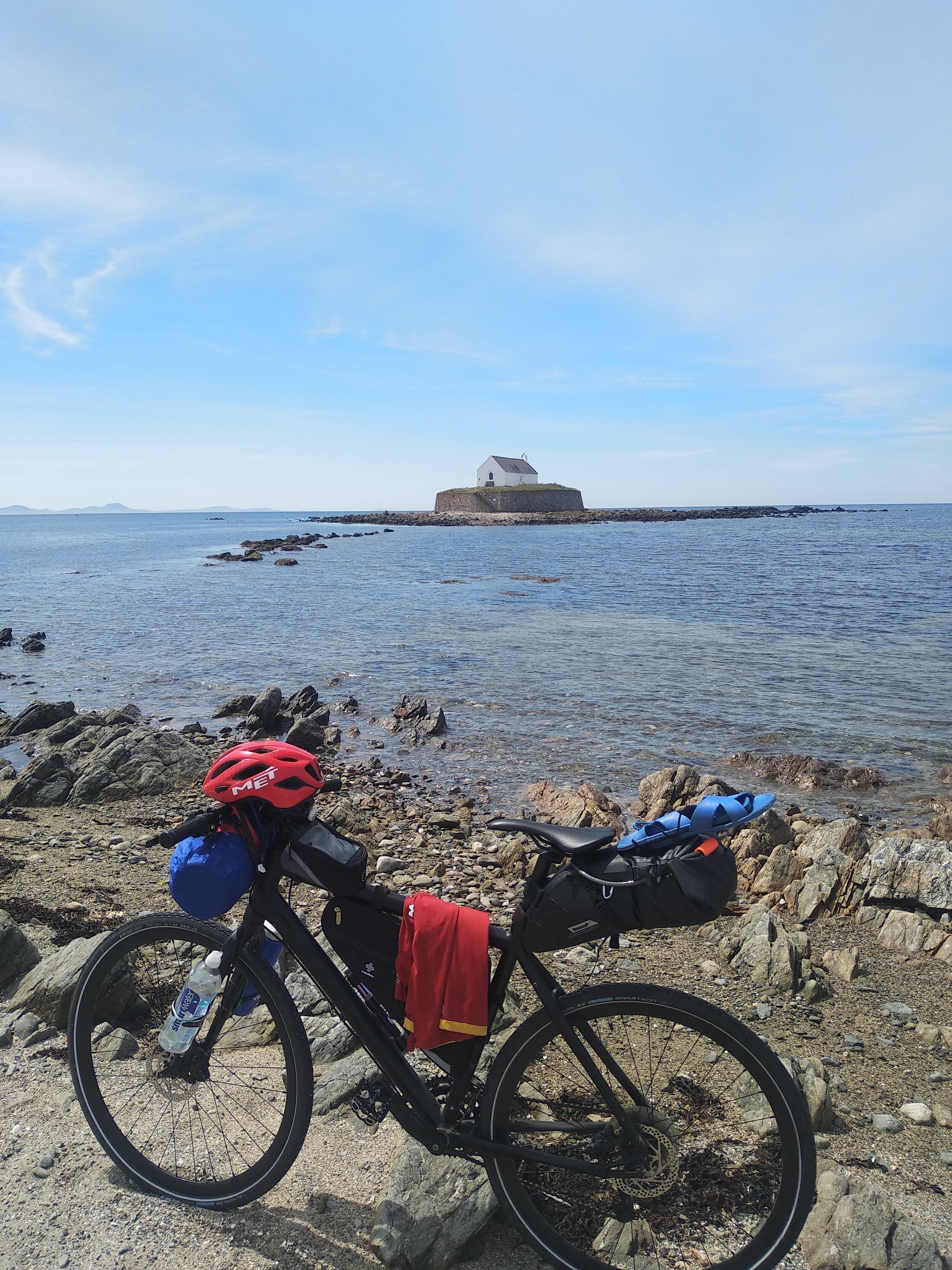

It was a place I’d always wanted to visit and it didn’t disappoint, despite thee tide not being low enough to reach the island. Spirits lifted I pushed on, knowing that my favourite place on Anglesey was yet to come.
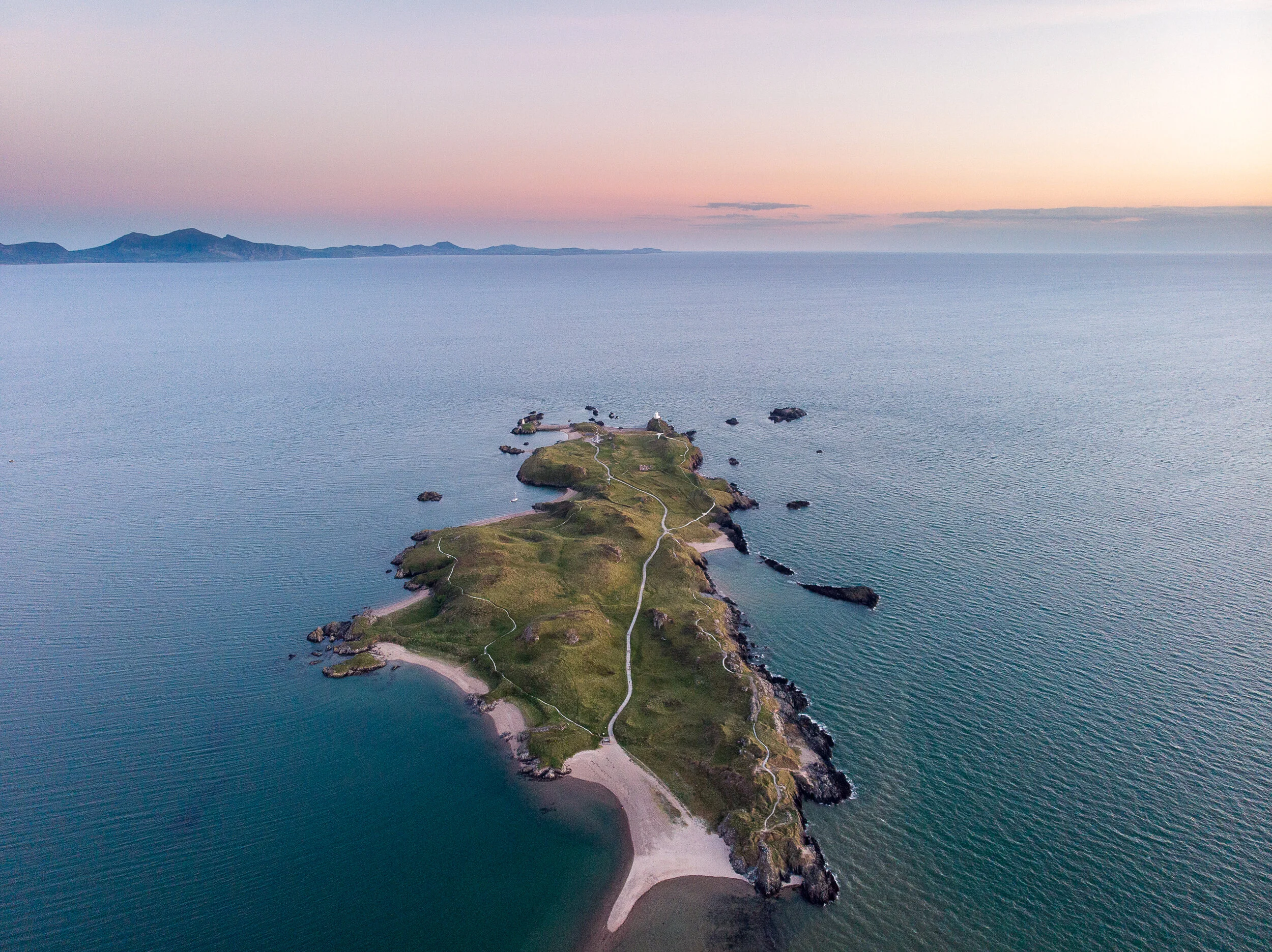
Six miles later I was weaving my way through the Corsican pine trees of Newborough forest on the route to Ynys Llandwyn. This stunning outcrop of land is one of the most picturesque locations in Wales and was designated as Wales’ first coastal National Nature Reserve back in 1955.
Situated on the island is the white lighthouse and church which was once home to Saint Dwynwen - the Welsh patron saint of lovers. This narrow finger of land is only cut off from the mainland at the highest if tides. Fortunately, I was able to cross and spent a good hour relaxing and swimming at one of its golden sanded shores which looks back towards the mountains of Snowdonia.
Refreshed and replenished I hopped back up on my bike and followed the coastal path for a further 17 miles until I reached the Menai bridge, stopping briefly at Llanfairpwllgwyngyllgogerychwyrndrobwllllantysiliogogogoch to get an obligatory photo of the sign.
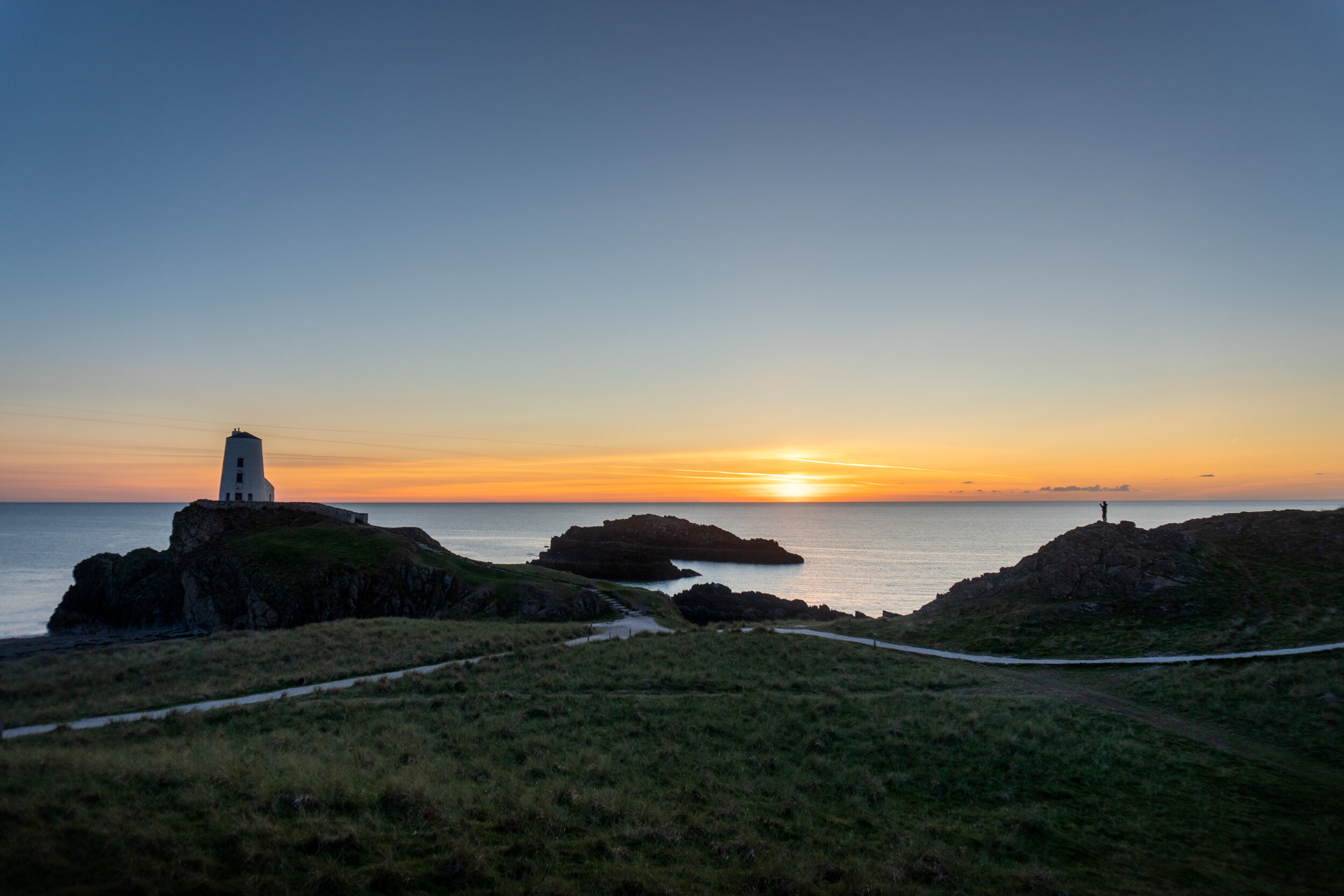
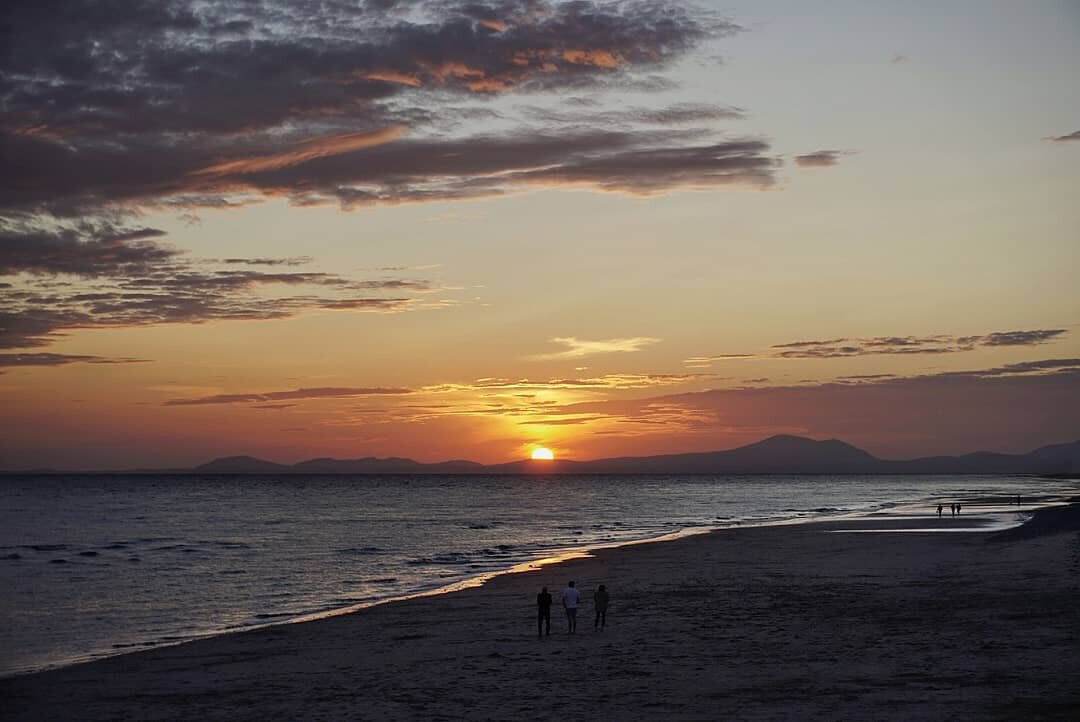
Arriving back in Bangor shortly after 5:30 pm and having cycled my shortest distance yet, me and the couple I was staying with decided to make the most of the fine weather and drive back to Ynys Llandwyn for a sunset BBQ and beers. Both the company and food distracted my mind from the task at hand and allowed me to relax. To top it all off the sky lit up a magical orange, putting an incredible end to the most memorable day of the cycle so far.
215 miles ridden, 11,436ft climbed, 15,300 calories burned
Sunset over Llandwyn Island
Day 5: Llyn Peninsula - Bangor to Abersoch
Day five was once again blue-skied and glorious, it seemed my prayers to the weather gods were being answered.
It was also a day I was looking forward to as the Llyn Peninsula was also a region of Wales I had never visited before. The peninsula has been described as the Cornwall of 50 years ago and having researched some of the beaches I was excited to explore the coastlines many sandy coves.
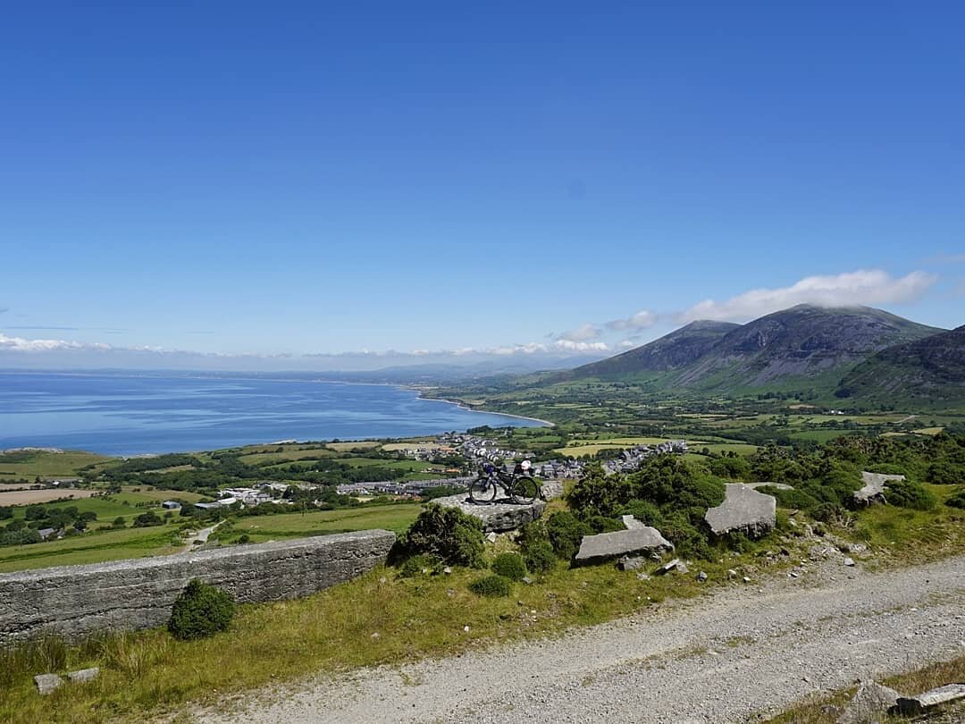
From Bangor the I followed coastal path west passing through the town of Caernarfon, from here I picked up the coastal road for a further 12 miles making my way to the village of Trefor.
It was here I reached my first decision of the day. Either climb up and over the coastal mountains of Yr Eifl, a group of three peaks which top out at 560m, or shamelessly detour inland. Having discovered there was some form of road leading to the top and being the mountain goat that I am, I ignored my already aching legs and chose death.
What followed was a one mile, 1,000ft slog up a loose gravel path with a gradient which topped out at 26%.
With the unrelenting sun beating down on me and the bike on my bike it was a decision that I questioned for the entire journey. Even the Mountain goats who roamed its steep slopes seemed to be staring at me in bemusement.
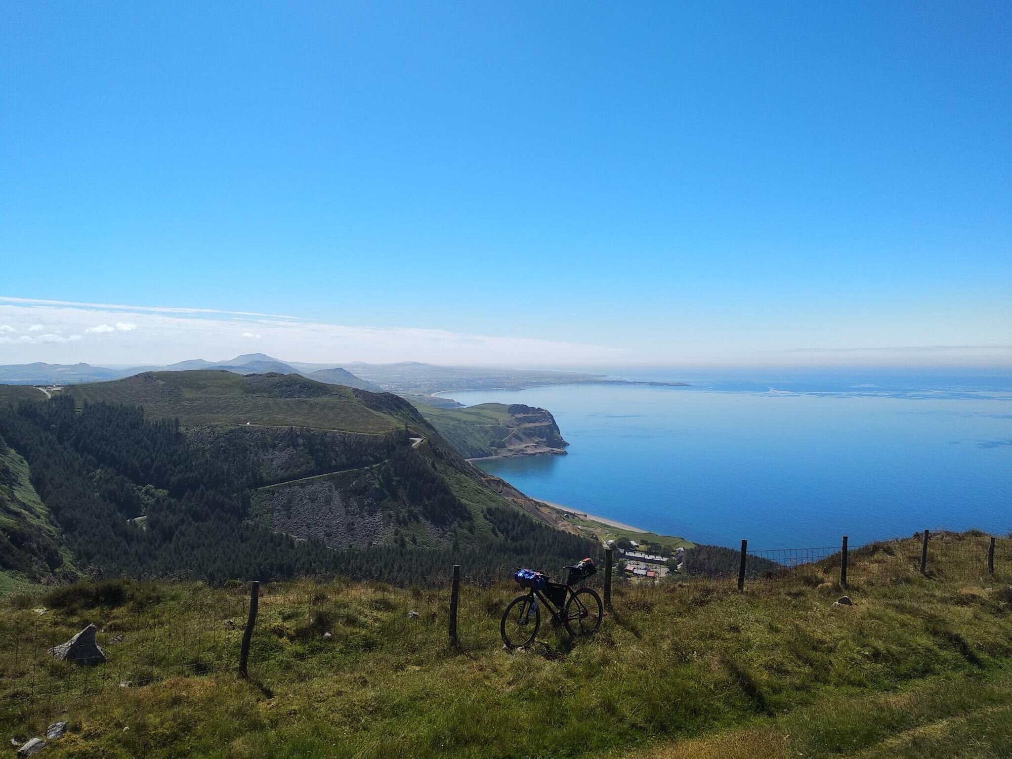
After several brief stops to explore the disused granite quarries which lined the mountains slopes, I reached the summit an hour later. Despite my legs feeling like they were made of jelly, my barmy decision was justified by the remarkable panoramic views back towards Anglesey. These views were then amplified as I passed up over the saddle of the mountain and began the descent towards the tip of the Peninsula.
A delightful four mile descent followed before I continued onto the iconic Ty Coch Inn situated in the village of Porthdinllaen. Famously voted as one of the top 10 beach bars in the world, Ty Coch is quite literally a pub on the beach. What makes the location even more impressive is the beach is situated the tip of a small peninsula and is backed by the gorgeous Nefyn and district golf course.
With the magnificent mountainous backdrop of Snowdonia looming in the distance, This spot was honestly one of the most picturesque locations I’ve ever laid eye on in Wales. I didn’t stop at the Ty Coch inn, instead I continued along the peninsula and had a dip and power nap at the empty beach located next to the lifeboat station.
Ty- Coch inn on the shores of Porthdinllaen
With elements of the coastal path being uncyclable from here I pushed on and followed the coastal roads sdouth-west stopping briefly at the just as impressive Porthor, aka Whistling Sands. The name is derived from the noisy sand which squeaks under your feet. This is caused by the specific shape and silica content of the sand which squeaks or whistles when rubbed together if walked upon in warm weather.
From Pothor I hugged the coastal road until I reached Aberardon. 55 miles and 9 hours into my day I was now on the lookout for a place to eat and a suitable spot to spend my first night wildcamping. Even though it was 7 pm and the light was at I premium I decided to push on for a further 9 miles towards the popular seaside town of Abersoch in the hope of finding a wider choice of places to eat.
I regretted this decision immediately, as I went straight into a four-mile, 550 ft climb. On a positive note, at the saddle I was treated to incredible coastal views over Hells Mouth and a delightful three-mile descent back down to sea level. As I was pushed for time I stuck on the roads and managed to make it to Abersoch shortly before 8:30 pm.
A quick dip and a pizza later I was now on the hunt for a place to wildcamp. My decision to push on to a more built-up area may have been justified for finding food however I struggled to find a suitable place to pitch my tent. The sun had set and I was aimlessly cycling around the peninsula desperately trying to find a place quiet enough not to be disturbed by the weekend revellers.
45 panic fuelled minutes later I descended towards a beach which looked slightly further away from civilisation. It was now pitch black, and with not much other choice I pitched my tent in the dark next to a fence and hoped for the best.
289 miles ridden, 16,068ft climbed, 16,971 calories burned

Whistling Sands: I can confirm the sand does squeak and I celebrated finding this out with a feast ice cream.
Day 6: Llyn Peninsula- Abersoch to Talybont
Fortunately, I wasn’t disturbed overnight and awoke to a grey overcast sky and the wonderful view of Porth Cariad. I was even complimented by an early morning dog walker on my choice of pitch, which by looking at the image below wasn’t half bad.
After five days of being baked like a potato in the pure sunshine, I was grateful to awake to come cloud cover. Tent packed and breakfast eaten I left my first wild camp spot and pushed on, well-rested despite the stress that finding a suitable pitch location had brought.
With heavy legs and a morning conversation with a member of the public who informed me I wouldn’t get much joy out of cycling the coastal path, I followed the coastal road east, passing through the seaside villages of Pwllelli and Criccieth on the way to Porthmadog. The day was rather uneventful and slightly less uninspiring when compared to the northern coastline of the peninsula .

My wildcamp spot above Porth Ceiriad, a long day on the bike followed by prioritising pizza meant that I pitched up in the dark and did see where I was camped until the morning.

My pitch on night six
The highlight of the day was meant to the coastal village of Portmeirion. However after finding out you had to pay £10 to enter and being tighter than a ducks arse I choose to skip the village and push on.
Now I’m unsure why I decided to take an 8-mile detour inland via the village of Maentwrog rather than crossing the one mile Pont Briwet bridge. One can only assume it was because the bridge was closed, however, my poor memory and lack of photos can neither confirm nor deny this. One thing I can remember is stopping at a war memorial in Maentwrog for a lunch break. After being informed by a local there wasn’t anywhere in the village to buy a coffee, I was over the moon when he re-emerged from his home with a fresh brew and several chocolate digestives.
My decision to bolt the coffee then immediately have a 15-minute‘ coffee nap’ on a nearby metal bench must have completely bamboozled him, however there is a science to this madness. Conventional wisdom is that caffeine interferes with sleep. But if you caffeinate immediately before napping and sleep for 20 minutes or less, you can exploit a quirk in the way both sleep and caffeine affect your brain to maximize alertness. You can find out more about this witchcraft here.
Refreshed, replenished, and having been on the receiving end of a random act of human kindness, I left Maentwrog and pushed down the Snowdonia coastline towards my final destination of Talybont.
Having announced my challenge to the world of social media, I was pleasantly surprised when the owner of Tony’s Takeaway in Talybont reached out and kindly offered to refuel me when pass through. Having never turned down a free meal I took him up on the offer. Not only did he feed me until I could barely walk, he even put me in contact with a local campsite who
offered me one of their pitches for free. There was even a hot shower on site which was an absolute delight.
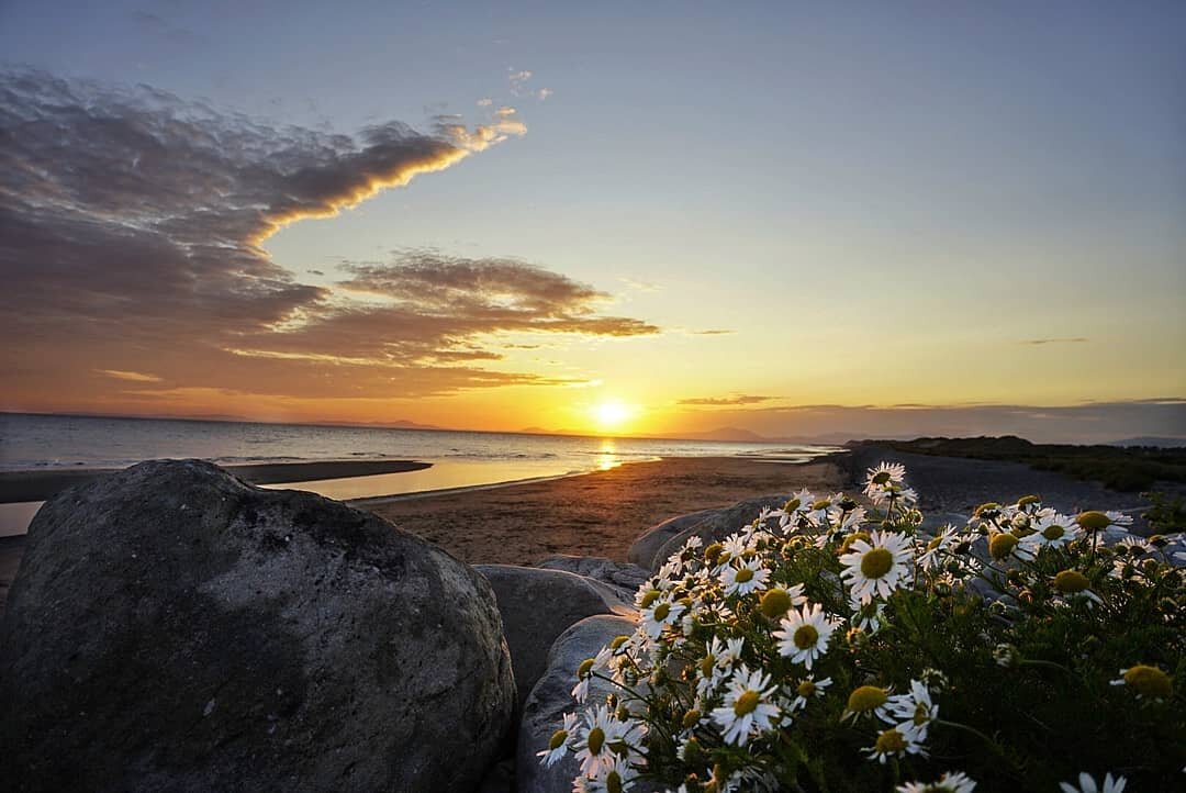
With my tent pitched stress-free and a belly full of Italian food, I made the time to cycle down to Barmouth Beach to watch an incredible sunset. It was quite surreal looking back across to the tip of the Llyn peninsula and realising I had camped there 12 hours previously. The scale and distance of the journey were beginning to sink in.
359 miles ridden, 18,811ft climbed, 21,714 calories burned
Day 7: Southern Snowdonia - Talybont to Aberystwyth
Carb-loaded I departed Talybont and crossed the magnificent Barmouth Bridge across the Mawddach Estuary.
Looming beneath the shadow of Cadair Idris and the southern Snowdonia mountains, this 800 metre Grade II* listed bridge is the longest timber viaduct in Wales and one of the oldest in regular use in Britain. I was grateful for it being part of the coastal path as the alternative was a 16-mile detour inland via Dolgellau.
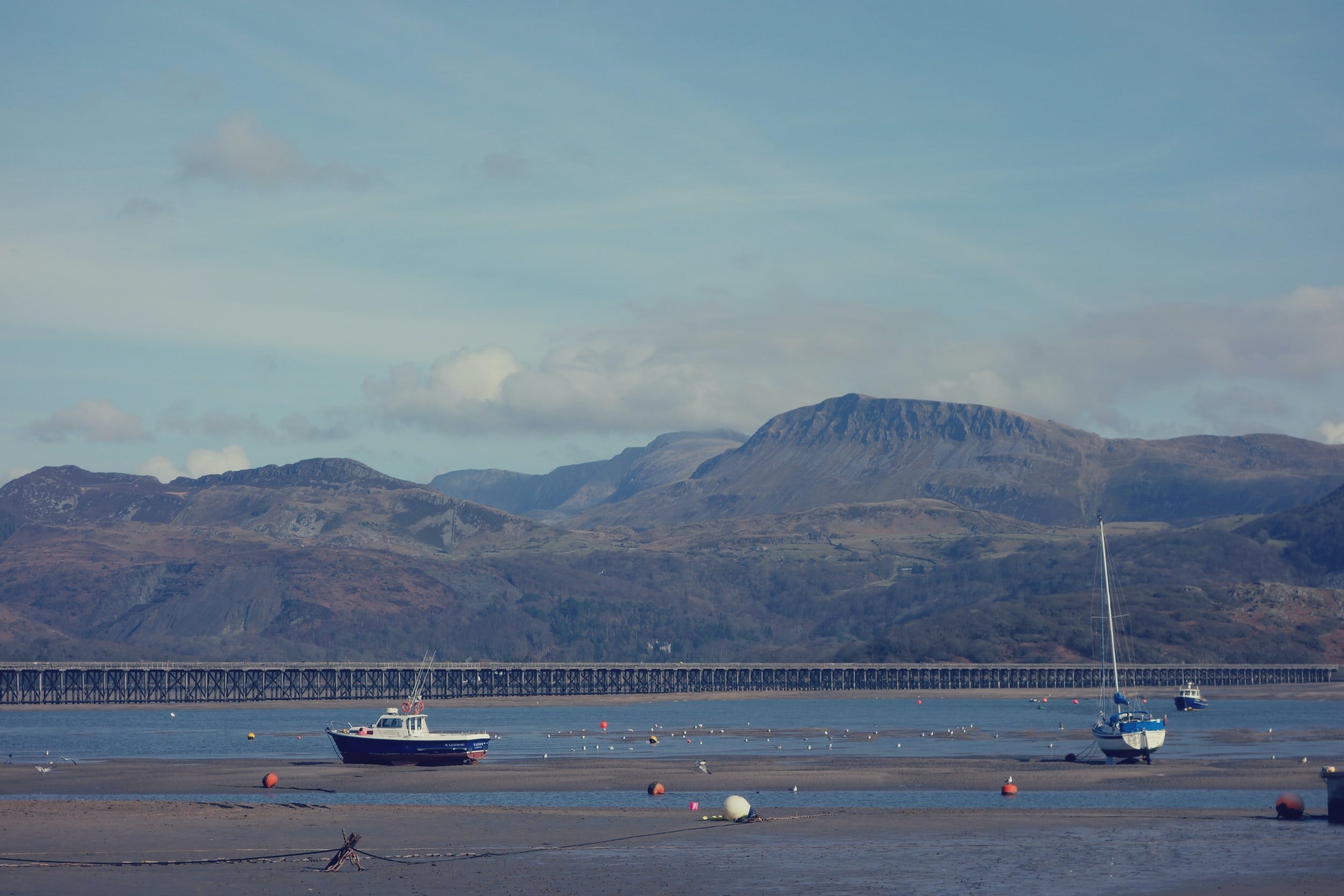
Barmouth bridge looking towards Cadair Idris
From here I followed the spectacular coastal path south passing through the final sections of Snowdonia national park to the seaside town of Aberdyfi. Some of the sections of the route were so dramatic they reminded me of the famous pacific coast highway in California.
A coffee stop and lunch break in Aberdyfi did nothing to take my mind of the fact that despite being less than 500m from the tip of the nature reserve on the other side of the estuary, I had now had to follow the coastal path for 22 miles inland via Machynlleth to reach the other side.
two hours later I reached the other side of the estuary and cracked on with the final 10 miles of the day. Over 400 miles into my journey I was then greeted by two savage hill climbs to finish the day. The first was 15% and the second was around 13%, both involved around 400ft of elevation gain over one horrific mile.
The reward was a refuel at the incredible PD’s Diner situated on the Aberystwyth sea front and a night spent with one of my oldest and closest friends who had relocated to town. Despite eating fish and chips and copious amounts of ice cream two hours previously, I still found room for an extra-large KFC.
418 miles ridden, 22,148ft climbed, 21,714 calories burned

Borth hill, after a savage 25% climb to the top

Aberystwyth Sea front
Day 8: Mid Wales- Aberystwyth to Cardigan
Day eight marked the half-way point in my journey, over 420 miles ridden and just over 420 miles to go.
Having driven the coastal road up through Aberystwyth many times before, I knew full well how erratic the coastline was and I was dreading this section of the route.
It turns out, cycling it was significantly worse than I had imagined.
Two and a half miles in, my first climb; 1.5 miles, 450ft and a 10% gradient, a delightful way to wake the lungs and legs up. 23 miles and a couple more savage climbs later I reached New Quay feeling flatter than a witches tit.
Not even the dolphins swimming around the harbour could pull me out of the slump I was in. Two scotch eggs, a Tesco meal deal and a 45-minute power nap later, I peeled myself off the harbour wall and begrudgingly got back on my bike.
By this point, I decided to abandon the official coastal path as it was un-rideable and I wasn’t in the mood for lumping my bike on my back for miles at a time. Instead, I chose to follow the roads which run closest to the sea. However I’m pretty sure this actually made my journey worse as every beach seemed to be located at the bottom of a steep valley between two headlands.
I usually live for steep descents but it got to the point where I could no longer enjoy them. I knew as soon as the hill reached the flat, there would be another hill equally as steep leading back out of the bay. With my legs screaming like a six-month-old toddler and my energy levels lower than the marina trench, the thought of seeing another 20% gradient sign actually made me shiver.
Worried I was going to buckle like an uncooked piece of spaghetti, I decided to pick and choose which bays I dropped down to. I avoided Llangrannog, mostly due to the fact there’s a dry ski slope within the village which indicated the hills weren't exactly flat.
I did however choose to drop down the wonderful Tresaith Bay. Named after the River Saith which cascades as a waterfall over the cliffs onto the rocks below, it was a beach I had seen on social media and always wanted to visit.

Tresaith Bay
I immediately regretted my decision to drop down into Tresaith as the one and half-mile, 500ft descent seemed to go on for an eternity. Knowing I had a horrific hill climb ahead of me, I took my time to enjoy the beach before reluctantly climbing back on my iron steed and completing the final 15 miles towards Cardigan.
Arriving at my friend’s house I was completely spent. I had climbed over 5,000ft and my strava elevation map looked like a cardiogram. To paraphrase Ian Beale in Eastenders ‘I had nothing left” and having spent most of the day in the hurt locker was eternally grateful that I didn’t have to worry about where I had to pitch my tent.
468 miles ridden, 27,226ft climbed, 26,047 calories burned
Not its not a Echocardiogram, its in fact my strava elevation map for the day. so much for the coast being flat.

Oh Piss off

The aftermath of day eight
Day 9: Pembrokeshire - Cardigan to St Davids
Day nine saw me leave the Ceredigion coast and cross over into Pembrokeshire national park.
With 186 miles of breath-taking coastline and more blue flag beaches than any other county, Pembrokeshire is a national park like no other. This beautiful stretch of rugged coastline is also the only UK national park to be situated completely on the coast and has a diverse landscape that houses world-renowned beaches, an abundance of coastal wildlife and a plethora of picturesque seaside villages.
Although I was excited to explore Pembrokeshire’s crinkled coastline, I was also conscious of how difficult it would prove to be. Having visited this slice of heaven on numerous occasions I knew first hand how rugged and unrelenting aspects of the coastal path were. I was certainly going to have to pick my battles and choose my coastal sections wisely if I was going to stand any chance of completing.
I followed the coastal path to Poppit sands before a 500ft hill climb reminded me that even if I stuck to the roads I wasn’t in for an easy ride. I ventured on and off the coastal path, passing trough Newport before briefly stopping in the idyllic Cwm-yr-Eglwys beach.
Cwm-yr-Eglwys beach
I had opted to stay off the coastal path as my bike simply wasn’t suitable for the task at hand. Unfortunately for my legs, this meant I was constantly descending and ascending hills. This was a tough decision as I missed out on such beautiful locations as Strumble lighthouse. I did however stop by the magnificent Blue Lagoon in Abereiddi.
Blue lagoon is an abandoned slate quarry, filled with turquoise water on the north coast of the coastal path. Shut down in 1910, the seaward wall of the quarry was blasted open by fisherman in order to flood the mine and provide refuge for their boats. With the fishing industry all but disappeared, Blue Lagoon is now an oasis for swimming, coasteering and even cliff diving. Despite the name, the water within the quarry has a beautiful greenish hue due to its high mineral content.


I took the time to have a dip and even found the energy to swim across the quarry and jump off the steep slate walls. After having £10 cash donated to me from a stranger I pushed on towards the St Davids Peninsula.
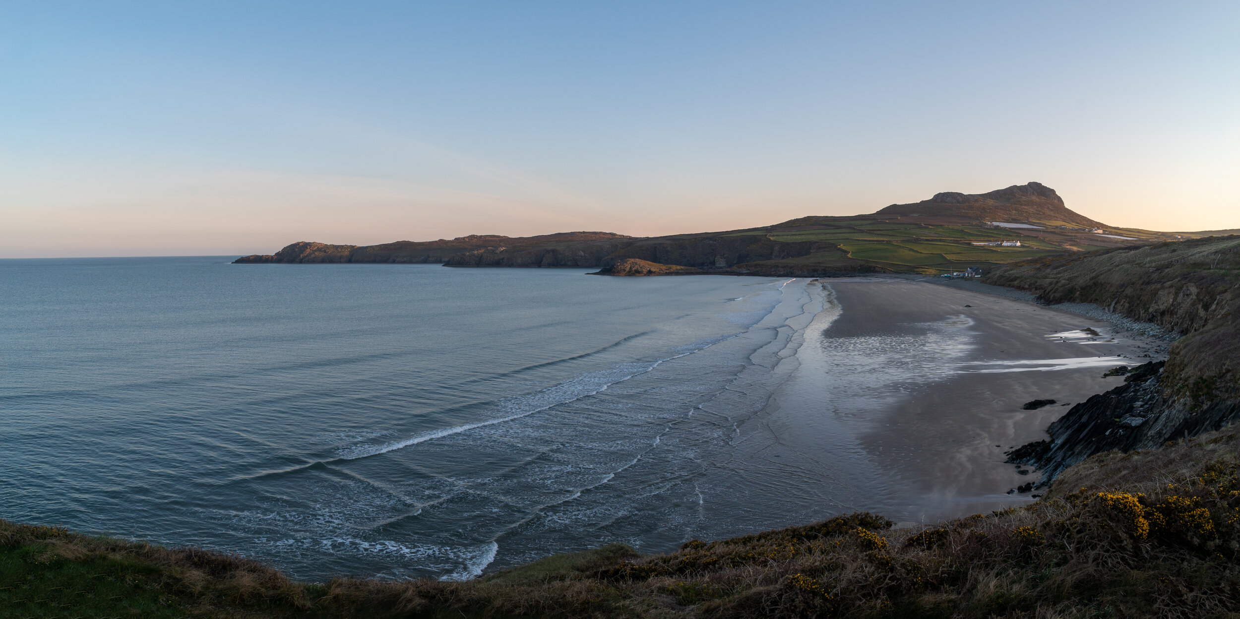
This section of the Pembrokeshire coastal path is absolutely beautiful, from the panoramic peak of Carn Llidi to the gorgeous golden sands of Whitesands bay, there’s no shortage of things to see and do. I carried along towards the tip of the peninsula, passing the beautiful St Justinian Lifeboat station before heading inland to source my bed for the night.
I had been offered accommodation with a friends sister who lived at a local farmhouse. The building turned out to be the most westerly settlement on mainland Wales, which I thought was a pretty cool fact. Accommodation sorted, I settled in for the evening feeling grateful not only to have been blessed with such incredible weather, but for also the kindness of both friends and strangers who had supported me on my journey so far.
519 miles ridden, 32,067ft climbed, 30,375 calories burned
Day 10: Pembrokeshire - St Davids to Milford Haven
Day 10 brought my first sighting of rain which was a relief as I was beginning to think I was in some form of the Trueman show up to this point. I set of from Treginnis farm on the roads, avoiding the uncyclable coastal path and passing through St Davids and Solva until reached Newgale. After a panoramic descent back down onto the shoreline I followed the coastal path south through to the quaint seaside villages of Broadhaven and Littlehaven.
By this point the light drizzle had departed and blue skies once again began to emerge. From here I dropped on and off the coastal path, passing through some absolutely sensational coastal scenery on the way to Martin Haven. From this tiny cove you are able to catch a boat over the magical Skomer Island and visit the puffins.
Cycling onwards the coastal path continued to amaze me as I skirted past Marloes sands and onto Dale head. Having vigilantly stuck to the coastal path for the majority of the day, progress was slow going as I only managed to cover 35 miles in over 7 hours. Unsure where I was going to wildcamp I switched back over to the roads in order to make haste towards Milford Haven.

Marloes Sands
Despite the fading light I made the bizarre decision to venture back onto the official coastal path and navigate all the way around the massive oil refinery which sits to the east of Milford. The views weren’t exactly picturesque and spent a significant amount of it carrying my bike up and down steps. Another terrible decision to add to the ever growing list
Upon reaching Milford Haven I realised that wildcamping wasn’t going to be an option. The town is too built up and after the fiasco which occurred on the Llyn Peninsula I didn’t fancy cycling around aimlessly trying to find a suitable location to pitch a bright red inconspicuous tent.
Instead I contacted Eco Escape campsite who kindly offered to put me up for free. Situated just outside of Milford Haven the quaint campsite was an absolute delight. Nestled away in ta luscious green space, each pitch had plenty of room alongside its own fire pit and BBQ. On site there was also eco friendly toilets, showers and kitchen facilities. It’s a location I would definitely recommended if anyone is planning on camping in Pembrokeshire, especially now the hot tub is functioning.
Once again I was on the receiving end of another act of human kindness. In the pitch next to me were three friends who were on a weekend camping trip. Their circus-esqe bell tent dwarfed my one man coffin, and after we got chatting they invited me inside for some food and beers. The hearty food and exceptional company was an absolute treat and took my mind off the rather achy muscles which quite frankly were in absolute pieces.
569 miles ridden, 62,530ft climbed, 34,444 calories burned

Day 11: Pembrokeshire- Milford Haven to Saundersfoot
Despite feeling completely emancipated I awoke on day 11 with a slight spring in my step.
From Milford haven I stuck to the coastal path as I passed through Pembroke Dock, where I made my obligatory Lidl stop to purchase three pan-au-chocolates and a bundle of fruit, and Pembroke before reaching Angle. Skipping the rugged peninsula of angle I re-joined the costal path and pushed on past Freshwater West and into Castlemartin.
From here the coastal road cuts through a military firing range which is often closed for training exercises. Unfortunately, the road was closed so I was unable to visit one of my favourite sections of the Pembrokeshire coast which would have seen me pass the Green bridge of Wales, Elgug stacks, Huntsman’s leap.
Instead I was forced to follow the alternative coastal path inland down to Bosherton. Re-joining the coastline I was then treated to an another equally beautiful stretch of coastline.
It starts with the impressive St Govan’s Chapel, a 12th century place of worship built into the cliff face. Shortly afterward I passed beautiful Broadhaven South and Bosherton lily ponds, It was here I got into a battle with my arch nemesis of the trip, the humble sand dunes. After hitting a wall pushing my bike half a mile through the dunes I found myself back on the dramatic coastal cliffs which drop vertically over a hundred feet into the sea below.


Bosherton Lilley ponds
Skirting around the magical one mile stretch of coastline I reached the golden sands of Barafundle Bay. The beach regularly listed as one of the top beaches in the world and could easily be mistaken for somewhere in the Caribbean.
Rejoining the coastal road in Stackpole, I followed it eastwards past Freshwater East and Manorbier tackling some savage hill climbs which make up the Infamous Iron man route into the seaside village of Tenby.

Barafundle

Barafundle
Dinbych-y-Pysgod (which translated from Welsh to "little town of fishes”) is a quintessential seaside town Pembrokeshire’s south coast.
Surrounded by a 13th century medieval stone wall, it’s cobbled streets are lined with charm and are perfect for roaming around with an ice cream in hand. The popular holiday destination has everything you can ask for and more, including four different beaches, a castle, bustling town centre and a vibrant nightlife.
I made a quick pitstop for an obligatory fish and chips before pushing on to the nearby town of Saundersfoot where I was kindly being put up by another friend.
After a much needed soak in hi shot tub (which was a right treat after 11 days on the saddle) I then consumed an inhumane amount of Chinese food before packing down for the evening.
626 miles ridden, 36,809ft climbed, 38,804 calories burned

Sunset over the magnificent Tenby from the drone
Day 12: Carmarthen - Saundersfoot to Llanmadoc
With next stop being home, and no longer having the need to wildcamp, I was fortunate able to ditch the majority of my baggage in Saundersfoot and begin my long journey across Carmarthen bay into Swansea.
Despite the lack of baggage, the first hour heading out of Saundersfoot towards Pendine sands was a constant struggle, the route tackled some savage climbs that formed part of the brutal Iron Man Wales course.
Upon hitting the famous Pendine sands the coastal path levelled out and became much more enjoyable as I quickly reached Laugharne. After a quick pitstop to view Dylan Thomas’s boathouse & writing shed, I failed to restart my strava and I pushed inland around the estuary of the River Taf onto St Clears.
From St Clears I followed the coastal path through several farmers fields towards Llansteffan. This section of the day was a navigational nightmare. I hit several dead ends, was chased chased by a herd of cows cows and electrocuted by a farmers fence. After an hour of complete and utter head loss, I scrambled through a hedge with a 6ft drop on the other side and finally re-joined the coastal path only to cycle a mile downhill in the wrong direction.
After a few more brutal hill climbs I reached Llansteffan where I was met by the Team Sky support team (mum and dad). After a brief lunch stop and a failed attempt to switch my pedals to clip-ins I finally restarted my strava, waved goodbye to Team Sky and pushed on towards Carmarthen.
After a couple of laps on the Carmarthen Velodrome I pushed on through Ferryside, St Ishmaels, Kidwelly before a quick venture through the Sandy Pembrey country park. I took another break just before the start of Millennium coastal path and it was here, as I sat with a chicken sandwich in one hand and a cliff bar in another, staring across towards the Gower Peninsula that I was overcome with a wave of euphoria.
With my proverbial back garden sitting across the Loughor estuary and having completed 3/4 my cycle, a massive smile lit up my face. I had barely thought about the journey and I was slightly overwhelmed by how far I had come with so little training. After a emotional five minutes, during which I had also gobbled half a pack of Haribo tangfastics, I cracked on with my journey.
The rest of my route was flatter than a witches tit as I raced through Llanelli, across the Loughor bridge and passed back into Swansea. Buoyed by success of the day I decided to make some inroads into the the next leg of my journey, tackling the first section of the Gower Peninsula from Gowerton to Llanmaddoc before ringing team sky for a lift back to HQ.
83 miles(including the 12 lost via strava), home comforts, and my own bed, it was safe to say I slept well that evening.
697 miles ridden, 40,733ft climbed, 43,311 calories burned
Pendine Sands
Day 13: The Gower peninsula - Llanmadoc to Swansea Marina
The Gower, although one of the more technical and difficult coastlines to navigate was meant to be one of the more enjoyable days of my cycle.
Refreshed after a nights sleep in my own bed, I knew the coastline inside out having cycled the entire length the previous summer. Morale was also at a high as I was also able to call upon the company of one of my closest friends and bikepacking machine Sam Main, who had once cycled from Wales to Singapore over 11 months.
The day started well, after the previous 700 miles of solitude the company was an absolute delight. we traded bike packing stories and anecdotes from our childhood passing by Whiteford and around to the magnificent Rhossili Bay and Worms Head.

Worms head

Rhossili Bay
However after a brief stint in a gorse bush, which Sam had to pull me out of, things took a significant turn for the worse. Despite swapping to my full suspension mountain bike in order to tackle the harsher terrain, I had a puncture 12 miles in.
We had arrogantly undertook the cycle without a spare tube between us, so I had to called in the support team (the fantastic parents) and walked the remaining two miles to Port Eynon beach to meet them.
After a half hour battle to change the rear tube, we confidently waved my dad off and set about conquering the remaining miles. However one squeeze of my front tyres soon drained all the enthusiasm as it was obvious I also had a front puncture. Sam also checked his tyres and despite not having a puncture found them completely riddled with thorns.
Here were two men, having bike packed nearly 13,000 miles between them (admittedly 12,000 of them were by Sam) being beaten by a thorn bush in their own back garden.
Upon my dads return, I was also informed that the bike I’d cycled on for the previous 700 miles had also suffered a slow release puncture from a thorn. Refusing to take a day off, we packed both mountain bikes into the car, I switched onto my road bike, waved goodbye to my companion and finished off the rest of the Gower on the coastal road.

Tor and Three Cliffs bay
Clip in pedals and smooth tarmac felt awfully strange, but but was an absolute dream. I flew round the rest of the Gower, finishing up at Coast Café Marina where I had a delightful feed and coffee to help pick me up.
With it being a a Saturday and with a local pub several hundred meters from my house, I thought it would have been rude if I didn’t pop out for a few shandies. Being awfully thirsty and seeing several familiar faces, who kindly kept offering me a drink wrongly thinking I had finished my cycle, I ended up having far too many beers.
738 miles ridden, 43,613ft climbed, 47,098 calories burned
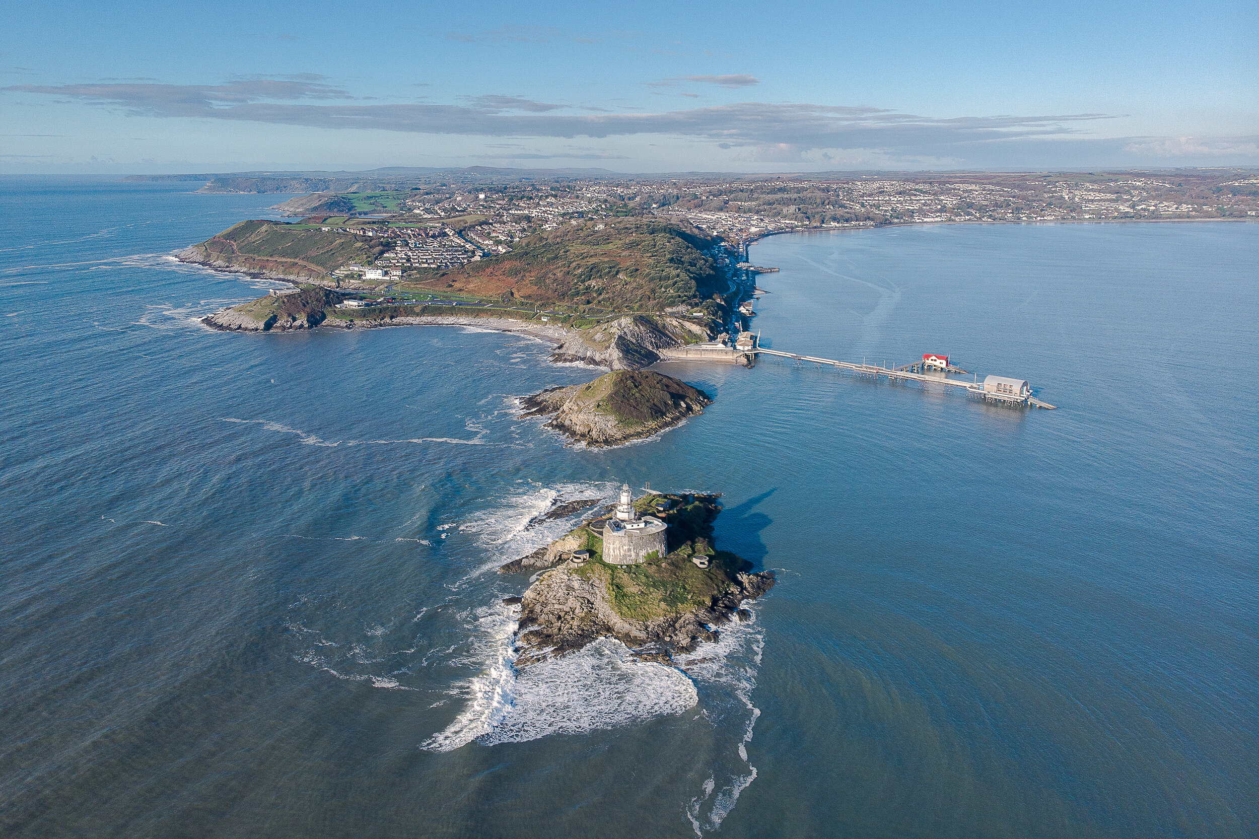
Mumbles lighthouse
Day 14: South Wales - Swansea Marina to Cardiff Bay
Day 14 was a struggle. As you can probably imagine, the eight pints I had the night before really didn’t help me, especially when the temperatures were in the high 20’s and I started the days cycle at noon.
The first several miles of the were a breeze until I made my first poor decision of the day. Thinking there was an actual gravel road road round the back of Baglan Energy park, I went against my own advice and stayed true to my cause by following the official coastal path instead of sticking on the road which ran parallel. 10 minutes into my off-road adventure got a puncture, frustrating but easily changed. The gravel path then disappeared and I was faced by sand dunes. A 45 minute slog through a mile of undulating sand dunes lead me onto Aberavon seafront. Somewhere I could of been an hour earlier if it wasn’t for my pride.
Hangover still looming large I pushed onwards towards Porthcawl, the sun roasting me like a nando’s chicken. From here it was a quick skirt inland around the notorious Merthyr Mawr Sand dunes to Ogmore by the Sea to re-join the the Glamorgan Heritage Coast.
The magnificent stretch of coastline consists of 14 miles of steep sided, plunging cliffs, secluded coves and breath-taking views throughout.

The Glamorgan heritage coast
From Ogmore I hugged the coastline all the way to Summerhouse bay. The stretch from Southerndown through to Nash Point lighthouse was breathtakingly beautiful and one of the highlights of my entire cycle. The coastal path, which was s a mix between single track dirt and farmers fields, lingered a mere 2m from the vertical rugged cliffs, occasionally dropping down into a secluded bay.
I originally planned to tackle this stretch over two days and after getting 50 miles in, I nearly called in Team Sky when the path vanished into rocky beach at Summerhouse Bay.
However after a quick pep talk and another bag of Tangfastics I then worked my way back inland and pushed onto Barry Island. Clearly the sugar didn’t go to my brain as I made the decision to carry my bike half a mile across the aptly named pebble beach. Several tumbles later and back on solid ground I weaved my way through Penarth before crossing the Cardiff Bay Barrage after the sun had set.
I was then kindly put up at a friends house just off the coastal path, which was a huge relief as I wouldn’t of fancied wildcamping in Cardiff Bay and waking up without my bike.
811miles ridden, 46,945ft climbed, 51,408 calories burned

Cardiff Bay
Day 15: South Wales - Cardiff Bay to Chepstow
14 days down, one to go.
Day 15 was a breeze. Although the views weren’t the most spectacular, the route was delightfully flat. There was little in the way of trouble apart from a couple of ‘moist’ farmers fields & constantly being narrowly overtaken by articulated lorries and impatient cars.
Newport wetlands were pleasant to cycle through but cycling alongside the Seven bridge was a particularly memorable.

Severn Bridge crossing
Cycling through the official coastal path markers in Chepstow and over the bridge into England was a strange feeling. On one hand I was euphoric that I had completed the cycle, but on the other I was also slightly sad my adventure was over.
It was a rather surreal experience arriving at 4pm in the afternoon and just having my parents there to congratulate me.
To this day, I still don’t think it has quite sunk in what I did, in fact I often forget that actually completed this challenge. That being said I’m certainly eager to do another bonkers cycle and have one lined up for this summer so keep your eyes peeled.
Final totals: 858 miles ridden, 47,752ft climbed, 53,375 calories burned
Reflections & Takeaways
The four major things which I took away from this cycle.
I wish I wore clip in shoes
I wish I had trained
I wish I had a bike with front suspension
I wish I had taken a bivvy bag instead of a tent
For a man who has a body made out of paper Mache and an injury list longer than an Argos catalogue I was honestly surprised how my body held up and adapted across the 860 miles .I hit massive wall on day eight but my body accepted that the bike was my home each day and just cracked on with it. I didn’t once have cramp and only lost a couple of kilos across the 15 days which shows how well I refuelled.
What really stood out for me was the weather.
I believe I had tremendous luck across the 15 days, I had blue skies at some point during every day and only encountering one morning of light drizzle. These sort of conditions are unprecedented in Wales, especially in July and meant I was able to fully appreciate and enjoy my journey. Enduring 15 days of rain would have made the entire experience completely miserable and this blog would have been written in a far less happier tone.
I was also overwhelmed and humbled with amount of support I received, especially from people I hade never met or barely knew. I had originally planned to camp for 8 of the 15 nights. however I only ended up camping for three nights and two of them were in official campsites I didn’t have to pay for. I pretty much carried a 1.5kg tent around the coastline of for sake of it and would have been much better off with a bivouac bag. The generosity and kindness shown by those who fed and housed me not only put a huge smile on my face but also restored my faith in humanity.
Finally I was blown away by the Welsh coastal landscape.
Although I didn’t manage to see every mile of the coastal path, I witnessed enough to be left both captivated and feeling blessed about were I live. Here in Wales we truly are fortunate to have hundreds of miles of beautifully rugged yet accessible coastline. From panoramic sweeping vistas to hidden, idyllic coves Wales is home to some of the most spectacular beaches in the world. I now have a list longer than this blog post of beaches I cant wait to re-visit once this lockdown ends.
Thanks for reading this far,
I hope you enjoyed and if you have any question please feel to ask it in the comments or drop me an email.
