Pen Pych Mountain and Waterfall Hike Guide
Often overlooked for the more popular peaks and waterfalls of Bannau Brycheiniog National Park, Pen Pych waterfall and mountain is a hidden gem of a hike tucked away in the South Wales Valleys.
The short 4.2 km walk takes in waterfalls, woods and mountain views alongside passing plenty of local and ancient history.
In this blog I take you through all the key information on the Pen Pych Waterfall and mountain hike, including where to park alongside providing photos and maps of the route.
Key Information
Hike Type: Out and back
Hike Distance: 4.2km
Elevation Gain: 218m
Hike Difficulty: Easy/Moderate
Parking: Pen Pych Forest Car Park
What Three Words location: ///shadowed.scratches.barmaid
Where to Park?
Parking is available at Pen Pych Forest car park, located between the villages of Blaenrhondda and Blaencwm. The car park is free and has space for around 15-20 cars.
The hike to Pen Pych waterfall
From the car park, pass through the metal swing gate and begin to follow the path towards the forest.
After around 200m the path will begin to zig zags before turning back towards the car park.
From here the route climbs gently through the forest following a well maintained path.
After around 1km you will reach a wooden fence and a large boulder, from here the path branches right and begins to steepen, narrow, and become more unstable.
The path isn’t technical or exposed but because of the steep and uneven terrain, some less abled and unfit people may find this difficult.
After a further 500m you should emerge from the forest at the base of the waterfall.
Pen Pych Waterfall
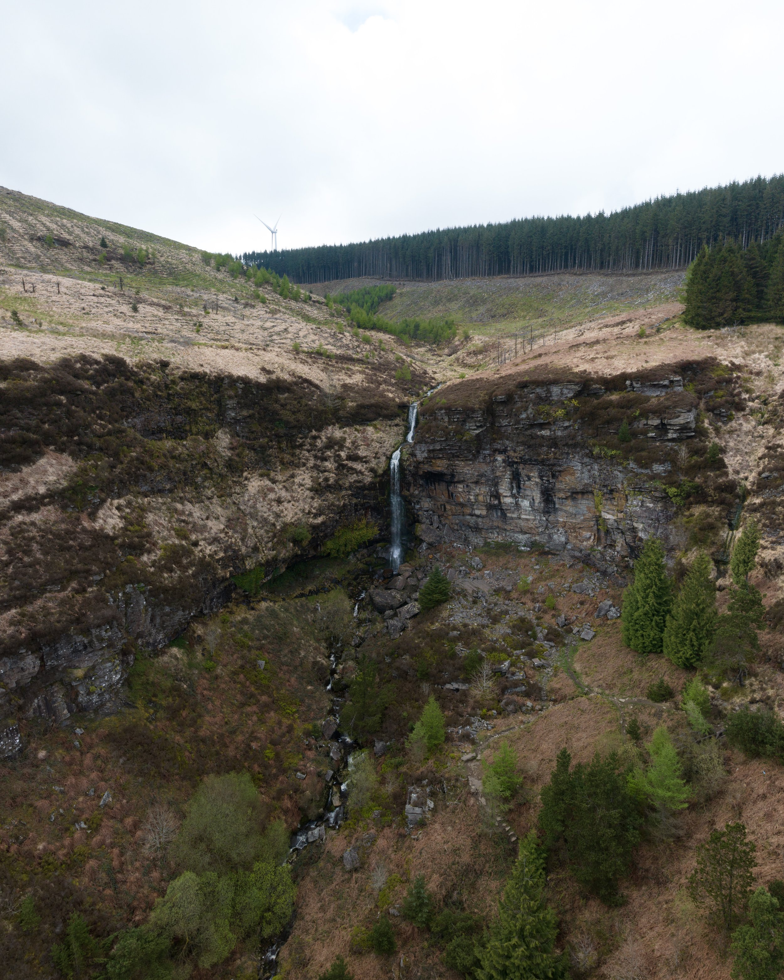
Resembling something which should be found in Iceland, Pen Pych waterfall is a series of cascades which tumble over a sheer sided sedimentary rock face.
The base of waterfall is enveloped by a half amphitheatre cliffs which only adds to the waterfalls impressive appearance.
Theres is no plunge pool at the base of the falls, instead the tallest section spills 21m onto number of boulders which have tumbled from the cliffs above in years gone by.
The path will lead you to a large rocky viewing area to the right hand side of the falls beneath the cliffs. You can climb up to the base of the falls, if you do do that take care as the rocks can be very slippery.
Hike to Pen Pych Mountain
From the waterfall its only a further 700m with around 50m of elevation gain to the summit Pen Pych Mountain.
From the base of the falls, drop back to the path and turn left (if you are facing away from the waterfall), climbing the zigzagging path up the mountain.
After two switchbacks the path with begin to slowly become more shallow as it climbs towards the summit.
The two zig zags can be seen in the centre of the image
Pen Pych Mountain
Pen Pych Mountain only stands at a mere 445m, but affords terrific views Rhondda Fawr Valley and back up towards the Rhigos Mountain.
The mountain has an unique flat topped summit, which is extremely rare across Europe.
The summit is also home to two flag poles, one which fly’s the national flag of Wales and the other randomly has a Manchester United flag.
How to get back to your car
From the summit you have two options.
You can either turn around and retrace your steps for 2.2km back past the waterfall to the car park.
Alternatively if you want to do some more walking, you can extend the walk to complete a 8km loop aroud the village of Blaenrhondda.
The walk involves 380m of elevation gain and passes a series of additional waterfalls alongside some historic and ancient relics. A route for that walk can be found here:
Looking towards the Rhigos from Pen Pych Mountain. The 8km loop goes around this valley.
So there we have it, a hike guide to Pen Pych Mountain and Waterfall.
Did you find the blog useful? Let me know your thoughts in the comments below.
If you did find it helpful, I’d appreciate you giving it a share or giving me a follow on social media, every bit of support goes a long way.
You can find more Welsh hiking inspiration in the following blogs
For more Welsh travel inspiration check out my in-depth guides to each of my favourite Welsh regions below.


