Snowdonia Cloud Inversion

On the 21st December 2021, I was treated to a spectacular sunrise cloud Inversion from the summit of Wales highest mountain, Yr Wyddfa (or Snowdon for you English folk).
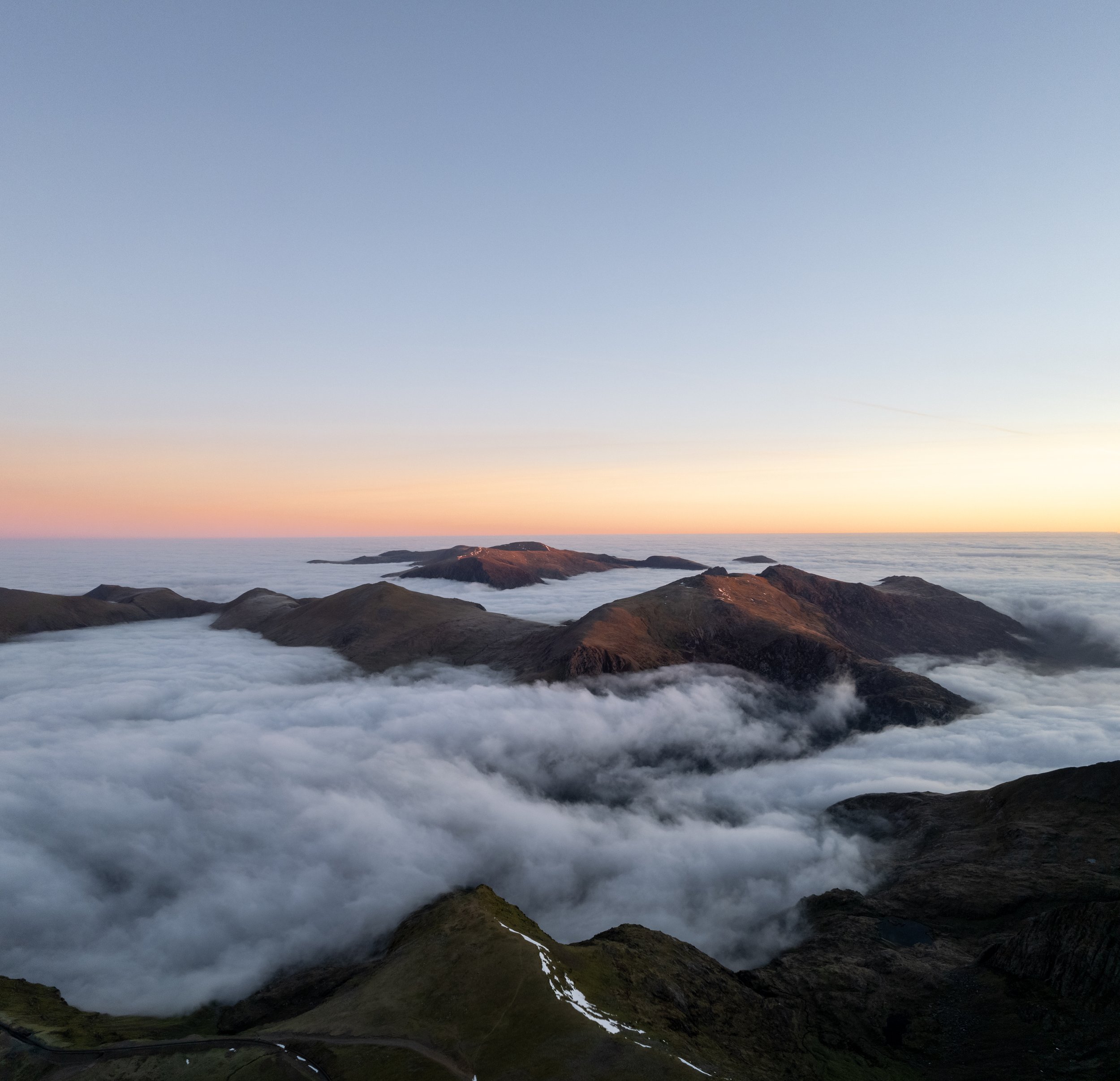
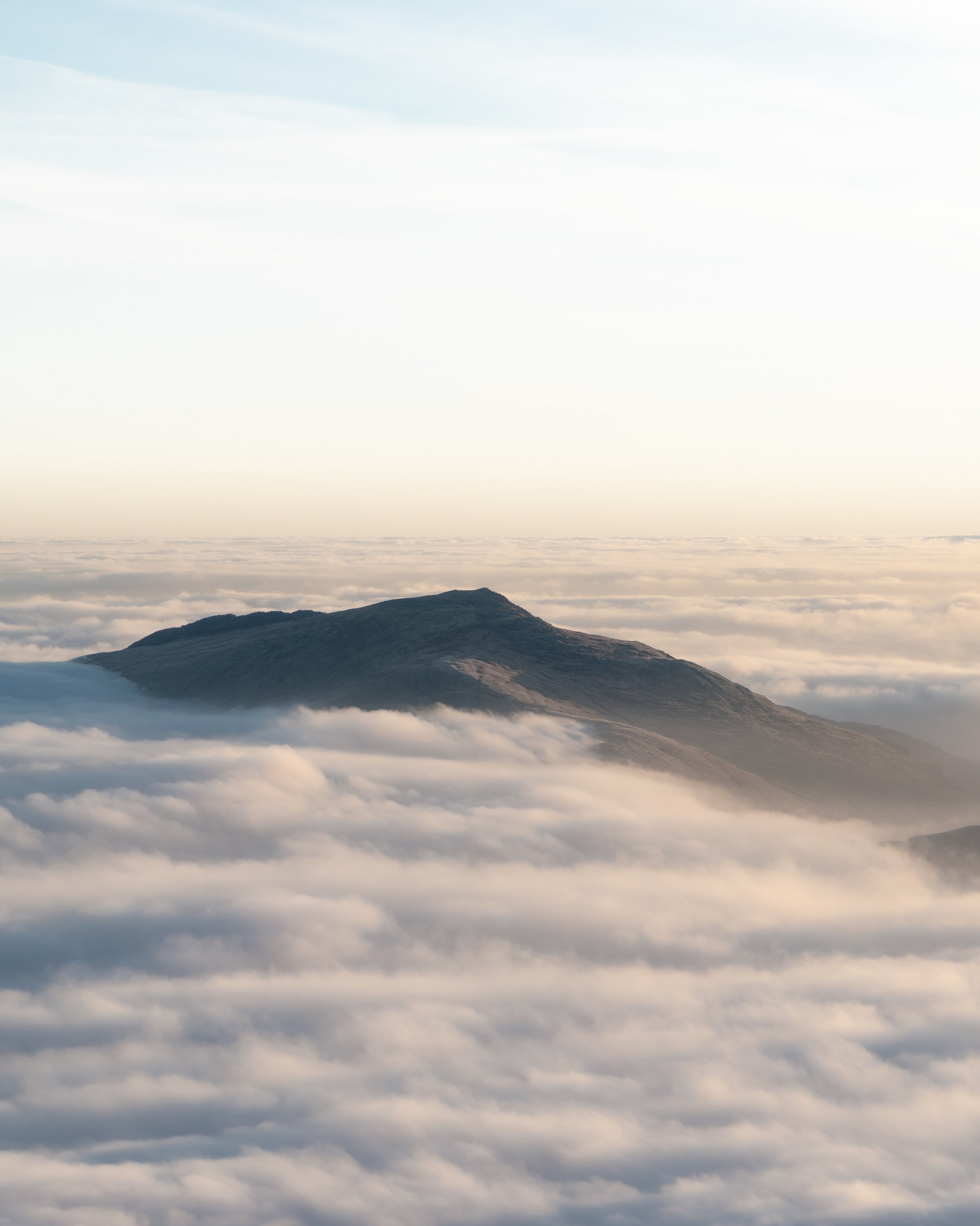
To give you some context, a cloud inversion or temperature inversion is when the normal temperature distribution of air – warm at the bottom and colder as you get higher – becomes flipped or ‘inverted’. This means at ground level you have a cold layer of air trapped and overlain by a layer of warm air. In mountainous locations his can result in the summits of peaks protruding from a layer of cloud which has become trapped in the valleys below .
Shortly before 6:30am we set off from the Pen-Y-Gwryd Hotel, which is situated a mile beneath the pen-y-pass, and began to ascend Snowdon via the Miners track. Due to the low cloud and fog causing poor visibility there was very little to see ,during the initial section of the hike. However after around an hour and 45 minutes of hiking, we emerged from the cloud just above Llyn Glaslyn where the Pyg and Miners tracks meet.
Fortunately for us the sun was due to rise in 10 minutes so we were treated to an stunning orange glow along the horizon. However as we were not going to make the summit for sunrise, I decided to launch the drone in order to get a glimpse of that the inversion looked like from above.

It was from this flight I managed to get some spectacular shots of the sun rising above a blanket of white cloud with island like mountain tops protruding from its silky smooth surface.
After a brief 10 minute flight we then pushed on up the miners track and arrived at the summit of Yr Wyddfa at around 9am, half an hour after sunrise. Although some sections of cloud were beginning to burn off, the majority of the inversion was still covering the valleys below us. We hung around on the summit for a good hour, taking it all in, feasting on some some well earned breakfast, and watching the cloud slowly burn off.
I managed to briefly put the drone up one final time (yes I was ‘that guy’) to a get a few more shots of the inversion, before descending back down to the Pen-y-Pass via the Pyg Track.
Below are the camera and drone images I captured of the morning. My drone shots were taken with a DJI Mavic 2S and the camera shots were taken with a Sony A6300 with a Sony Zeiss 16-70mm F4 lens.


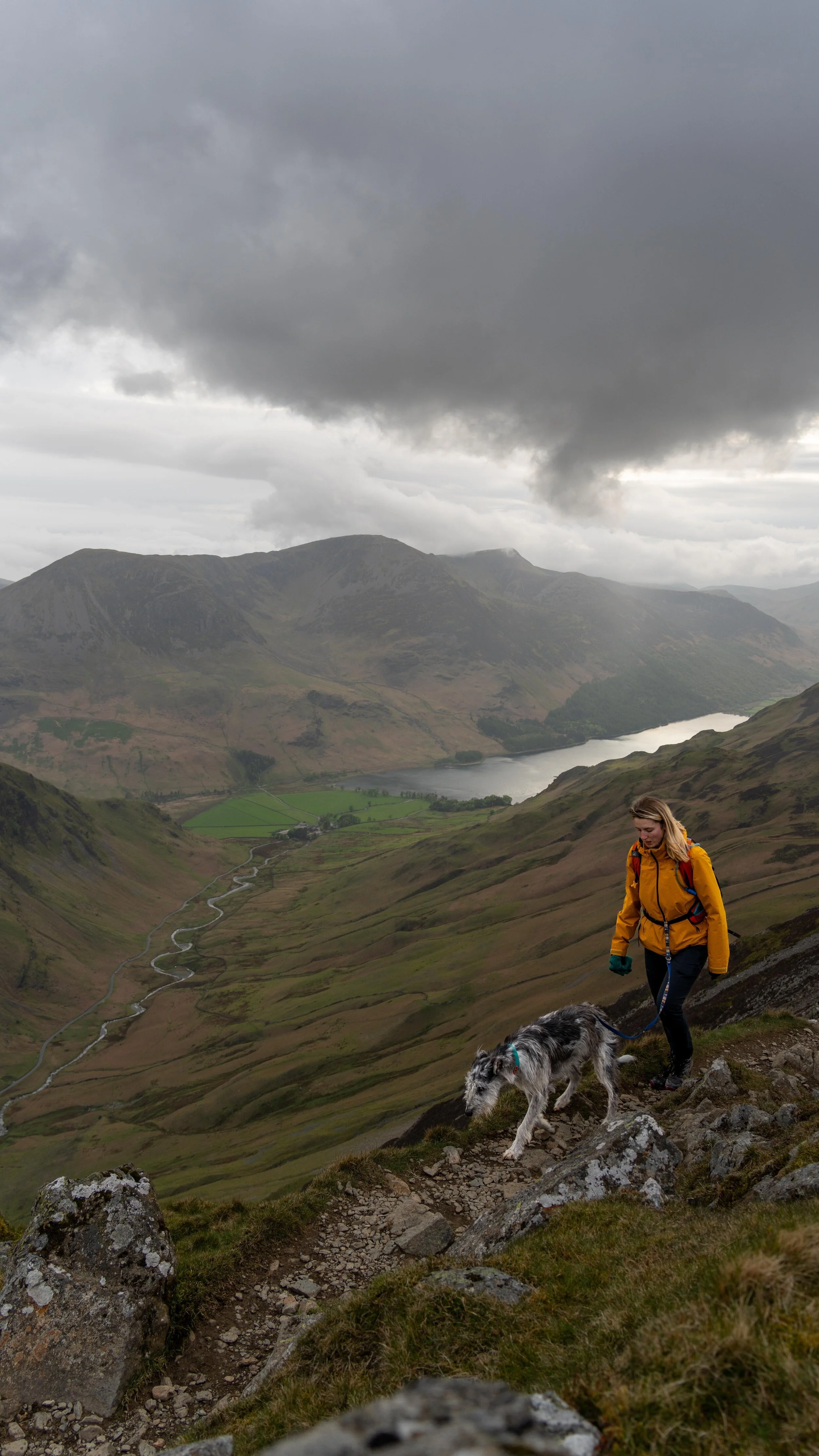
So there we have it, my hike guide to Waun Fach via the Dragons back. Did you find the blog useful and will you be wanting to tackle this hike in the future? Let me know your thoughts in the comments below.
You can find more Welsh hiking inspiration in the following blogs
For more travel & photography inspiration around Wales check out my in-depth guides to each of my favourite regions below.
If you did find it helpful, I’d appreciate you giving it a share or giving me a follow on social media, every bit of support goes a long way.