
Snowdon Horseshoe Hike Guide | Snowdonia National Park
If you are heading to Snowdonia to climb some mountains, then it’s odds on that the highest peak in Wales will be at the top of your list.
Although there are several routes up and down Yr Wyddfa, there is one classic that stands head and shoulders above the others in terms of wow factor, the Snowdon Horseshoe.
The horseshoe is arguably one of the finest day hikes and ridge walks in the UK, and depending on what you're like with heights, will either leave you either astonished or crapping your pants.
The route encompasses everything that’s great about the Snowdon Massif, from jaw-dropping views, tricky knife-edge scrambles, and a certain solitude which you won’t find at the summit of Snowdon.
It’s a must do hike, however it should only be attempted in good weather conditions, wearing the proper footwear and kit, and by competent hikers.
Snowdon Horseshoe Hike info
Summits: Crib Goch (923m), Garnedd Ugain (1,065m), Snowdon (1,085m), Y Lliwedd (895m)
Route Type: Loop
Route Difficulty: Very hard
Route Length: 7.5 miles / 12 km
Hike Duration: 5-8 hours
Elevation Gain: 1,180m / 2,725ft
Technical elements: Grade one scrambling
Parking & Start point: Pen-y-Pass Car Park

Things to know before tackling the Snowdon Horseshoe
As Snowdon is one of, if not the most popular mountain in Britain, the summit and sections of this hike will be outrageously busy, especially on weekends. Crib Goch and Y-Lliwedd will be the quietest sections of the hike, so enjoy the solitude while you can.
Personally I’d avoid hiking Snowdon on a weekend and head for another peak in Snowdonia instead. However If you do have your heart set on the summit, try to start as early as possible (I’m talking pre sunrise early) to secure a parking space and beat some of the crowds.
Are there facilities on the Snowdon Horseshoe?
There are toilets at Pen-y-Pass car park, usually open from pre-sunrise until sunset.
You will also find a café and toilets at the Snowdon Mountain Railway station just below the summit. These are often closed outside of train operating hours, so do not rely on them being available.
There are no facilities once you are on the ridge, so make sure you are prepared before setting off.

Is Crib Goch really that bad?
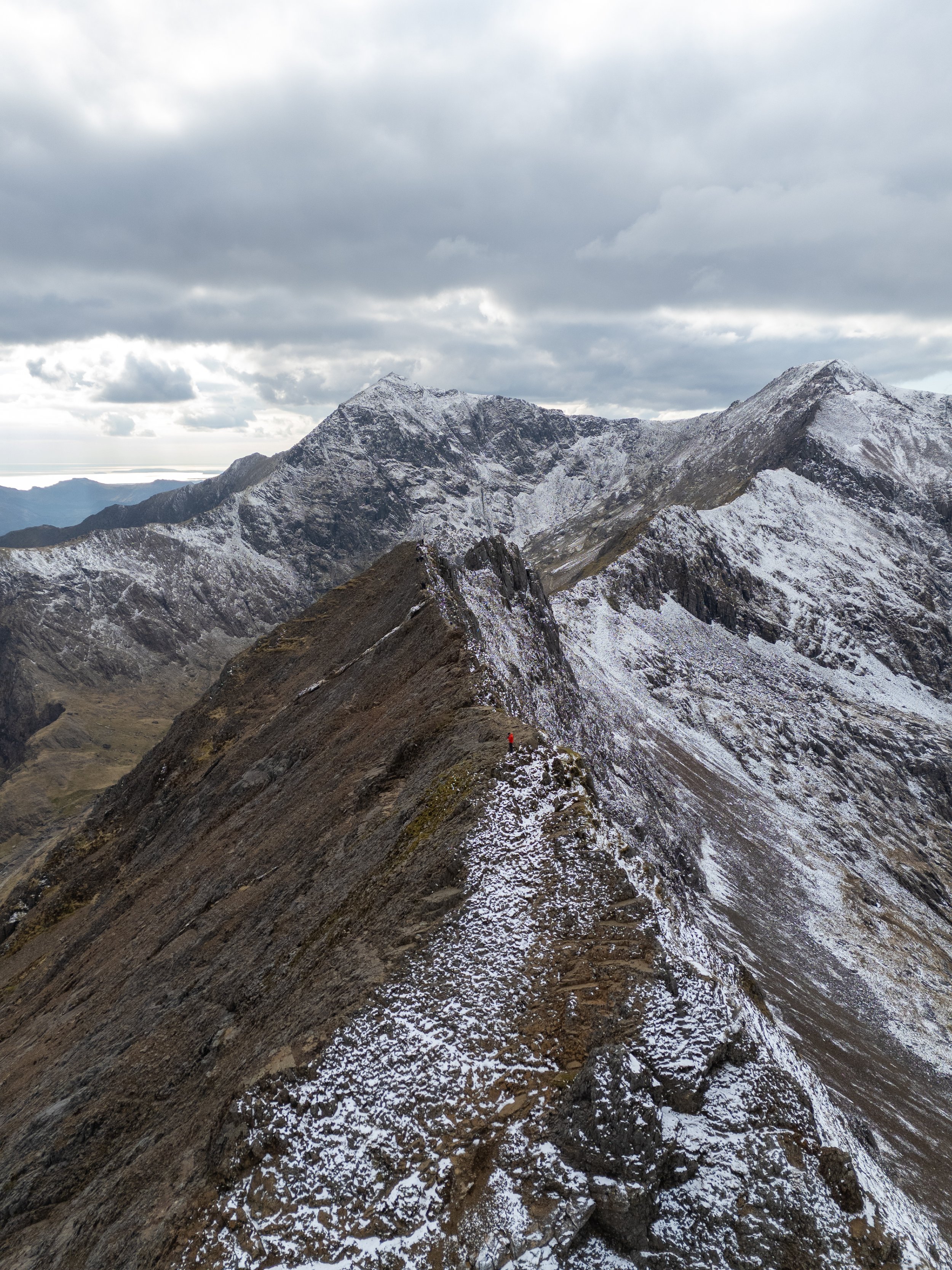
The Snowdon Horseshoe involves traversing Crib Goch, a notorious knife-edge ridge which in sections is no wider than 1.5m and has drops of several hundred meters either side.
The route from the base of Crib Goch to the summit of Garnedd Ugain is around 1.6 miles, with roughly 1,500 ft of ascent.
This section typically takes between 1.5 and 4 hours. Your pace will depend on your fitness, confidence on exposed terrain, and how comfortable you are with scrambling. It is not a place to rush, take your time and move carefully.
It is a precarious and exposed ridgeline, which is no joke. Tragically, walkers have died falling from the ridge and the mountain rescue team is often called out to help stranded or injured climbers who either get stuck or injured falling from the ridge.
No matter how many YouTube videos you may have watched, Crib Goch should really be tackled by competent hikers, who have a head for heights are are comfortable scrambling. In addition it should only be hiked in clear, calm, and dry weather.
Please do not attempt this route in adverse weather conditions (wind, rain, or fog) as it will be a recipe for disaster and you might end up as a statistic on the mountain rescue website.
If you are looking for a less challenging and dangerous route to the summit of Snowdon then a full description of the 6 alternative routes can be found here. My recommendation would be to ascend via the Pyg track and descend via the Miners Path. Both start and finish at the Pen-y-Pass car park.
Where to park for the Snowdon Horseshoe
The most popular starting point is Pen-y-Pass car park, but spaces are extremely limited.
There are around 30 spaces. During summer and school holidays, parking is pre-book only and costs £25 per day. Outside of peak times, if you are lucky enough to get a space, it costs £10 for the day.
If Pen-y-Pass is full, the closest alternative is roadside parking near Pen-y-Gwryd Hotel.
AIf the car park is full and your planning on tackling this hike early, the next best option would be to park a the pay and display layby’s next to the Pen Y Gwryd Hotel. This costs around £4 for up to 6 hours or £8 for the full day (coins only) and will add an additional 2.5km to the hike.
If you’re not planning on setting off early I would park in the nearby villages of Llanberis or Nant Peris and catch the Snowdon Sherpa bus up to the Pen-y-Pass car park.
This unique bus service uses the road network which runs around the base Snowdon. You can hop on and off at any point and it costs £2 per journey. More information about the bus service, including a full timetable, can be found here.
DO NOT park on the side of the mountain roads leading up to the Pen-y-Pass. Not only does this block access for emergency vehicles but you will return to your car to find a £60 parking ticket slapped across your windshield. Not the nicest treat after 7 hours of hiking.
The Route
Starting and finishing at the Pen-y-pass car park, the Snowdon horseshoe can be tackled in a clockwise or anti-clockwise fashion. I would recommend tackling the route in an anti-clockwise fashion. Ascending Crib Goch first while you are still fresh and so you hopefully don’t run into any oncoming traffic whilst on the precarious ridgeline.
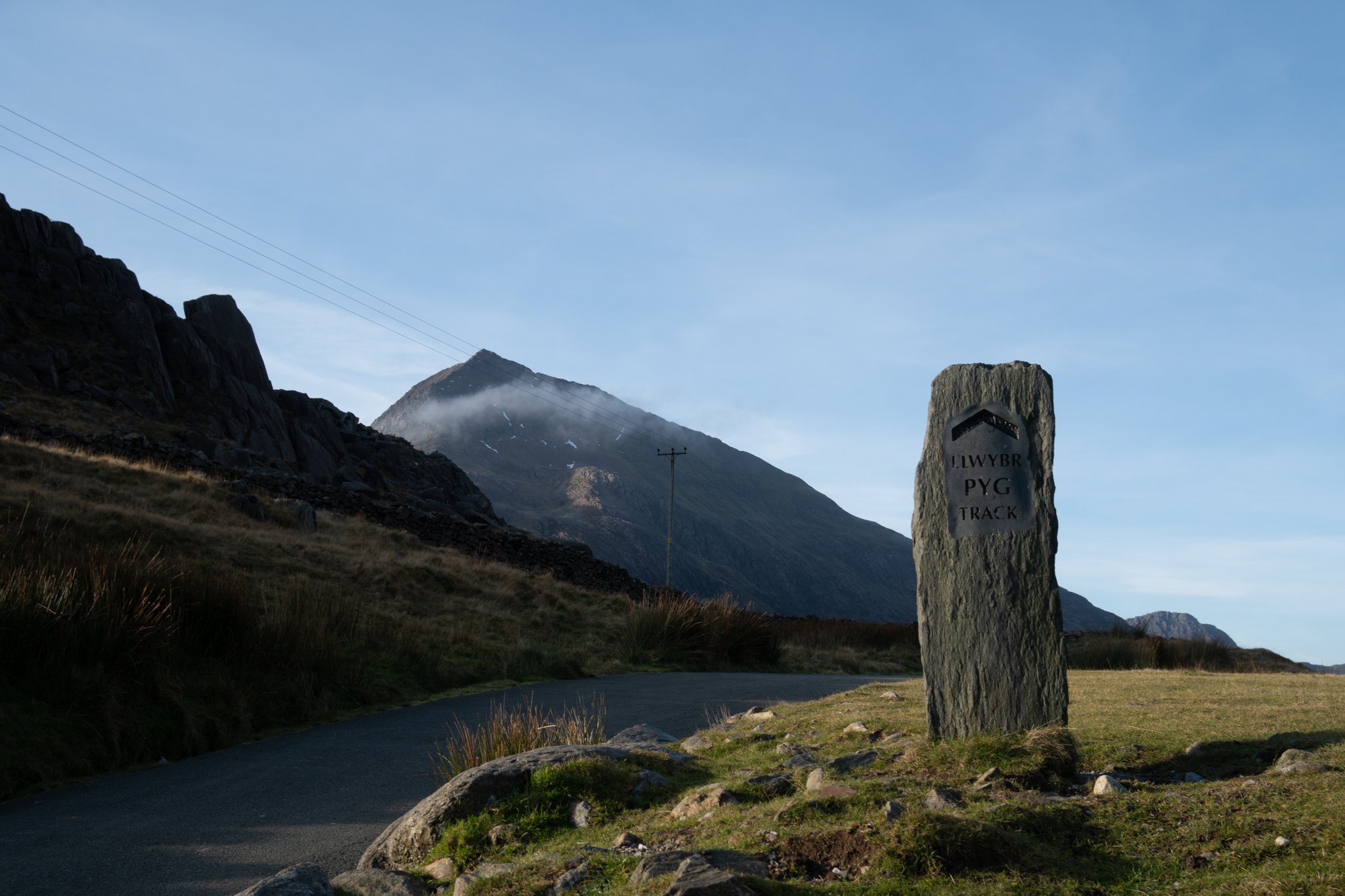
From the Pen-y-Pass car park follow the Pyg track, which runs to the left of toilet block. The path is well engineered and is very easy to follow. If the weather is clear you will be able to see the triangular peak of Crib Goch directly in front of you.
After 1.3 miles the path will level off at a cross junction and you will see the dual styles at Bwlch y Moch. Turn right, just after the stone wall and ascend the path which runs alongside the metal fence up towards Crib Goch.

Crib Goch
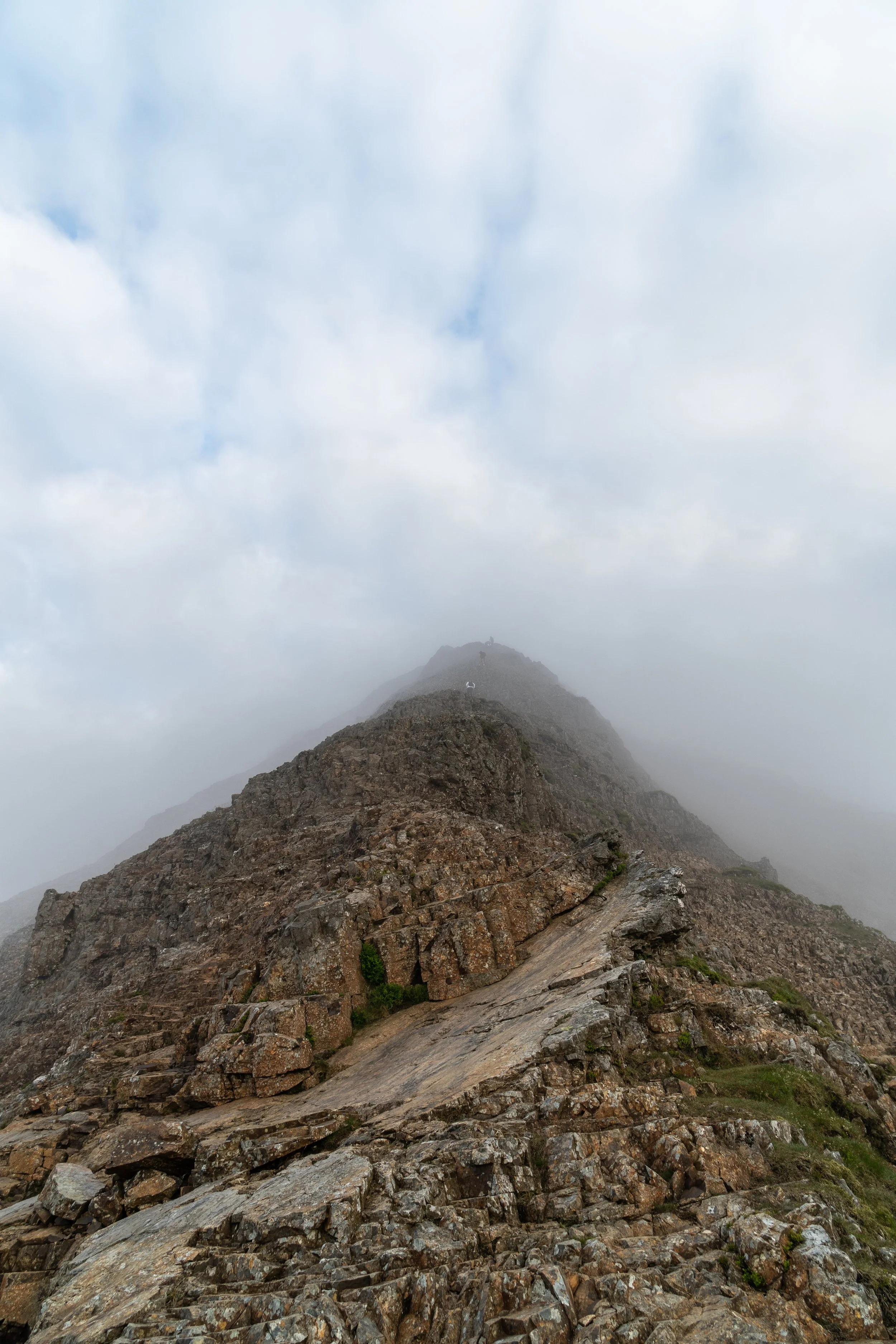
The initial section of the climb isn’t at all technical and is mainly a tedious loose scree path which rises gently up to a smooth, rocky section, Don’t let this fool you into false sense of security as you will eventually reach a craggy wall – known as the ‘bad step’. - which will signal where the tricky scrambling begins.
From here you’ll have to use your best judgement pick you way through the crags and gully’s as the path becomes significantly steeper and more difficult. It best to look up and well ahead and pick a route which doesn’t lead you into a dead end, as the last thing you want to do is have to down climb.
If you find yourself struggling with the height or exposure on this section, I would recommend that you turn around and head back to the Pyg track. The actual ridgeline will only get more precarious and exposed and you will save yourself and possible the mountain rescue a significant amount of hassle and time.


Once you have tackled the bad step, the trail will ease off slightly and you will be able to give your hands a brief break. To reach the summit, navigate your way onto the you can either walk up the the spine of the mountain and follow it directly up to the summit.
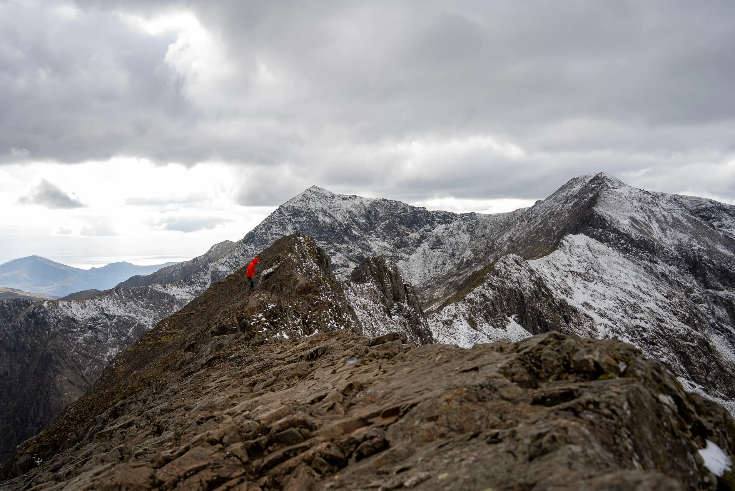
Once you reach the summit you will not only be greeted by magnificent panoramic views over Snowdonia, but you will get your first glimpse of the precarious and notorious ridgeline which now lays in front of you.

The view from half way up Crib Goch
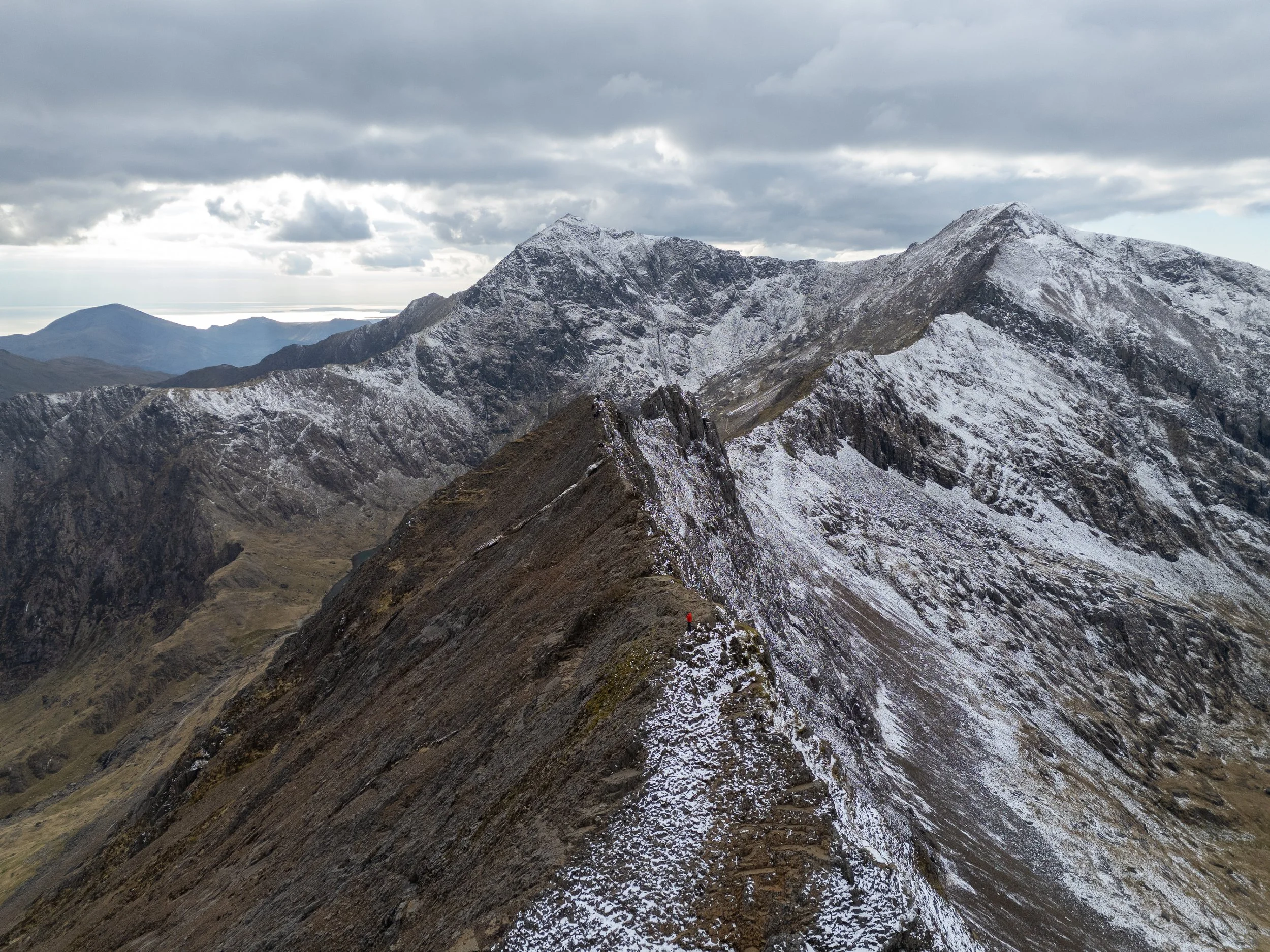
Crib Goch Ridgeline
The easiest route is to traverse is slightly down to the left of the ridgeline. This section is easier and less exposed than the apex of the ridge, as you aren’t staring down the near vertical drop on the right hand side. That being said if you do have a head for heights you can carefully hike along the tip of the ridgeline for maximum exposure.
Either way feel free to use your hands, proceed at your own pace, and dont be afraid to stop.
Alongside the treacherous, near vertical drops, the main hazard here, especially on a busy day, will be other hikers (oh and that one idiot who has tried to take their dog up Crib Goch) Take your time, dont rush, and be respectful of other hikers who may be more or less competent than you.

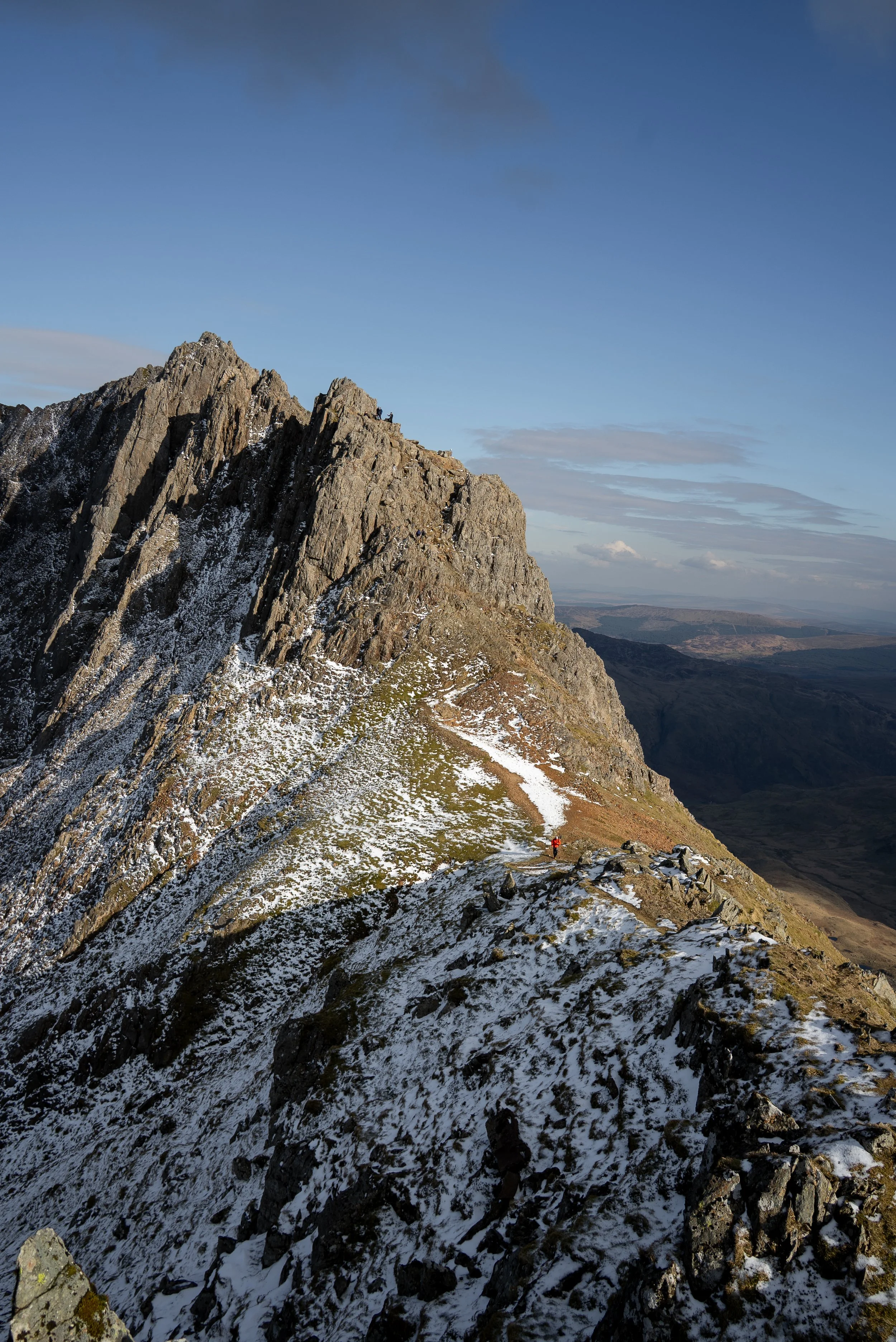
The Crib Goch Pinnacles
Once you have navigated the ridgeline you will approach the first of the three pinnacles. The easiest and quickest route is to stick to the left hand side and drop down and around the first two.
You will then reach a saddle with grassy gully which drops steeply down to the right hand side. Cross over this and climb back up and over the right hand side of the third pinnacle. This will be the trickiest part of the route so take you time and breath a sigh of relief once you’re through.
Descend down to Bwlch Coch and continue to hike up towards Crib y Ddysgl. This section of the route is very mellow , being made up of series of wide grassy level sections interspersed with several patches of rocky pinnacles.


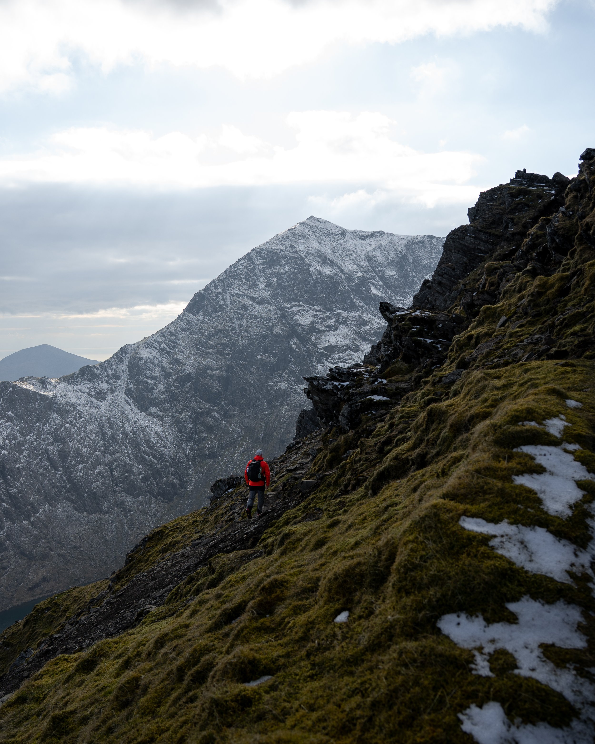
You eventually reach the steep rocky face which you cannot go around. From here you have to weave and scramble your way through the rocky crags (you can either go left or right here) up to the Crib y Ddysgl ridge. Once over the initial climb the path will continue to rise gently across the spine of the ridge towards the trig point of Garnedd Ugain.
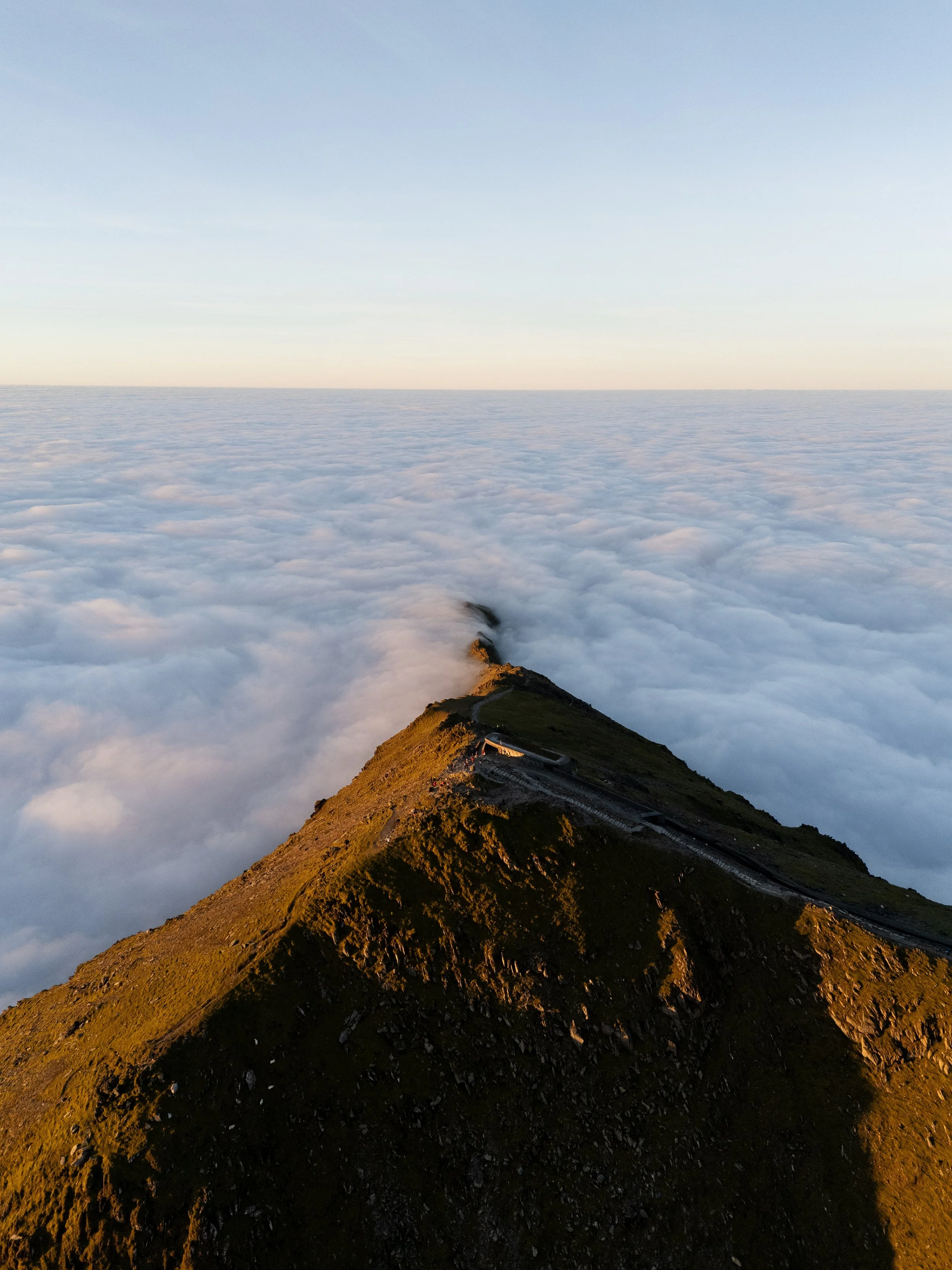
At 3,494ft, Garnedd Ugain is only 20m shorter than Snowdon but receives a fraction of the crowds. Enjoy a brief moment of solitude here before descending down to the train tracks at Bwlch Glas. This a saddle is one of the busiest sections of the route as it connects the Llanberis, Ranger, and Pyg tracks.
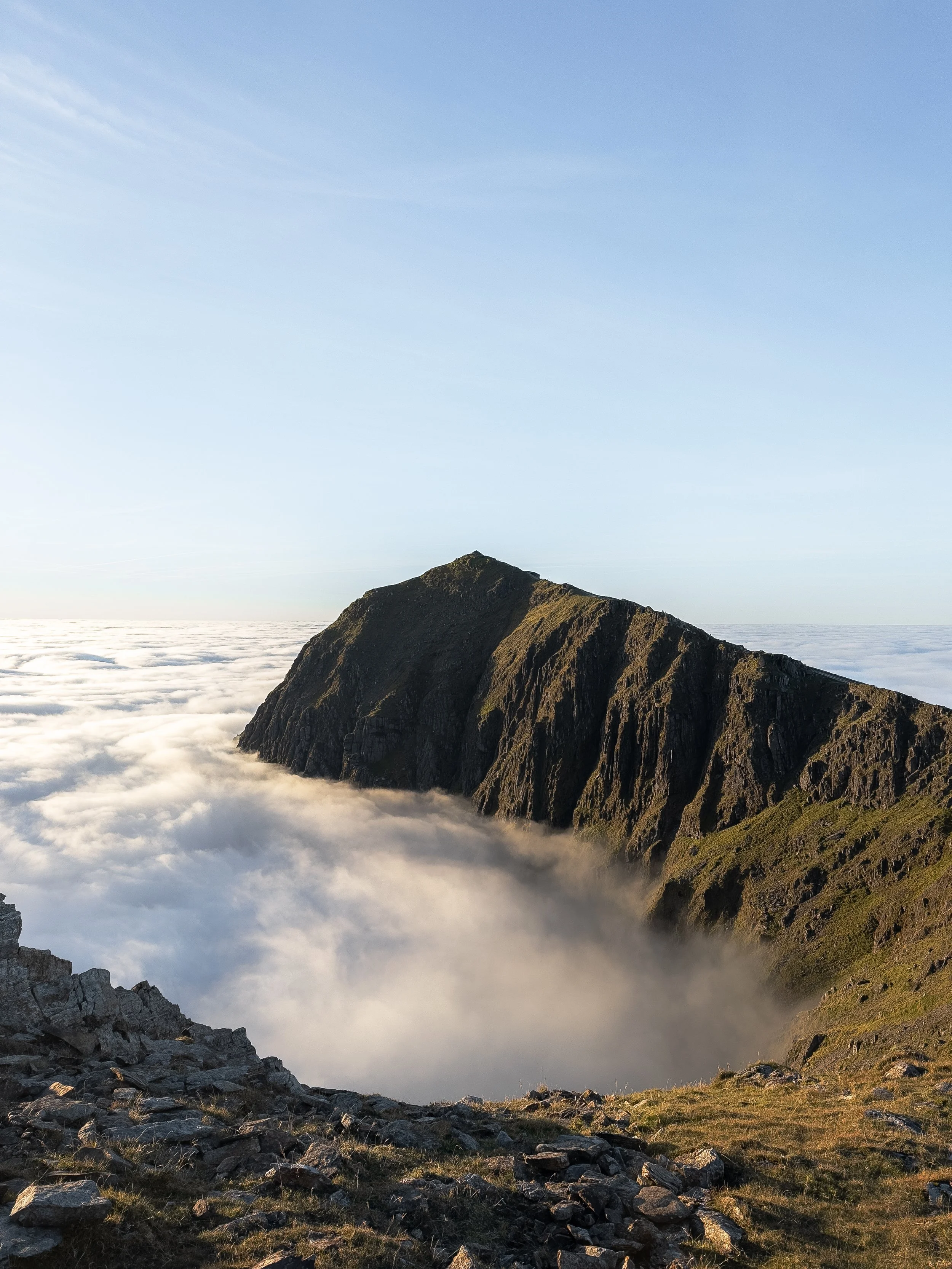

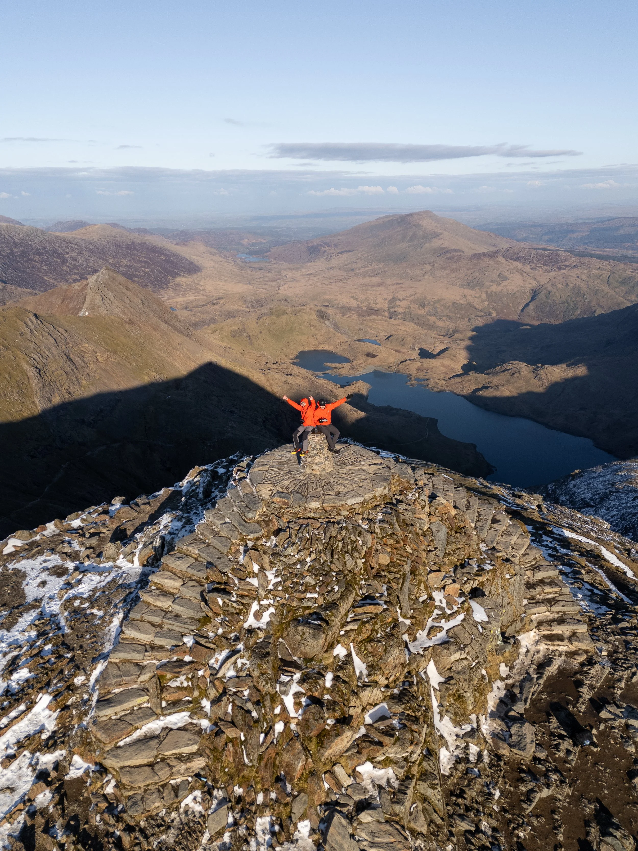
Summit of Yr Wyddfa
From the saddle turn left and follow the train tracks up to the summit of Wales highest mountain. The peak stands at 1085m (3581ft) and is the 23rd highest mountain in the UK.
The Welsh name for the mountain is 'Yr Wyddfa’. which is translated to grave, as it is believed that the giant Rhita Gawr was buried on the mountain. The more common English name of 'Snowdon' comes from the Saxon word "snow dune" which means "snow hill".
Depending on the time of the day and year of your visit, alongside the conditions you will either be treated to serene panoramic views across the whole of Snowdonia, or a jam packed summit which resembles a scene out of Mad Max and the Thunderdome.
The summit is either idyllic dream or a solo hikers nightmare. The first time I summited the mountain I was left bitterly disappointed, despite it being a bluebird day. The sheer number of people, amount of litter, and the pack seagulls encircling the peak tainted the summit experience and took away from the peaks magic aurora.
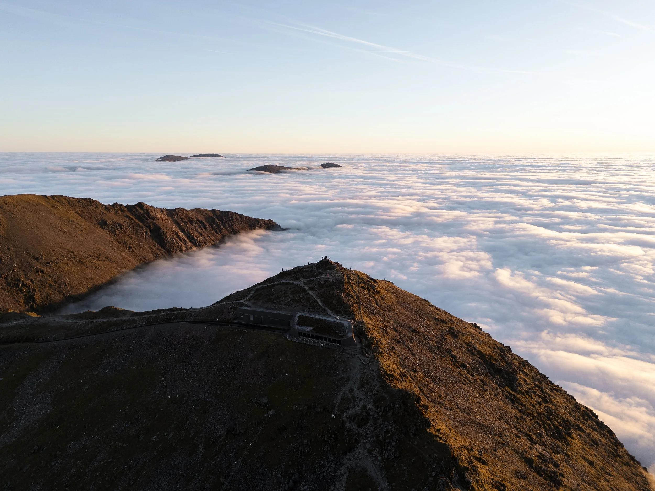
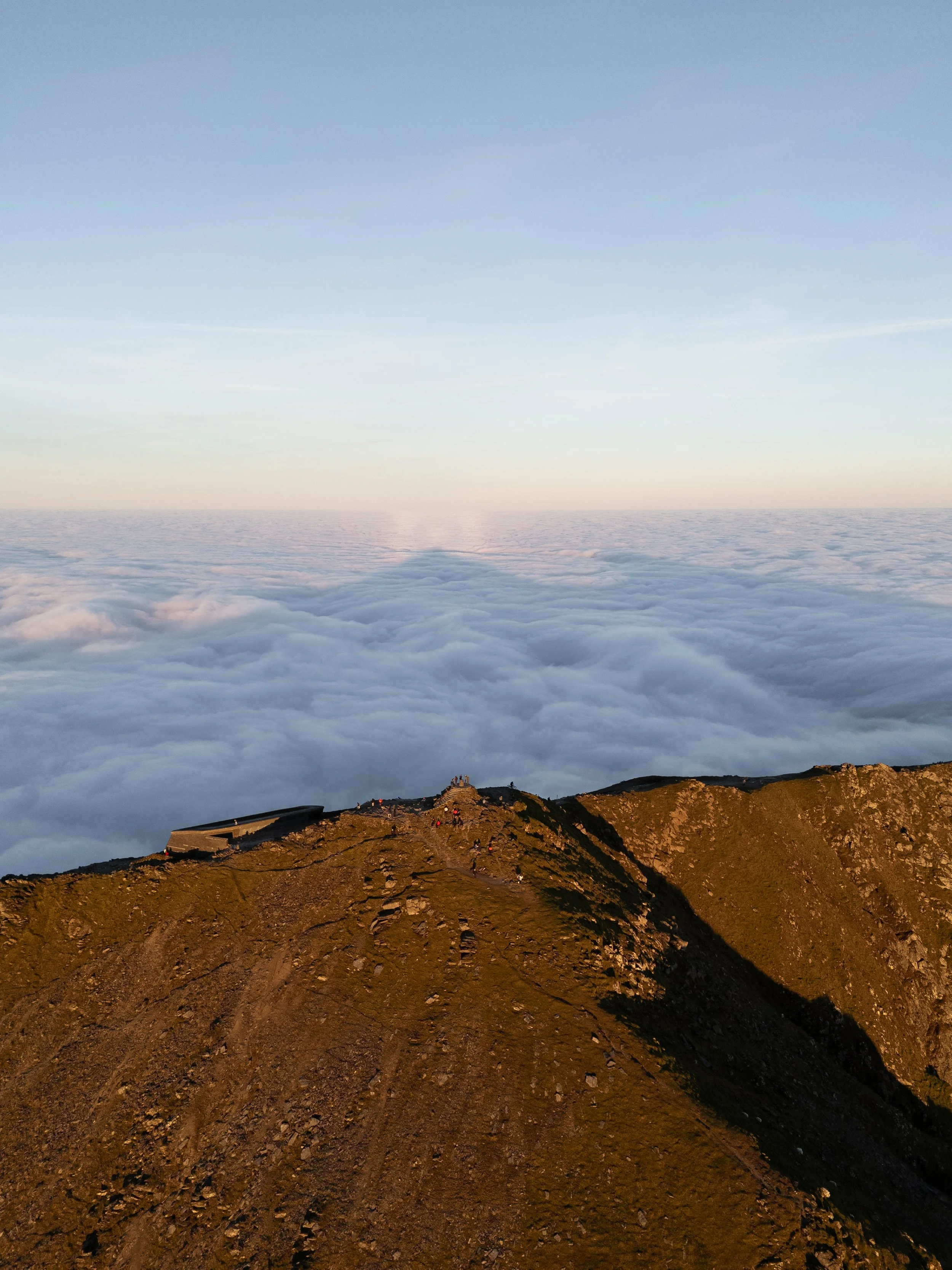
Since then my opinion of the summit has dramatically changed. In May 2021, I briefly had the summit to myself after hiking it the day before Wales-England lockdown ended.
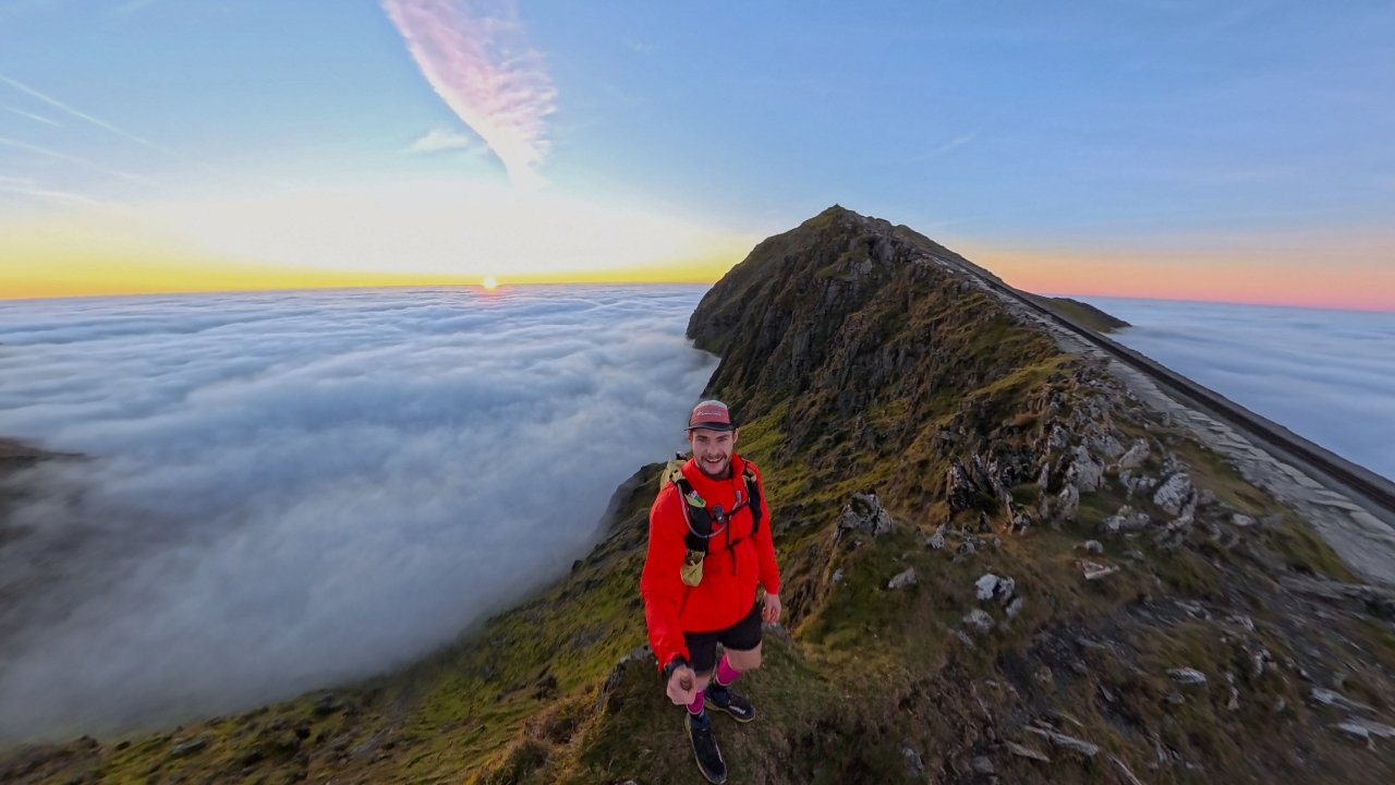
Then back in December summited it mid-week for a sunrise cloud inversion and was left speechless by the mind blowing views. Some of the images of that day are in this blog however a full album can be found below.
I also had the summit to myself again for a hike in March 2025., and witnessed another inversion in October 2025 when completing the Welsh 300s for a third time


Journey to Y-Lliwedd
From the summit head south past the café and join the path for the Watkin and Rhyd Ddu routes. Head left and descend the steep Watkin Path down to the flat Bwlch y Saethau. The top section of the descent is predominately made up of the horribly loose scree, and is very tricky underfoot
Once at the bottom continue along the path to your left, ignoring the Watkin Path which drops down into the valley on your right. If you venture off the path over to ridgeline on your left , you will be greeted by terrific views over Llyn Llydaw.


From the saddle there are multiple routes which you can scramble up to the summit Y Lliwedd. The most exhilarating line hugs the edge and allows you to soak up the views and experience the exposure. The path is not obvious all the way, and you will need to make your way around some chunky boulders during the 140m ascent.
The first summit you will reach is known as West peak. At 898m it is the higher of Y-Lliwedd’s two summits. Continue the scramble along the ridge over the east peak before descending down towards Llyn Llydaw.
Once at the shoreline, head right and follow the Miners track for 1.5 miles back down to the Pen-y-Pass.

Final thoughts
The Snowdon Horseshoe is arguably one of the finest day hikes and ridge walks in the UK. Depending on how you handle heights, it will either leave you completely in awe or seriously questioning your life choices.
This route showcases everything that makes the Snowdon massif so special, dramatic ridgelines, sustained scrambling, and huge exposure with views that are hard to beat on a clear day.
That said, Crib Goch is not to be taken lightly.
Do not attempt it in bad weather, including high winds, rain, or poor visibility. It is also not suitable if you do not have prior scrambling experience. Always wear appropriate kit, check the weather forecast via the Met Office and MWIS before setting off, and make sure you have the route downloaded. Never rely on blindly following others.
If you catch this route on a good day, it easily becomes one of the best mountain days out in Snowdonia National Park.
If you want to make it even better, there is a brilliant variation. After summiting Y Lliwedd, you can retrace your steps back to the saddle and descend via the Watkin Path. This finishes at Nant Gwynant, where you can take a dip in the incredible Watkin Pools, a perfect way to end the day.
To do this variation, you will need two cars, leaving one at Nant Gwynant, or you can use the Sherpa bus to link the start and finish points.

HELP SUPPORT MY WEBSITE
I created and I run this website in order to help inform, amaze, inspire people (for free) to get outside and explore the adventurous side of the UK and beyond.
If you’d like to support this website, you can use the affiliate links below to book your accommodation or transport. These come at no extra cost to you, but help keep this site running.
Book your car using Discover Cars
Book your accommodation using Booking.com
If you are feeling generous you can also buy me a coffee to say thank you, and give me a follow-on social media.
Thank you, and if you have any questions, leave them in the comments below or drop me an email.
You can find more Snowdonia and North Wales inspiration in the following blogs
The must-visit photography spots in Snowdonia National Park
The best places to watch the sunrise in Snowdonia National Park
The 10 best places to watch the sunset in Snowdonia National Park & North Wales
Hike Guides
For more Welsh travel inspiration check out my in-depth guides to each of my favourite Welsh regions below.

Find me on Instagram


