
Rhinogs Fach and Fawr Hike Guide | The Most Wild and Rugged Hike in Snowdonia
There are hikes in Snowdonia that feel busy, well trodden, and follow clear, obvious paths.
And then there are the Rhinogs.
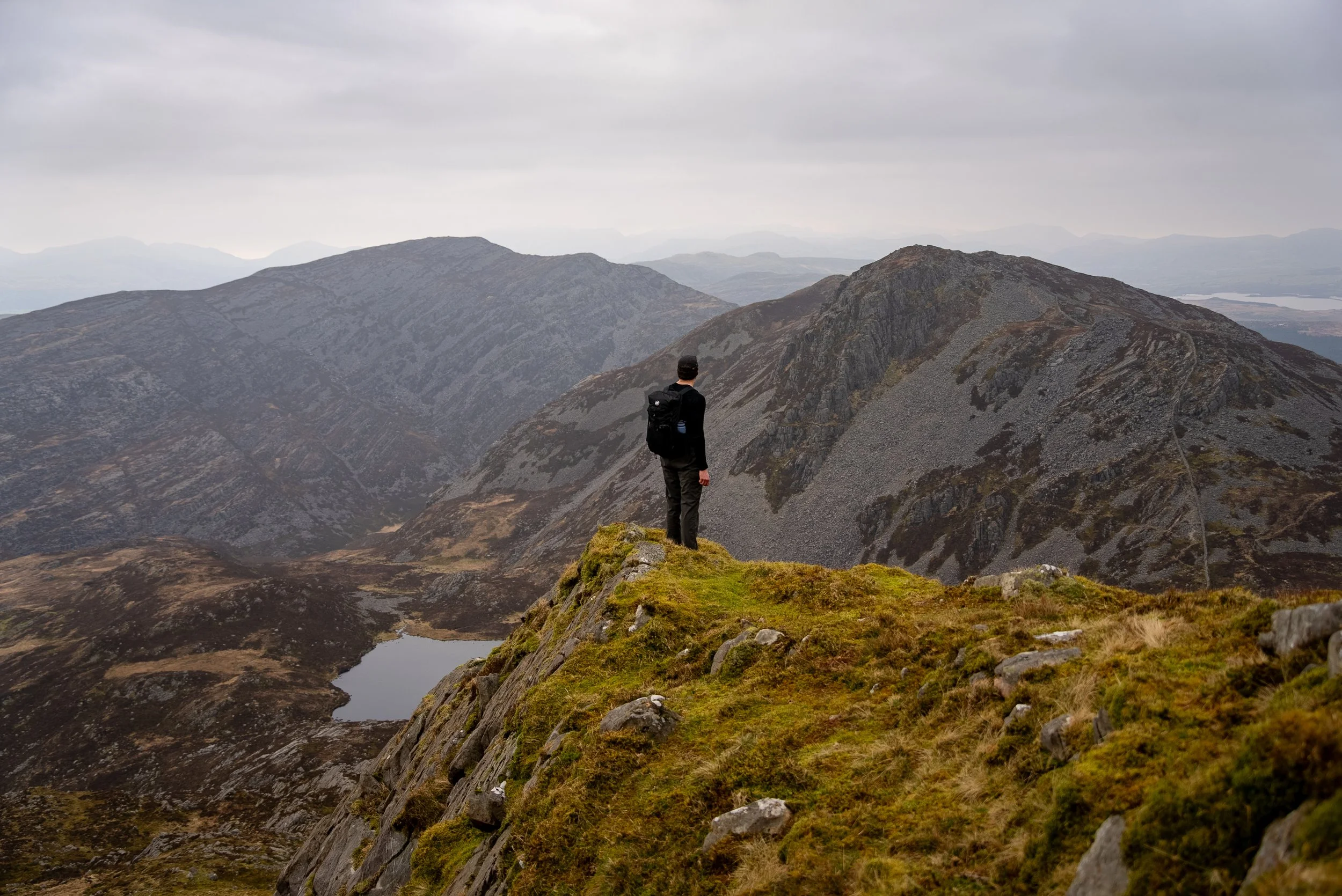
This is easily one of the most wild and rugged mountain days you can have in Wales, and arguably the best hike in Snowdonia that you have probably never heard of.
There are no crowds, barely any defined paths, and terrain that constantly keeps you on your toes. It is rocky, boggy, slow going, and at times frustrating, but that is exactly what makes it so rewarding.
It might not sound appealing at first, but this route delivers incredible panoramic views over both mountains and coastline. The landscape feels more like the Scottish Highlands, with a level of remoteness that is hard to find elsewhere in Snowdonia.
Most blogs suggest tackling the Rhinogs as a loop, either from the east or west. This guide covers a full north to south traverse, linking Rhinog Fawr and Rhinog Fach with Y Llethr and Diffwys to create one complete and varied mountain day.
At 18km, this route packs in four summits while offering some of the best views in the area for the least amount of repetition.
The terrain starts off tough, steep, rocky, boggy, and with very faint paths that are hard to follow. But as the route progresses, it opens out into wide, grassy ridgelines that are far easier underfoot and much more straightforward to navigate.
It is worth noting that this is a one way route and requires two cars, which adds to the sense of adventure. That said, if logistics are an issue, you can still experience the best of the Rhinogs by hiking Rhinog Fawr and Rhinog Fach as part of a circular or out and back route.
If you are looking for something raw, quiet, and genuinely adventurous, this is it.
Hike Deatails
Hike Type: One way
Difficulty: Hard
Distance: 17.5km / 11 miles
Elevation Gain: 1,280m
Estimated Time: 7-10 hours
Terrain: Mix of steep rocky climbs, alongside grassy and boggy paths
Technical aspects: Some light, non technical scrambling
Facilities: No toilets, no water refill points
Start Point and Parking: Coedwig Crafnant Forest Car Park
End Point: Above Bontddu

Parking
Because this is a one way route which can’t be accessed using public transport (unless you want to hike an extra 5 miles), you will need two cars.
You will need to leave one car at the end point above the village of Bontddu, overlooking the Mawddach Estuary. It is a small gravel car park at the top of a narrow single track road. What3Words:///scale.collect.dispenser
Trust the What Three Words and keep following the road as it climbs up into the valley. There is space for around 5 to 6 cars, so park responsibly and do not block access. You will see the gate where the route finishes directly opposite the car park
The start point of the hike is located in the Coedwig Crafnant Forest Car Park.
It’s around a 35 minute drive from the other car park and is located of the A470 south of Bronaber. You will have to turn off the main road, pass through a closed farm gate. Drive a further two miles along a single track road, before passing through a second farm gate to reach the car park. Please sure you make sure you close both gates behind you.
There is space for around a dozen cars in the gravel car park. If full, you can park further along the track as long as access is not blocked. What3Words: ///deflection.dozens.funky
Tips for Hiking The Rhinogs
The first half of the route is very rugged, boggy, and difficult to navigate. It will take longer than you expect, so give yourself plenty of time.
Waterproof hiking boots with good grip are essential. The terrain is often wet, slippery, and uneven underfoot.
Navigation can be tricky even in good visibility. Make sure you have the route downloaded on a reliable hiking app, I use OS Maps.
There is no signal at the start point, so download your route before you arrive.
Check the weather before heading out. The summits are exposed and conditions can change quickly.
Parking is limited at both the start and end points, and both are accessed via narrow dead end roads. Arrive early, especially on weekends.
-
Know and plan the Route: Use proper hiking app (I use and recommend OS Maps) and have the route downloaded for offline use
Check the Weather: Always check the weather forecast for the specific peaks and mountain ranges you are planning on hiking. I use MWIS and Met Office
Start Early: Give yourself plenty of daylight to complete the hike.
Know Your Limits: This hike requires a good level of fitness and a head for heights.
Group Up: If possible, hike with others or consider hiring a local guide for extra safety
Wear and carry the correct kit: see below
-
The correct kit and equipment are essential when hiking in Scotland.
Sturdy hiking boots with good grip
Waterproof jacket and overtrousers
A layering system (wear/carry a minimum of 3 top half layers, with a 4th in winter)
GPS device with the route downloaded (or Map and compass)
Power bank and charging cable
Headtorch + First aid kit
Plenty of fluids and high-energy snacks
Gloves and a hat for cooler conditions
If it’s winter then crampons, micro spikes, and an ice axe(s) are essential alongside extra clothing. I’d also recommend walking poles and ski goggles.
You can find my hiking kit List here: https://ohwhataknight.co.uk/my-hiking-gear

The route
Ascent to Rhinog Fawr
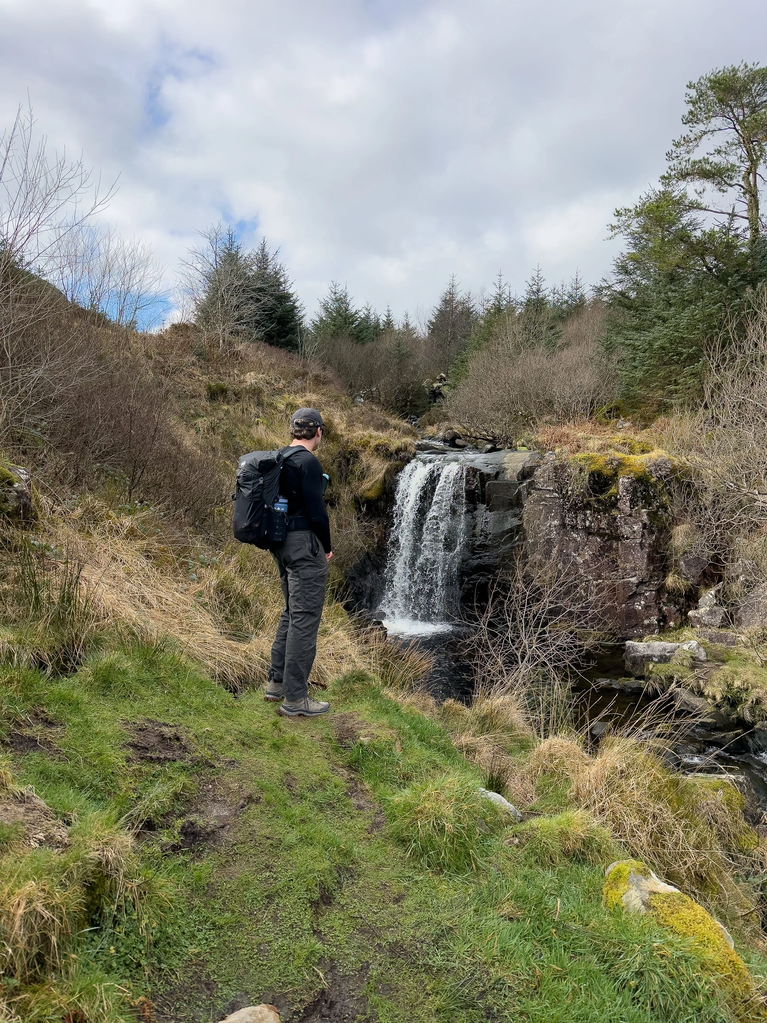
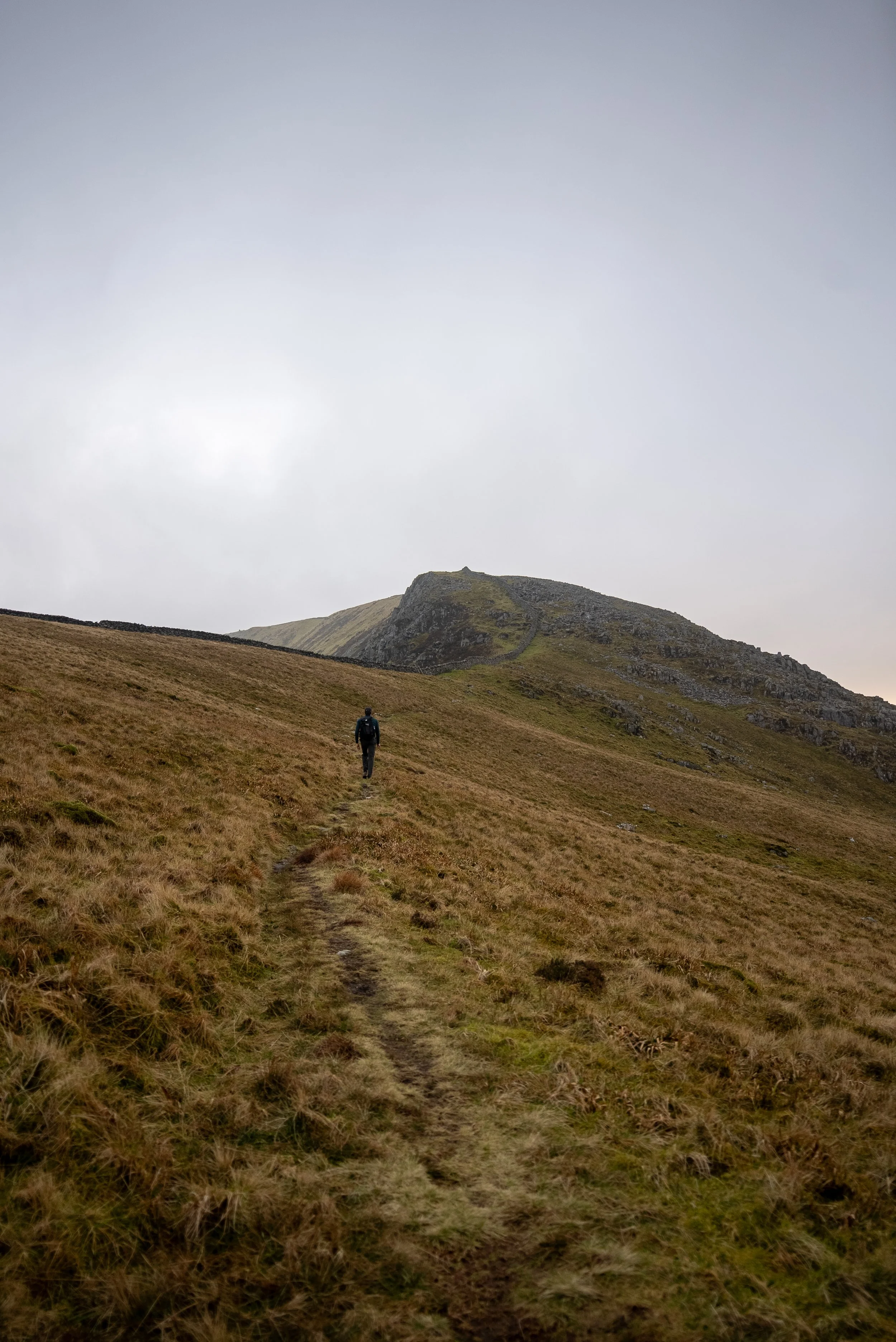
The route begins by following a gravel track past a house before branching right after around 700 metres, joining a narrow path through the forest. The climb starts gently as you make your way through the trees, passing a small waterfall before emerging into the open hills.
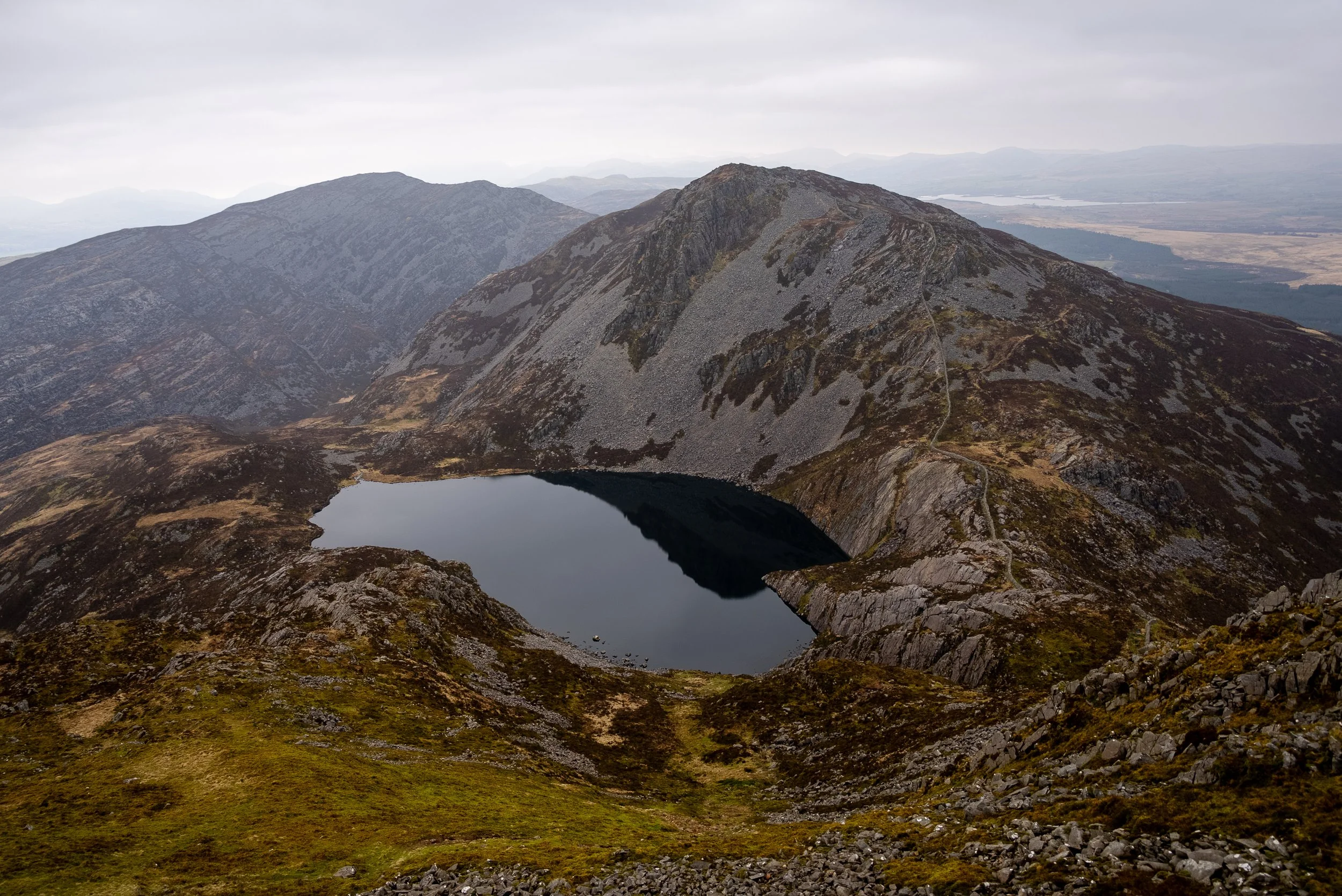
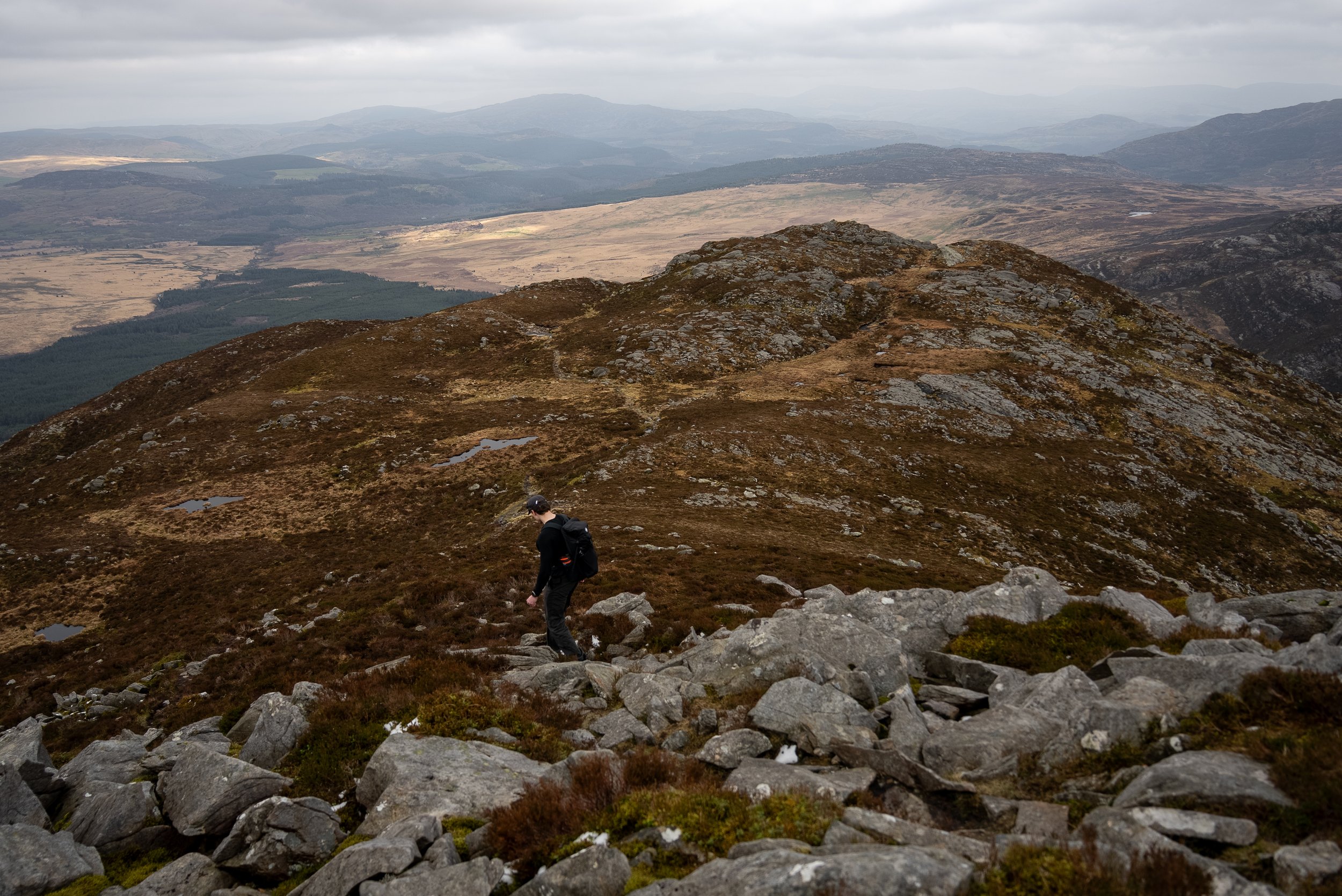
From here, the character of the route changes quickly. The terrain becomes rocky and boggy as you gradually climb towards Llyn Du, a beautiful but rugged lake sitting beneath Rhinog Fawr.
Beyond the lake, the route turns into a proper climb up a boulder covered chute. It is steep, rocky, and a bit of a slog, with a few sections where you will need to use your hands. Nothing technical or exposed, just hard work.
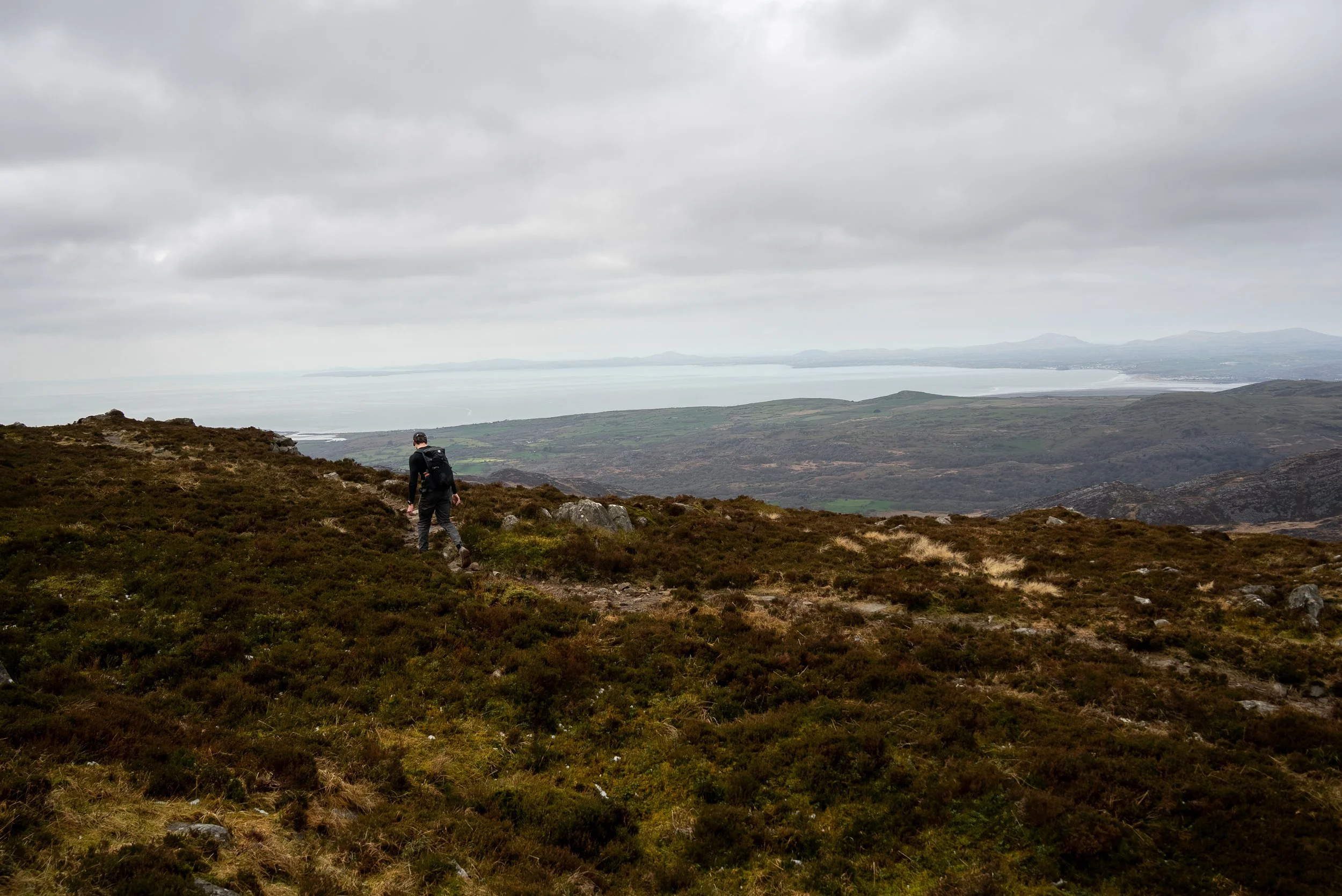
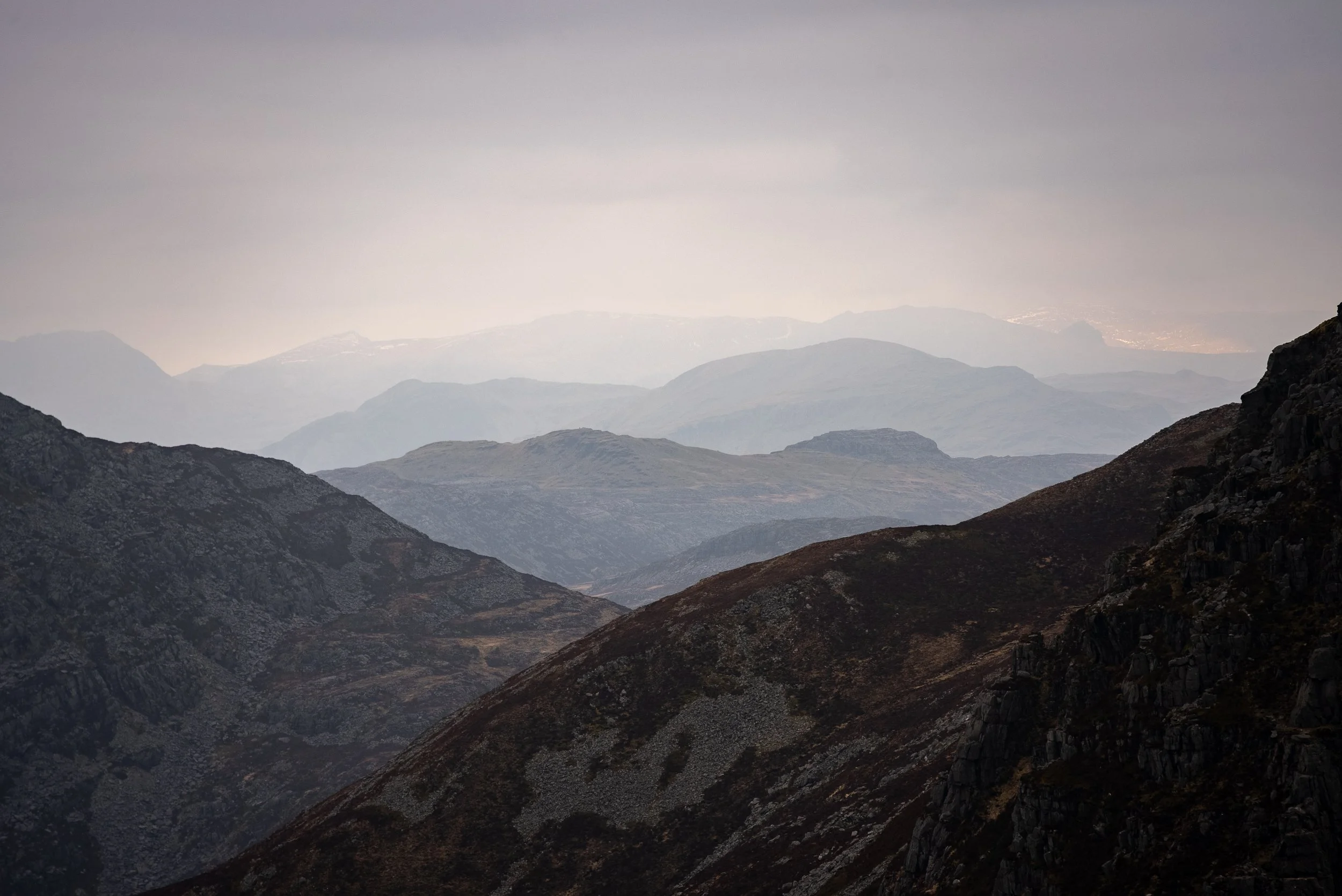
You get a bit of a breather as the path skirts around the northern side of Rhinog Fawr, and this is where the views really start to open up. You can see out over Porthmadog, the Llŷn Peninsula, and across to northern Snowdonia, and it is the first moment where you realise how wild this place actually is.
But it does not last long as the route kicks up again, finishing with one final short but steep push up a rocky gully to the summit.
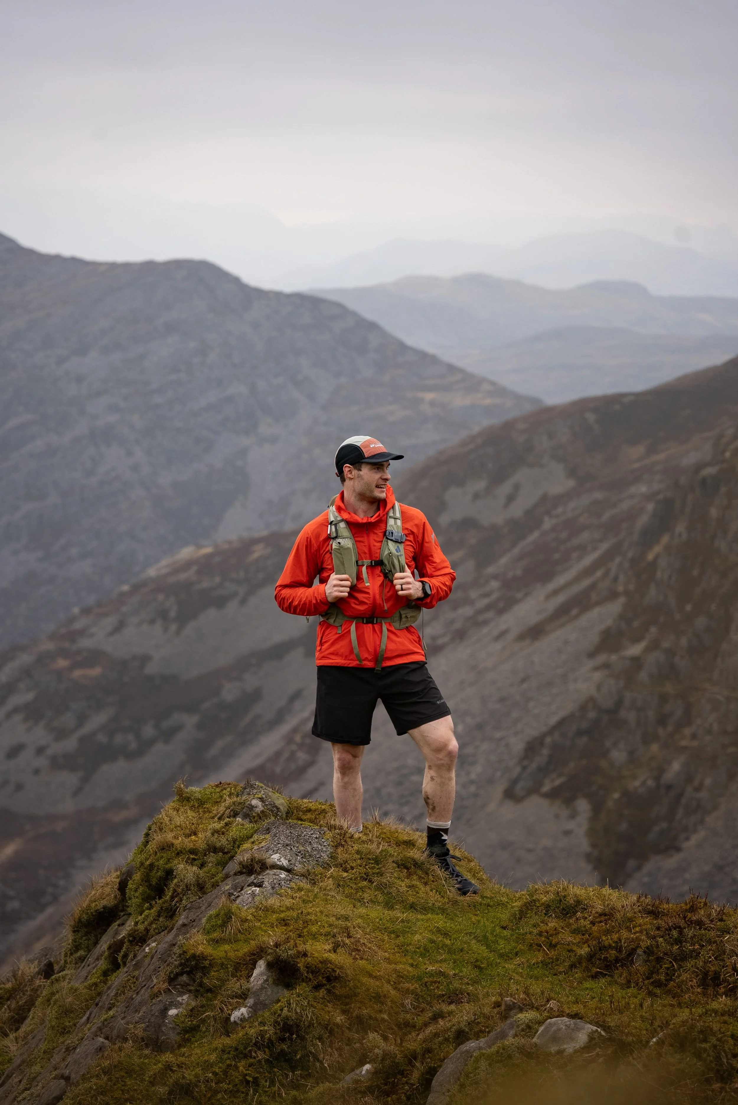
Rhinog Fawr Summit
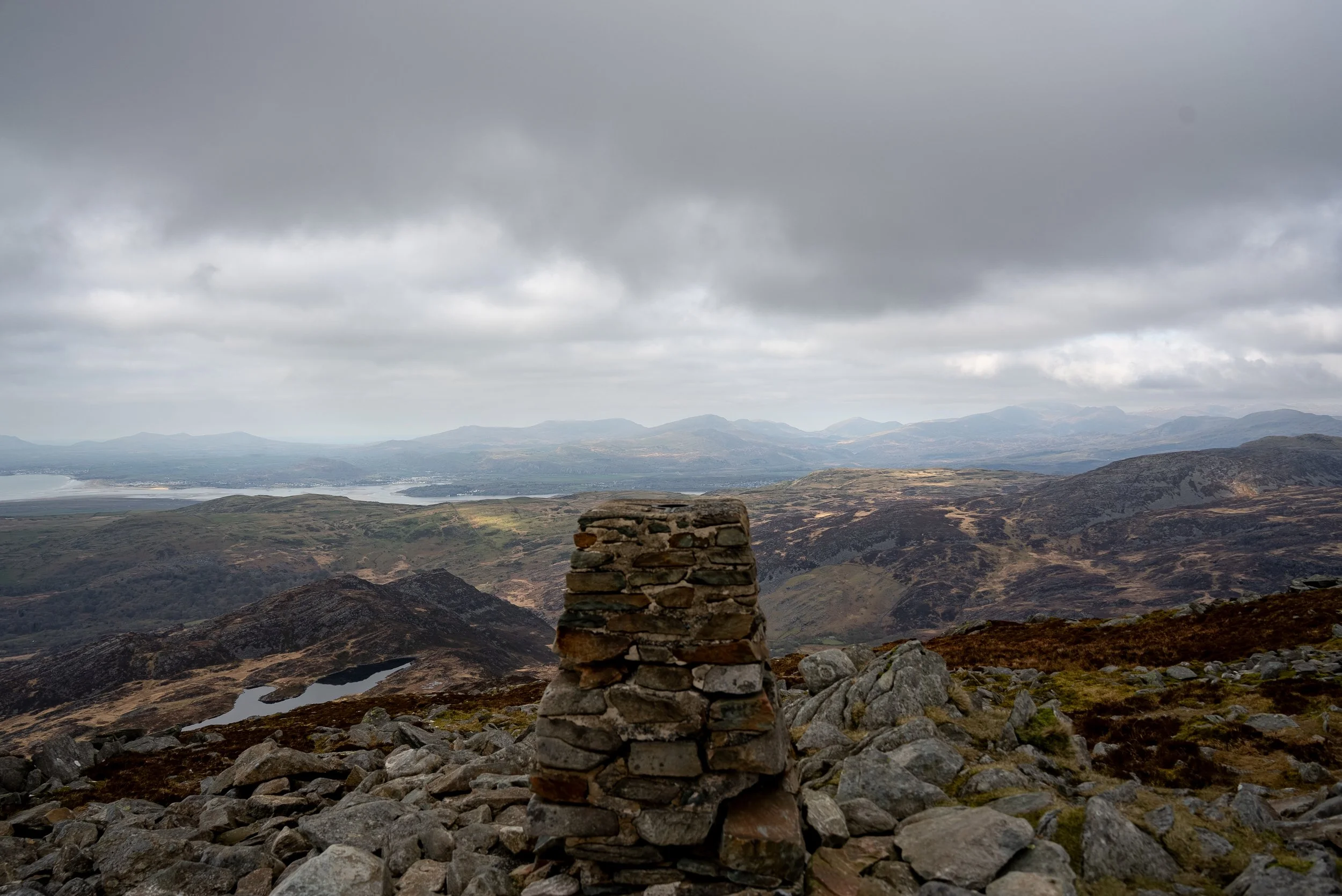
The summit of Rhinog Fawr is a broad, rocky plateau marked by a large cairn. It feels remote and exposed, with a real sense of being deep in the mountains.
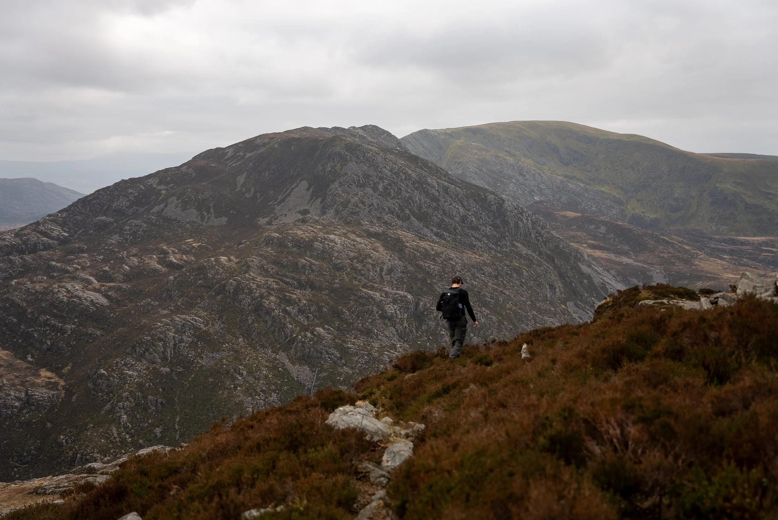
On a clear day, the views are incredible. To the north, you can see across to the peaks of Snowdonia, while to the west the landscape drops away towards the coast and the Llyn Peninsula. Looking south, you get your first glimpse of the route ahead, with Rhinog Fach, Y Llethr, and Diffwys stretching out in front of you.
It is a great place to pause, take it all in, and prepare for the more challenging terrain still to come.
Rhinog Fawr to Rhinog Fach
The descent from Rhinog Fawr is one of the trickiest parts of the entire day.
It drops off the eastern side of the mountain, almost feeling like you are heading back towards where you started, before eventually curving around. It does not follow an obvious or intuitive line, which makes it surprisingly easy to go wrong. I assumed I was following the correct path on multiple occasions, only to check the route and realise I had gone way off path, and that was with full visibility.
On top of that, the descent is very slippery due to how wet and boggy it is, so taking your time and carefully picking your line is essential.
Eventually, you will drop down into a narrow valley marked by a stone wall, which acts as a clear marker that you are back on track.
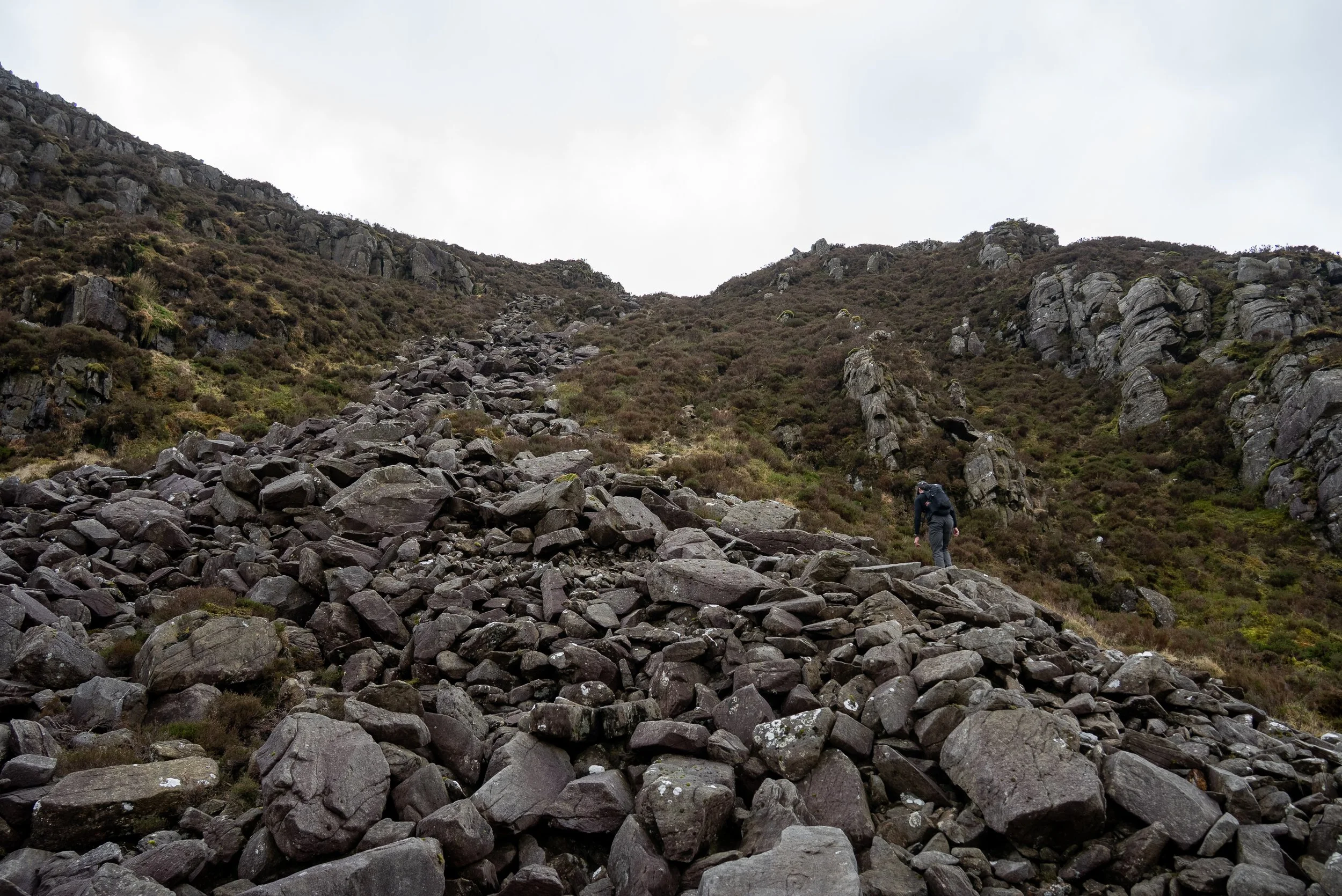
From the valley, the route goes straight back up. The climb starts steep, and I mean properly steep. It is relentless from the beginning and will require the use of your hands in places, although it is not exposed.
After the initial push, the gradient eases slightly, giving you a brief moment to recover, before another steep section kicks in and leads you up onto a wide, rocky plateau.
From here, the effort is mostly behind you, with a more gentle climb taking you up to the second summit of the day.
Rhinog Fach Summit
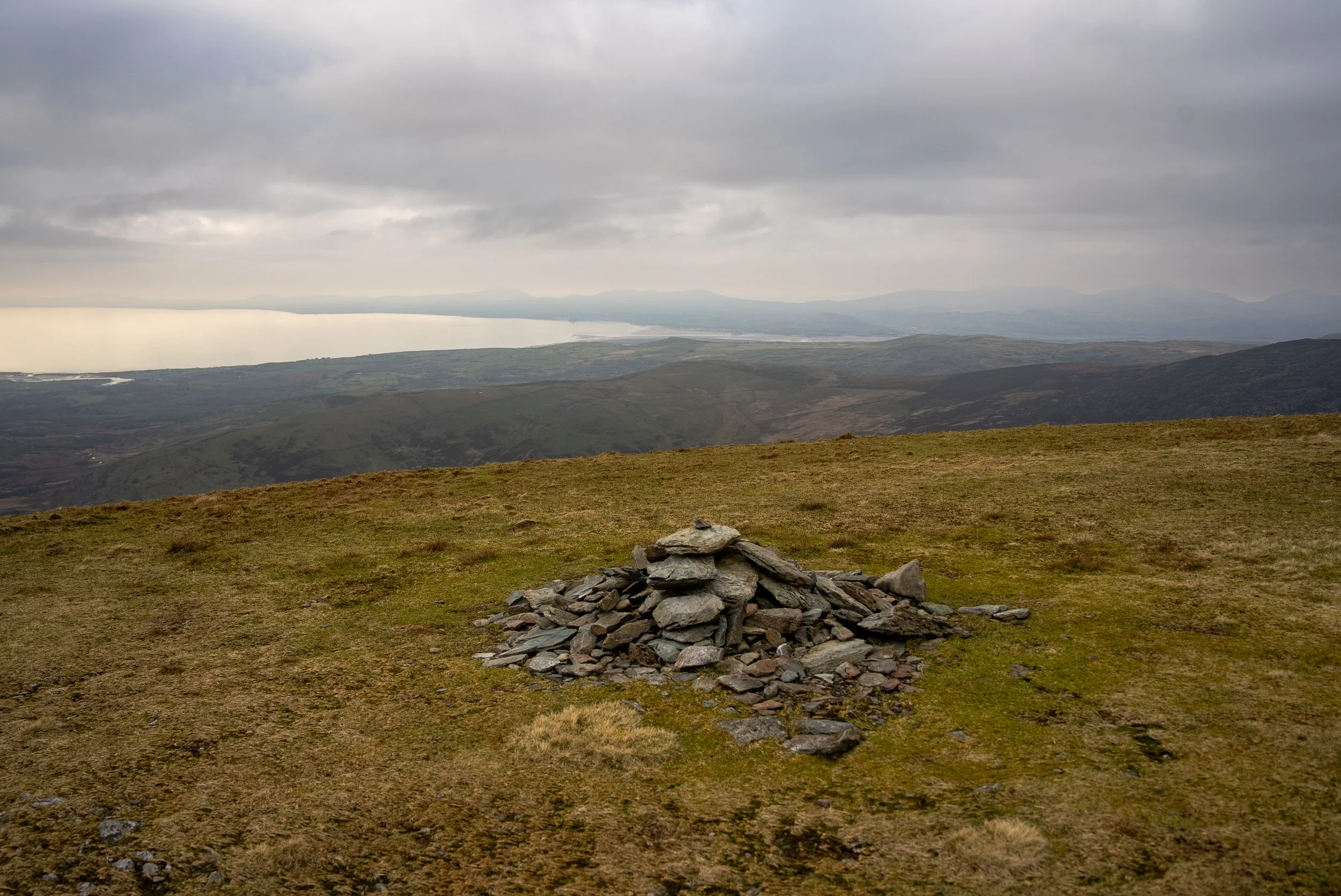
The summit of Rhinog Fach is far less distinctive than Rhinog Fawr, marked only by a pile of stones rather than a clear cairn or trig point.
The views from the summit itself are not quite as impressive either, especially compared to what you have just experienced.
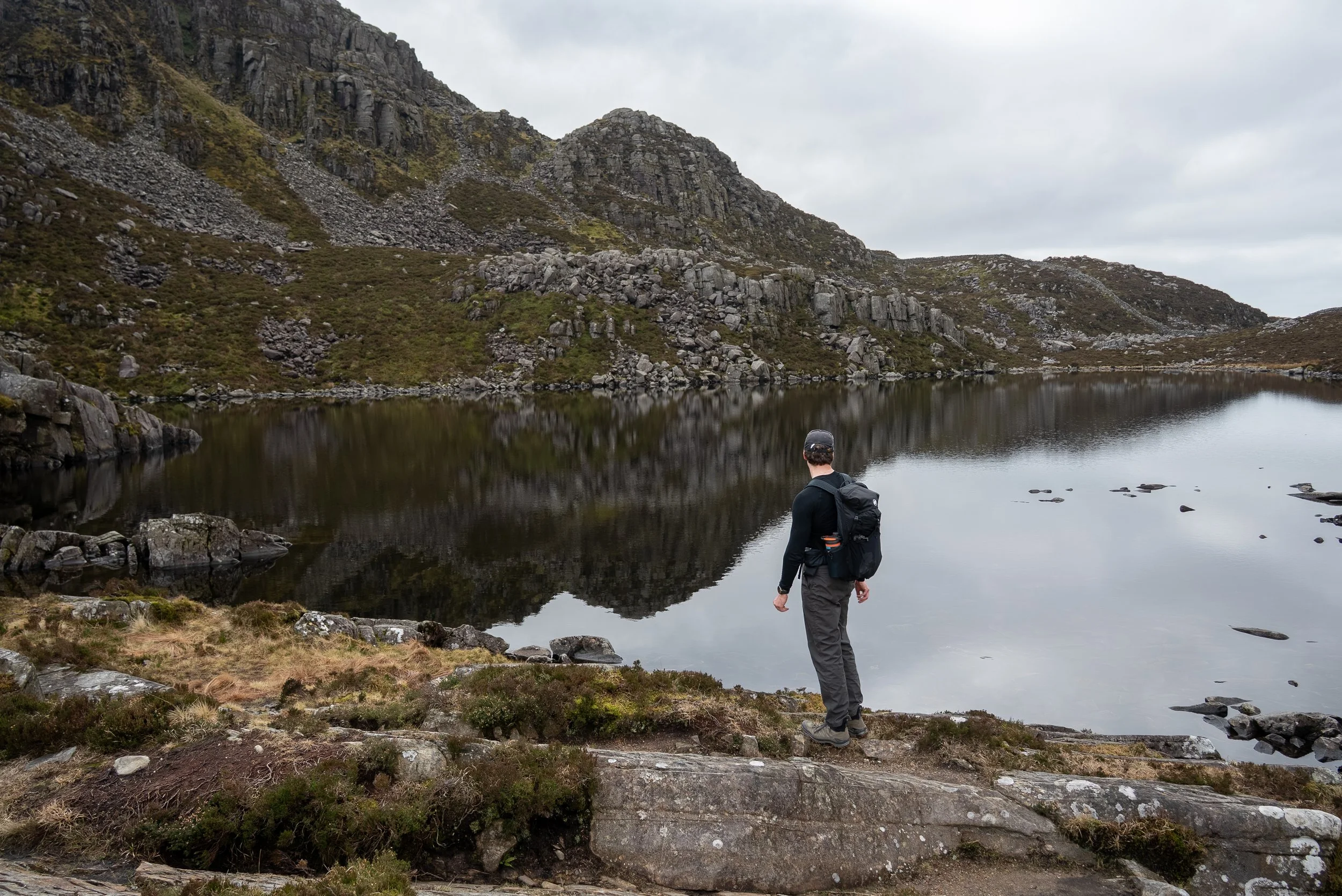
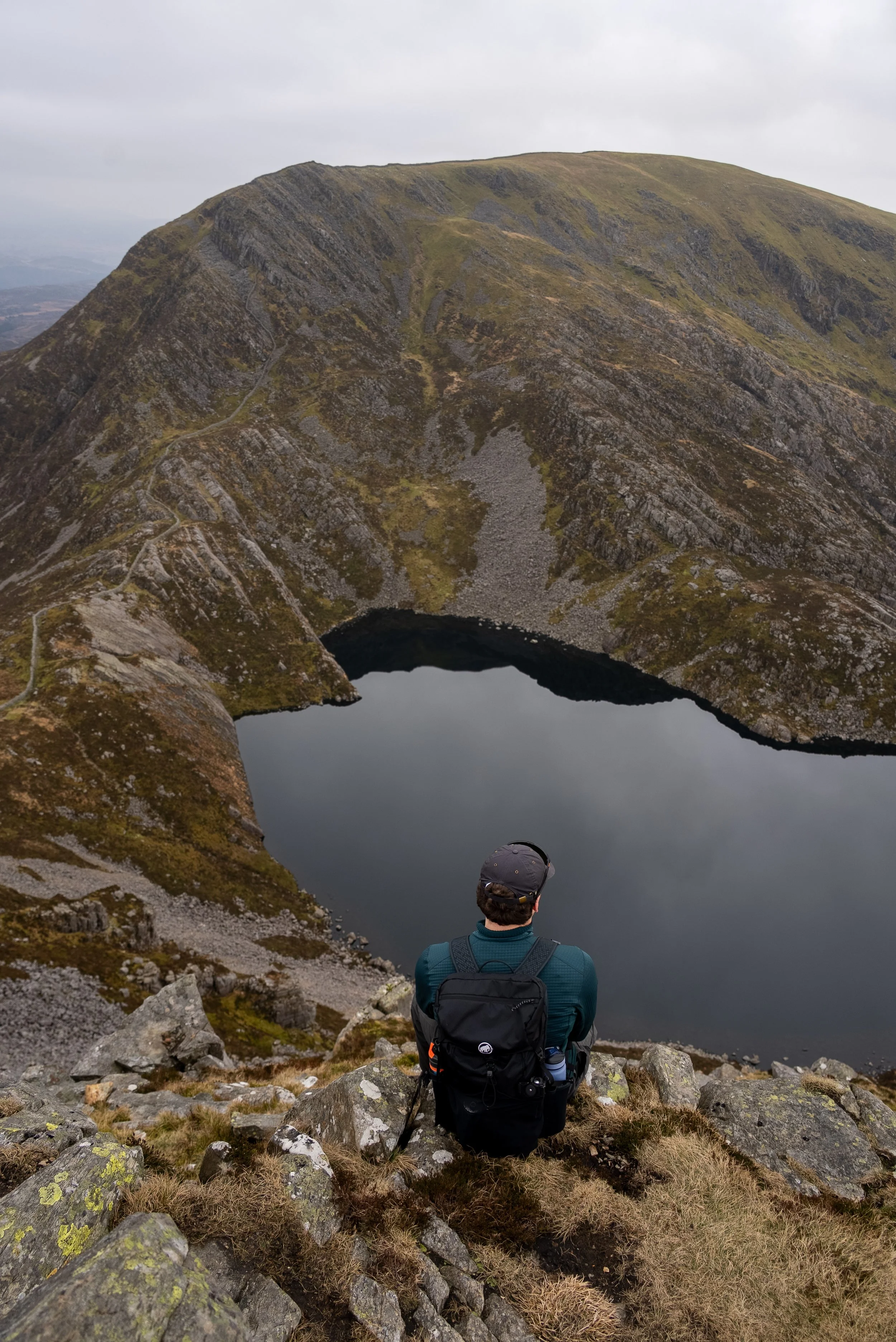
However, if you take a short detour and drop around 50 metres south, you are rewarded with a sensational view looking down over the lake below with the rugged Rhinog landscape stretching out around you.
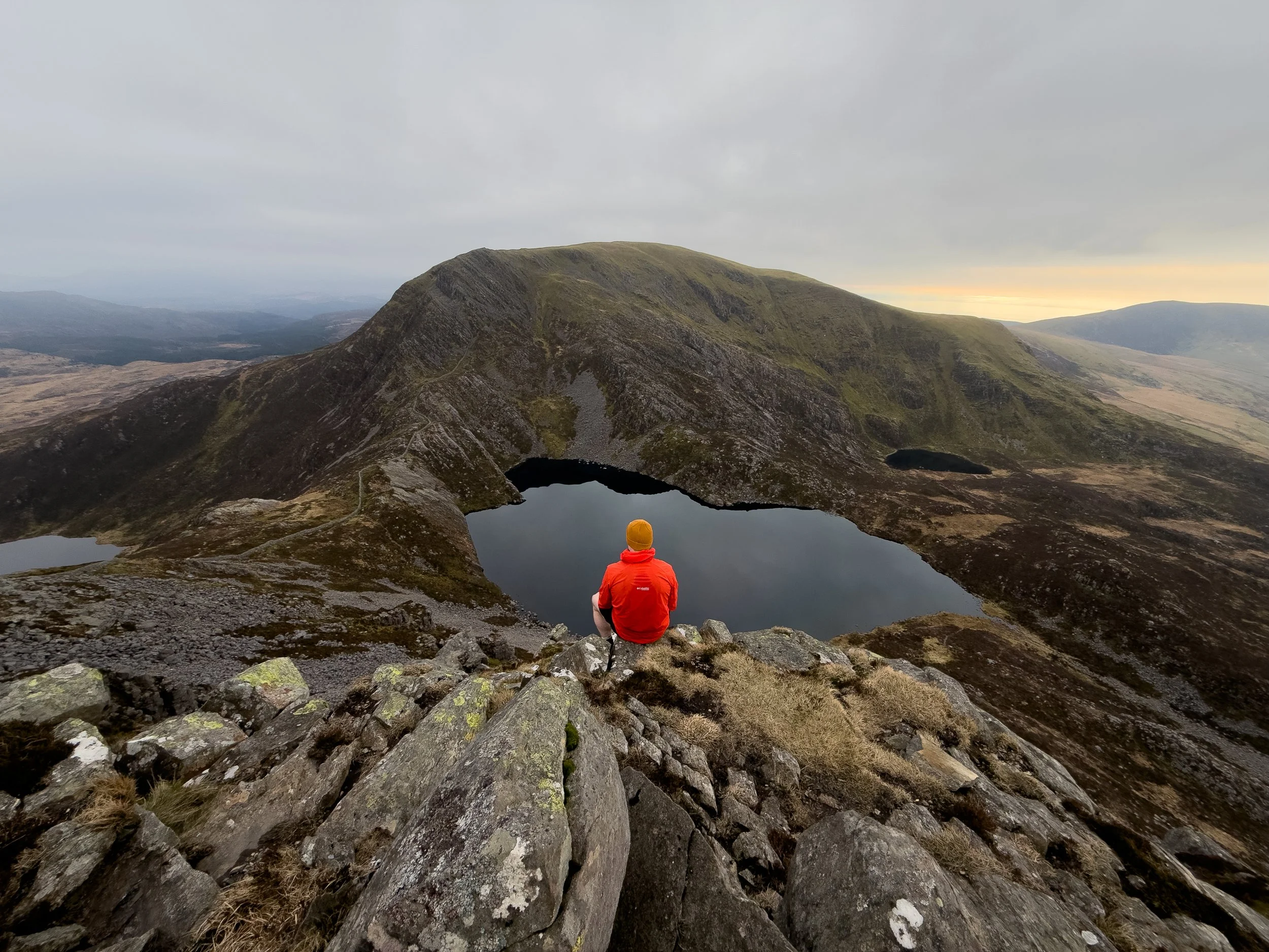
Rhinog Fach to Y Llythr
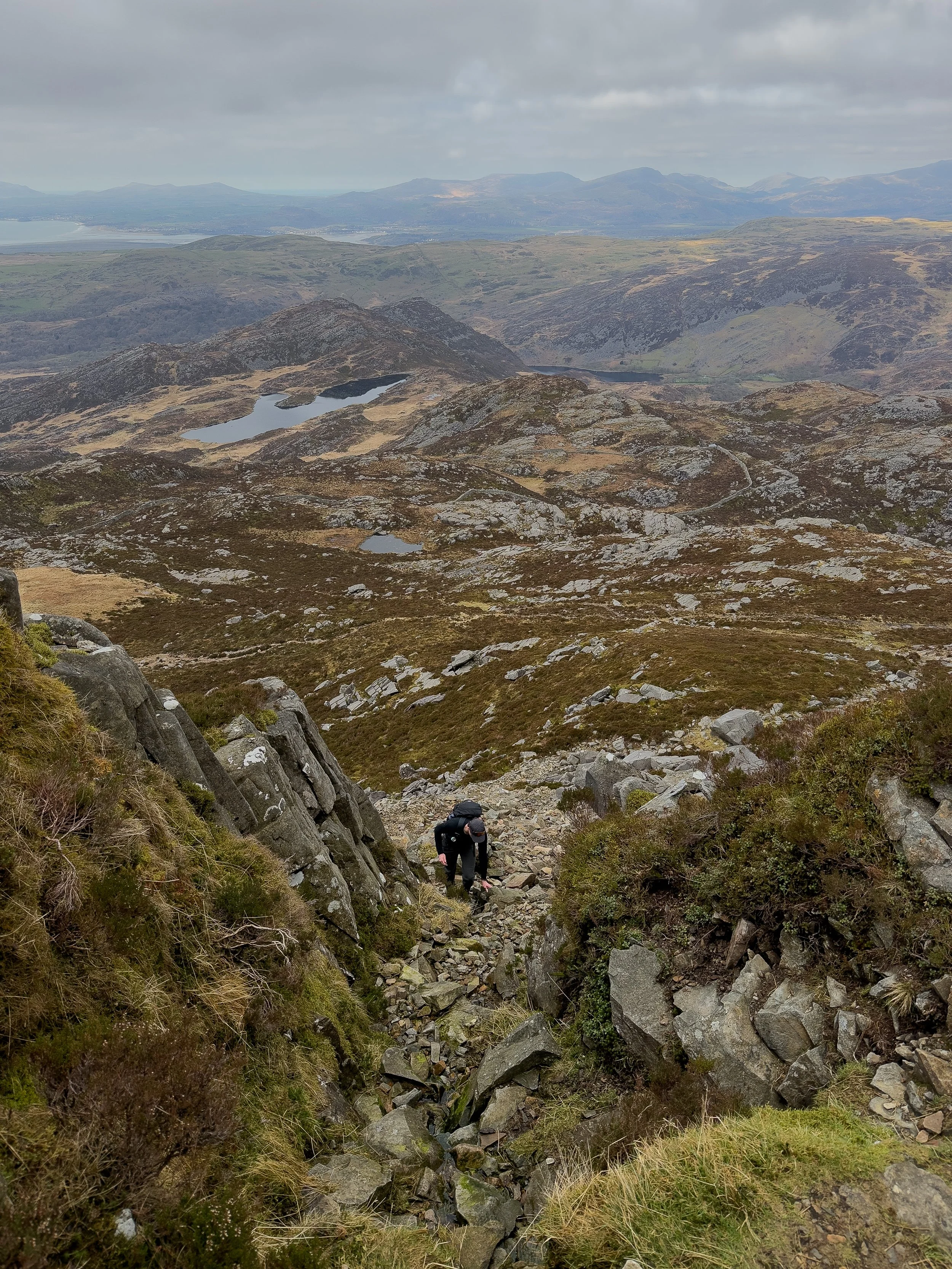
You will then have a very rocky descent, following one of the stone walls the Rhinogs are known for, all the way down towards the lake below. It is slow going and rough underfoot, so take your time through here.
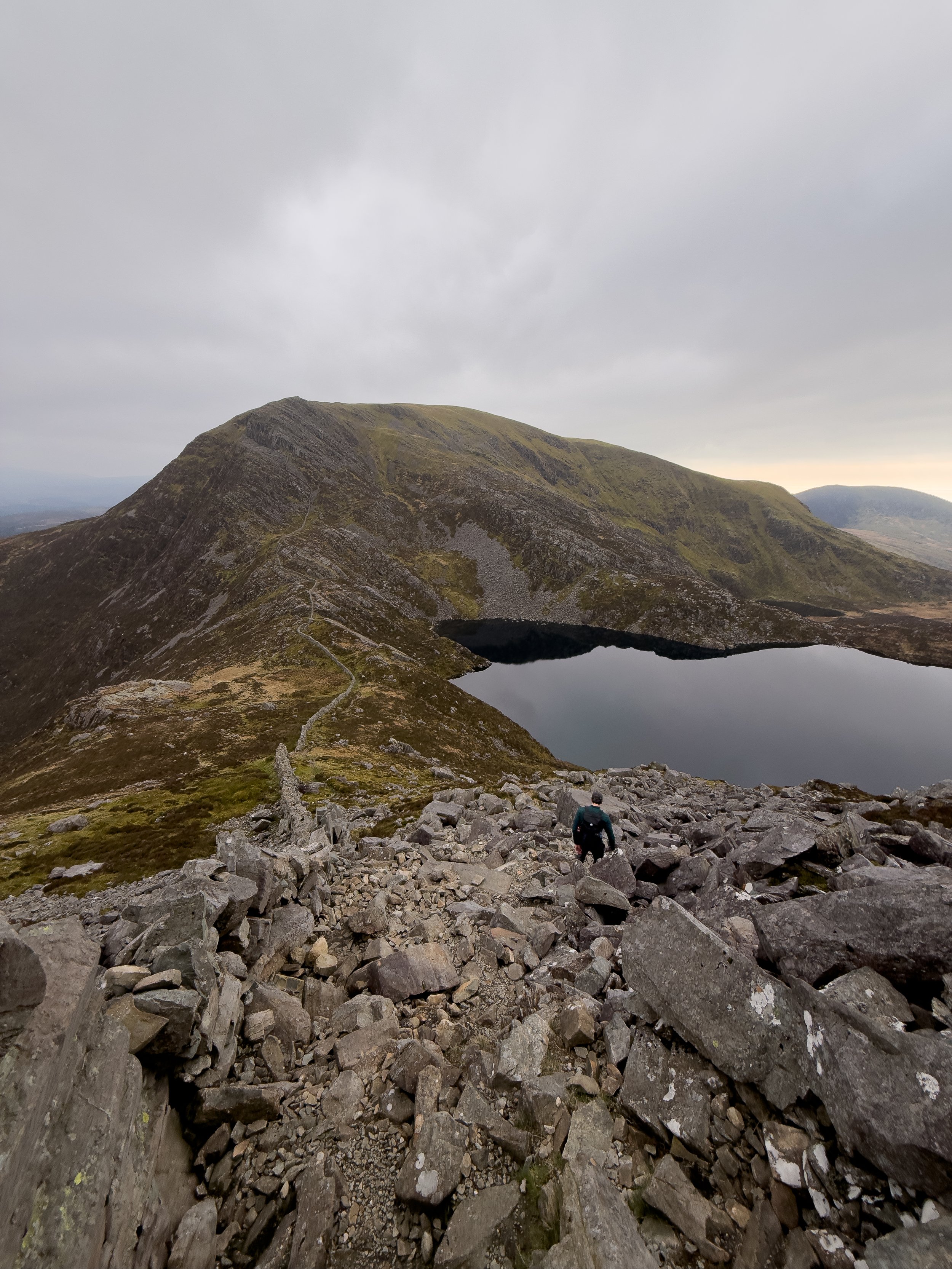
From the lake, the route heads straight back up again with another steep and rocky climb towards Y Llethr. It is a bit of a grind, but when you reach the top of the climb, just before the terrain turns grassy again, you are rewarded with what is probably the best view of the entire route. It is a perfect spot to stop, catch your breath, and have some food.
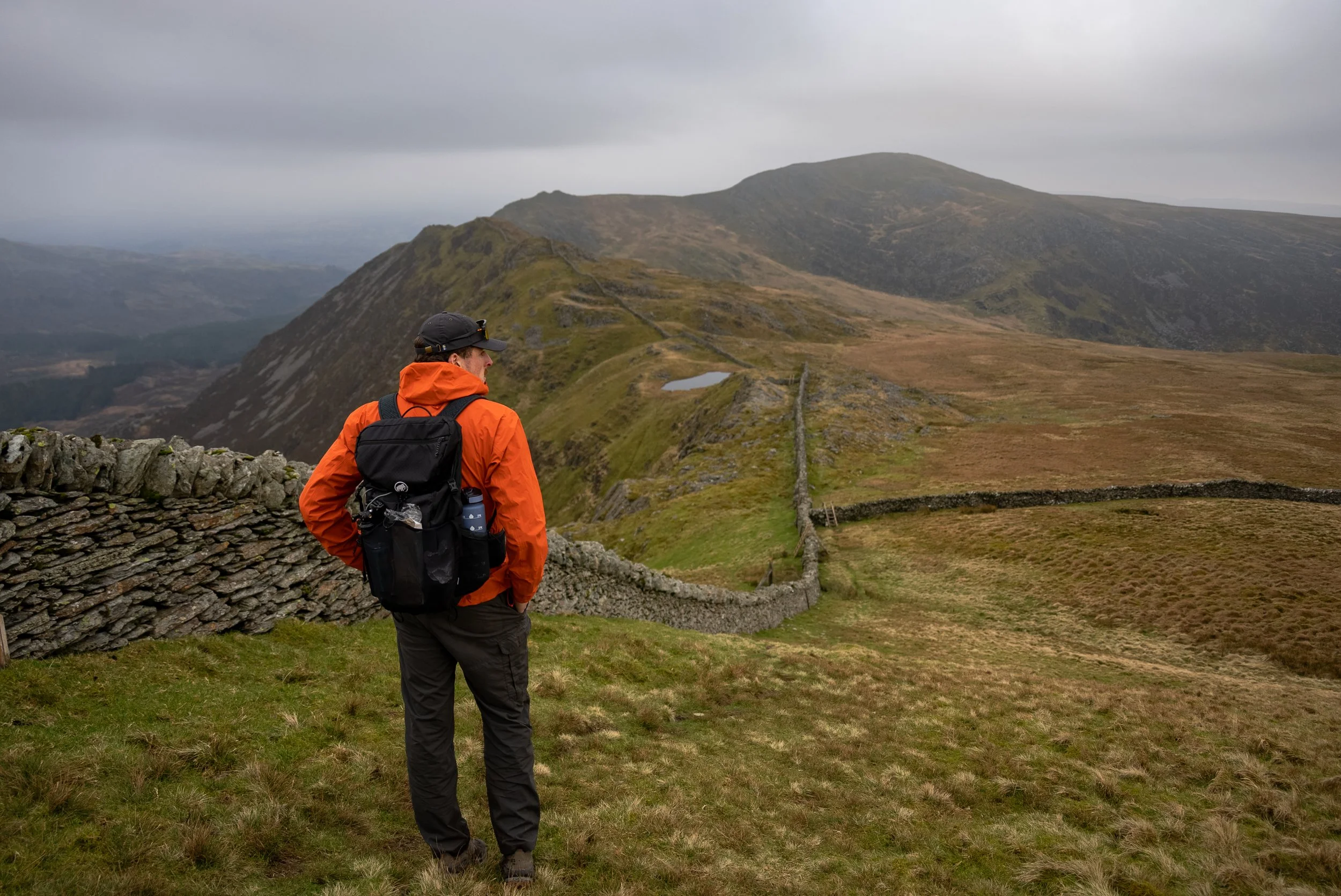
From here, the gradient eases off and the terrain becomes much more forgiving underfoot. You follow the stone wall up towards the summit of Y Llethr.
The summit itself is fairly unassuming, a broad, slightly flat grassy plateau backed by the wall. It does not have the same dramatic feel as the Rhinogs, but it does offer some nice views out towards the coast.

Y Llethr to Diffwys
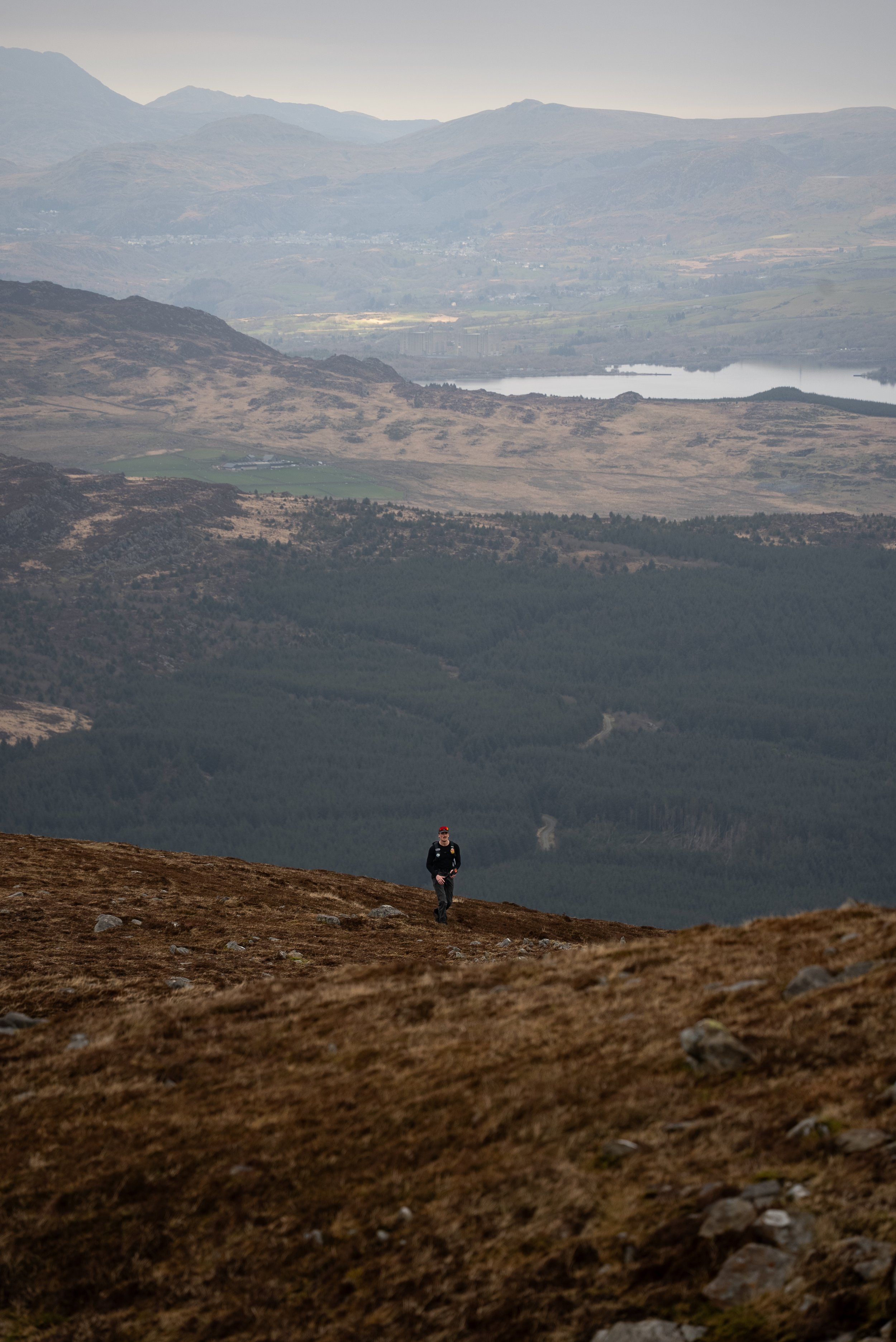
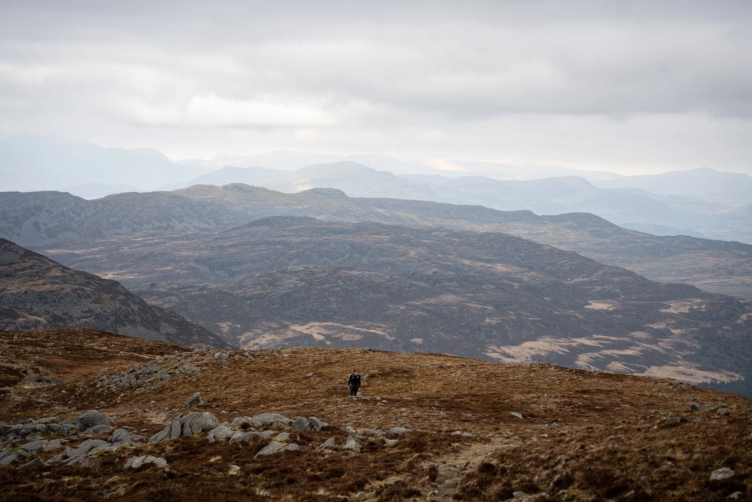
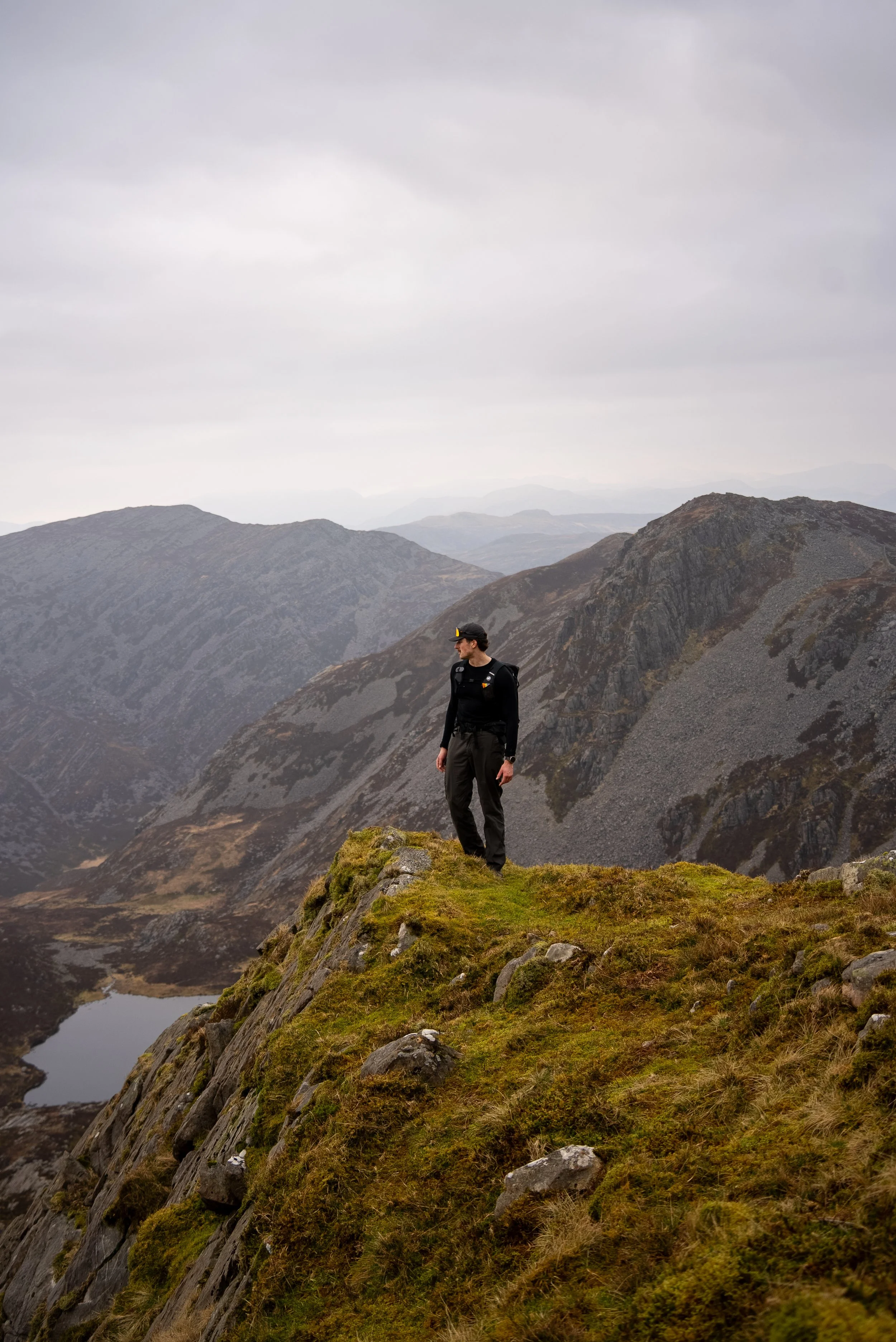
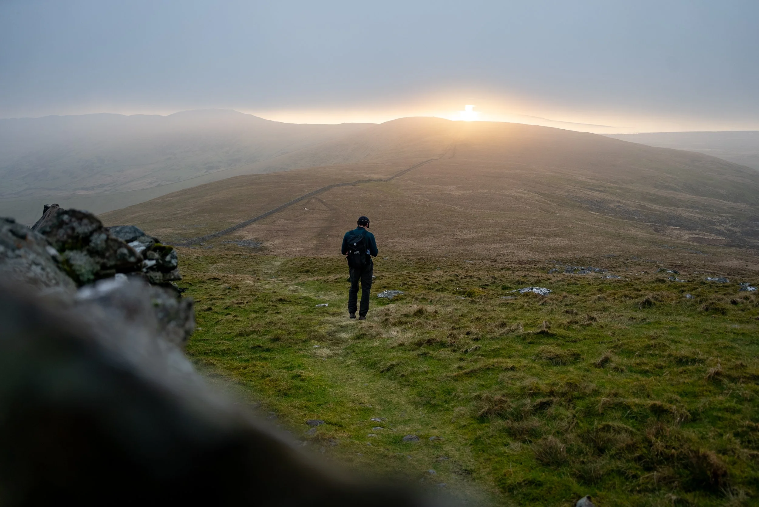
From here, the route eases off both in gradient and underfoot. The steep, rocky terrain is replaced by wide, grassy ridgelines, a complete contrast to the first half of the hike and a very welcome relief for tired legs and likely damp feet.
It is still boggy in places, but the path is much easier to follow now. You simply stick to the stone wall, keeping it on your right hand side on the coastal side, heading towards the summit of Diffwys. It is a really nice section of the route, a gentle, weaving ridgeline with a real sense of space.
There is one final climb up to the summit but it will feel like a breeze compared to the ascent of the Rhinogs.
Unfortunately, I cannot tell you what the views from the summit of Diffwys are like, as it was completely in cloud when I was there. The summit itself is marked by a trig point next to the wall, but I did not hang around for long.
Diffwys West Top and Descent
From there, continue following the wall as the route gradually descends onto a very boggy plateau, before rising again towards Diffwys West Top. Again, it is as simple as sticking with the wall.
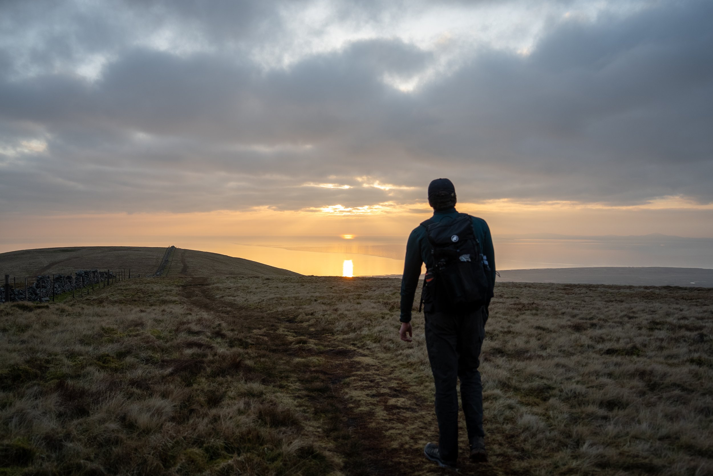
This is where you should get some great views up the coast towards the Llyn Peninsula, and if you time it right, it would be an incredible place to catch the sunset.
If you want to continue on to Barmouth, you just keep following the wall along the undulating ridge.
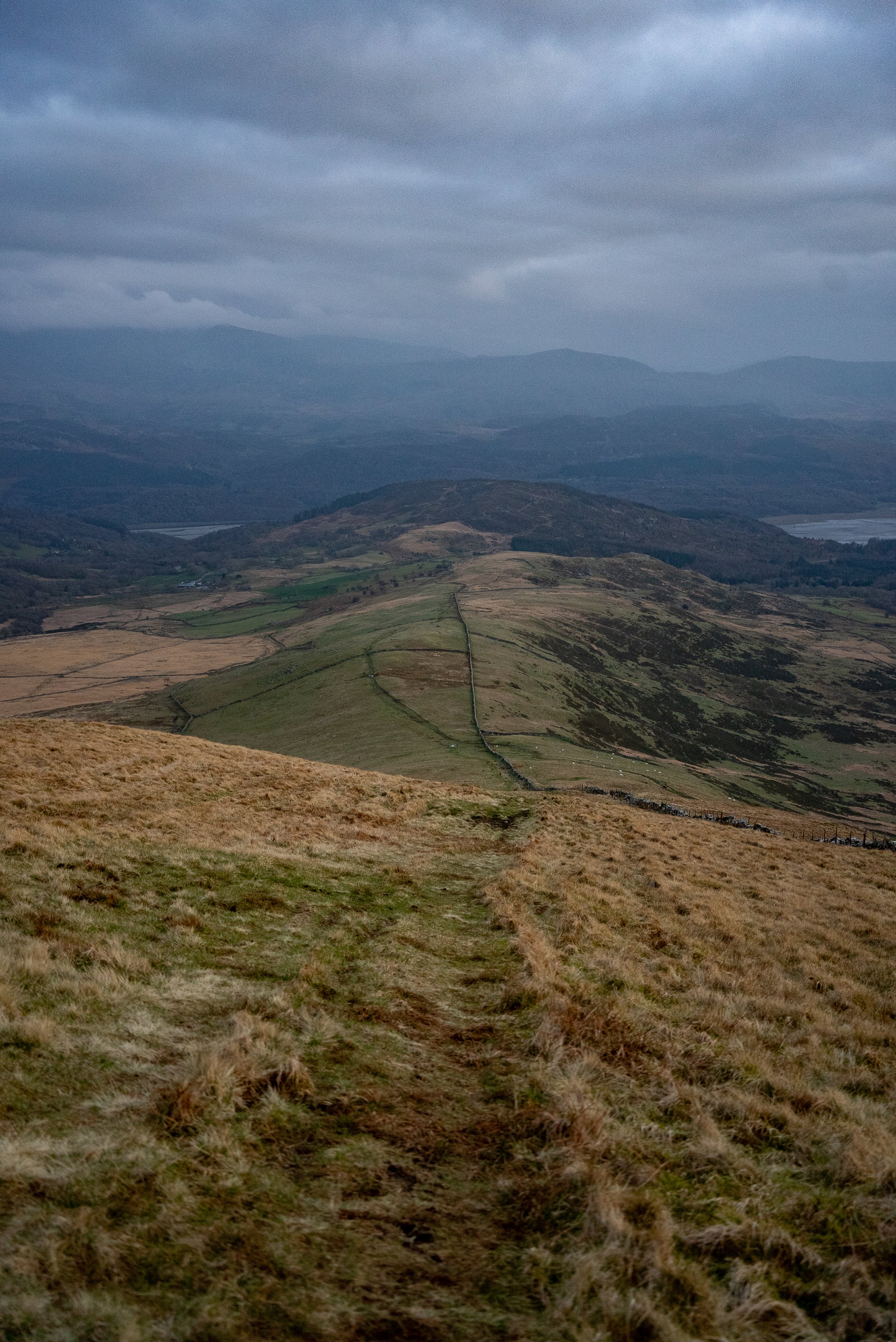
For the descent back to the car, look out for a break in the wall with a stile. From here, you follow the obvious path that runs parallel to the wall all the way down. It is around 3km, grassy underfoot, and very straightforward, although it does weave slightly towards the bottom, so it is still worth keeping an eye on your route.
Final Thoughts
This was one of the best hikes I have done in Wales.
Not just because of the views, but because of how wild and remote it feels. The terrain is constantly changing, the landscape is rugged and raw, and there is a real sense of isolation that is hard to find elsewhere in Snowdonia.
We did not have perfect conditions, but it was a calm, wind free day with good visibility. Even though it was the first sunny Saturday in what felt like months, in mid March 2026, we only passed three groups all day.
There are higher, more dramatic peaks in Snowdonia, but this hike offers something different. A proper sense of remoteness and a noticeable lack of crowds that is becoming harder to find.
At times, the rocky terrain and heather covered hills felt more like Scotland than Wales, which brought back some great memories.If you are lucky, you might even spot the wild goats that roam these mountains.
Just make sure you pick a clear day. In poor weather, this would quickly turn into a long and difficult slog. Plan your route, download it before you set off, and make sure you are carrying the right kit and wearing proper footwear.
In the right conditions, this is an incredible day in the hills.
Where to Eat
TH Roberts, Dolgellau - A great little spot to grab a coffee before heading out. Perfect for a quick stop before the drive up the valley.
DD’s Bakery, Dolgellau - An incredible range of pastries, sweets, and homemade sandwiches. Definitely worth stopping by, even if you’re just passing through.
Torrent Walk Hotel, Dolgellau - Great for a proper sit-down meal after the hike. Delicious pasta and solid home-cooked pub food.
Mawddach Pizza - Very good pizza just outside Dolgellau. Ideal if you want something more relaxed after a long day in the mountains.
Where to Stay
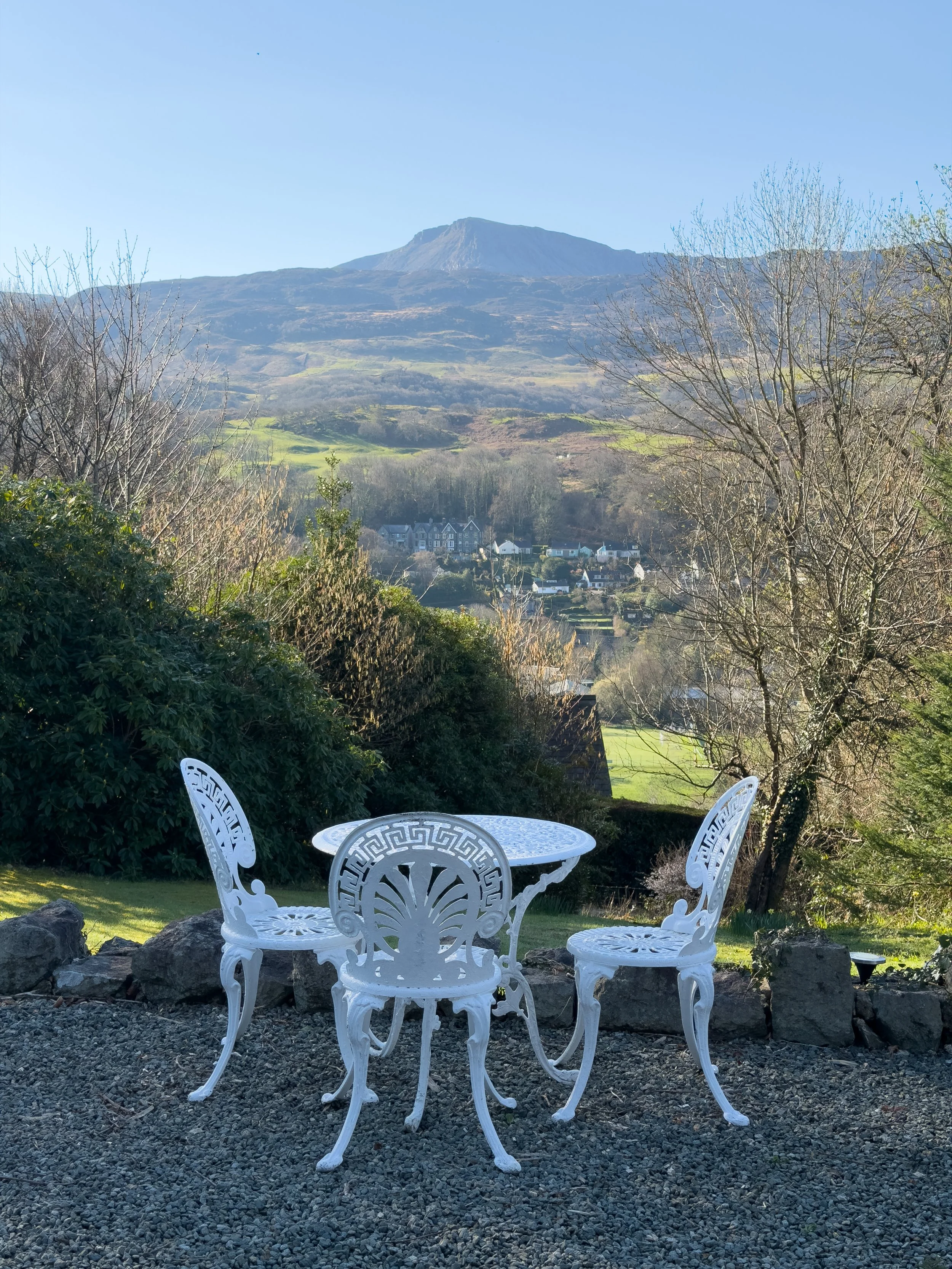
Pen y Coed Hall, Dolgellau - A lovely but incredibly quirky B&B /Apartments just above Dolgellau. The rooms are really spacious (we had three rooms) well furnished, and full of character. It’s dog friendly, the owners are lovely, and you get free parking as well. The views towards Cadair Idris are a real highlight.
Help support what I do
I created and I run this website in order to help inform, amaze, inspire people (for free) to get outside and explore the adventurous side of the UK and beyond.
If you’d like to support this website, you can use the affiliate links below to book your accommodation or transport. These come at no extra cost to you, but help keep this site running.
Book your car using Discover Cars
Book your accommodation using Booking.com
If you are feeling generous you can also buy me a coffee to say thank you, and give me a follow on social media.
Thank you, and if you have any questions, leave them in the comments below or drop me an email.
You can find more Welsh hiking inspiration in the following blogs
For more travel, hiking, & photography inspiration around Wales, check out my in-depth guides to each of my favourite regions below.
