
Aran Fawddwy Hike Guide | Snowdonia National Park
If you’re looking to escape the crowds in Snowdonia, Aran Fawddwy should be right at the top of your list.
At 905m, Aran Fawddwy is the highest peak in southern Snowdonia and offers incredible 360 degree panoramic views across Snowdonia, the Cambrian Mountains, and even out to the coast on a clear day.
This Aran Fawddwy walk, which is a circular hike from Cwm Cywarch, is a beautiful route that feels properly off the beaten track, with a sense of wild remoteness that’s becoming harder to find in Snowdonia.
You get a bit of everything on this hike too, a steep gorge climb to start, waterfalls, a boggy plateau, and wide grassy ridgelines on the way down, making it one of the most rewarding and quiet mountain routes in the area.
Aran Fawddwy Hike Info
Hike Type: Circular
Difficulty: Moderate-Hard
Distance: <12km
Elevation Gain: 820m
Estimated Time: 4-6 hours
Terrain: Mix of rocky climbs, alongside grassy and boggy paths
Technical aspects: None
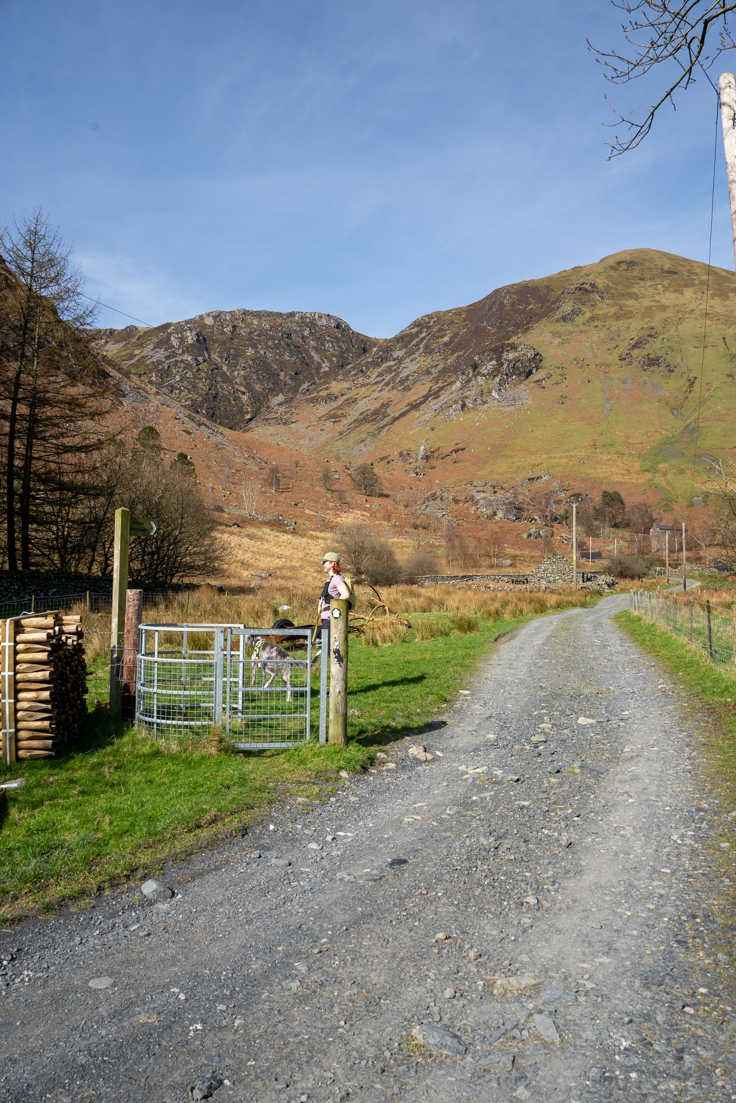
Start Point and Parking: Cwm Cywarch Valley
Parking
Free parking is available at the head of Cwm Cywarch valley (OS Grid Ref: SH852188) There is a designated car park with space for around a dozen vehicles. There are also toilets which is always welcome.
What Three Words Location ///bumpy.crunching.slices
To reach the car park, drive from Dinas Mawddwy towards Abercywarch, then turn left at the sign for Cwm Cywarch. From here, follow the single track road for 2.5 miles all the way to the end of the valley. The car park on the left right at the end of the road just before the final farm. As always please park appropriately.
Tips for Hiking Aran Fawddwy
Waterproof shoes are essential (the plateau you cross is extremely boggy)
Navigation can be tricky in poor visibility, Have the route downloaded on a proper hiking app
There is no signal at the car park, so download the route before you set off.
Check the weather before heading up, the summit is very exposed
Parking is limited and at the end of a dead end road, so get there early on busy weekends.
-
Know and plan the Route: Use proper hiking app (I use and recommend OS Maps) and have the route downloaded for offline use
Check the Weather: Always check the weather forecast for the specific peaks and mountain ranges you are planning on hiking. I use MWIS and Met Office
Start Early: Give yourself plenty of daylight to complete the hike.
Know Your Limits: This hike requires a good level of fitness and a head for heights.
Group Up: If possible, hike with others or consider hiring a local guide for extra safety
Wear and carry the correct kit: see below
-
The correct kit and equipment are essential when hiking in Scotland.
Sturdy hiking boots with good grip
Waterproof jacket and overtrousers
A layering system (wear/carry a minimum of 3 top half layers, with a 4th in winter)
GPS device with the route downloaded (or Map and compass)
Power bank and charging cable
Headtorch + First aid kit
Plenty of fluids and high-energy snacks
Gloves and a hat for cooler conditions
If it’s winter then crampons, micro spikes, and an ice axe(s) are essential alongside extra clothing. I’d also recommend walking poles and ski goggles.
You can find my hiking kit List here: https://ohwhataknight.co.uk/my-hiking-gear
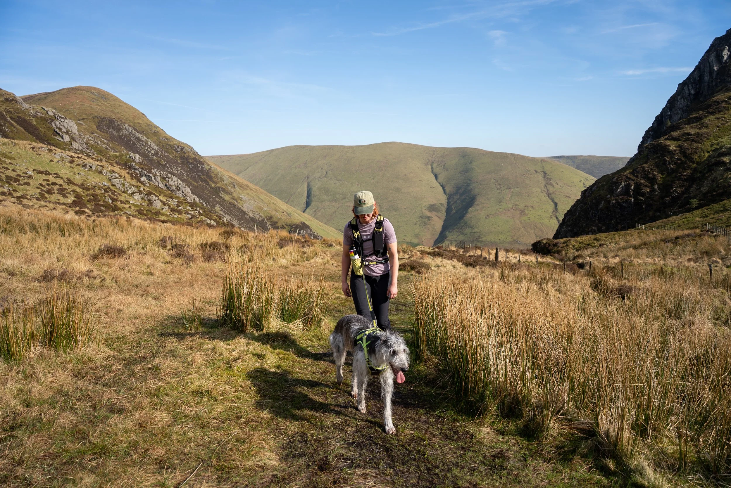
The route
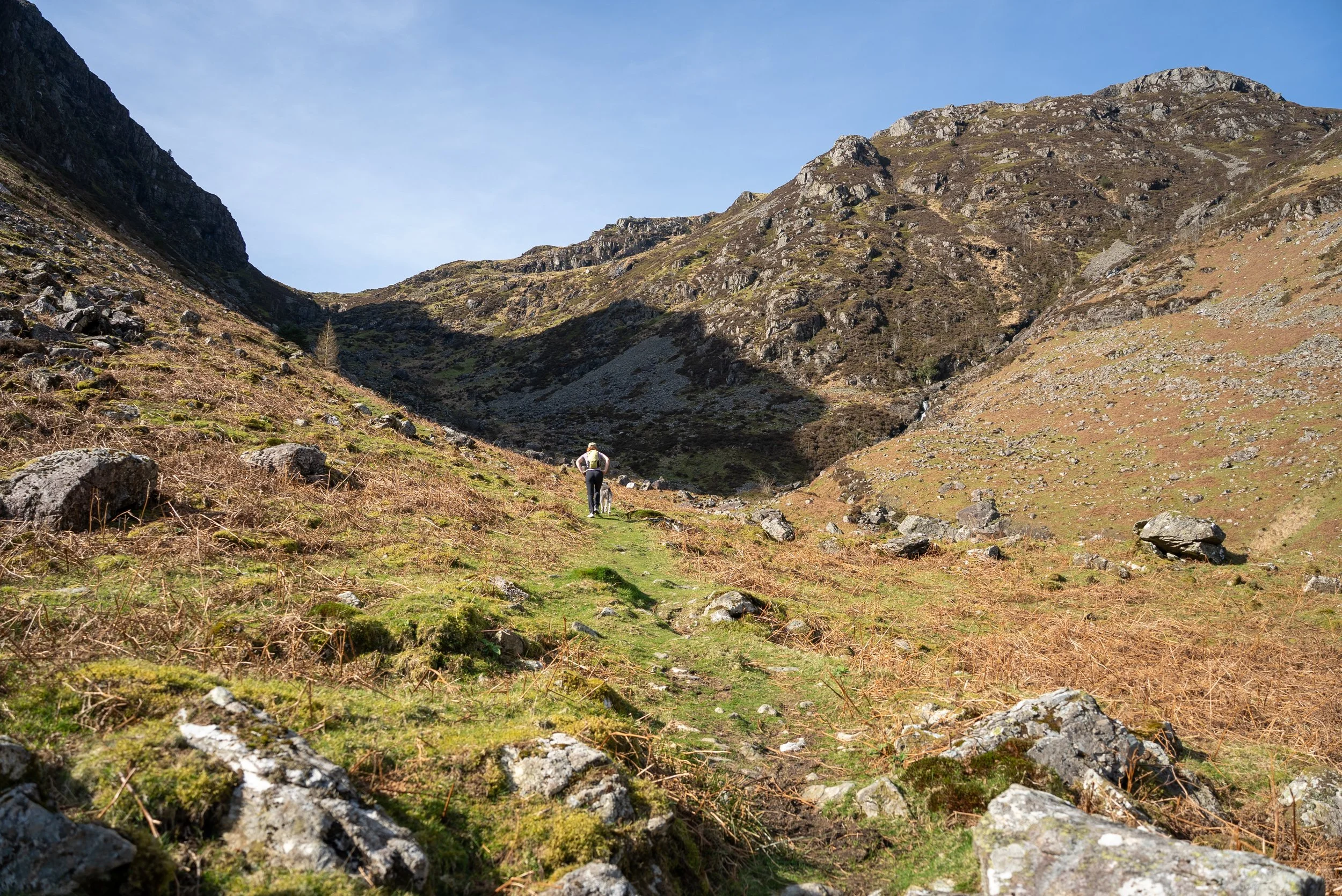
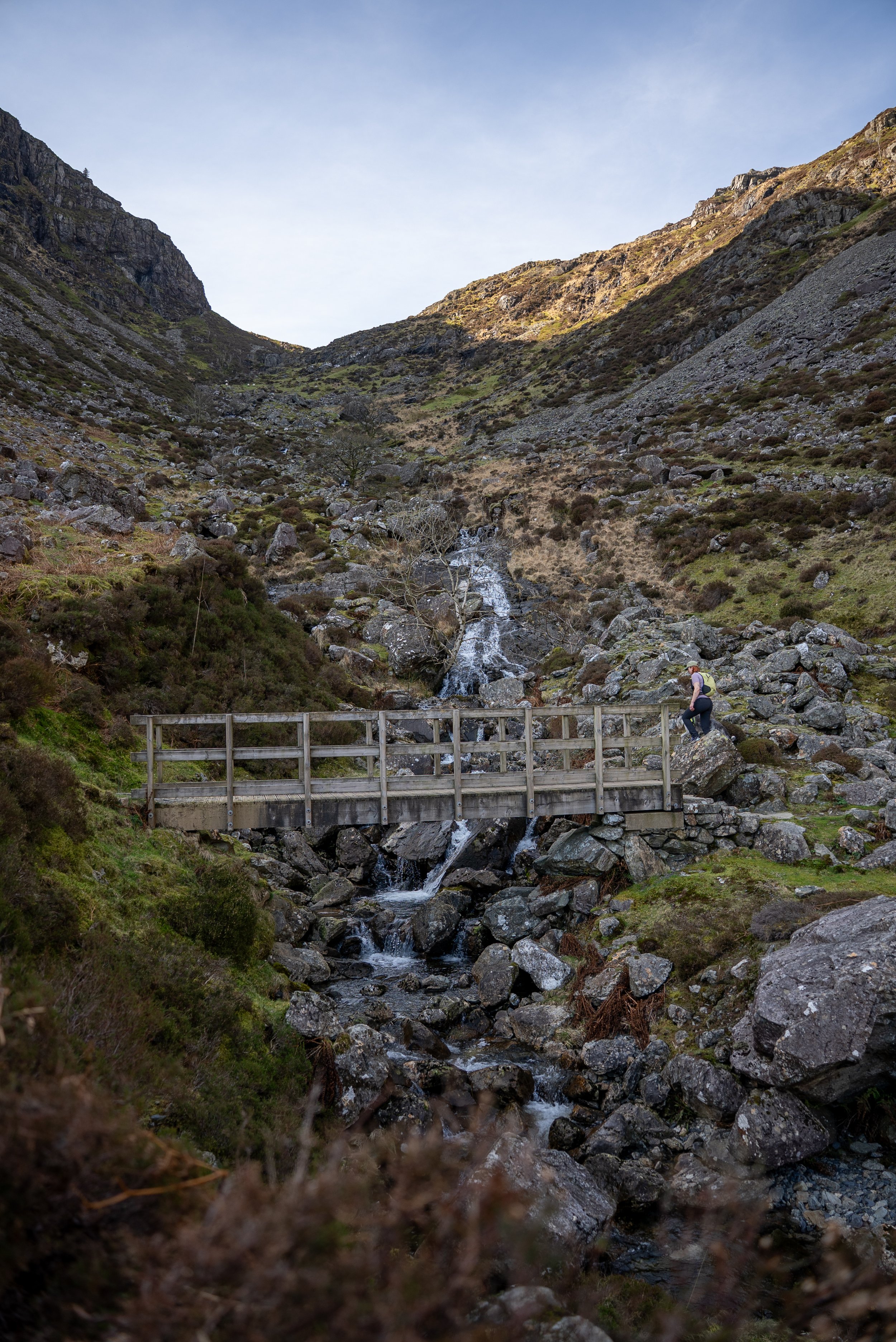
There’s no easing into this one. From the car park turn left, and then branch right, following the road which then becomes a gravel bridleway. After around 400m you will turn left and begin the first climb up through a steep gorge.
The path is initially well signposted and easy to follow.
You’ll cross a bridge over the stream, after which the route does get a a little tricker to follow, narrower and steeper in sections. You might have to use your hands in theodd place for but its not technical.
You want to stick close to the river but not cross it ( towards the top youll cross over one or two small streams but keep the river on you left
This is easily the toughest part of the hike, a sustained climb that doesn’t give you much of a break, but looking back down the valley as you gain height makes it worthwhile.
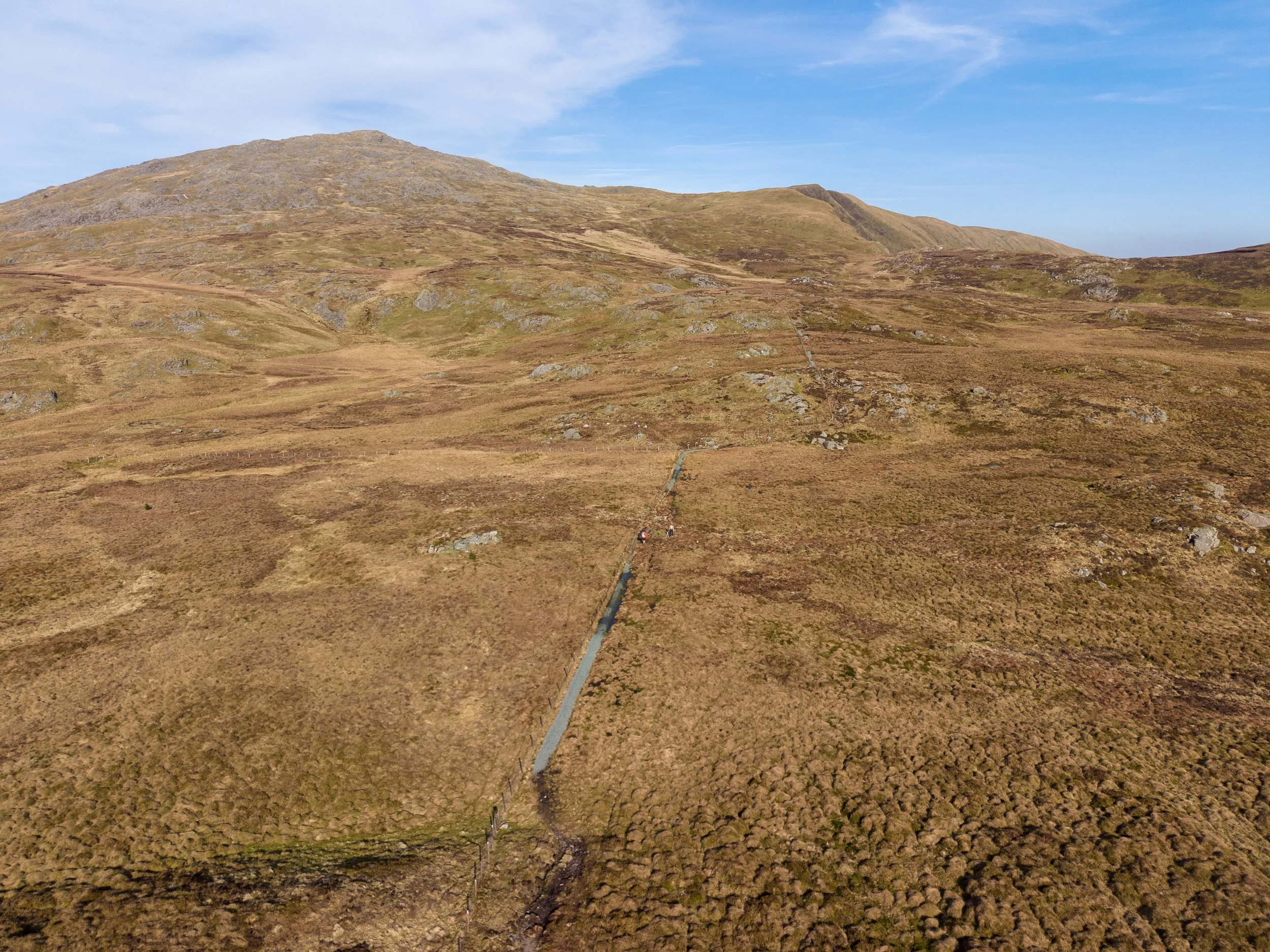
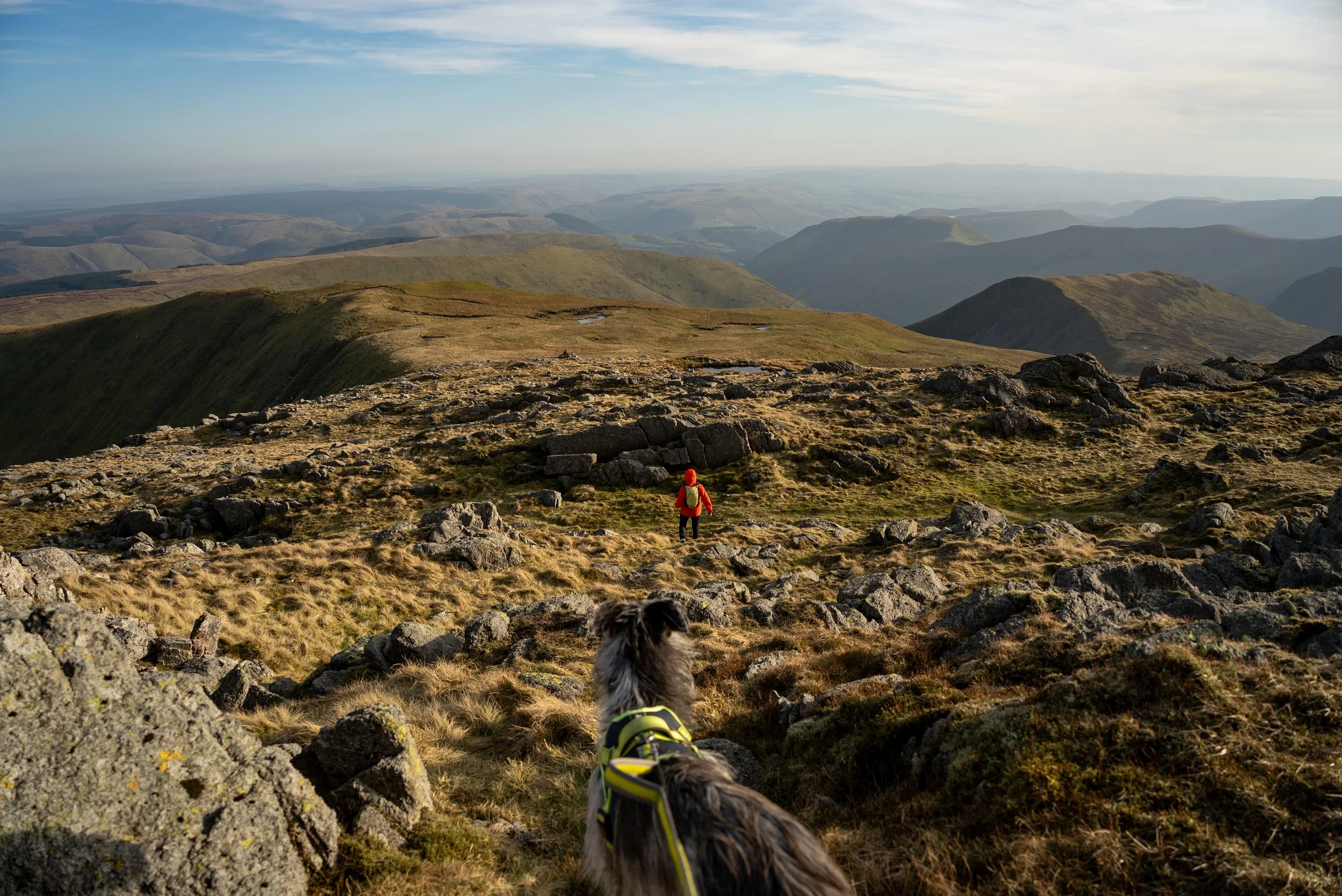
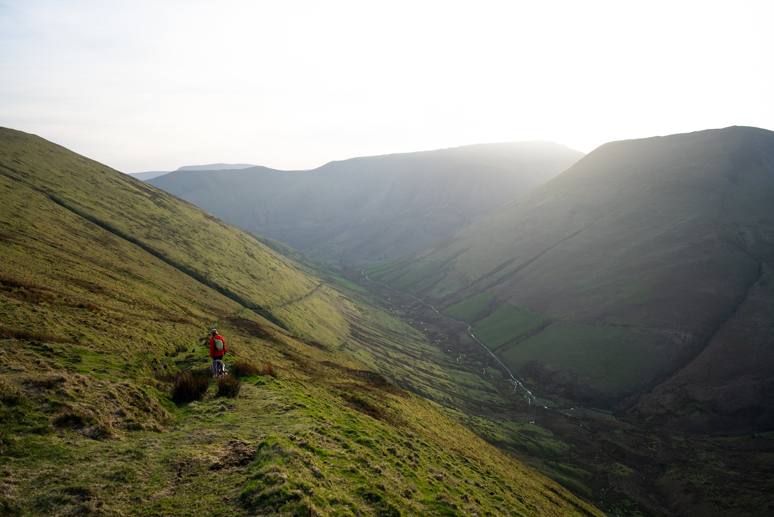
Crossing the boggy Plateau
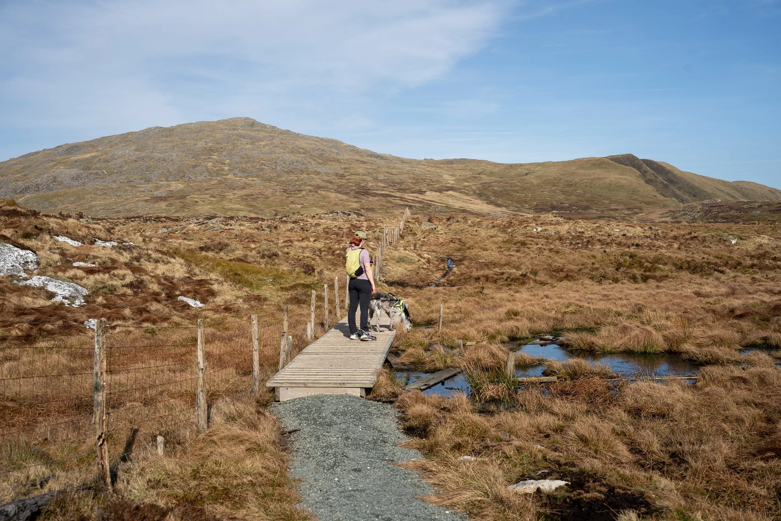
After the initial climb, the route begins to level out and the terrain changes completely.
You emerge onto a small boggy plateau and follow a fence line as it continues on a short climb. As it starts to flatten off, the path branches right and opens out into a wide, boggy stretch of moorland.
From here, you get your first proper views over the mountains of northern Snowdonia, with the Rhinogs visible in the distance, along with a clear view up towards the rocky summit ahead.
Continue following the fence line across the plateau. There are sections of boardwalk which help, but it’s still very wet underfoot, so waterproof footwear will make a big difference.
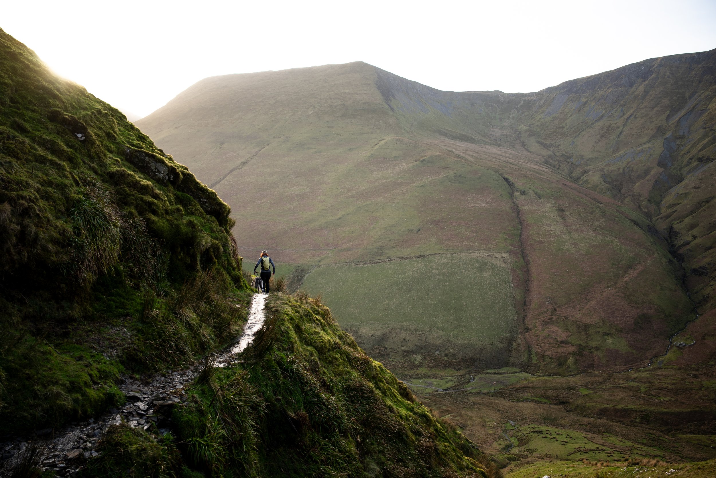
Final Climb to the Summit
After crossing the boggy plateau, which honestly feels a bit like the Dead Marshes from Lord of the Rings, the route begins the final climb up to the summit.
You continue following the fence line, and while it’s less intense than the initial ascent, it’s still steep in sections, with more rocky ground as you gain height.
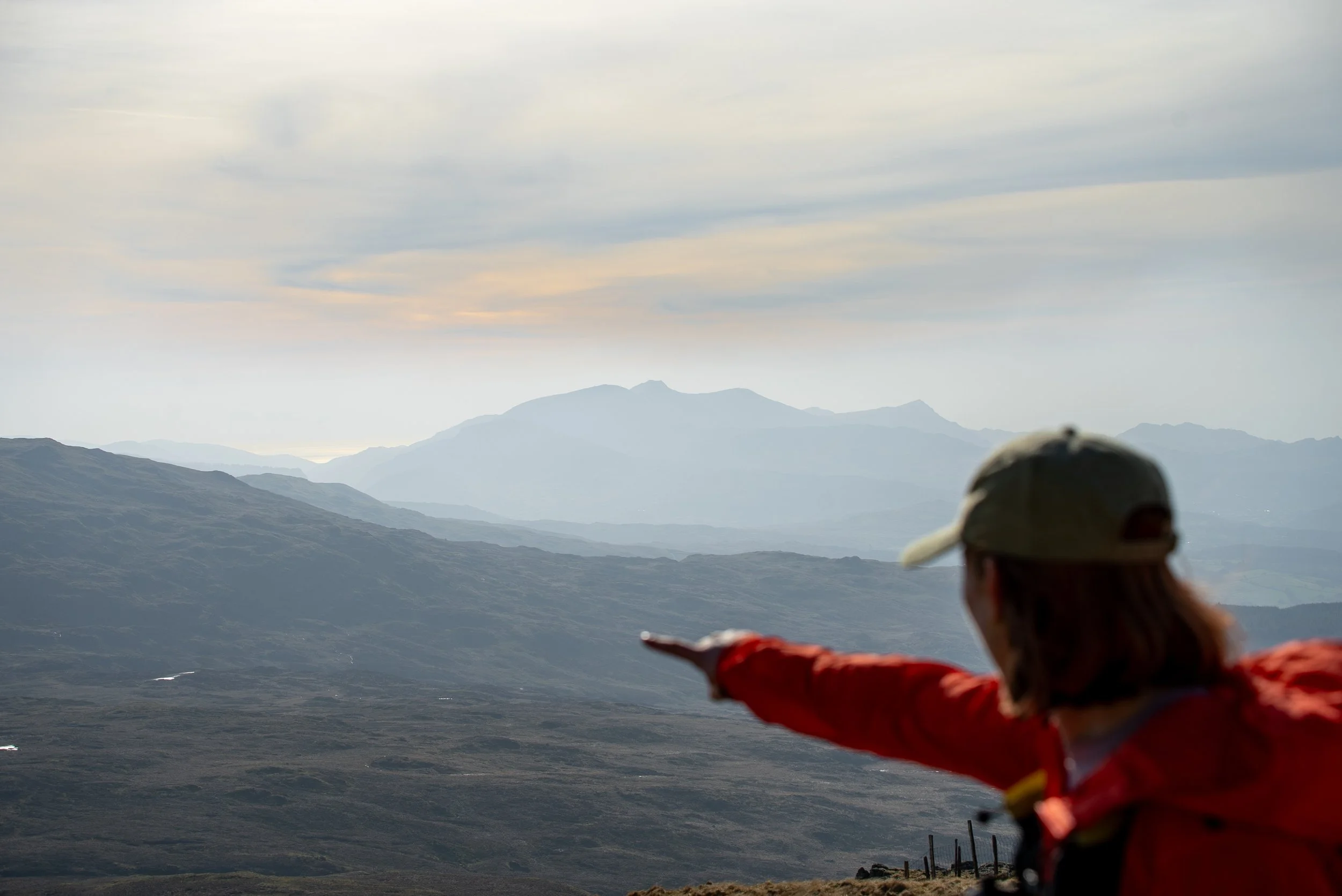
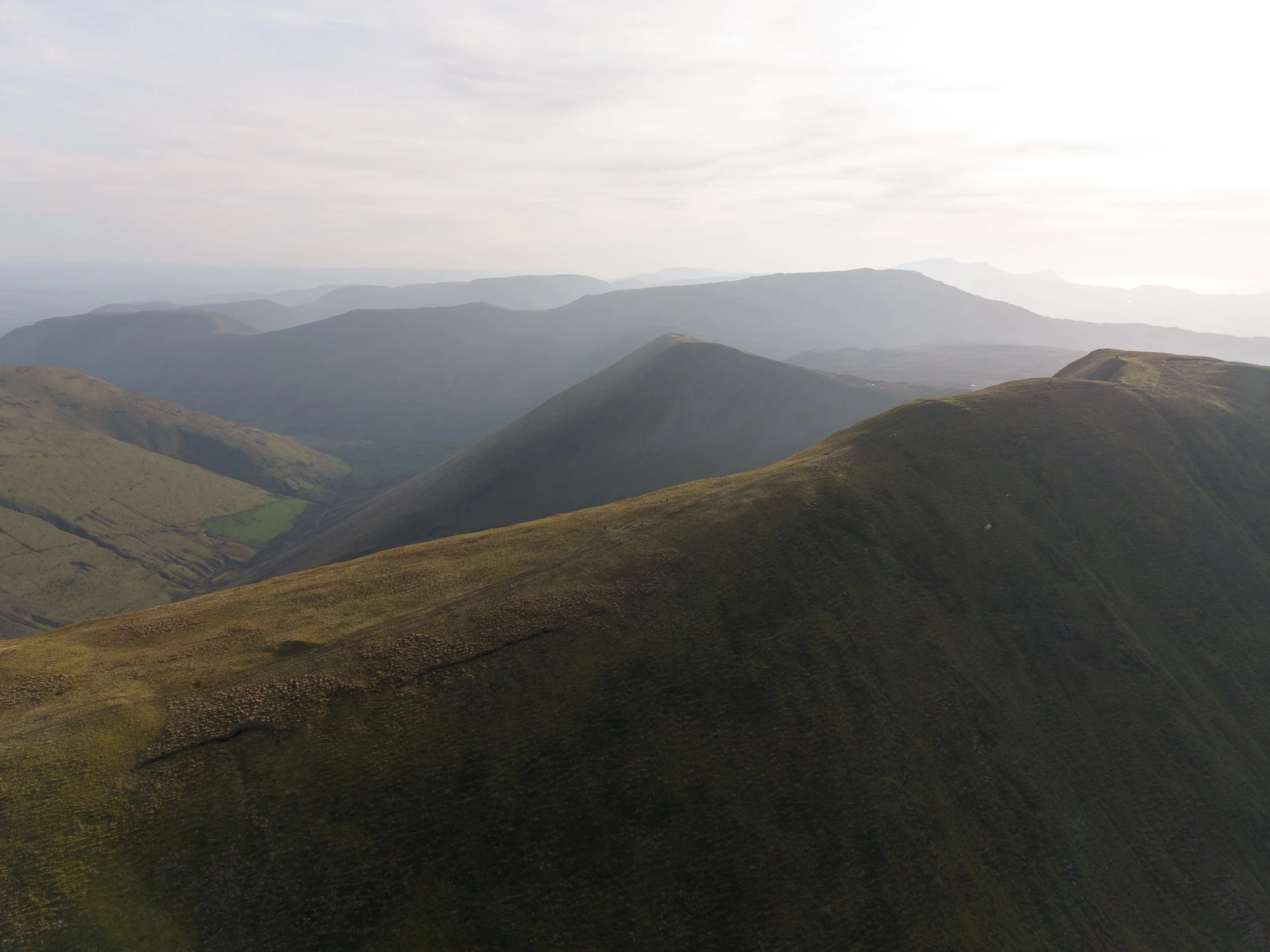
It’s a steady climb, and the views begin to open up more and more with every step. Take your time here and stop to look back, especially to the south west, where Cadair Idris, the coast, and layers of rolling hills across mid Wales start to come into view.
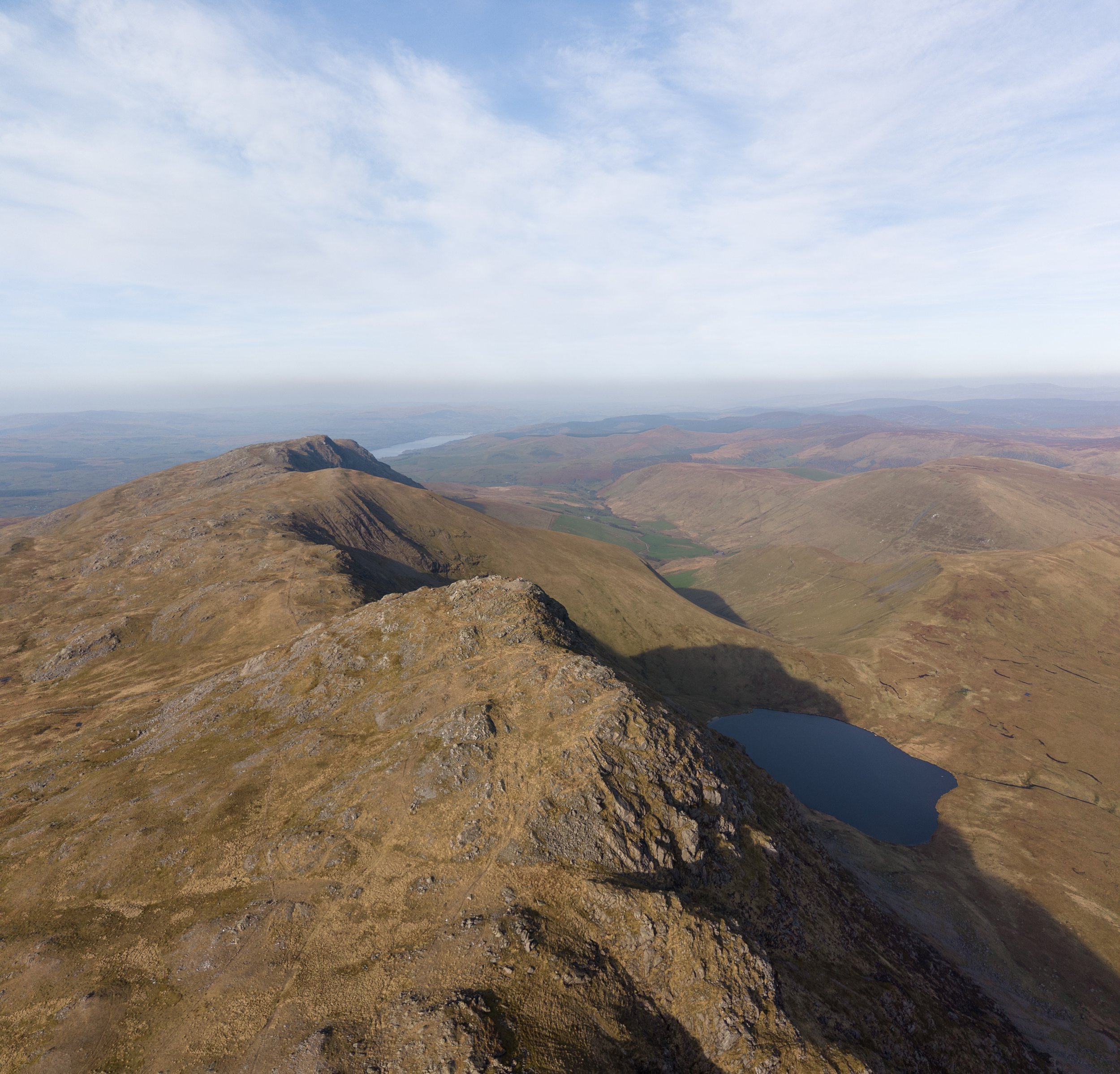
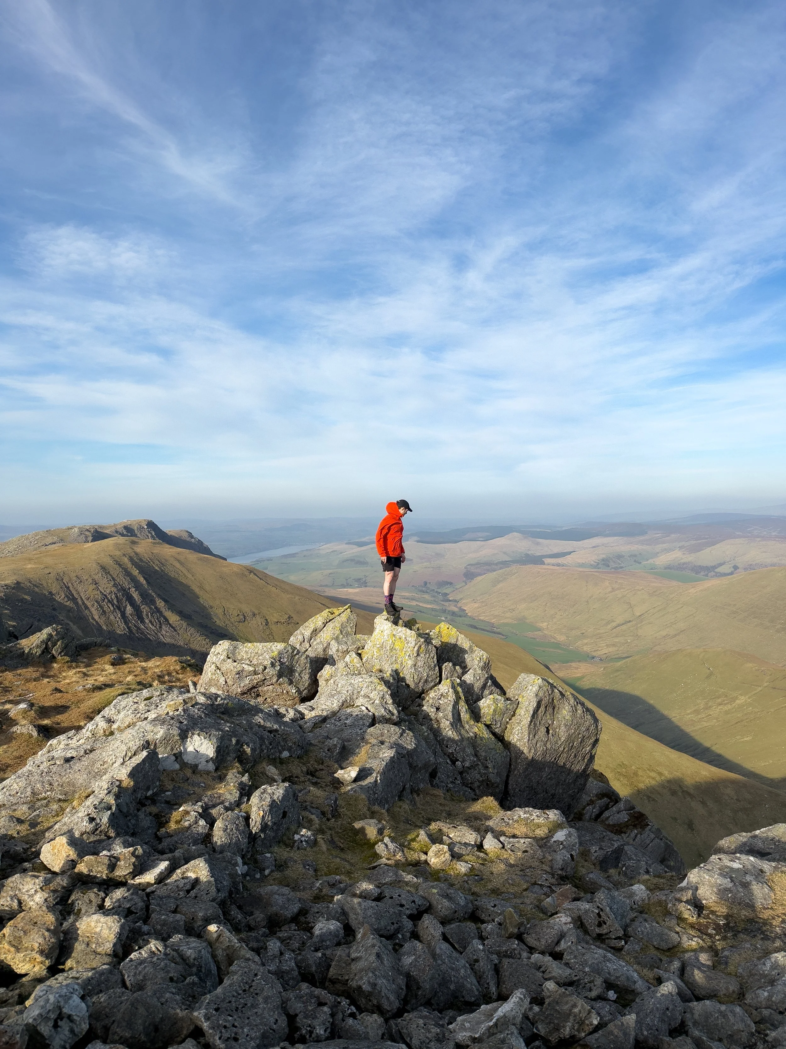
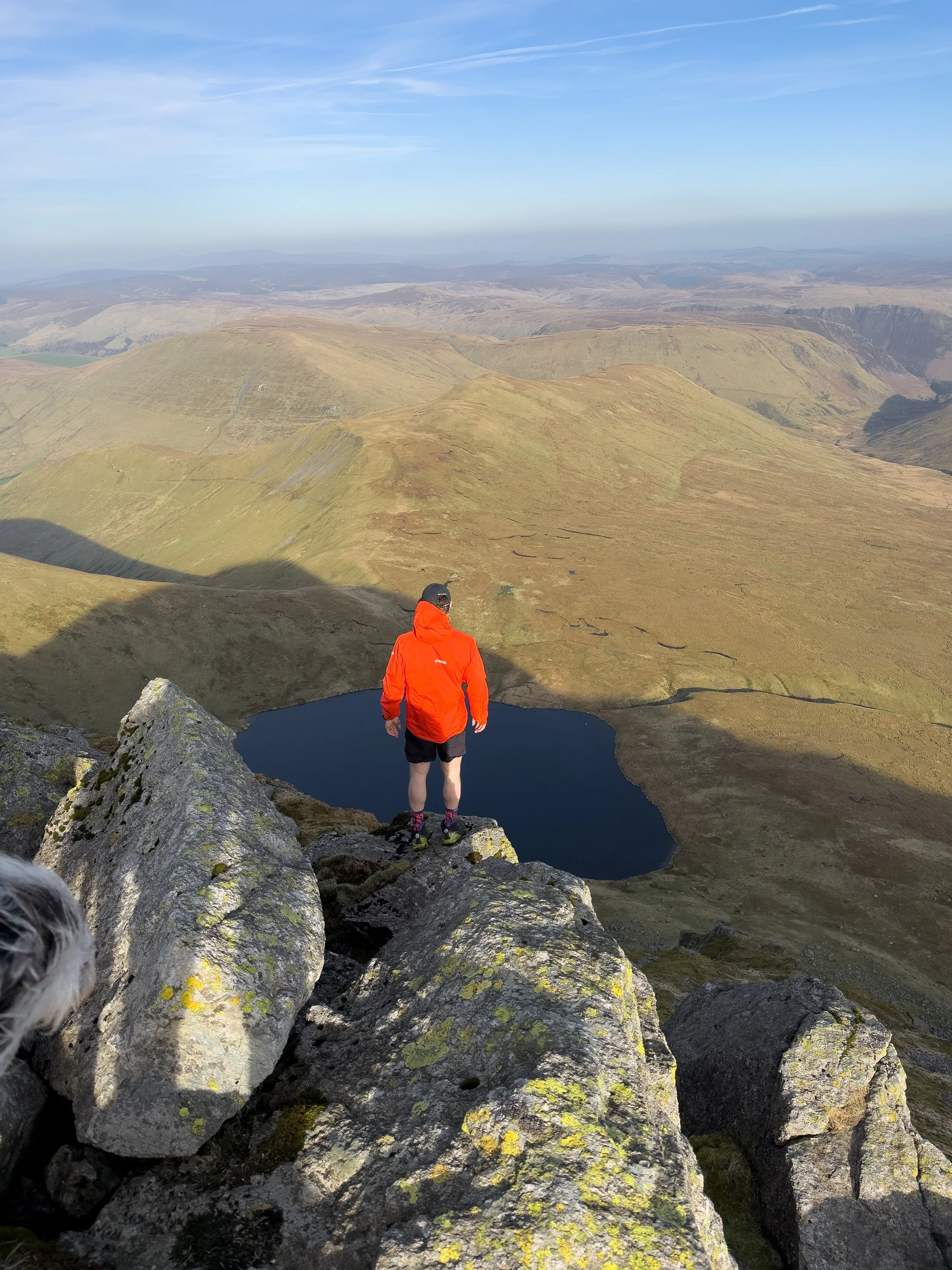
Summit of Aran Fawddwy
The summit of Aran Fawddwy is a rocky outcrop marked by a cairn and trig point, with steep drops on one side that make it feel even more dramatic.
From the top, you get incredible 360 degree views across Snowdonia, towards the Cambrian Mountains, down to Llyn Tegid, and even out to the sea on a clear day.
It’s one of those views that just keeps going, layer after layer across the landscape.
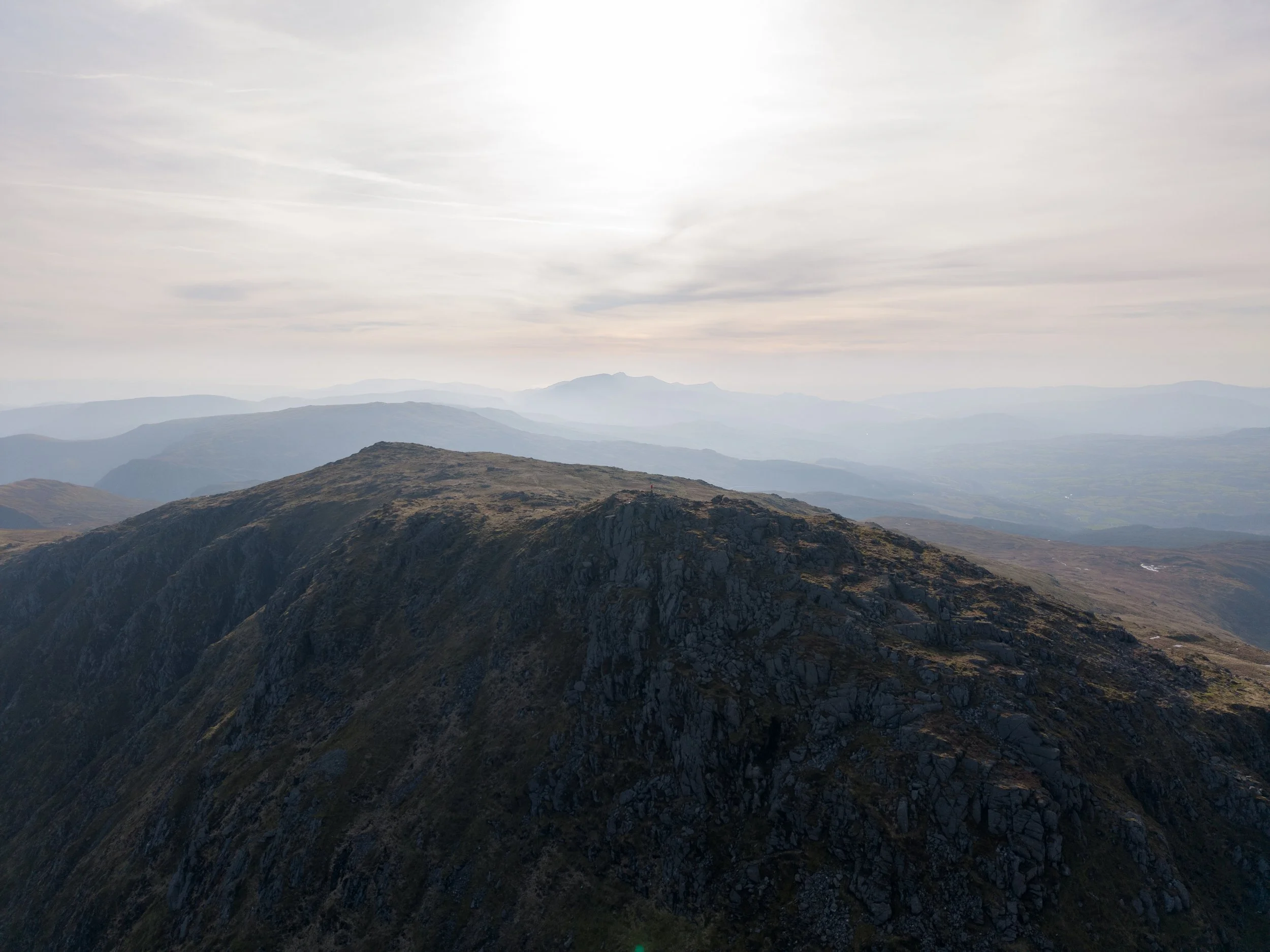

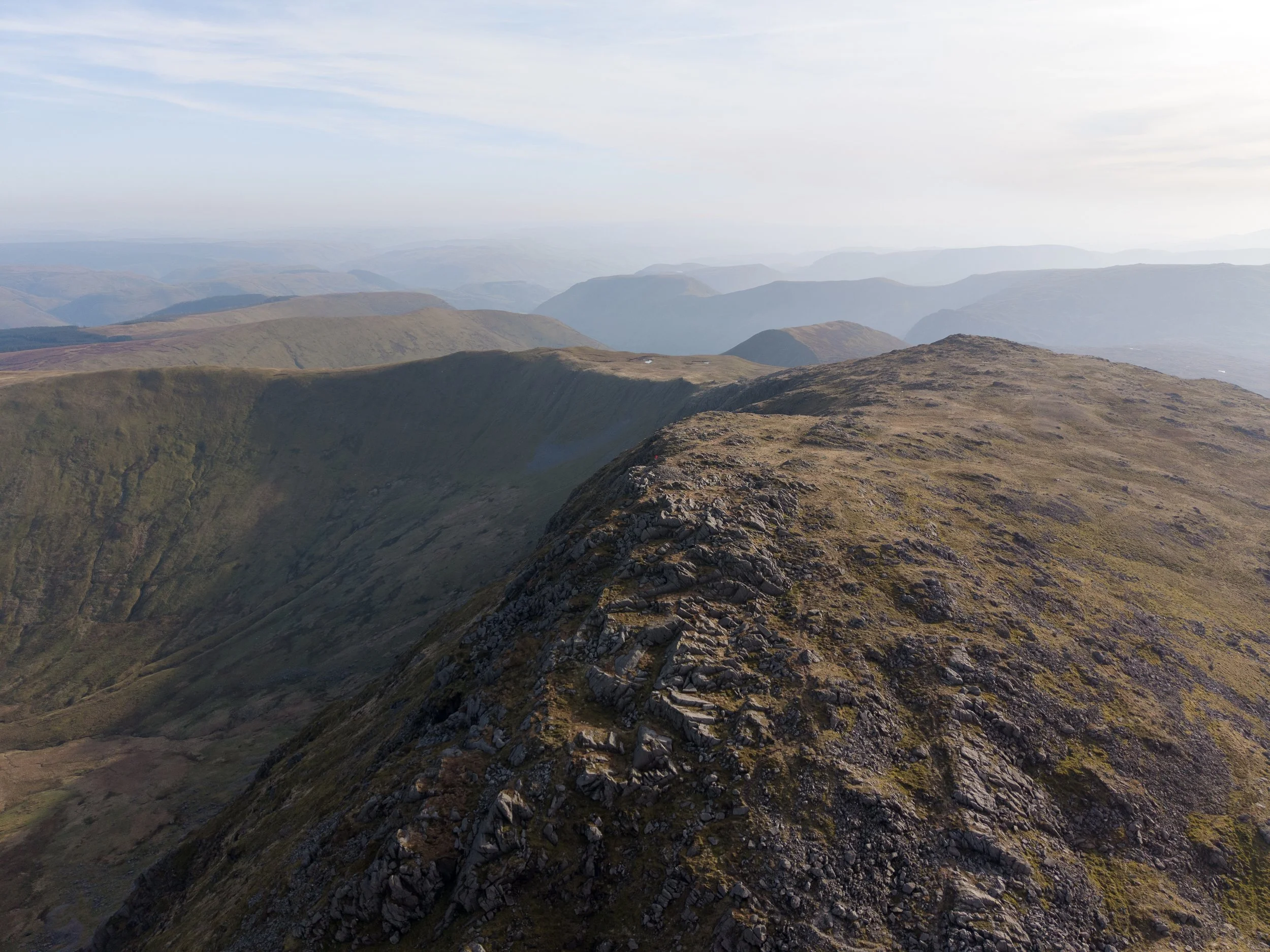
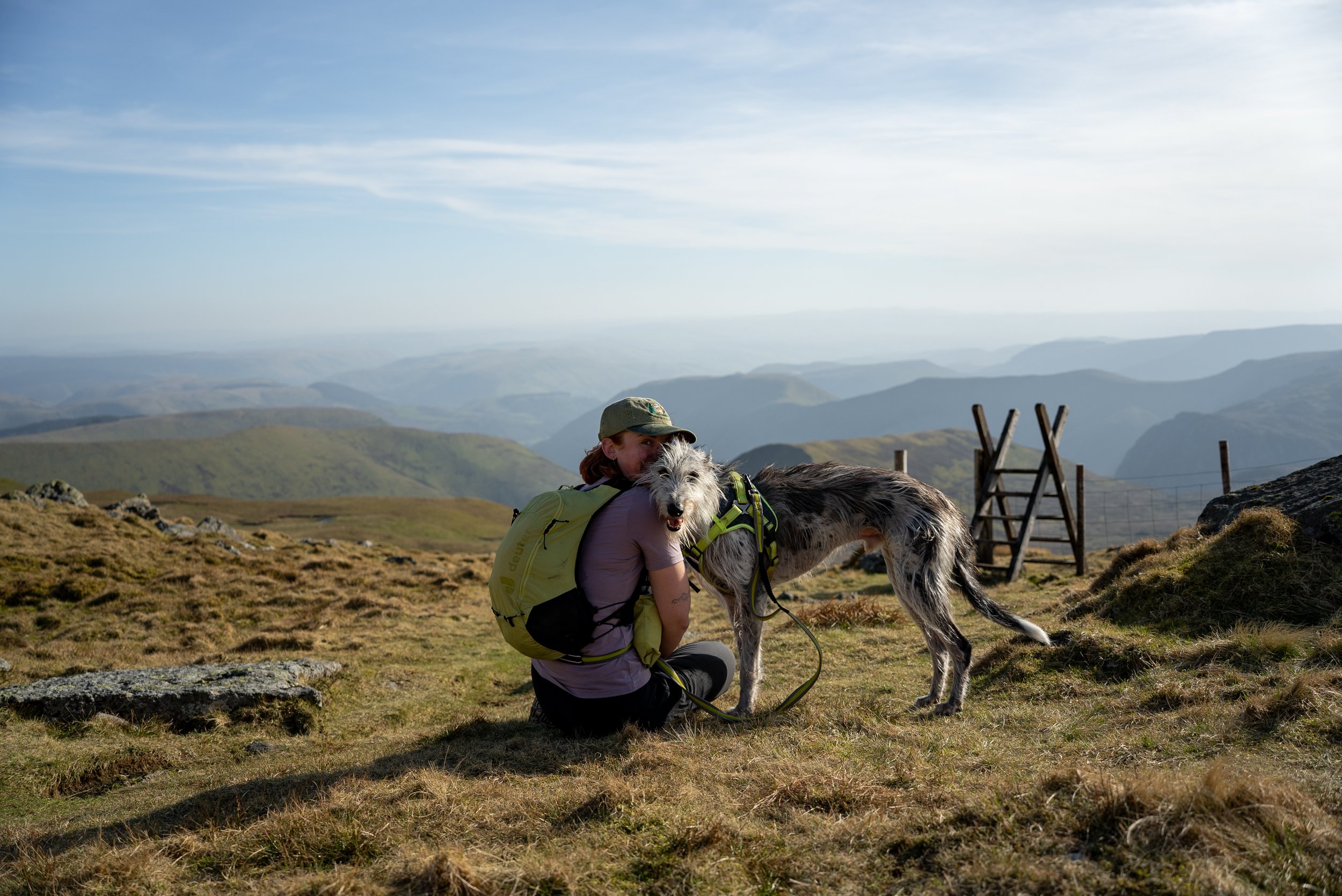
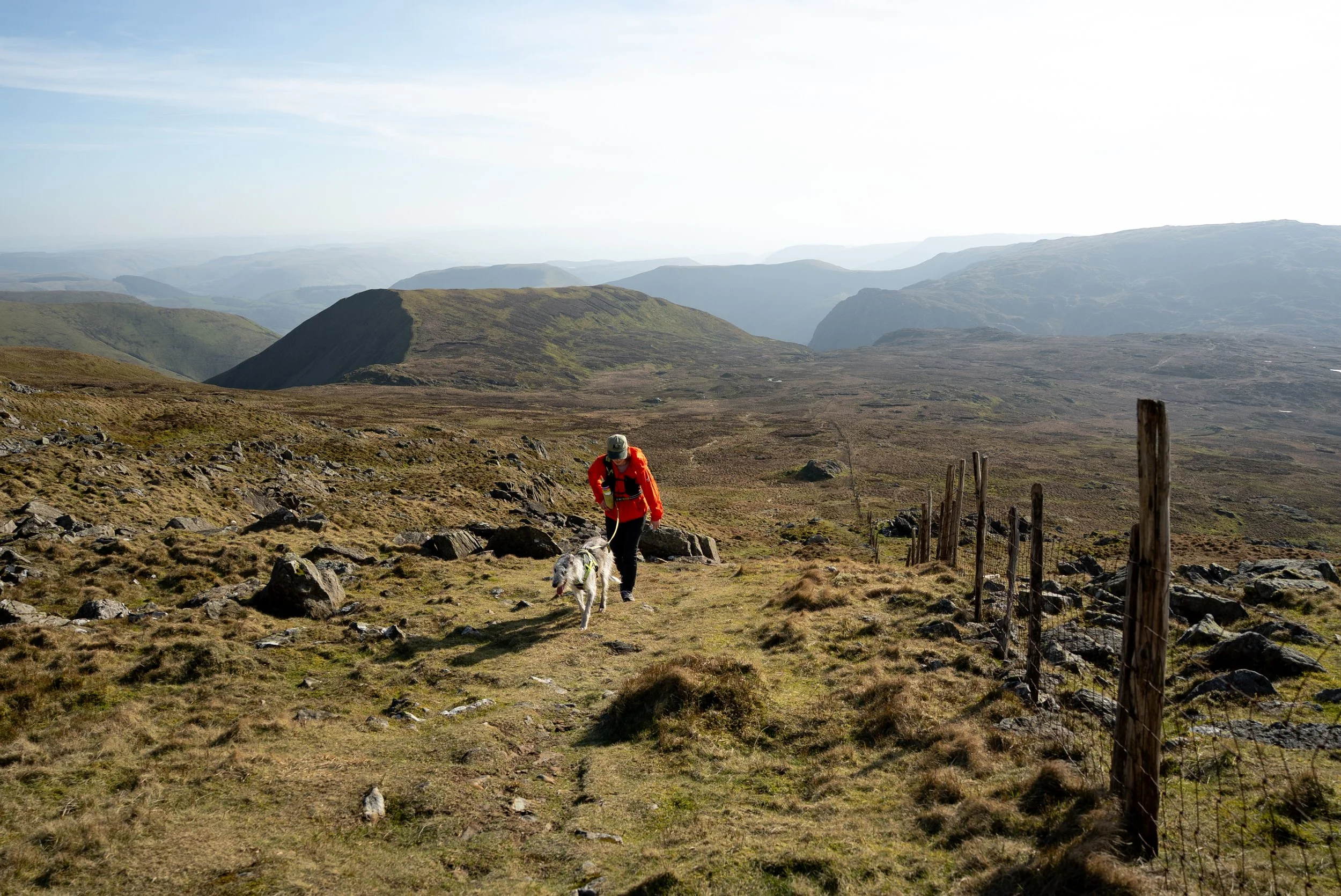
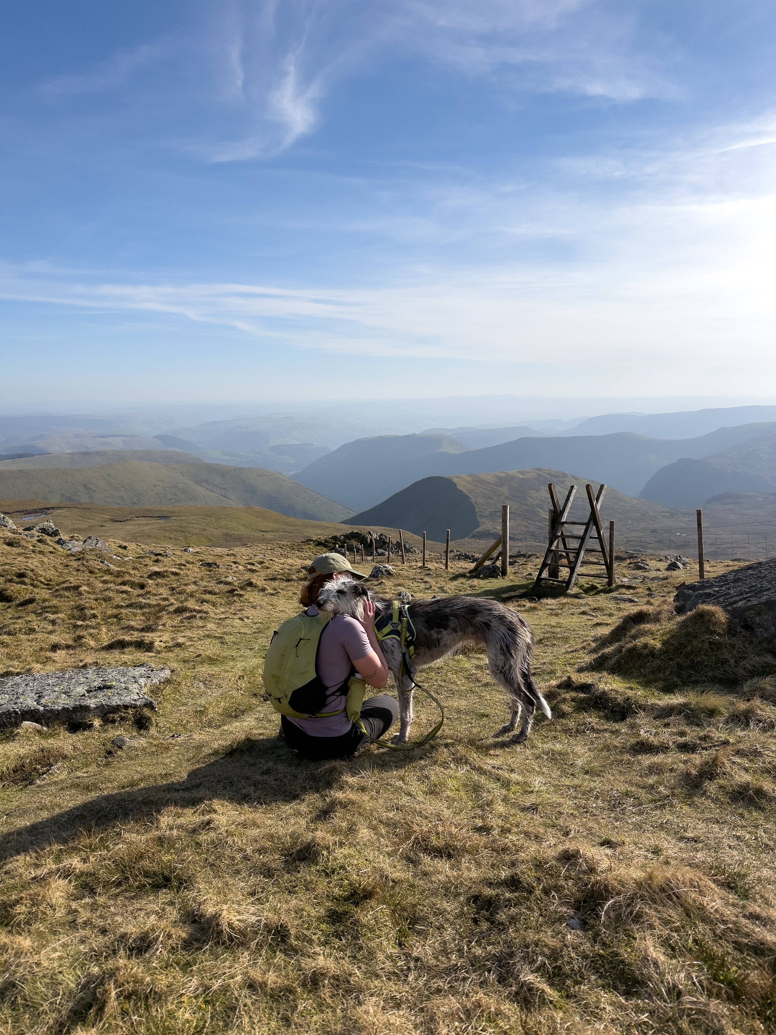
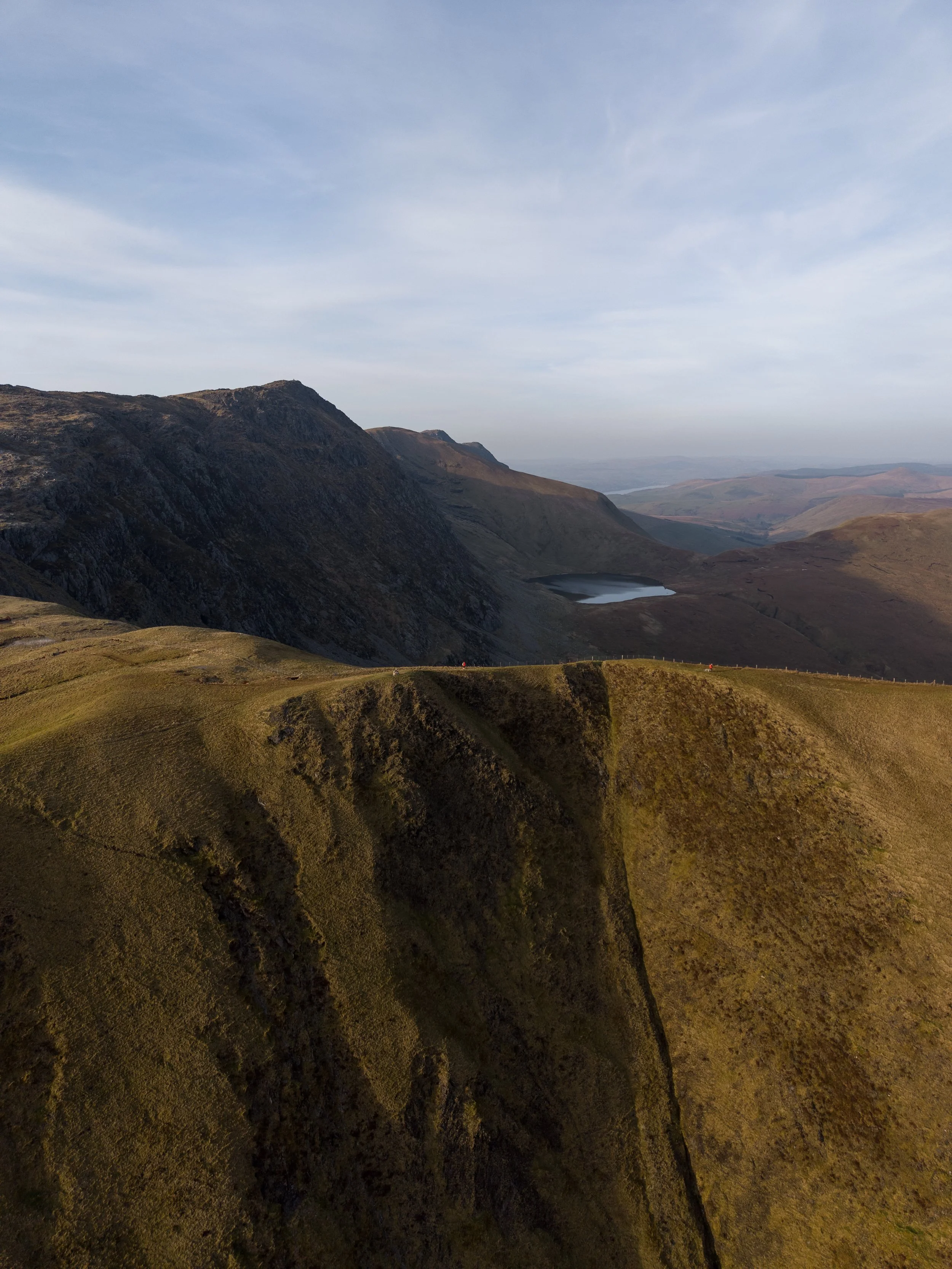
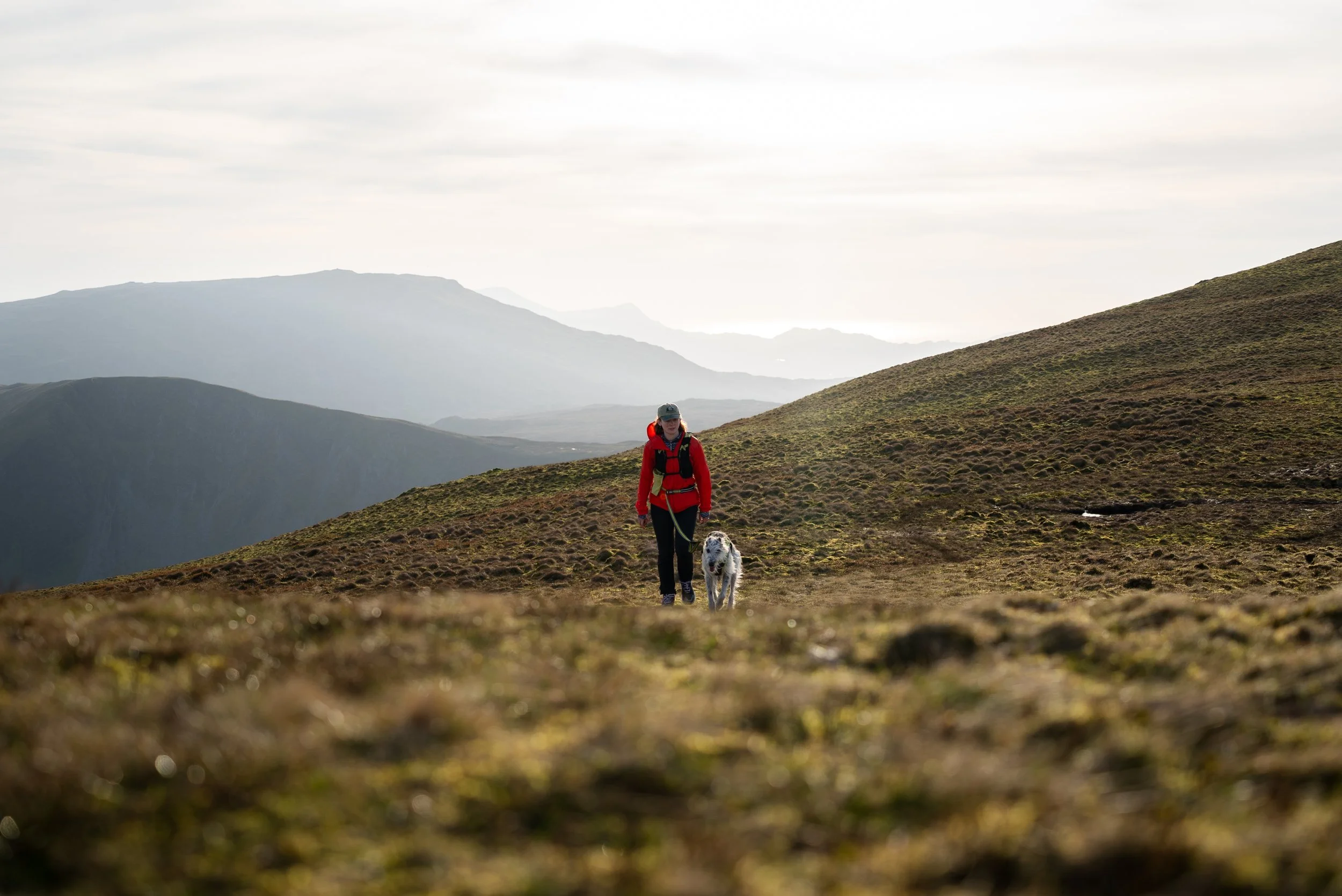
Descent via the ridgeline
From the summit, head back across the rocky plateau the way you came, but branch left to begin the descent towards the wide, scenic ridgeline.
This section is marked by a memorial cairn and is easily one of the highlights of the route.
From here, you get incredible views back over the lake and down into the valley, with layers of Snowdonia’s mountains stretching out into the distance.
The descent itself is long and gradual, with big open views the whole way. The ground is mostly grassy, which makes it much easier on the legs, although it can still be boggy in places.
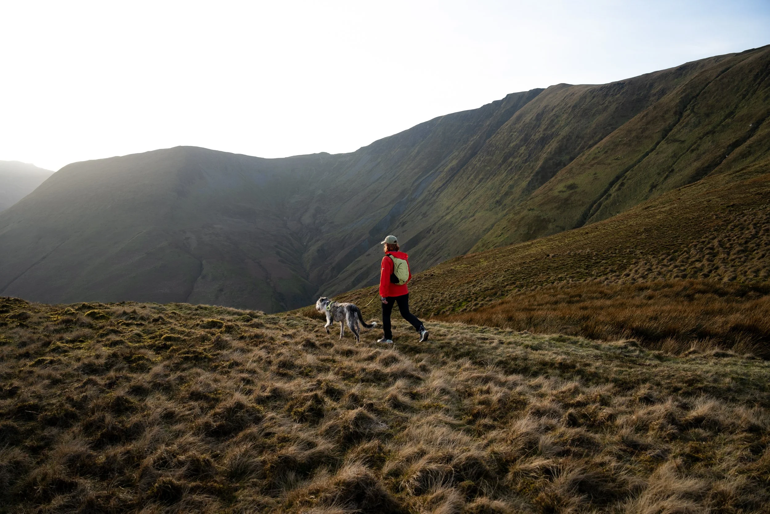
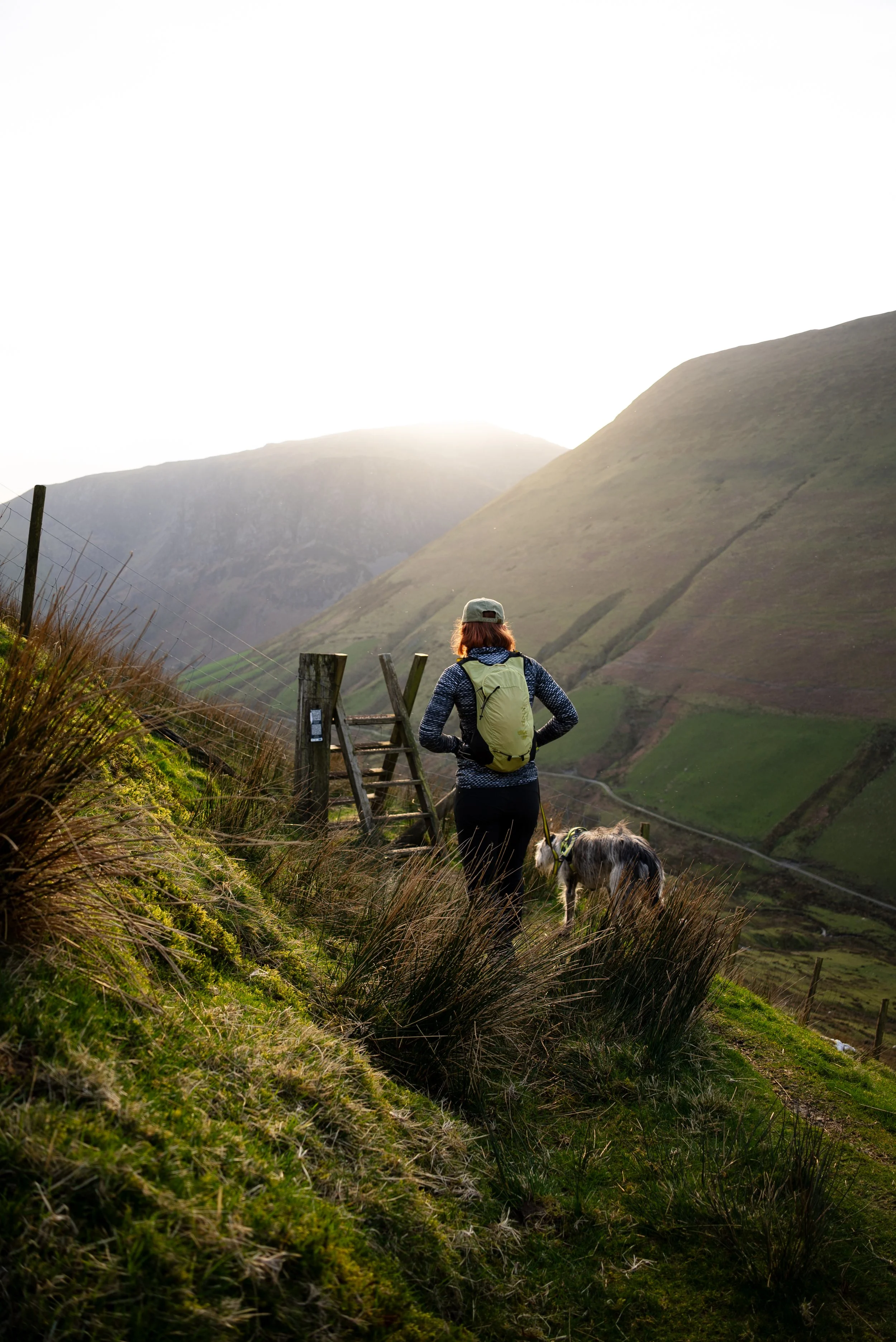
Final Descent into the Valley
The route eventually skirts around the mountainside and drops back into the valley. The final descent follows a narrow path that steadily winds its way down the valley side.
This section is really scenic, but take care as it can be boggy and slippery in places. My wife found that out the hard way and ended up falling off path and sliding down the side of the steep slope on her bum into the valley, much to my amusement.
Once back in the valley, you’ll cross the river before following the road for around 200 metres back to the car park, a nice easy finish to a big day out.
Final Thoughts
If you’re searching for a quiet but challenging Snowdonia hike, Aran Fawddwy is hard to beat.
This circular route from Cwm Cywarch gives you a bit of everything, steep climbs, remote terrain, and incredible panoramic views, all without the crowds you’ll find on more popular mountains. When I did this in mid March, I saw just two people all day.
It’s a proper mountain day, and one that’s well worth the effort. Plus, you can say you’ve climbed the highest peak in southern Snowdonia.
Just remember to pack waterproof shoes, and if you’re heading here on a sunny weekend, arrive early to secure a parking space.
Where to Eat
TH Roberts, Dolgellau - A great little spot to grab a coffee before heading out. Perfect for a quick stop before the drive up the valley.
DD’s Bakery, Dolgellau - An incredible range of pastries, sweets, and homemade sandwiches. Definitely worth stopping by, even if you’re just passing through.
Torrent Walk Hotel, Dolgellau - Great for a proper sit-down meal after the hike. Delicious pasta and solid home-cooked pub food.
Mawddach Pizza - Very good pizza just outside Dolgellau. Ideal if you want something more relaxed after a long day in the mountains.
Where to Stay
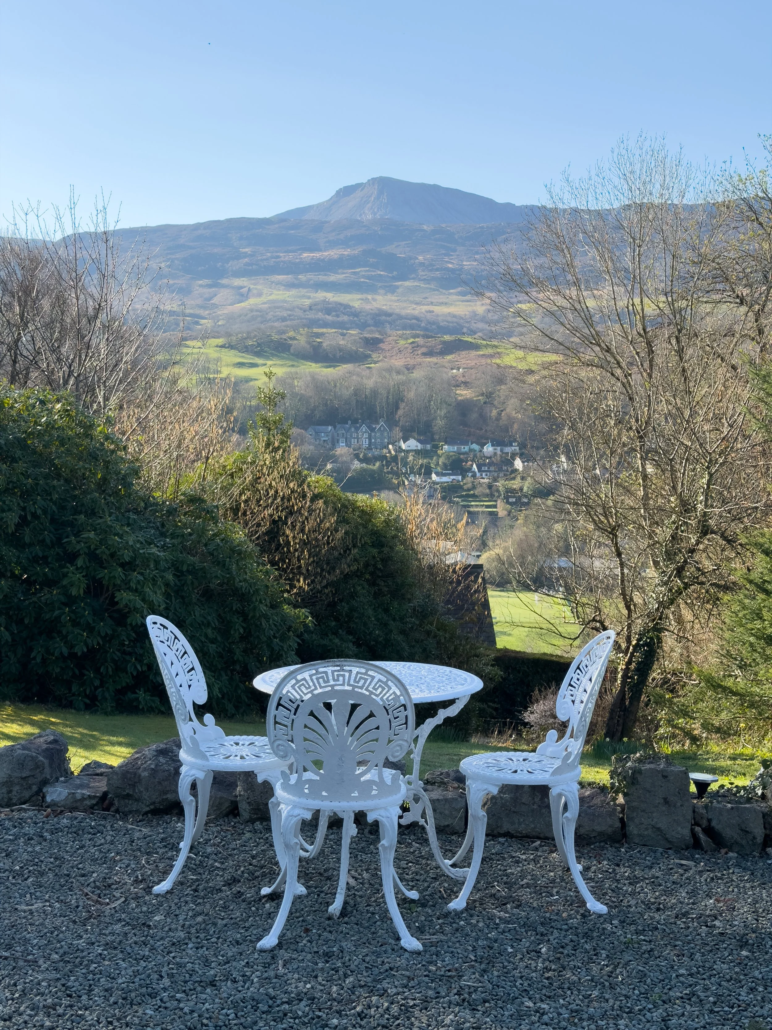
Pen y Coed Hall, Dolgellau - A lovely but incredibly quirky B&B /Apartments just above Dolgellau. The rooms are really spacious (we had three rooms) well furnished, and full of character. It’s dog friendly, the owners are lovely, and you get free parking as well. The views towards Cadair Idris are a real highlight.
Help support what I do
I created and I run this website in order to help inform, amaze, inspire people (for free) to get outside and explore the adventurous side of the UK and beyond.
If you’d like to support this website, you can use the affiliate links below to book your accommodation or transport. These come at no extra cost to you, but help keep this site running.
Book your car using Discover Cars
Book your accommodation using Booking.com
If you are feeling generous you can also buy me a coffee to say thank you, and give me a follow on social media.
Thank you, and if you have any questions, leave them in the comments below or drop me an email.
You can find more Welsh hiking inspiration in the following blogs
For more travel, hiking, & photography inspiration around Wales, check out my in-depth guides to each of my favourite regions below.
