
Cadair Idris via the Minffordd path Hike Guide | Snowdonia National Park

If you’re looking for a challenging hike in southern Snowdonia, Cadair Idris is hard to beat, and the Minffordd Path is easily one of the best routes to the summit.
Cadair Idris, or “Idris’s Chair”, is one of the three mountains that make up the Welsh Three Peaks. Shrouded in Welsh myth and legend, it sits at the southern end of Snowdonia National Park near the town of Dolgellau.
At 891m, it may not be the highest mountain in Wales, but it’s a corker of a hike that really packs a punch.
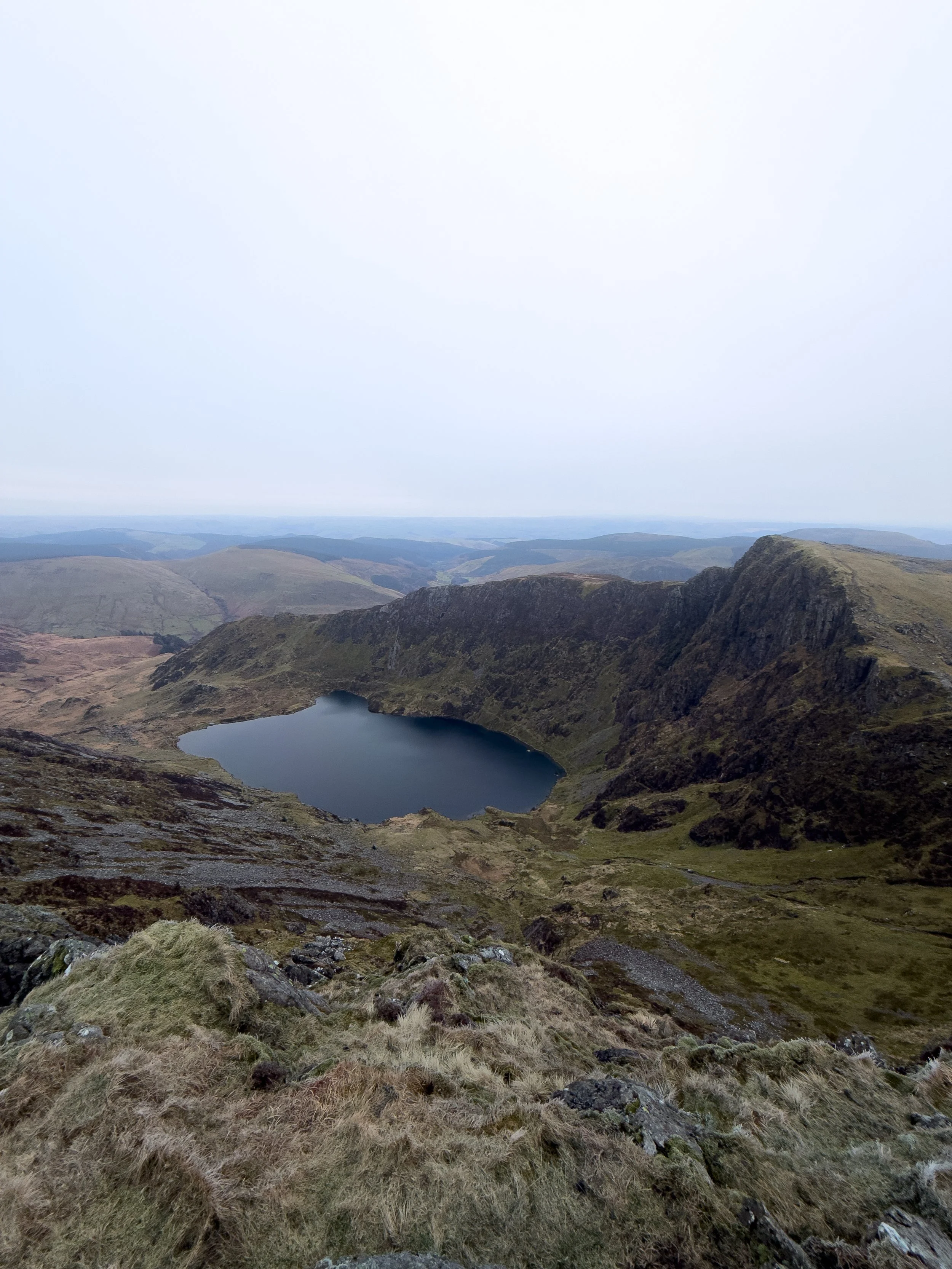
This route takes you past the stunning Llyn Cau before climbing steeply up to the summit, making it one of the most scenic ways up the mountain.
It’s also a great option if you want to escape the busier peaks of northern Snowdonia, and on a clear day, the summit offers phenomenal 360 degree panoramic views across southern Snowdonia and beyond.
Key Information
Hike Distance: 6.1 miles / 10km
Hike Duration: 4-6 hours
Elevation Gain: 977m
Hike Difficulty: Moderate -Hard
Technical aspects: None
Start Point: Dol Idris Car Park
Can be accessed using the Traws Cymru T2 Bus
Where to park for Cadair Idris
Parking is available at Dôl Idris Car Park, which is £6 for the day. You can park for free on the road just outside the car park but you run the risk of getting a ticket. What Three Words location: //household.feels.dairy
There is also a Bus stop just outside the car park, which is serviced by the Traws Cymru T2 bus which runs between Bangor and Aberystwyth. so you dont need a car to complete this hike.
The Route
The hike begins by cross the river, passing the café, and bearing right through a wooden gate and into the forest.
The path will then begin to zig zag very steeply up through the forest alongside the river. Although this is the steepest section of the route, the path is well maintained and easy to follow.
After 1km the path will emerge from the forest and you will come across a stone bridge over the river. Do not cross the bridge and instead follow the path up and around for a further 1,3km until you reach the shores of Llyn Cau.
The beautiful Llyn Cau is situated in natural bowl-shaped depression and is enveloped on three sides by 400m high imposing cliffs. This crater-like shape which surrounds the lake has given rise to the mistaken claim that Cader Idris is an extinct volcano.
However the lake is actually formed by massive a cirque glacier which used to sit in the chair shaped hollow. Hence the English translation of the mountain to ‘Idris’ Chair’.

You can swim in this lake, but it is extremely cold.
This hike guide is a loop, meaning you wont pass llyn Cau on the way back down, however if you did want to take a dip after you have reached the summit you can just descend the same way you ascended.
From the shoreline, double back on yourself and begin to climb the ridgeline which will be to the south (left hand side)of the lake. This path climbs 340m over one mile, up and a round to the summit of Craig Cwm Amarch. From here you will have epic views directly down over llyn Cau.
From Craig Cwm Amarch descend down to the saddle before making the final ascent up to the summit of Cadair idris.
the final section of this route is quite steep, very rocky, and sections consists of loose scree. This can make the final climb a bit of a slog and quite hard going.

The Summit of Cadair Idris
The summit of Cadair Idris isn’t the most dramatic, and feels more like a wide rocky plateau than a sharp peak.
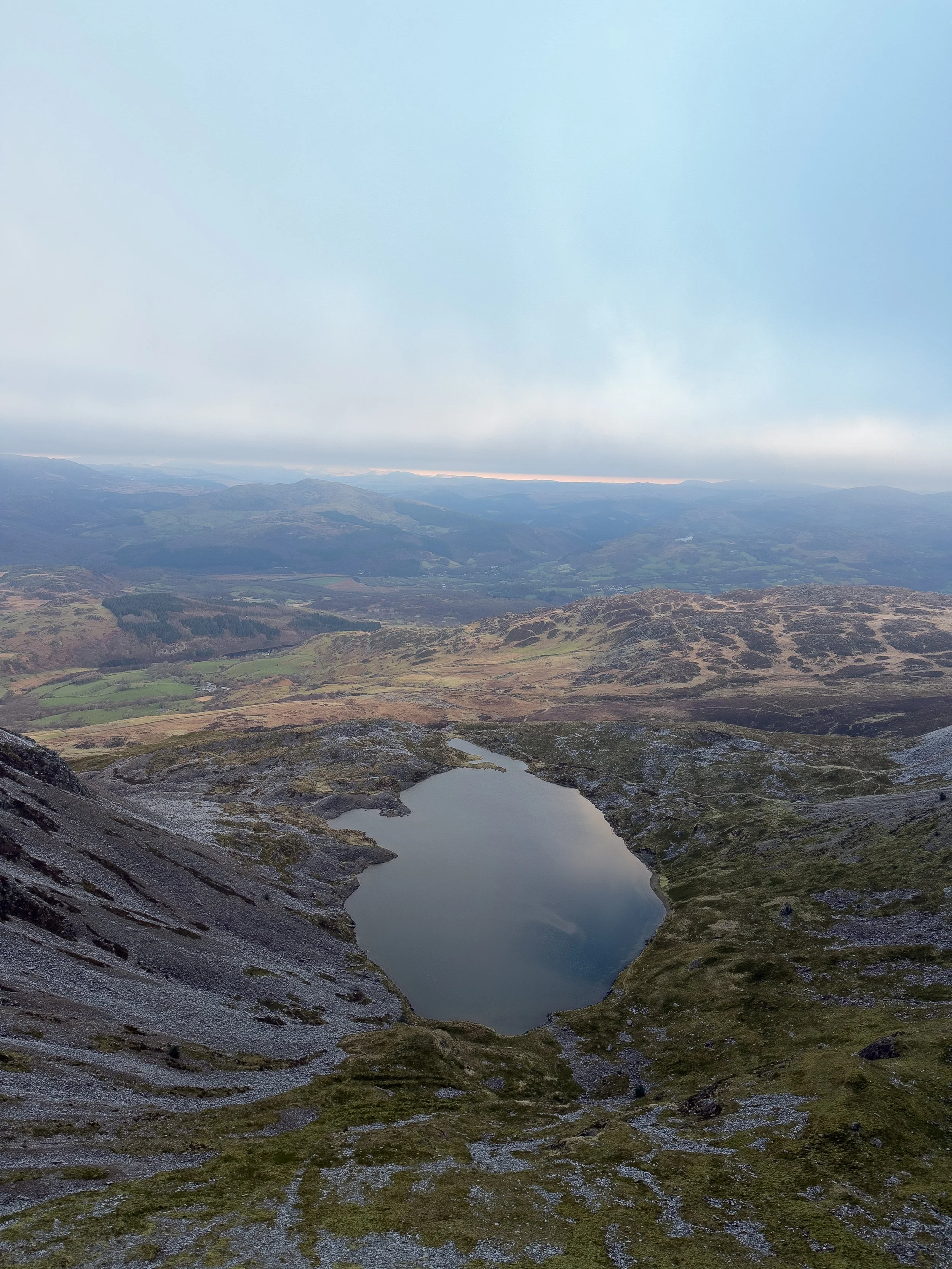
That said, it still delivers on views. While the angle means you don’t get the best look back down to Llyn Cau, you’re still treated to fantastic 360 degree views across the national park.
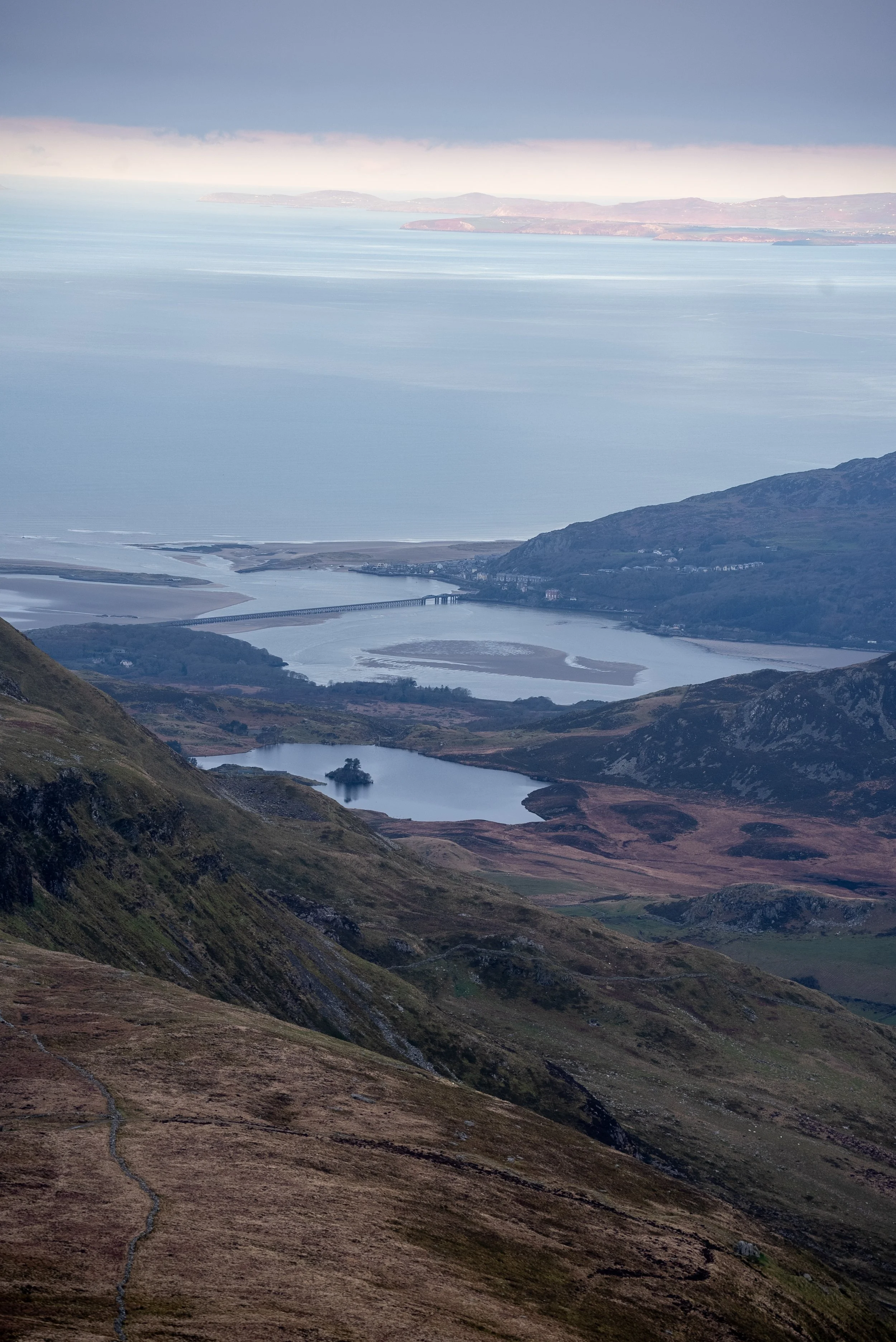
On a clear day, you can see out across the Cambrian Mountains to the south, towards Barmouth and the coast to the north west, and across the mountains of Snowdonia to the north.
The summit itself is marked by a trig point sitting on a large pile of rocks, and there’s also a stone refuge hut nearby, which can be a lifesaver if the weather turns.
The wide plateau means there’s plenty of space to find a quiet spot, sit down, and take it all in before heading back down.

Descent Back to the Car Park
From the summit, you’ve got three main options to get back down to the car park.
The first is to retrace your steps back to Craig Cwm Amarch, then descend down and around towards Llyn Cau. This is the most straightforward option if you want to stick to the main path.
The second option is to drop down to the saddle between Craig Cwm Amarch and Cadair Idris, then descend via the steep gully down to Llyn Cau. This is the quickest route, but it’s very steep and can be tricky underfoot, so it’s not one to attempt unless you’re comfortable scrambling.
The third option is to continue east from the summit towards Mynydd Moel, before looping around and descending back through the wooded gorge you climbed earlier. This makes for a full circular route and is a great way to finish the hike.
Personally, if you’re comfortable scrambling and fancy a dip, the gully down to Llyn Cau is a great option. If not, continuing towards Mynydd Moel for the full loop is the better choice.

Final Thoughts
Cadair Idris via the Minffordd Path is one of the most rewarding hikes in Snowdonia, but it definitely makes you work for it.
The climb is steep pretty much from the start, and it doesn’t really let up, but the payoff is huge. Llyn Cau is easily one of the best lakes in Snowdonia, and the views from the summit stretch out in every direction.
It’s a much quieter alternative to some of the more popular routes up Cadair Idris, but still gives you that proper mountain day feel.
Whether you’re here for the challenge, the views, or even a swim in the lake, this route has a bit of everything.Just be prepared for a tough climb, take your time on the way up, and enjoy it once you’re at the top.
Definitely one to add to your Snowdonia list.
Where to Eat
TH Roberts, Dolgellau - A great little spot to grab a coffee before heading out. Perfect for a quick stop before the drive up the valley.
DD’s Bakery, Dolgellau - An incredible range of pastries, sweets, and homemade sandwiches. Definitely worth stopping by, even if you’re just passing through.
Torrent Walk Hotel, Dolgellau - Great for a proper sit-down meal after the hike. Delicious pasta and solid home-cooked pub food.
Mawddach Pizza - Very good pizza just outside Dolgellau. Ideal if you want something more relaxed after a long day in the mountains.
Where to Stay
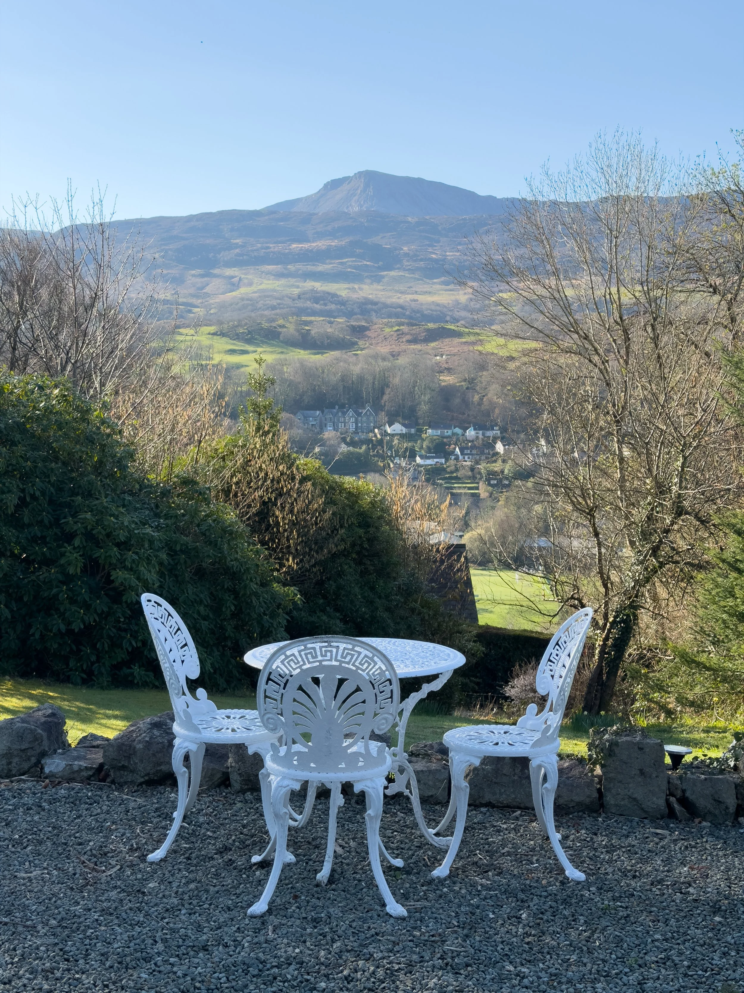
Pen y Coed Hall, Dolgellau - A lovely but incredibly quirky B&B /Apartments just above Dolgellau. The rooms are really spacious (we had three rooms) well furnished, and full of character. It’s dog friendly, the owners are lovely, and you get free parking as well. The views towards Cadair Idris are a real highlight.
HELP SUPPORT WHAT I DO
I created and I run this website in order to help inform, amaze, inspire people (for free) to get outside and explore the adventurous side of the UK and beyond.
If you’d like to support this website, you can use the affiliate links below to book your accommodation or transport. These come at no extra cost to you, but help keep this site running.
Book your car using Discover Cars
Book your accommodation using Booking.com
If you are feeling generous you can also buy me a coffee to say thank you, and give me a follow on social media.
Thank you, and if you have any questions, leave them in the comments below or drop me an email.
You can find more Snowdonia and North Wales inspiration in the following blogs
The must-visit photography spots in Snowdonia National Park
The best places to watch the sunrise in Snowdonia National Park
The 10 best places to watch the sunset in Snowdonia National Park & North Wales
Hike Guides
For more Welsh travel inspiration check out my in-depth guides to each of my favourite Welsh regions below.

Find me on Instagram


