
Tryfan, Glyder Fach, and Glyder Fawr Hike Guide | Snowdonia National park
The route encompasses dramatic alpine-esque scrambles, jaw-dropping 360-degree views, and a series of unique topographical features that you won’t find anywhere else in Snowdonia.
Not only are the views just as spectacular as summiting Snowdon but here you’ll find a fraction of the crowds.
Warning this a very tough mountain day involving summiting three peaks over 3,000ft and ascending/descending several exposed rocky sections. In addition, the initial ascent involves tackling the notorious Tryfan North face, a very exposed route suited for those without a fear of heights and who are comfortable scrambling on steep mountain terrain.
This route should only be attempted with the proper equipment and supplies and should not be undertaken in poor weather.
Glyder Fawr
Key information
Hike Distance: 8 miles / 13km
Hike Duration: 6-8 hours
Elevation Gain: 1,097 m
Hike Type: Loop
Hike Difficulty: Very hard
Peaks Summited: Tryfan, Glyder Fach, and Glyder Fawr.
Technical aspects: Grade 1 scrambling
Parking : Ogwen Valley
What Three Words start point: ///manifests.cashiers.smiles
Where to park
Parking is a bit of a free for all in the Ogwen Valley.
There are numerous free car parks and laybys available on the side of the A5, several of which are conveniently located beneath the shadow of Tryfan.
These spaces fill up fast so arrive early to avoid any disappointment.
Please don’t park like a w*anker on the side of the main road, otherwise you will return to find either a parking ticket on the windshield or even worse, that your car has been towed.
The Route
The route begins in from the A5 in the Ogwen Valley and first tackles the famous north ridge of Tryfan. This is a Grade 1 scramble renowned for its tricky route-finding, which when looked at from below looks unclimbable without a rope and harness.
If you’re not comfortable scrambling, I would firstly hike towards Llyn Bochlwyd then head up Tryfans western face.
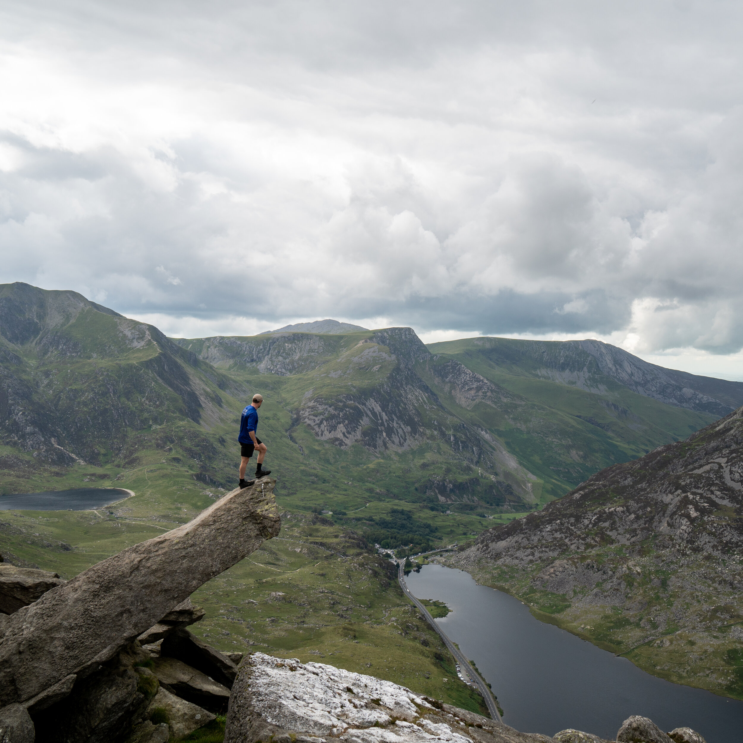
Whilst ascending Tryfan’s north face you will pass the iconic cannon stone, which is a great place for photo.

The cannon stone
The 918m summit of Tryfan will be marked by two pillars called Adam and Eve will offer incredible views over the Ogwen valley.
If the conditions allow and you’re feeling brave enough, you can leap the 3ft between the two pillars to gain the ‘Fredom of Tryfan’

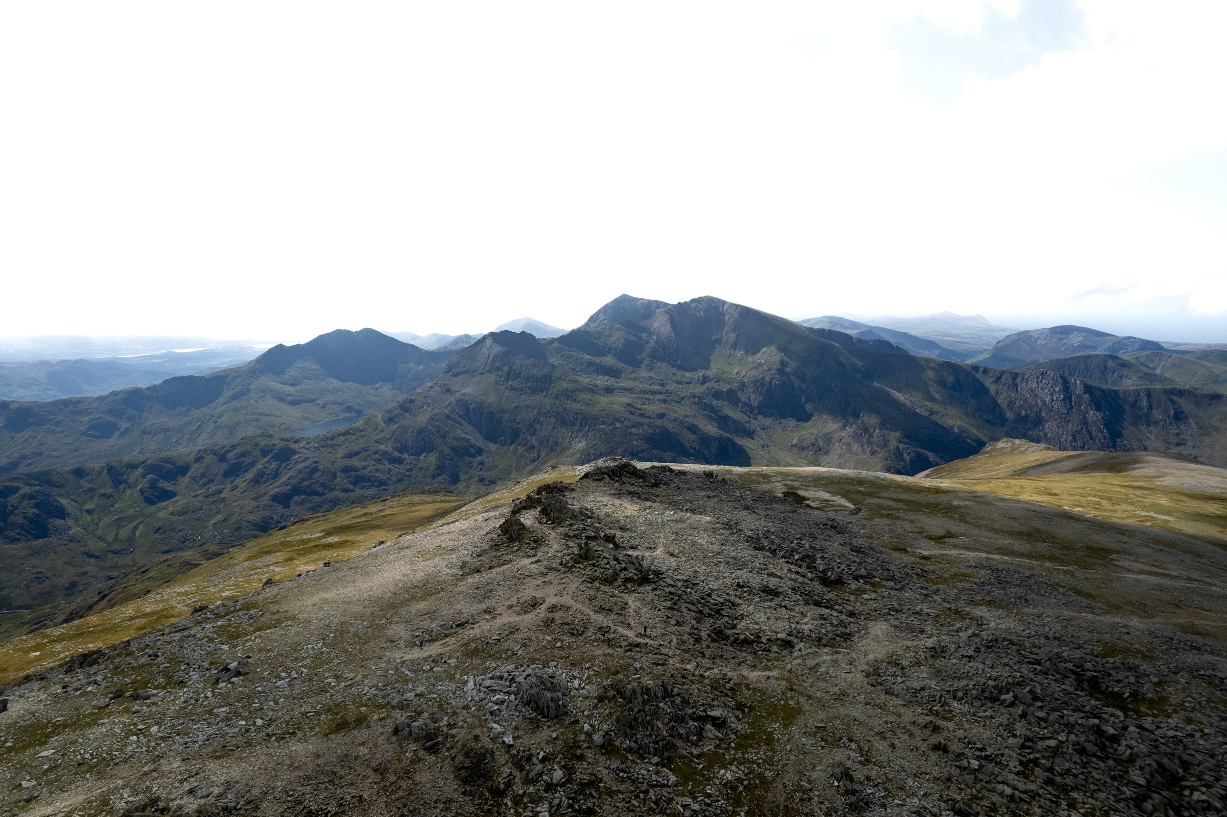
The view from the summit of Tryfan
From the summit of Tryfan begin to descend down its southern face.
Although this descent it’s not as steep nor difficult as its north face, this route is still quite technical and shouldn’t be taken lightly.
The initial section is made up of lots of large boulders which will require plenty of scrambling and looking ahead to scope out the best and easiest route down.
After the boulders of the upper section are navigated, you will hit a 30m of section of stone wall. This indicates the end of the more difficult section of the descent and from here the path should become more clear and obvious.
Dont cross the stile over the wall and instead continue to head down to the saddle.
Tryans South Face
Once at the saddle, cross the wooden stile over the stone wall and and begin to make your assent towards bristly ridge.
Unless you are a proficient scrambler with lots of climbing experience, I would avoid the gully on bristly ridge and instead head up the steep loose scree path.
Unfortunately this climb is not only horrible but can be extremely energy sapping as your footing will seem to give way with every step you take.
There are several snaking paths which have been cut into the mountainside which can offer numerous different routes to the summit. My recommendation would be to stick to the edges to try and find as much stable rock or ground as possible.
The stable terrain also give you a chance to get your hands involved and give your thighs some rest bite.
Caution should be taken ascending this route as you dont want to dislodge any rocks which may tumble down behind you and potentially cause a life threating injury to any hikers beneath you.
In addition keep an eye on who’s ahead of you as you dont want any loose rocks to come tumbling your way.

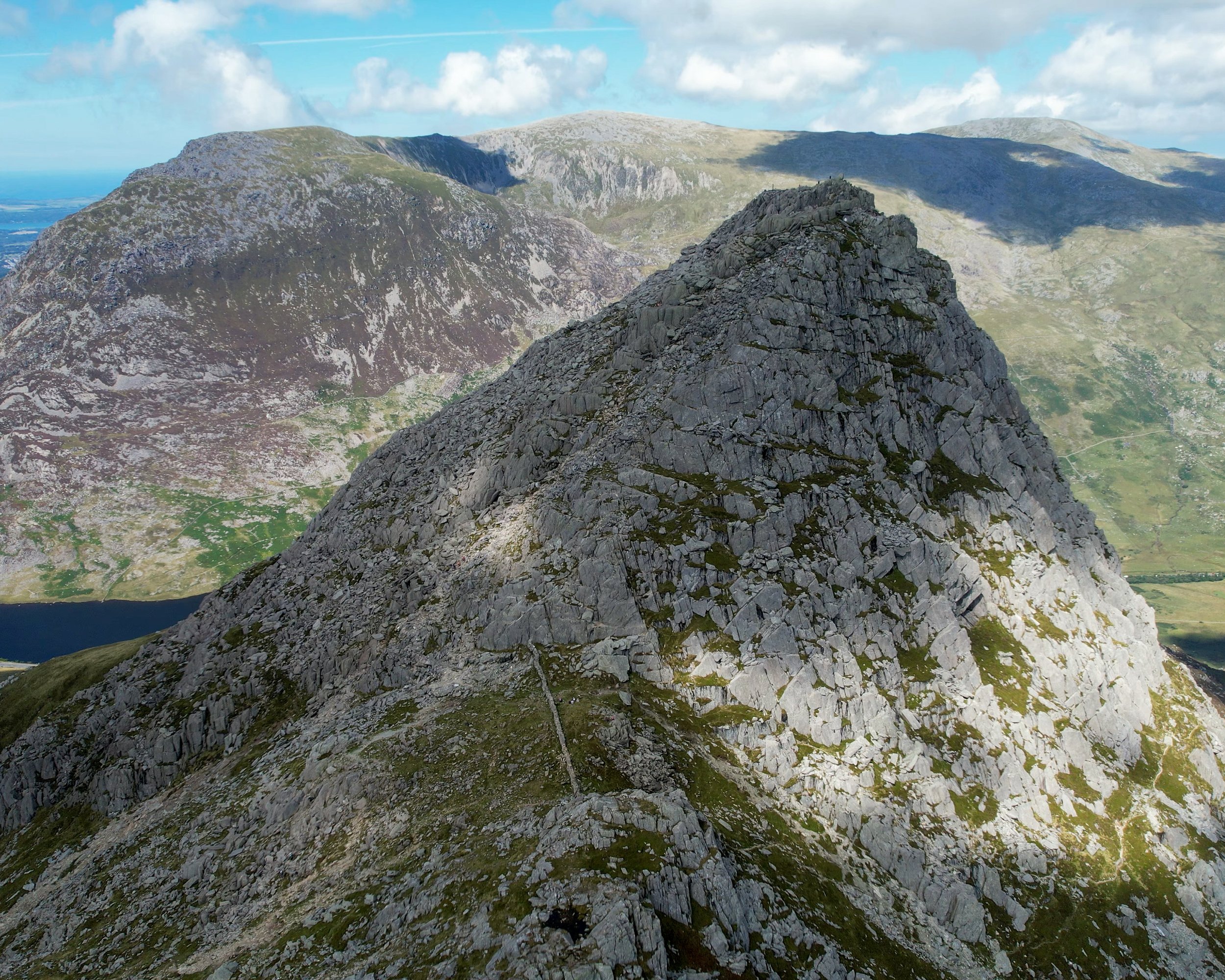
Bristly Ridge
Once at the top of bristly ridge, the route levels out and gently climbs over a very rocky alien like surface towards Glyder Fach, which will be marked by the bemusing but brilliant, cantilever stone.
The 994m Glyder Fach is the second highest of the Glyderau and the sixth highest in Wales.
The word "Glyder" derives from the Welsh word "Gludair", meaning a heap of stones, which is quite fitting as the the summit will be marked by a huge heap of rocks which can actually be quite tricky to get to the top off.
From Glyder Fach continue onwards past the otherworldly Castell y Gwynt.
Translated to Castle of the Wind, This summit is marked with a spectacular crown of spiky shattered rocks making you feel as if you’ve been transported into a Ridley Scott movie.
Its an extraordinarily prominent feature which is hugely popular with landscape photographers.
The route will skirt down and around to the left of Castell y Gwynt before steadily climbing back up to Glyder Fawr

Castell y Gwynt.
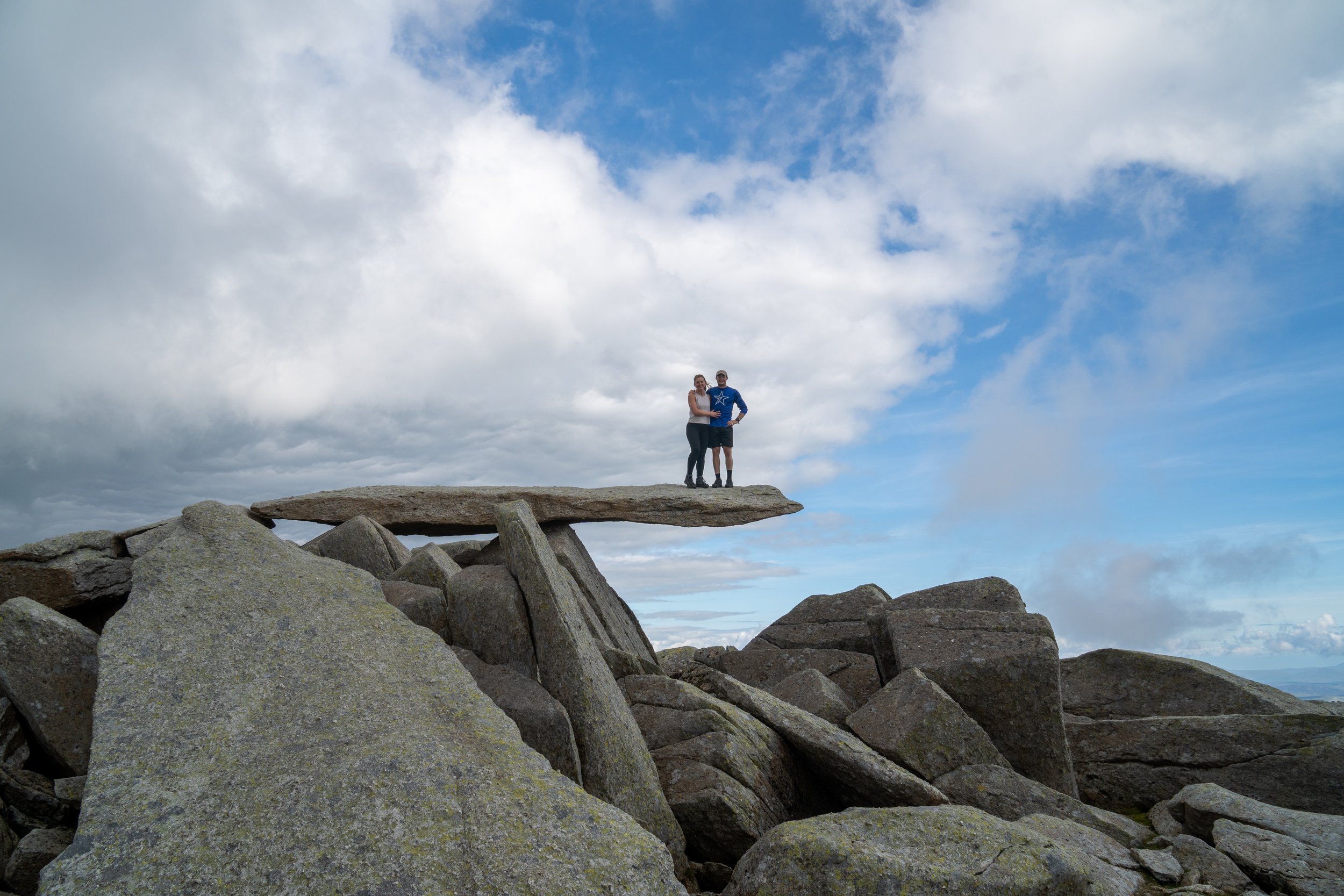
Cantilever stone, Glyder Fach
over 1,000 metres Glyder Fawr is the highest peak in the Glyderau range at the fifth-highest mountain in Wales.
The summit is once again marked by a shatterd crown of rocks whichjh looks directly towards the Snodwon massif.
There are actually serval piles of rocks on the summit which roughly all look like their at a similar height and can make determining which is the true summit quite difficult.
Its actually the pile of rocks closet to Castell y Gwynt which marks the highest point on the mountain.

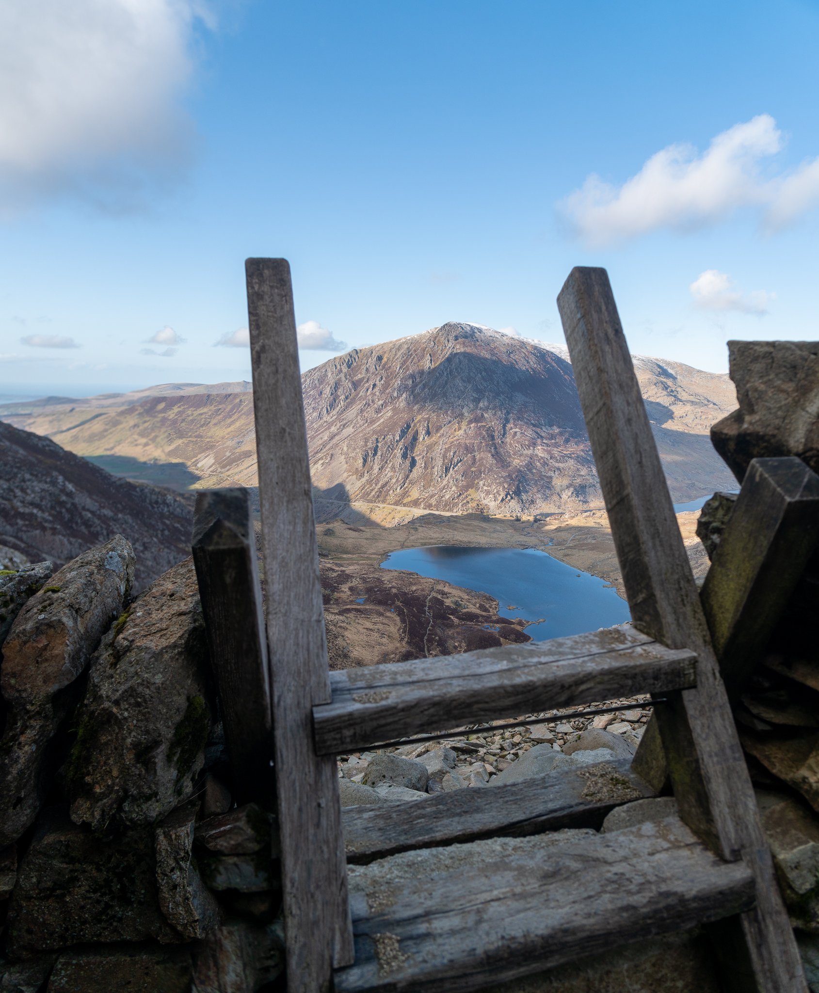
Glyder Fawr
From Glyder Fawr, head west and begin descending over the huge boulder field beneath its summit.
The route will then north westward and begin to drop very steeply down a horrible loose scree slope.
Once again there will be multiple routes down, just take your time and find the most suitable path for you.
You’ll eventually reach a small lake called Llyn y Cwn. Bear right at the saddle and begin the descent down the Devils kitchen towards Pen yr Ole wen
The top of Devils Kitchen looking towards Pen yr Ole Wen
The Devils kitchen is a steep and rocky gully which will lead you down to Cwm Idwal. The route gives you terrific views over the National Nature Reserve which sits below.
At times it may require some scrambling but the route is nowhere near as technical as Tryfan or as horrendous as the two scree slopes which you have already navigated.
Once at the shore line of Llyn Idwal, simply follow the path around to its northern shoreline and then descend down to the Ogwen Partnership Centre in Pont Pen-y-benglog.
Here you will find toilets, and if the hours isn’t too late, a shop selling drinks and snacks. From the centre simply head back up the A5 to wherever you may have legally parked your car.
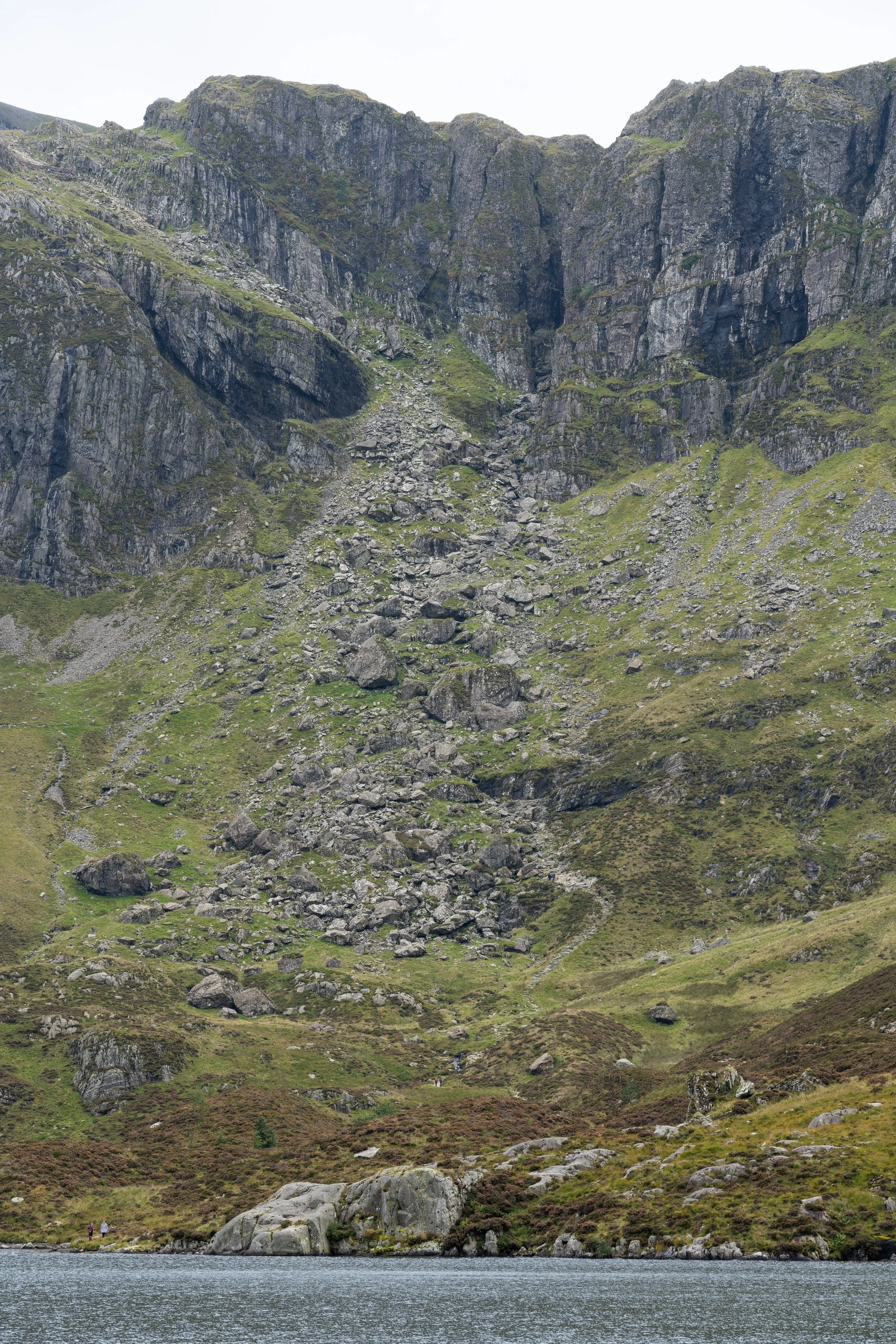
The devils kitchen from Cwm Idwal

Cwm Idwal
Final Thoughts
This hike is easily one of my favourites in Snowdonia and one I am quick to recommend.
If you have a little more in your legs at the saddle above Devils Kitchen, then you can extend the hike by climbing up to the summit of Y Garn.
This peak offers stupendous 360 degree views over the Ogwen valley and Nant peris and is also a a great option for sunset.
From Y Garn you can then either retrace your route back down to the saddle and then down Devils Kitchen or head down Y Garns North face into Ogwen valley .
Alternatively if you don’t feel comfortable climbing the North face of Tryfan, you can tackle this route in an anticlockwise fashion by ascending Devils kitchen to Glyder Fawr. You would then climb up the South Face of Tryfan before either descending back down its south slope or its western face into the Ogwen valley.
Failing that you can leave Tyfan out of the hike altogether by ascending or descending past Cwm Bochlwyd for a fantastic loop of the Glyders.

The summit of Y Garn
HELP SUPPORT MY WEBSITE
I created and I run this website in order to help inform, amaze, inspire people (for free) to get outside and explore the adventurous side of the UK and beyond.
If you’d like to support this website, you can use the affiliate links below to book your accommodation or transport. These come at no extra cost to you, but help keep this site running.
Book your car using Discover Cars
Book your accommodation using Booking.com
If you are feeling generous you can also buy me a coffee to say thank you, and give me a follow-on social media.
Thank you, and if you have any questions, leave them in the comments below or drop me an email.
You can find more Snowdonia and North Wales inspiration in the following blogs
The must-visit photography spots in Snowdonia National Park
The best places to watch the sunrise in Snowdonia National Park
The 10 best places to watch the sunset in Snowdonia National Park & North Wales
Hike Guides
For more Welsh travel inspiration check out my in-depth guides to each of my favourite Welsh regions below.

Find me on Instagram


