
Cnicht, Moelwyn Mawr and Moelwyn Bach Hike Guide | Snowdonia National Park

If you are after a proper mountain day in Snowdonia without the crowds, this is one to have on your list.
The loop over Cnicht, Moelwyn Mawr and Moelwyn Bach is a 15km route that delivers from start to finish. You get three summits, each with huge views, a mix of terrain that keeps things interesting, and a landscape shaped by industry and time, from abandoned slate quarries to old hydroelectric workings.
What really sets this route apart is the sense of space. Compared to Snowdon and the Ogwen Valley, it feels quieter, wilder, and far more remote. It is the kind of place where you can go hours without seeing many people, even on a good day.

Key information
Hike Difficulty: Hard
Hike Type: Loop
Hike Distance: 15km/ 9.3 Miles
Hike Duration: 6-8 hours
Elevation gain: 1,100m
Mountains Summited: Cnicht (689m), Moelwyn Mawr (770m) , Moelwyn Bach (710m)
Technical aspects: A small amount of non-exposed scrambling
Car park & Start point: Croesor Village
What Three Words location: eleases.electrode.stilted
Where to Park
Free parking is available for around 20-30 cars in the remote mining village of Croesor. You will reach the village via the narrow back roads of Snowdonia which can prove quite difficult.
f approaching from the south, avoid turning off the B4410 after passing Tan-y-bwlch train station. This steep narrow mountain road involves passing through four boundary gates which are a right pain in the arse to continuously get out of your vehicle to open and close.
The Route
I’d recommend tacking this route in the clockwise fashion starting off with Cnicht first.
Cnicht is way-marked from the outset. From the car park head right and follow the road up through the village, the initial climb will then head up a steep rocky track through some woodland before bearing right onto the hillside.
The distinctive summit of Cnicht will now be visible straight ahead of you. The route is very obvious and hard to detour from.
Follow the path as the mountain draws ever nearer. The higher you climb, the more impressive the views become, take the time to turn around and admire the views back towards Porthmadog estuary.
The final part of the climb involves a small section of scrambling, however it isn’t at all technical or exposed.

The path up to Cnicht

The final ascent up to the summit of Cnicht
Cnicht
Once up on the summit you will be presented with sensational panoramic views across the national park. To the west lies Porthmadog estuary and the Llyn Peninsula.
To the north, the Nantlle ridge, Snowdon, the Glyders, and Carneddau. To the south lies the mighty Moelwyn Mawr, Southern Snowdonia, and the remainder of the route.

Looking west towards porthmadog Estuary

Looking south towards Moelwyn Mawr
At this point the scale of the hike and what’s yet to come becomes overwhelmingly evident. Although you have knocked off one of the three climbs involved in this hike, you are not even a third of the way through. As tempting as it may seem, avoid tucking into your lunch, break out a one of your snacks and push on.
From the summit of Cnicht you have two options to reach Rhosydd quarry
The usual route follows the ridge north-east over Cnicht north top and past its rocky Knolls around to the lakes of Llyn y Biswail and Llyn yr Ada.
The shorter option is to b-line straight down Cnichts southern scree slopes towards Llyn-cwn y foel. The dammed lake sits to the southeast of the peak and offers a more direct, albeit steeper route the former slate mine.
There is no clear path here, instead just pick and weave your way down towards the head of the lake, before walking across the Dam and climbing up and through the boggy knolls on the other side towards the quarry.

Looking North towards Snowdon & the Glyderau

Looking back from Cnicht nNorth top towards Cnicht
Rhosydd quarry
Rhosydd quarry is truly a special place and humble remainder of days gone by. The remote, ruined remains are enveloped by an amphitheatre of rugged mountains making you feel like you’re in the last wilderness of Wales.
After following the steep tracks up through the quarry you’ll be presented two options.
You can bear left and hike up to the 647m summit of Moel Yr Hydd. This will give you great views back over Cwmorthin quarry.
If you don’t fancy adding some extra elevation to the hike you can head straight for the summit of Moelwyn Mawr.
I got distracted by the huge crater like hole which was a result of the areas industrial past and completely missed the path up to Moel yr Hydd.
The climb up to Moelwyn Mawr is an absolute bastard, there are no two ways about it. Its’ steep and unrelenting and every-time you look up the entire route just stares you in the face.

Looking back down towards Rhosyd Quarry


Half way up to Moelwyn Mawr, looking back towards Rhosyd Quarry
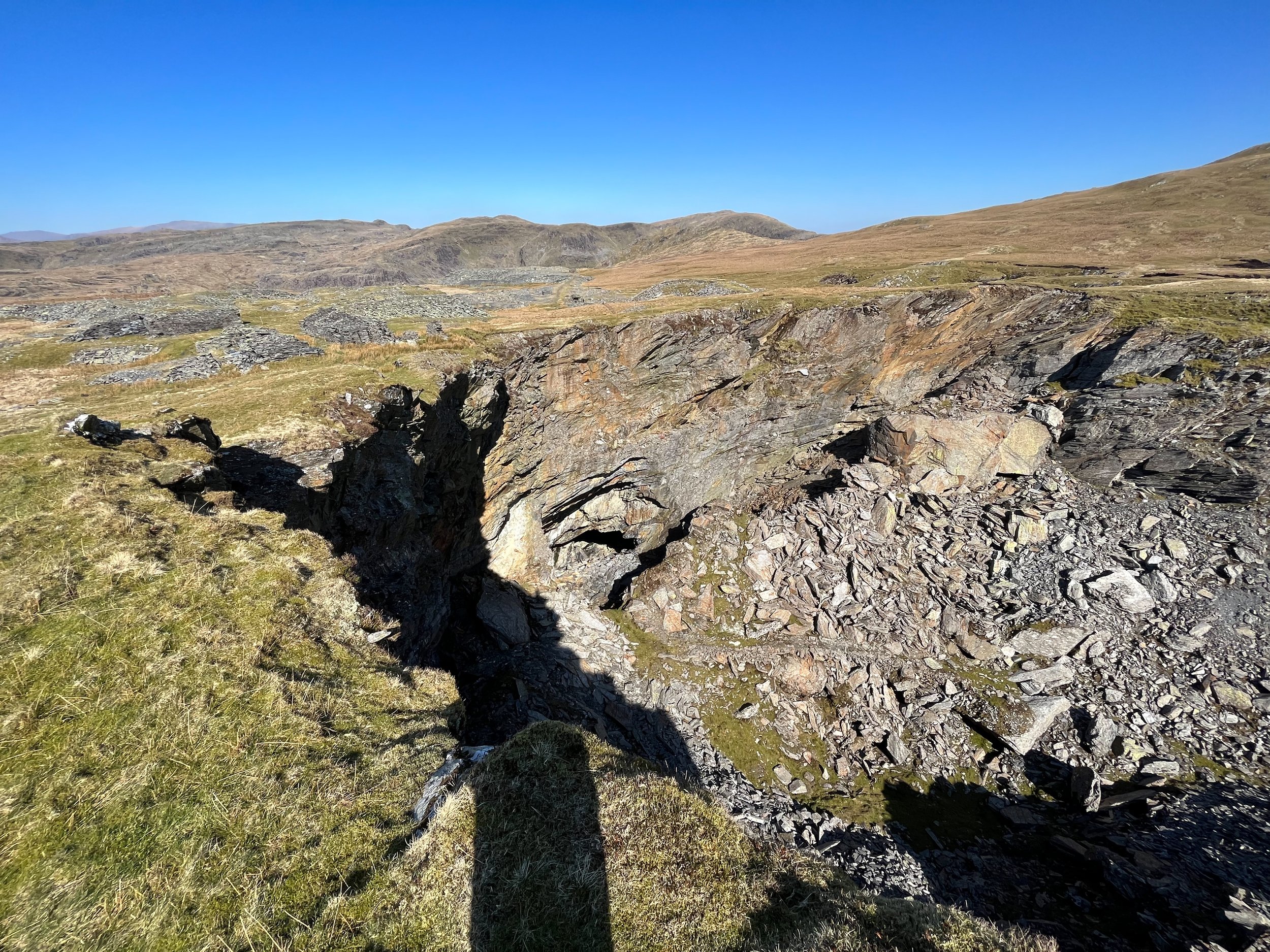
A huge 100m deep crater above Rhosydd Quarry
Moelwyn Mawr
Translated into ‘great white hill’ the summit of Moelwyn Mawr stands at 770m and offers sensational 360 degree panoramic views over Snowdonia.
I used this as an opportunity to stop for lunch to take it all in, rather than rave about how good the views are I will let the photos do the talking.


Craigysgafyn
From Moelwyn Mawr its short descent down its southern face and a traverse across Craigysgafyn ridge. This rocky outcrop stands at 690m and offers terrific views down over the Stwlan dam.
From Craigysgafyn drop down to the saddle and begin the final ascent up to Moelwyn Bach.

The route to Craigysgafyn from Moelwyn Mawr

Looking at Moelwyn Bach from Craigysgafyn

The climb up to Moelwyn bach looking back towards Moelwyn mawr and the Stwlan Dam
Moelwyn Bach
The views from the 710m Moelwyn Bach (English translation Little white hill) aren’t as spectacular as those on its parent peak but are still impressive.
From here you can really get an understanding about how impressive the Stwlan Dam is.
Sitting at an elevation of 512m (1,679ft), the mountain reservoir was built to supply water to the Blaenau Ffestiniog power station.
The road leading up to the dam is 2.7km long at has an average gradient of 10.1%. It has 8 hairpin bends, is closed to cars, and has a summit finish. Because of these features it is extremely popular with road cyclists. In fact it’s often voted as one of the best road climbs in the uk.

A drone shot of Moelwyn Bach looking towards Moelwyn Mawr and Snowdon

The view of Llyn Stwlan from Moelwyn Bach

A birds eye view of the road leading up to the Stwlan Dam


A drone shot of the Swlan Dam
The descent
The decent from Moelwyn Bach will initially take you west towards Porthmadog estuary for 2.7km. You will then turn right onto the mountain road which will lead you north for 1.4km back to the village of Croesor.
I would have thought finishing on the road would have been rather tedious, however because you’re walking directly towards Cnicht and Snowdon it’s quite a picturesque walk back to your car.
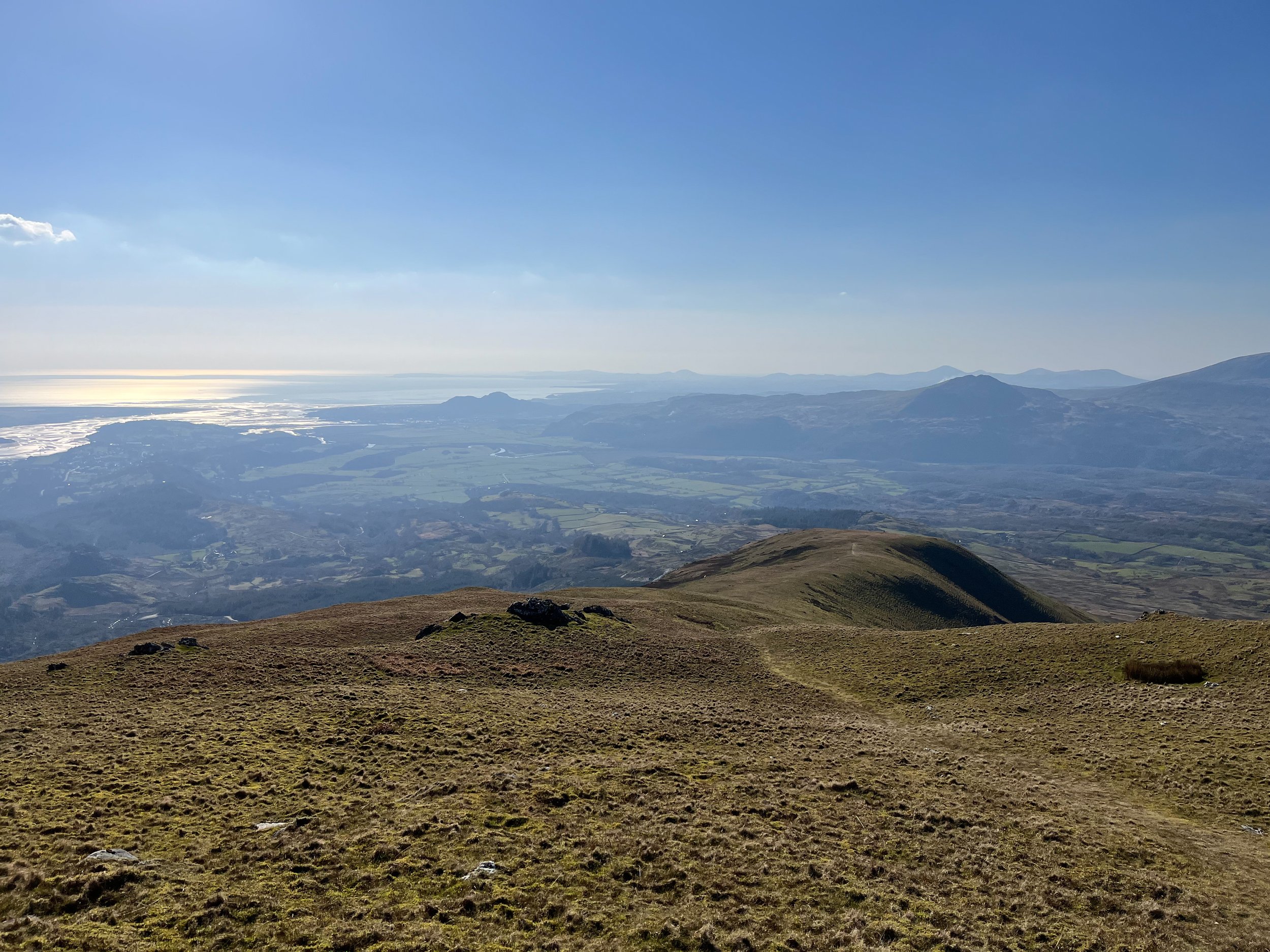
Looking towards Porthmadog & the Llyn peninsula from Moelwyn Bach

The road back to Croesor
Final thoughts
Everything about this hike left a lasting impression on me which has easily propelled it up into my top three walks in Snowdonia.
The variety of the landscape you pass through, the incredible vistas from each of the three summits, and remoteness of the walk had me at times lost for words.
A bonus was that because the landscape was so vast and the route relatively quiet, I only passed a handful of people all day.
The car park in Croesor can fill up quite quickly on weekends so I go early to secure a space and have plenty of solitude up on the mountains. The route can be tackled in either direction, which way you choose depends on if you want to start or finish your hike on a one mile stretch of road.
There’s not much else to say apart from take the time to tackle his hike. Take your time and pack plenty of food and water, it’s a long day out in the hills and you’ll want to enjoy it.

Snowdon in the distance

Cnicht from the road side
HELP SUPPORT MY WEBSITE
I created and I run this website in order to help inform, amaze, inspire people (for free) to get outside and explore the adventurous side of the UK and beyond.
If you’d like to support this website, you can use the affiliate links below to book your accommodation or transport. These come at no extra cost to you, but help keep this site running.
Book your car using Discover Cars
Book your accommodation using Booking.com
If you are feeling generous you can also buy me a coffee to say thank you, and give me a follow-on social media.
Thank you, and if you have any questions, leave them in the comments below or drop me an email.
You can find more Snowdonia and North Wales inspiration in the following blogs
The must-visit photography spots in Snowdonia National Park
The best places to watch the sunrise in Snowdonia National Park
The 10 best places to watch the sunset in Snowdonia National Park & North Wales
Hike Guides
For more Welsh travel inspiration check out my in-depth guides to each of my favourite Welsh regions below.

Find me on Instagram


