The best photography locations in Pembrokeshire

Pembrokeshire National Park, surrounded by the sea on three sides, has 186-miles of beautiful unspoiled coastline lined with arguably some of the finest coastal path in the entire world.
Hidden amongst the 186 miles of the national parks encaptivating coastline are some of the most incredible beaches in the UK alongside costal scenery which will leave you lost for words. Whether you are seasoned landscape photographer looking for inspiration or just someone looking to up your Instagram game then Pembrokeshire is the national park for you.
In this blog post I have included a number of my favourite and what I would describe as the best photography locations across Pembrokeshire. I have listed them in locational order starting in Tenby and working the way along the coastal path west, then northwards until Strumble head.
One thing I would say is this list is no means definitive as the entire coastline has an abundance of natural beauty. A good photography location can be found around every corner and sometimes all you need for a great shot is an eye for a composition and the right light.
I hope you find the information on these pages useful. If you have any questions, comments or feel I have missed out any spots, let me know in the comments below.
Tenby
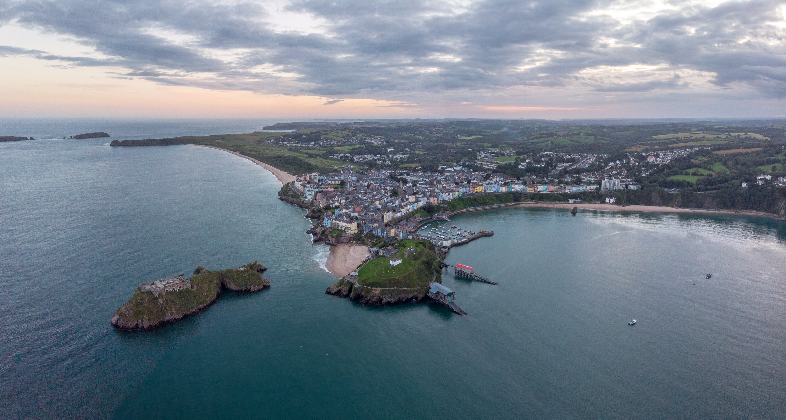
No Pembrokeshire photography list would be complete without the seaside village of Tenby.
Situated on the south coast of Pembrokeshire, Dinbych-y-Pysgod (which translated from Welsh to "little town of fishes”) is a small harbour town and seaside resort. Surrounded by a 13th century medieval stone wall, It’s quaint cobbled streets are lined with charm and worthy of a visit despite how busy it can get.
I would recommend heading down to the harbour to snap the colourful Victorian houses which line its narrow streets. Once you’ve snapped the harbour it recommend heading up to Castle hill to view St Katherines fort and the lifeboat stations.
Be warned though, Tenby is the most popular location in Pembrokeshire and is often busier than a one armed bricklayer in Baghdad, so its worth heading here in the early house for sunrise or sticking around for Sunset.
The best place to park is in the multi-storey car park beneath Sainsburys, its 50p per hour for a maximum of two hours, which is more you need to snap some picks and a grab a coffee or bite to eat.


Castle hill and Tenby Harbour
Church Door Cove & Skrinkle Haven

Shrinkle Haven (Centre) and Church door cove (right)
Church door cove is one of Pembrokeshire’s many geological wonders scattered across it’s rugged coastline.
The cove is an amphitheatre-shaped bowl with a magnificent door shaped arch which has been cut into the towering cliffs by the forces of the ocean. At mid to high tide the beach becomes cut off and consists of mainly large boulders, but as the tide drops away a beautiful, sheltered stretch of sand is revealed.
Next door to Church Cove are the golden sands of Shrinkle Haven beach. Unfortunately the steps leading down to the beach have been fenced off. However, the bay is accessible at low tide via Church door cove by either walking around the thin limestone headland or scrambling through a narrow and slippery cave. Be extremely careful if undertaking this trip as this beach will quickly get cut off, and you’ll either have to swim back around or wait 8 hours for the tide to retreat.
Check the tide times and aim to head down as the tide is retreating from mid to low in order to get the maximum amount of time here
Free parking is available either at Manorbier YHA, postcode SA70 7TT, or 500m further along the road, situated on the cliff top adjacent to the coastal path. From the Car park Church door cover which is easily accessible via a short walk which leads to the steep concrete and metal steps (140 in total) which drop down onto the bay.

Church door cove
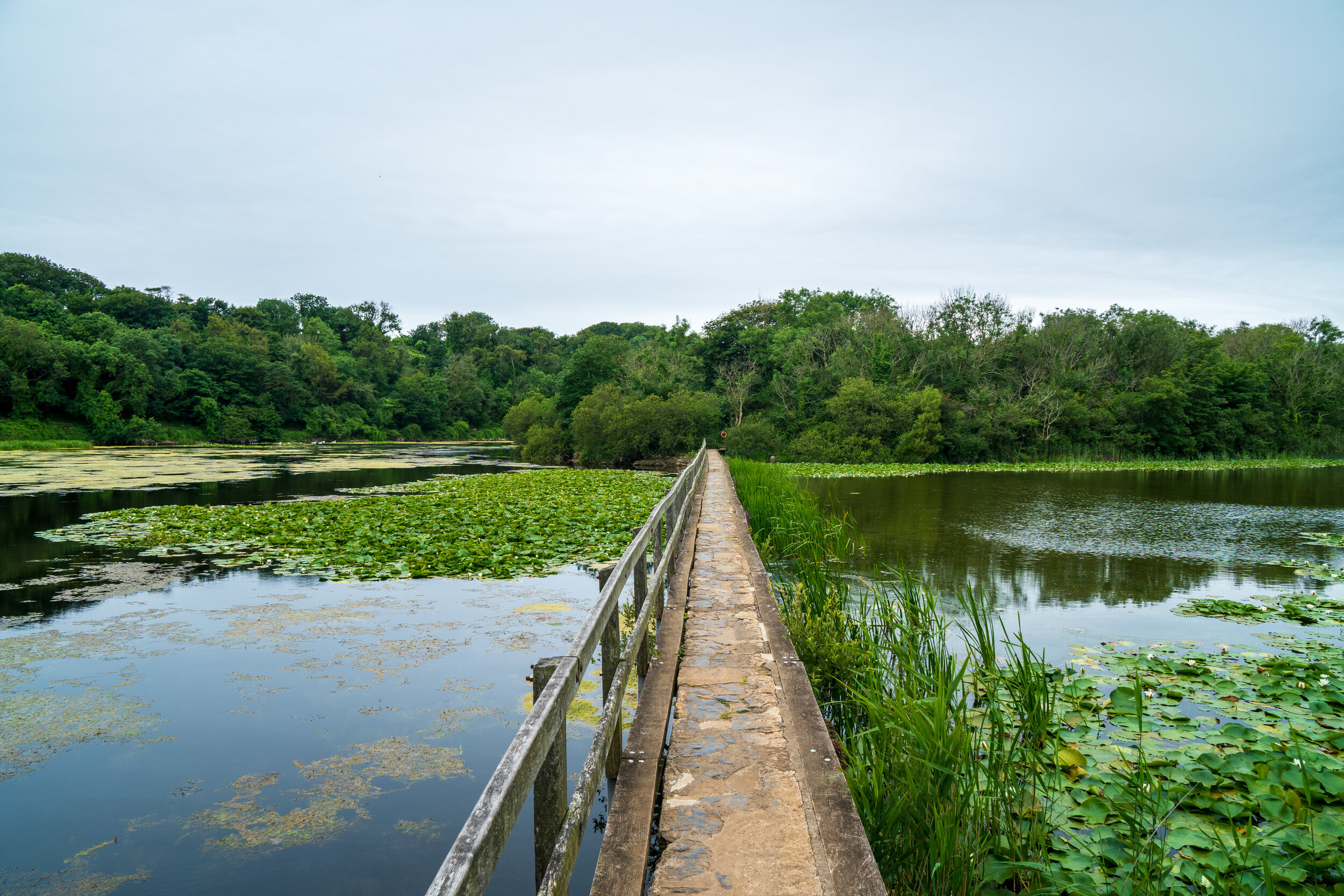
Bosherston Lily ponds & Broadhaven South

This forms part of one of my favourite walks on the peninsula, which encompasses two of Pembrokeshire finest beautiful golden sanded beaches, dramatic coastal cliffs and enchanting walk through the magical Bosherston lily ponds.
The real gem here are the Lily ponds. These man-made lakes are famous for their spectacular display of waterlilies and their resident otters make for a great way to reach Broadhaven beach. There are a number of paths which navigate through and around the ponds, with several bridges which make for some great photo opportunities.
Once you arrive at Broadhaven you can snap its famous Church Rock, which sits in the middle of the bay. From here I would recommend heading westwards along the dramatic cliff path to snap Barafundle bay, which I have highlighted below.
A large national trust car park can be found in Bosherton village, where there are also toilets, a country pub, and a small café.

Barafundle Bay
Golden sands and crystal clear waters backed by sand dunes and pine trees, Barafundle is nothing short of spectacular and one you have to visit.
The bay has constantly been voted as one of the best beaches not only in Britain but also Europe and of the sun is out you might mistake this beach for being located on a Caribbean island.
Barafundle’s isolated location means there are no facilities or lifeguards at the beach. There is a café and toilets located half a mile away at the national trust car park in Stackpole quay where car parking is £5 per day or £2 after 2pm.
The 1/2 mile walk to the beach is also a highlight as you’ll pass through a forest and over a lake before you reach the remote and slightly curved bay that looks out to rugged cliffs, clear ocean views and the greenery of the coastal path.
Another way to reach Barafundle Bay is to walk here from the equally as beautiful Broadhaven South beach. The short two-kilometre coastal walk will take you across some of the finest parts of the Pembrokeshire coastal path and you’ll barely see a soul in the process.


St Govan’s Chapel
This is a tiny stone building carved into the limestone cliffs of the Pembrokeshire Coast. Dating back to 13th Century the chapel was built to honour the hermit St Govan who lived here alone here during the 6th century.
The history of St. Govan is shrouded in mystery. He was believed to fleeing from some pesky Irish pirates when the cliffside allegedly morphed into a secret cave for him to hide in. After successfully evading his captors Govan chose to set up a monastic hermitage in the cove and remained there for the rest of his life. However I prefer to believe that he was forced to self isolate there after the 6th century Welsh Coronavirus outbreak started and Mark Drakeford imposed strict restrictions.

The chapel is reached by descending 52 stone steps, polished smooth by the feet of generations of visitors. After passing through the wonderfully atmospheric chapel you are able to head down and marvel at the structure from the rocks below.
Parking is available less than 50 meters from the church steps. (postcode SA71 5DR). Be warned that the car park is located within the confines of a military firing range.
Unfortunately, as I have found out on two occasions, this road leading to the car park can be closed off during certain times for training exercises This will be clearly indicated as there is a barrier and manned booth which will have a red flashing light on the top if the section of the coastal path is closed.
To avoid a wasted trip, you can check that the road through the firing range is open to the public by calling the Pembroke Visitor Centre (+44 01437 776499) or Castlemartin Firing Range (+44 01646 662367).


Green Bridge of Wales & Elgug stacks
For me this is the most impressive part of the Pembrokeshire coastline and also one of the most accessible.
The large car park is free and is located less than 100m from both Elgug Stacks and the Green Bridge of Wales. Access to both locations is Wheelchair friendly
To reach the car park you have to to (legally) drive 2.5km through a MOD military firing range. Unfortunately, as I have found out on two occasions, this road can be closed off during certain times for training exercises.This will be clearly indicated as there is a barrier and manned booth which will have a red flashing light on the top if the section of the coastal path is closed.

Elgug stacks

The Green Bridge of Wales
To avoid a wasted trip, you can check that the road through the firing range is open to the public by calling the Pembroke Visitor Centre (+44 01437 776499) or Castlemartin Firing Range (+44 01646 662367).
The locations south facing direction also makes it a great spot for sunrise and for photographing the Milky way.


Freshwater West
One for the Harry Potter fans amongst you.
Freshwater West is a wide, sandy and backed by an extensive system of dunes situated on Pembrokeshire exposed west coast
It's south westerly facing direction makes it the most consistent surf spot in Wales resulting it playing host to the Welsh Surfing Championships every year.
If the beach seems familiar that because it has featured in several Hollywood movies. Ridley Scott’s Robin Hood was filmed here alongside Harry Potter and the Deathly Hallows, where the beach was used as the back drop for Dobby’s Shell Cottage. The cottage has since been taken down after filming however there is a pile of stones and socks which pay homage to the fictional character so you can pay your respects then run around the dunes shouting "Dobby is a free elf”.
There are two small free car parks situated behind the dunes however these tend to fill up fast if there’s a decent bit of surf. If these become full then some parking is available along the very narrow road that leads down to the beach
If you’re a bit of a foodie and like your seafood then the award winning ‘Cafe Mor’ food shack operates out of the southern car park from spring to early autumn and is a must visit.

The view from the War memorial on the beaches northern Slopes

Dobbys Grave
Carew Castle and tidal mill
Set in a stunning location overlooking a 23-acre tidal Millpond, Carew Castle is one of the most architecturally diverse in Wales; from the west a Norman fortress, yet from the north a splendid Elizabethan mansion.
The site also incorporates the only restored Tidal Mill in Wales, an 11th century Celtic cross, a Medieval bridge and picnic area all linked by a mile-long circular walk, suitable for buggies and wheelchairs, with magnificent views over the Millpond.
Free Parking is located 100m from the castle. Aim to head down at high tide on a calm day to get stunning reflections like this incredible shot by Daniel Morris.
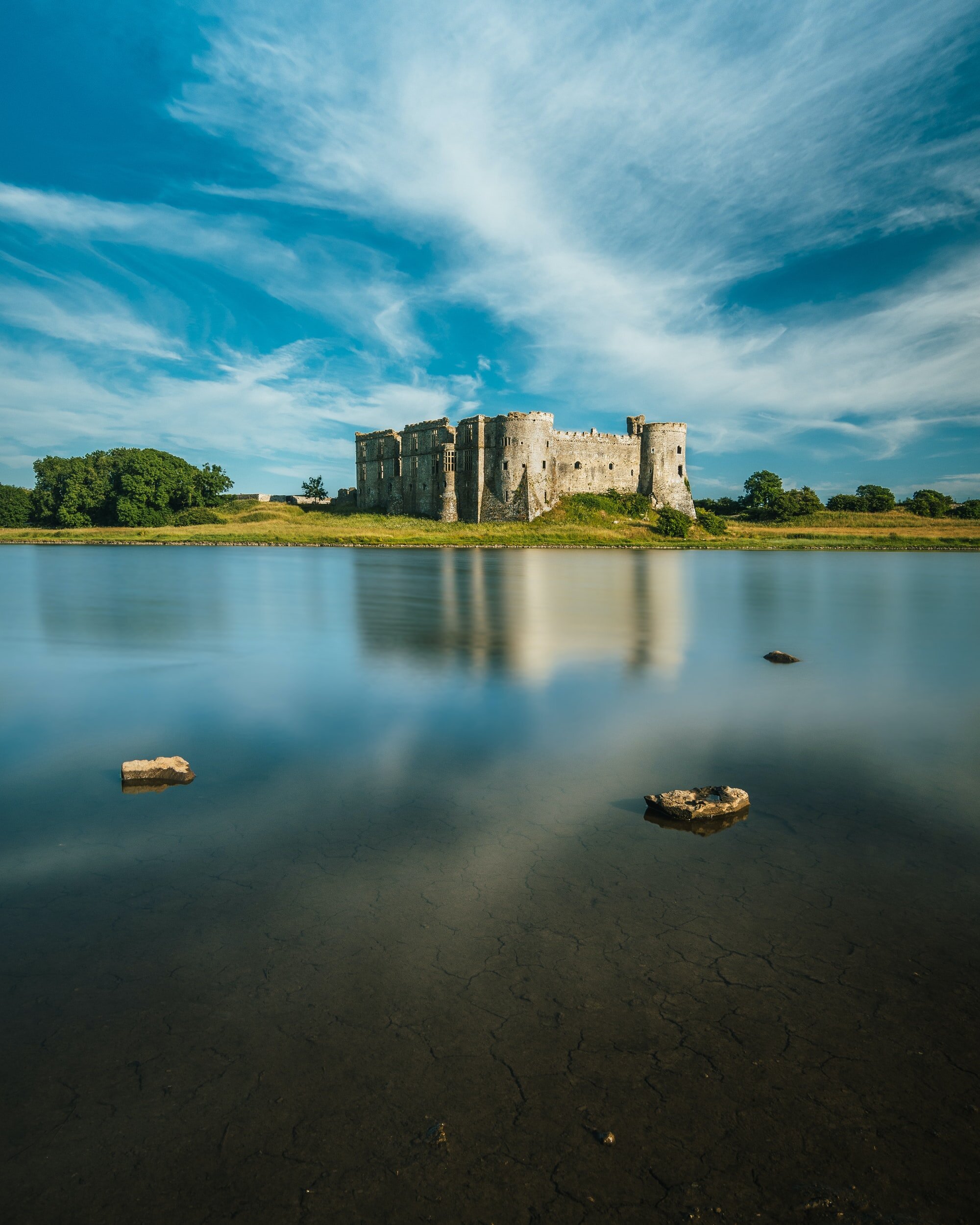
Photo by Daniel Morris on Unsplash
Marloes Sands
Marloes Sands is a hidden gem of a beach nestled on the very western edge of Pembrokeshire which offers an abundance of wildlife, and incredible views of the surrounding coastline
This one mile beach is backed by jagged sandstone cliffs and is divided into into smaller, more secluded bays by the dramatic rock formations which protrude from its golden shores.
The beach is popular with surfers and on Wednesdays and Saturdays in September and October, the National Trust arrange guided walks with a ranger to see the seal pups. The beach has also been used in the Hollywood film Snow White and the Huntsman and at low tide, you can see the remains of a wrecked ship sticking out of the sand.
Parking is available at Marloes Sands car park, near the Runwayskiln cafe, for £5 a day. From here you can access the beach is via half a mile walk along a well-maintained path.

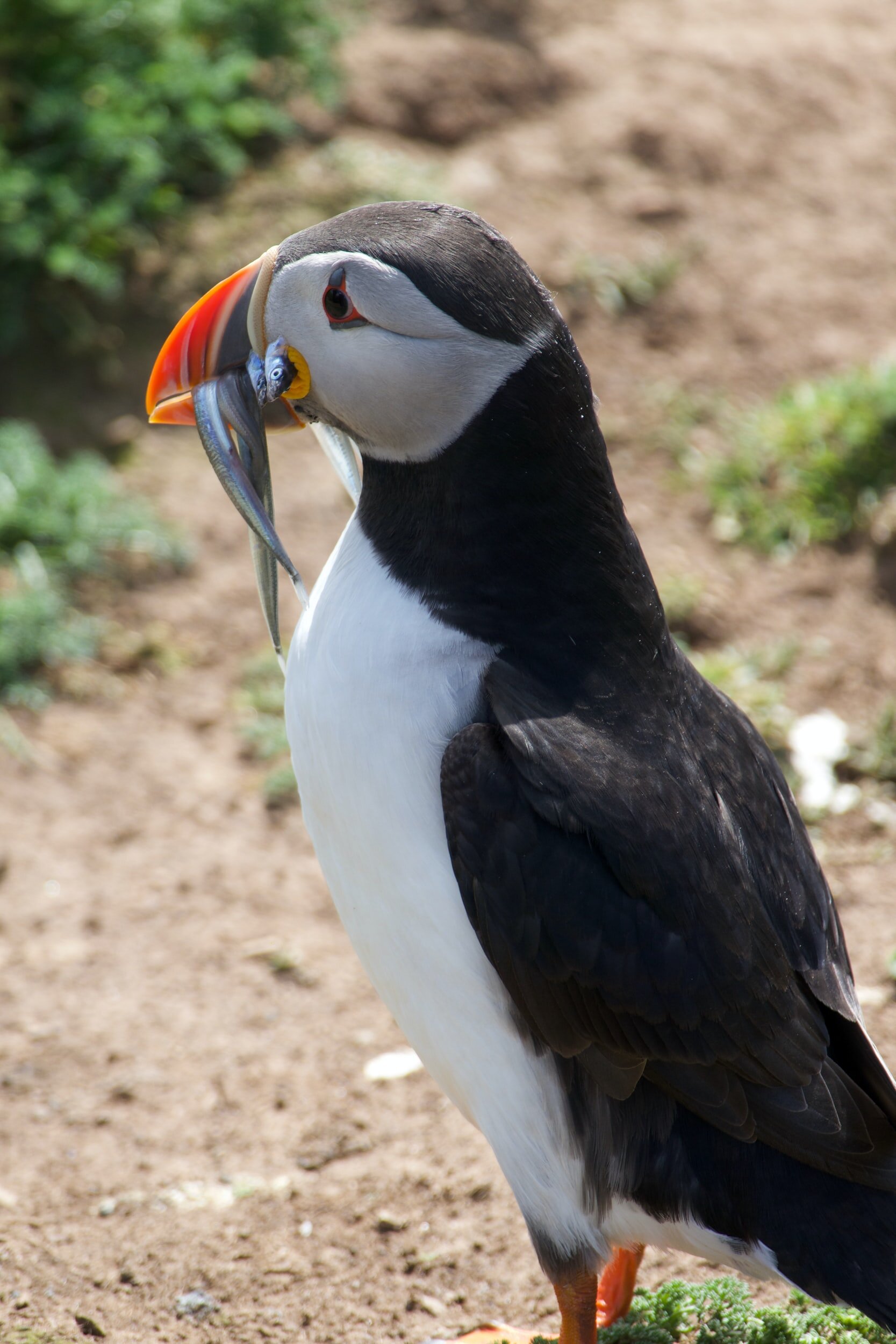
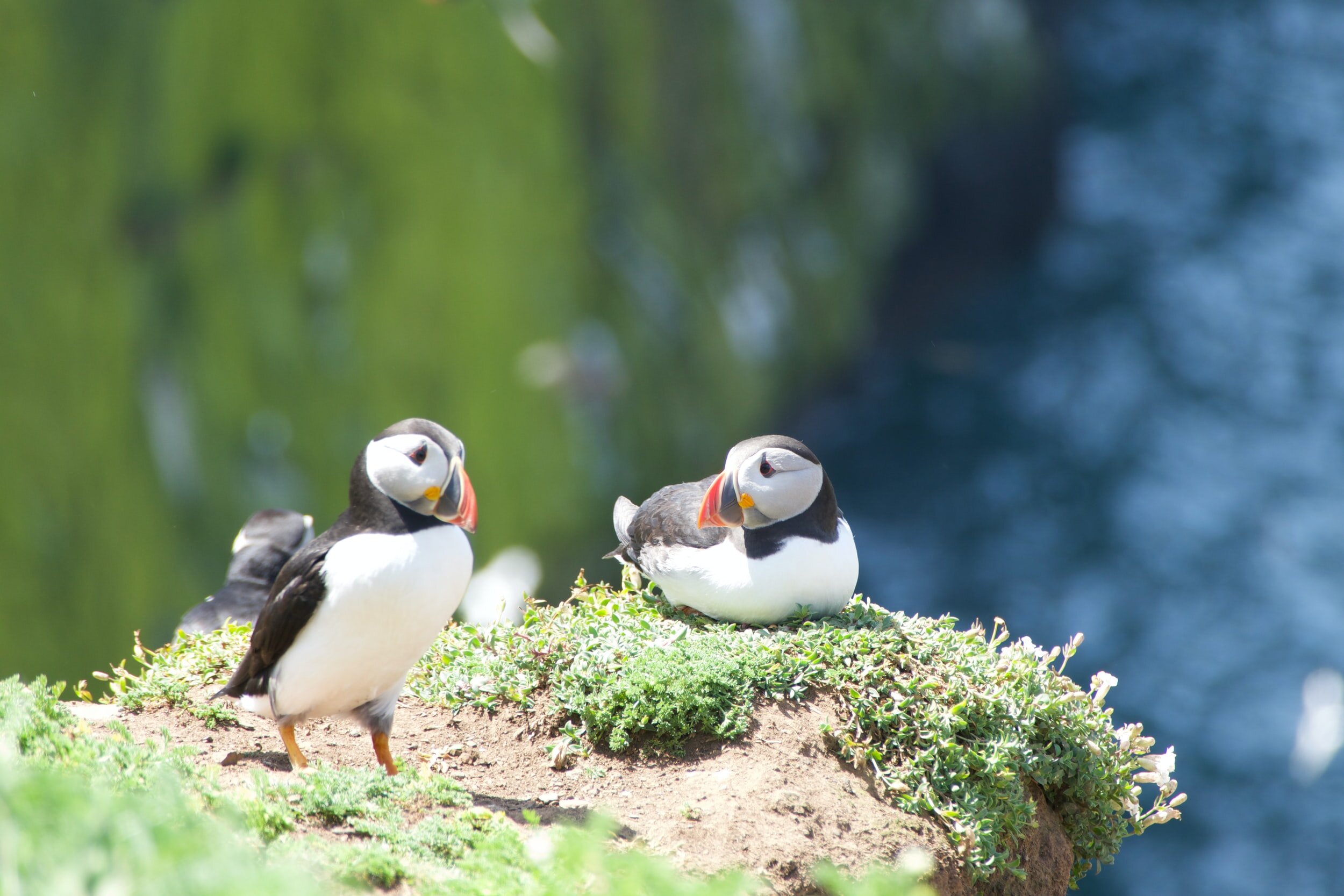
Skomer Island
A must visit for any nature or wildlife enthusiasts. Skomer Island is located less than a mile of the Pembrokeshire coast and is home to the the largest puffin colony in southern Britain.
However there is so much more to the bird paradise than just Puffins. The island is surrounded by some of the richest waters for wildlife off the British Isles and sightings of dolphins, porpoises and grey seals are extremely common.
Skomer island is only accessible by boat, but for conservation purposes, the total number of people who are allowed onto the island is capped at 250 people per day. All boats depart from Martins Haven, a delightful little cove situated on the north coast of the peninsula, Tuesday to Sunday at 10am, 11am and 12 noon.
Tickets used to be sold on a first come first serve basis but due top the coronavirus pandemic, Online advance booking is now required (that’s one positive of the virus) so pre book to avoid to disappointment. Parking for Skomer Island is available at Martins Haven beach
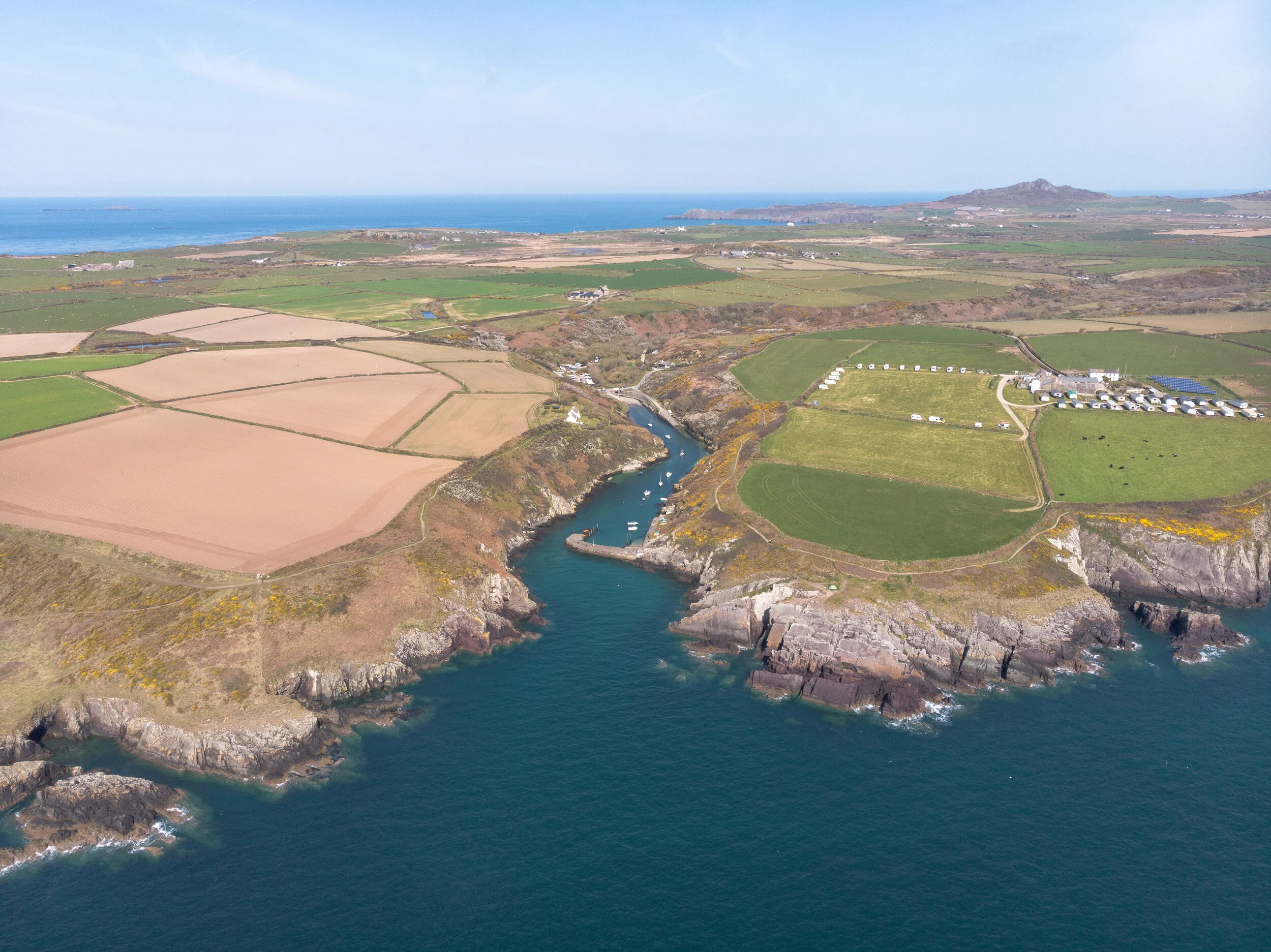
Porthclais Harbour
Porthclais is a quaint little harbour situated on the south-western tip of the St David’s Peninsula.
Built in the 12th century to serve the city of St David’s, The harbour used to be a bustling port alive with industry, with ships importing and exporting goods for the coastal communities. Timber, grain, limestone and coal were among the items traded, with the latter two fuelling the onshore lime kilns and nearby gas works.
You can still see the lime kilns on either side of the harbour, but all that remains of the gas works is the former pump room, which is now home to a fantastic refreshments kiosk which serves top notch coffee. Nowadays Porthclais harbour it’s a popular spot for kayakers, small boat owners and captivating coastal walks.
A small national Trust car park is situated 50m from the base of the harbour. Two other Harbours of note which could have easily made this list are Solva and Porthgain, the former does epic Welsh cakes and the latter does amazing fish and chips.

Carn Llidi
Sitting imposingly above Whitesands Bay, This craggy 181m hill is rich in history with two burial chambers located on the southwest slopes alongside an old WWII radar station on its summit.
The summit offers terrific views westwards towards Ramsey Island and northwards towards Strumble Head; on clear evenings you can also get a glimpse of the Wicklow Mountains in Ireland. I would recommend heading up for either sunset or sunrise as its panoramic views are only rivalled by Garn fawr Hillfort in Pembrokeshire.
Parking is available in Whitesands Car park, (SA62 6PS) for £5 a day. There is only space for 60 vehicles which tends to fill up quickly in the busy summer months. If no spaces are available you can catch the Celtic Coaster shuttle bus from the Oriel Y Parc in St Davids during the summer. From Whitesands Bay car park the easy to follow path leads through Porthmawr Farm and rises gently up to the small summit. The route is just under 1km and should take around half an hour to reach.


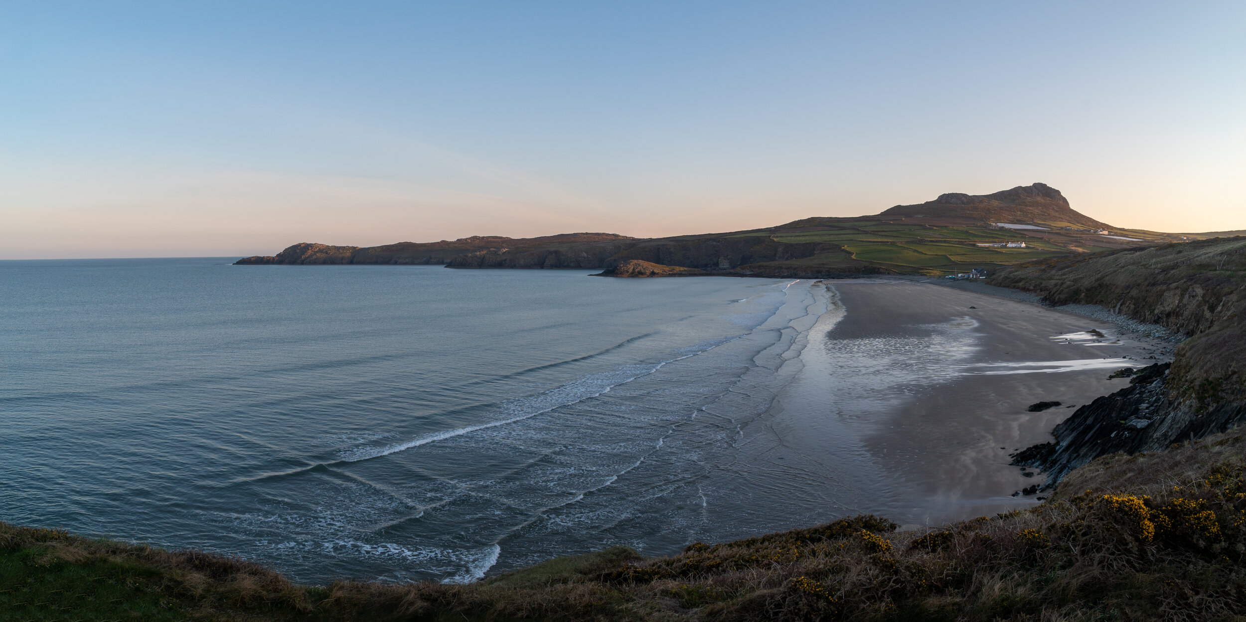
Whitesands Bay
Situated on the St David’s Peninsula in the North-west of Pembrokeshire, Whitesands (Porthmawr in Welsh) award-winning beach overlooked by the imposing craggy headland of Carn Llidi.
Its location on the North West tip on the Peninsula Make it a great spot to capture a sunset. Like most of Pembrokeshire the lack of light pollution would make a great place for astrophotography.
Parking costs £5 per day and there is space for 60 vehicles is available right next to the beach. The blue flag beach is extremely popular with families due to its easy access and a wide range of facilities , and his fills up quickly in the busy summer months. If no spaces are available you can catch the Celtic Coaster shuttle bus from the Oriel Y Parc in St Davids during the summer.
Blue Lagoon
Pembrokeshire's Blue lagoon is abandoned slate quarry, filled with turquoise water on the north coast of the coastal path. Shut down in 1910, the seaward wall of the quarry was blasted open by fisherman in order to flood the mine and provide refuge for their boats.
Ruined quarry buildings still sit on the clifftop, with the remains of the workmen’s cottages adjacent to the car park, along what was called The Row.
Bordered by beautiful beaches and craggy rocks, the lagoon is world-class for watersport and is a fantastic coastal location to capture some epic images.

Parking is available at the nearby Abereiddi Beach, its free in the winter months but costs £4 otherwise. From here the quarry is easily accessible via a short 5 minute walk which passes the ruined quarry buildings .From the base of the lagoon you can climb up and around the cliffs and visit the watch tower perched on the tip of the peninsula.
Whilst at Blue Lagoon I would also recommend walking the coastal path northwards for a further 3km until you reach the quaint, picturesque fishing harbour of Porthgain. On route you’ll skirt around some of Pembrokeshire’s most dramatic and rugged coastline which towers over one-hundred feet above its turquoise clear waters.

Porthgain Harbour
Another quaint fishing village which is located on the north coast of Pembrokeshire.
Once a small commercial harbour used for exporting stone from the nearby quarry, Porthgain is now a very popular tourist centre which is home to thanks to a great pub, a bistro serving fresh locally caught seafood, and excellent art galleries.
Alongside capturing the fishing boats which sit within the harbour walls, the remains of the former quarry buildings can be seen next to the harbour wall and on the cliffs above the harbour.

Garn Fawr - Strumble head
An old Iron age Hill fort situated on Strumble peninsula on the North coast of Pembrokeshire. The summit offers spectacular 360 panoramic views across the northern coastline and back south over the Preseli hills.
Free parking is available to the east of the Garn Fawr Hill fort in a small car park (nearest postcode is SA64 0JJ). From here you can reach the summit via a short 300m moderate incline which isn’t at all challenging.


Strumble Lighthouse
Strumble Head Lighthouse stands on Ynys Meicel (from Welsh: St. Michael's Island), also known as Strumble Head, a small rocky island five miles west of the town of Fishguard, in northern Pembrokeshire, Wales.
The white lighthouse is separated from the mainland and can only be reached by a small suspension bridge. The Lighthouse was fully automated in 1980 and unfortunately isn’t accessible to the general public.
The moths amongst you will absolutely love this location. Its North Westerly location coupled with the lack of light pollution makes it a great spot for a sunset and for astrophotography. There is free parking for around 30 cars around 50m from the cliffs which border the lighthouse.

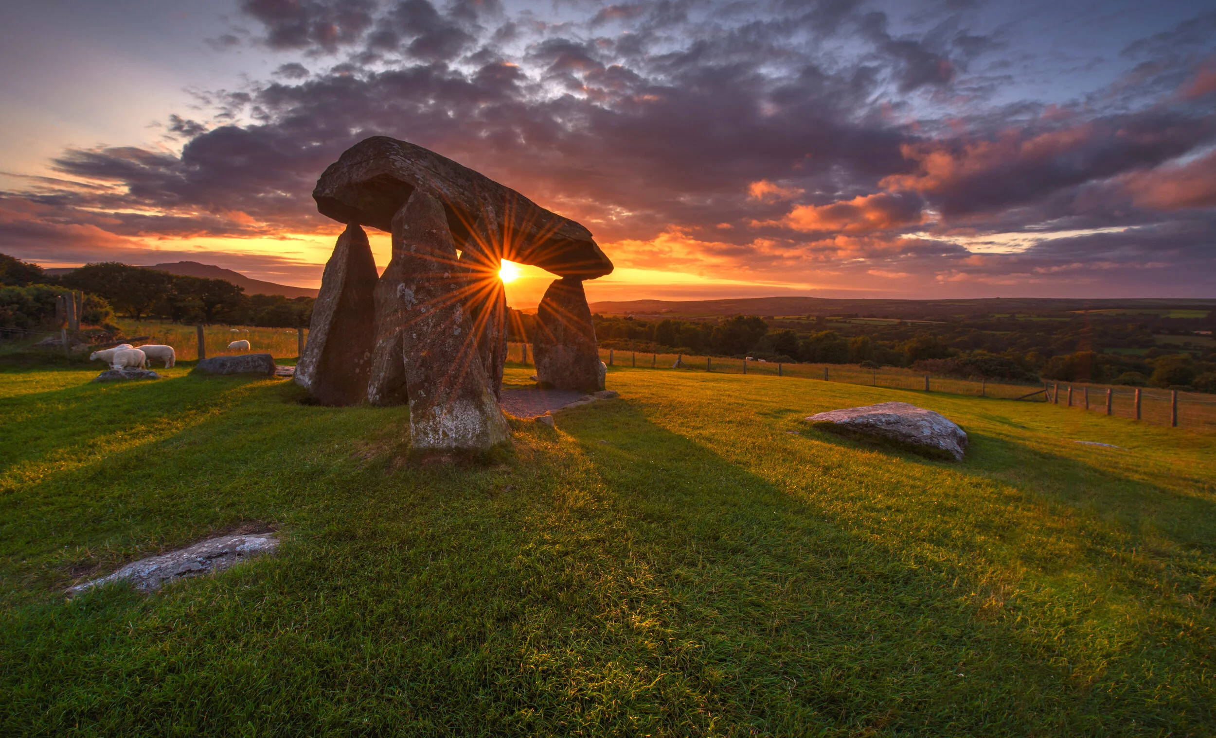
Pentre Ifan Burial Chamber
Wales Equivalent to Stonehenge.
Pentre Ifan is a Neolithic burial chamber with a huge capstone and six uprights. The enormous stones used to make the chamber are all of local igneous rock. The capstone, which is 5m long, 2.4m wide and is estimated to weigh over 16 tons, has been elegantly suspended 2.4m off the ground by three of the stone uprights for over 5,000 years.
The monument dates back to about 3500 BC and On June 20 1884 Pentre Ifan became Wales’s very first scheduled ancient monument. Today Cadw look after it.
Its sense of mystery is heightened by its surroundings and backdrop. Pentre Ifans outline neatly frames the Preseli Hills towering above, source of the famous Pembrokeshire ‘bluestones’ that went into the making of Stonehenge as well as Pentre Ifan itself. The location also offers wonderful views towards Carningli (Mount of Angels), Newport Bay and the Nevern Valley.
The google maps location of the monument can be found here. Limited parking of only approximately 5 parking spaces is located within 300 metres of the monument and access is via a gravel pathway accessible for wheelchairs,.
Newgale
A colossal beach which is perfect for families an water sports lovers.
Newgale’s two miles of gloriously golden sand is one of Pembrokeshire largest and most impressive beaches, No matter what direction you approach it from the initial views as you drop down towards the bay will definitely leave you reaching for the camera.

I hope you found this blog post useful, If you did (or didn’t) let me know in the comments below.
If you did find it helpful, I’d appreciate you giving it a share or giving me a follow on social media, every bit of support goes a long way.
For more travel, & photography inspiration around Wales check out my in-depth guides to each of my favourite regions below.