Waterfall County Circuit | The best waterfall hike in the Brecon Beacons
Contrary to TLC’s advice, we should all go chasing waterfalls and I would argue that South Wales is the perfect place to do so.
Waterfall Country is an area of over a dozen waterfalls between Pontneddfechan and Ystradfellte in the southwestern part of the Brecon Beacons National Park.
The waterfalls here may not be the most tropical or the biggest in the world, but their scale, location, alongside the fact that you can walk behind several of the waterfalls makes them some of the most spectacular you’ll lay eyes on.
Linking three separate waterfall trails (The Elidir, Four Falls, & Sychrhyd Gorge walk) this 9 mile loop passes by 9 waterfalls, two of which you can walk behind.
It is a wonderful woodland walk which encompasses some of the best waterfalls that Wales has to offer. It’s also a trail which is suitable to do all year round & no matter the weather (the wetter it is, the better the waterfall will be).
Sgwd yr Eira
Things to note before tackling this walk
The only toilets and facilities on this loop are located at the waterfall centre in Pontneddfechan. So for this reason I would recommend packing plenty of water and snacks (copious amounts of Haribo) to consume on route.
I’d recommend tackling this hike after a period of heavy rain or during the shoulder seasons. This should mean the waterfalls will be in full flow and the crowds will be a little bit smaller.
Although this isn’t the most technical of trails the paths can get very muddy and slippery underfoot so appropriate and grippy footwear is advised.
Alongside the 10 waterfalls there will be plenty of plunge pools and smaller cascades for you to take a rather chilly dip in. Pack your swimwear and a towel and don’t be afraid to brave the cold water.
Where to Park
As this is a loop there are several places you can park along this hike, that being said I would recommend parking at Dinas Rock car park which is 1km past the village of Pontneddfechan.
The free car park is relatively unknown and away from the main car parks meaning it will be significantly quieter than the main hub in Pontneddfechan, which at times can get outrageously busy.
Starting here and tackling the trail in an anti-clockwise direction will mean that you will finish at the popular Sgwd Gwladus waterfall on the Elidir Trail. From this waterfall you also have the option of extending the walk by one mile and trying to find the elusive Sgwd- yr Eira, a gorgeous 30 ft waterfall hidden away in a steep sided gorge.
The Route
From Dinas rock, follow the path that runs between the car park and the river Mellte (the one that you would have just crossed over) as it climbs steeply alongside Dinas Rock.
It’s quite rocky underfoot and can get slippery in the rain however there is a handrail for assistance.
After half a mile the path will flatten out then split, bear right then take the next right shortly after, following the path as it drops down some step towards the river Synchrhyd and the first waterfall.
Waterfall 1 - Sychryd Falls.
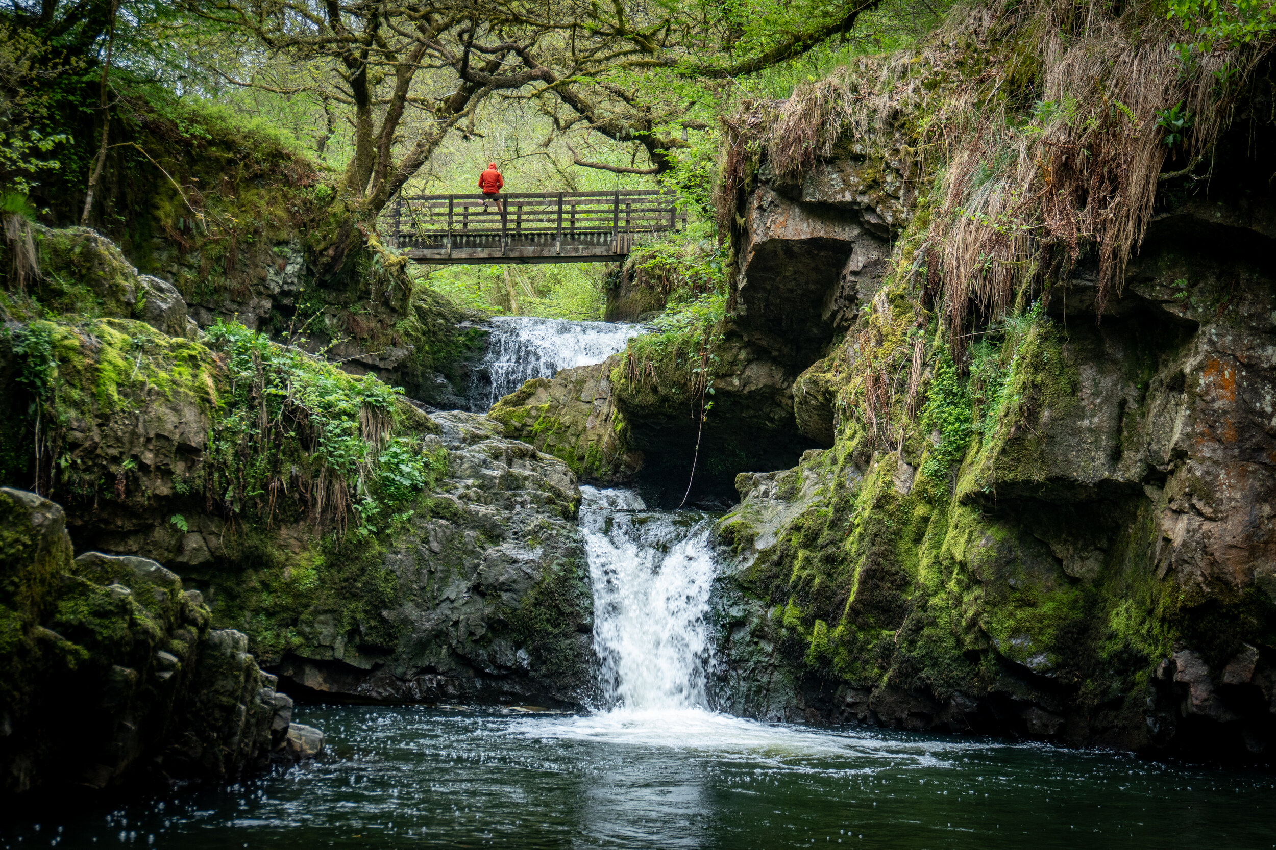
This is a under visited, fairytale-esque waterfall which cascades beneath a wooden footbridge over two drops into a deep gorge.
The bridge itself is set within a steep valley and surrounded by deserted silica mines, some of which you can still explore today, which makes the waterfall feel even more impressive and isolated than it already is.
You can view the waterfall from the bridge above, or if your feeling a little more adventurous can clamber down the side of the bank further down stream and view it from below.
To get back onto the trail, retrace your route back up the steps to the initial fork in the path.
From here turn right and head away from Dinas rock, following the path for 1.5 miles before dropping down to the first and most impressive of the waterfalls on the four falls trail, Sgwd yr Eira.
Synchrhyd falls from below
Waterfall 2 - Sgwd yr Eira
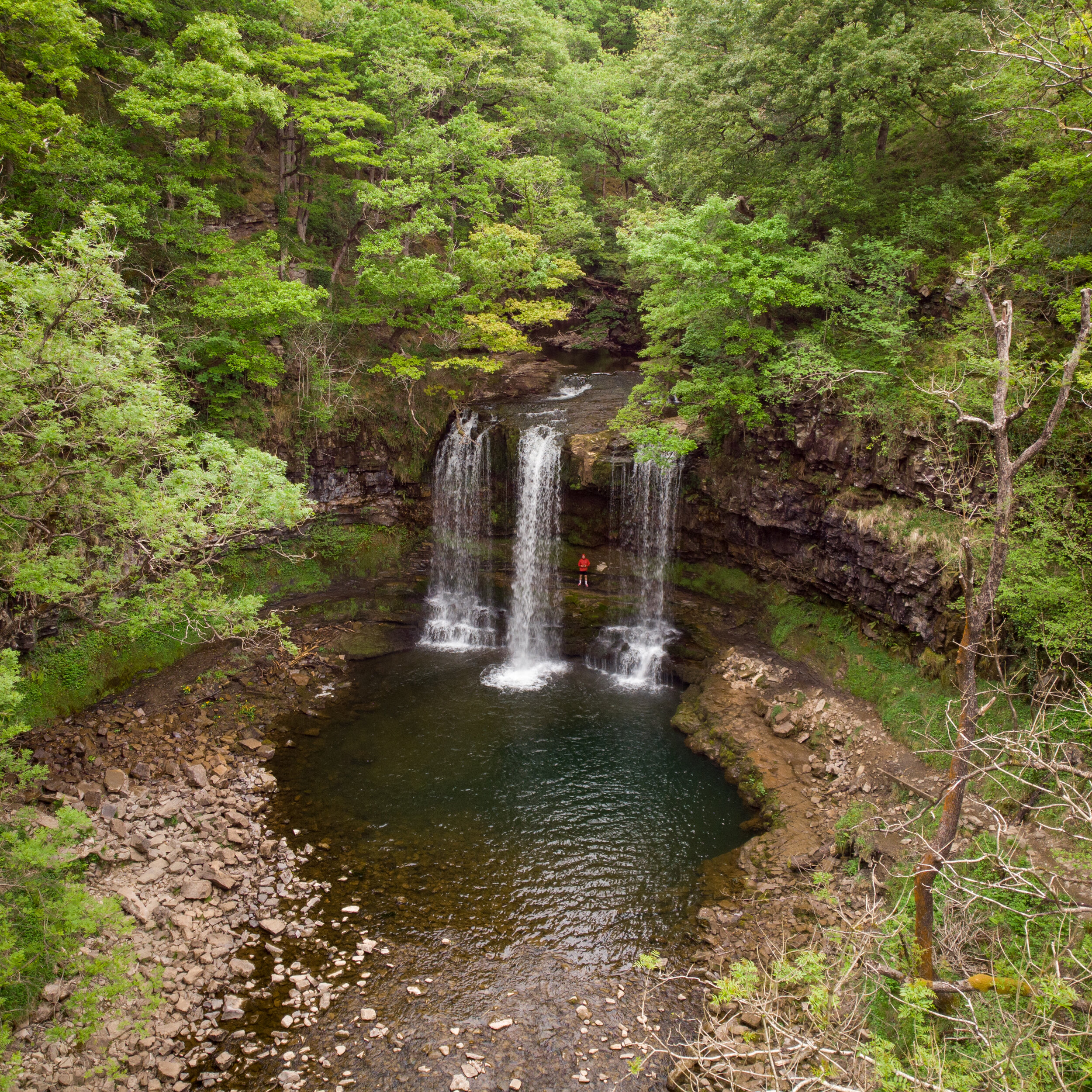
Sgwd yr Eira, or ‘Waterfall of Snow’ is the most impressive of the waterfalls on the four Falls walk, It’s a broad, 50ft waterfall which can resemble a curtain of water after a heavy period of rain.
What makes the waterfall so special is the path which allows you to walk directly behind the waterfall.
If the rainfall has been heavy I’d recommend packing a decent waterproof jacket as you are bound to get wetter than a haddocks bathing costume whilst gawping from behind the curtain of water.
From Sgwd yr Eira, walk behind the waterfall and onto the other side of the river, heading up the 170 B*stard steps before taking a quick breather on the benches which I can only assume have been put there for people to have a cardiac arrest on.
At the top if the steps head left and follow the red trail towards marker #25.
At Marker #25 take the path that descends down to the left into the valley and follow the green markers until you’ll eventually reach Sgwd y Pannwr at marker #30.
Waterfall 3 - Sgwd y Pannwr
The 15m wide Sgwd y Pannwr, which translates to ‘Fall of the woollen washer’, is probably the least impressive on the four falls trail but is still beautiful and worth visiting.
You will initially be stood looking over the waterfall however you are able to climb down a small gorge to view the waterfalls from below.
From Sgwd y Pannwr, follow the river upstream for a couple of hundred yards over some wooden boardwalks and a small rocky section until you reach Sgwd Isaf Clun-Gwyn at marker 32.
Waterfall 4 - Sgwd Isaf Clun-Gwyn
This is my favourite waterfall on the four falls trail. Translated to the ‘lower fall of the white meadows’ this is actually a sequence of waterfalls, separated by several ledges and deep pools which you can actually swim in.
From the path, you’ll initially only be able to see the smaller lower section of waterfalls. However, if you scramble up the bank covered in tree roots to the right of the river you will be able to reach a viewpoint for the upper part of the falls, which gets you up close and personal with the beautiful wide cascade of water.
To prevent you retracing your route and to save over a mile of unnecessary woodland walking, I would recommend taking a path which is no longer signposted that leads above the waterfall and follow the right hand river bank up to the fourth waterfall on the four Falls trail .
The path is well trodden, easy to follow and isn’t at all difficult apart from the initial ascent up the tree covered bank.
On route you might pass a warning sign saying the route is unsafe and to turn back. It honestly isn’t and as long as you stick to the path and keep a close eye on dogs and younger ones you will be perfectly fine.
Follow the green dots from marker 32 to 15
Carry on scrambling up the right-hand side of the Sgwd Isaf Clun-Gwyn waterfall (Marker #32).
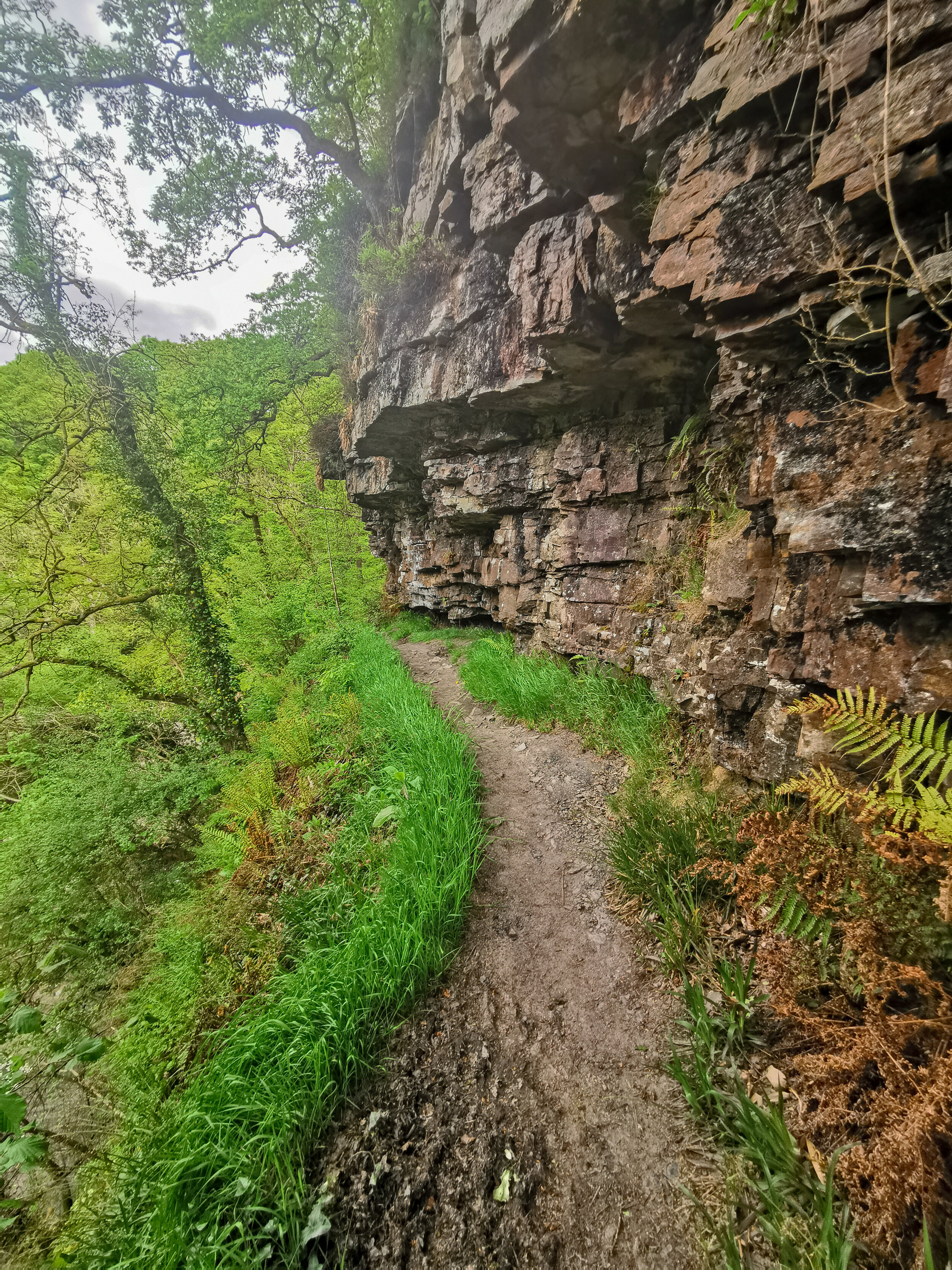
You’ll eventually see a narrow path on your left which runs above the waterfall and below the valley cliff face. This path sticks to the eastern bank (right side) of the river for several hundred yards and will take you upstream to Sgwd Clun-Gwyn at marker #15.
The overhanging cliff face which takes you towards marker 15
Waterfall 5 - Sgwd Clun-Gwyn
This fall translates to the ‘The upper fall of the wide meadow’ and plummets around 40 ft over two ledges.
Your initial of the falls will be front on, from the high river bank situated at marker 15 however if you continue to follow the route you can view the falls from directly above and below.
Head up to marker 16 and turn left, continuing to follow the right hand side of the river upstream for several hundred yards until you eventually reach a wooden footbridge.
Cross the bridge, turn left and follow the river downstream to the other side of Sgwd Clun-Gwyn.
If the water level is low enough you have the option to hike down the side of the waterfall to view it below.
The view of Sgwd Clun-Gwyn from above the falls
From Sgwd Clun-Gwyn follow the gravel path up into the woods, pass through two metal swing gates alongside Clyn Gwyn Bunkhouse, turn left and head up towards the small car park on main road which marks the end of the Four falls trail.
To connect to the Elidir trail turn left and follow the road for half a mile before take the first right turn which branches off the road ( this should be marked by a large stack of logs).
After half a mile of steep, narrow, winding roads, you’ll eventually cross a stone footbridge next to Pont Melin Fach car park which marks the top of the Elidir trail.
The final section - The Elidir Trail
Now the majority of this walk is very simple and not difficult to stray from. From the car park simply follow the trail downstream for 2km sticking to the right of the river Neath.
You will pass numerous cascades alongside three distinct waterfalls; Sgwd Ddwli Uchaf, Sgwd Ddwli Isaf, and Sgwd-y-Bedol before eventually reaching a fork in the river with two footbridges.
Waterfall 6 - Sgwd Ddwli Uchaf
Translated to ‘Upper gushing falls’, This waterfall is wider than it is tall, falling 5 meters in a beautiful curtain-like fashion.
You’ll first approach the waterfall from above and can gaze over the edge. To reach the bottom of the falls you can clamber down the steep bank next to the falls or carry along the path for around 200m and double back on yourself.
From here re-join the path and continue to follow the river downstream on its right hand bank.
Waterfall 7 - Sgwd Ddwli Isaf
Translated to ‘lower gushing Falls’, you will first hear then see this waterfall from high above the path.
To reach the base, continue walking a few hundred meters down the path towards the next waterfall, Sgwd-y-Bedol. Once you reach this waterfall, which is marked by a wooden footbridge, you can walk back up the river towards the waterfall.
I’d recommend trying to walk through the wooded bank on the side of the river as the smooth rocky riverbed is slipperier than a jellied eel and is very treacherous even when it isn’t wet.
Waterfall 8 - Sgwd-y-Bedol
Translated to the Horseshoe Falls, this is a small (2m) but wide set of double falls located next to a small wooden footbridge. Gaxing back upstream you will also be able to see Sgwd Ddwli Isaf in the background.
Cross the footbridge and continue to follow the path downstream, after around 700m you’ll eventually reach a fork in the river marked by two footbridges.
DO NOT cross either of the footbridges, instead, follow the path as it bends round to the right, sticking to the right-hand river bank for around 300m until you reach Sgwd Gwladus.
Waterfall 9 - Sgwd Gwladus
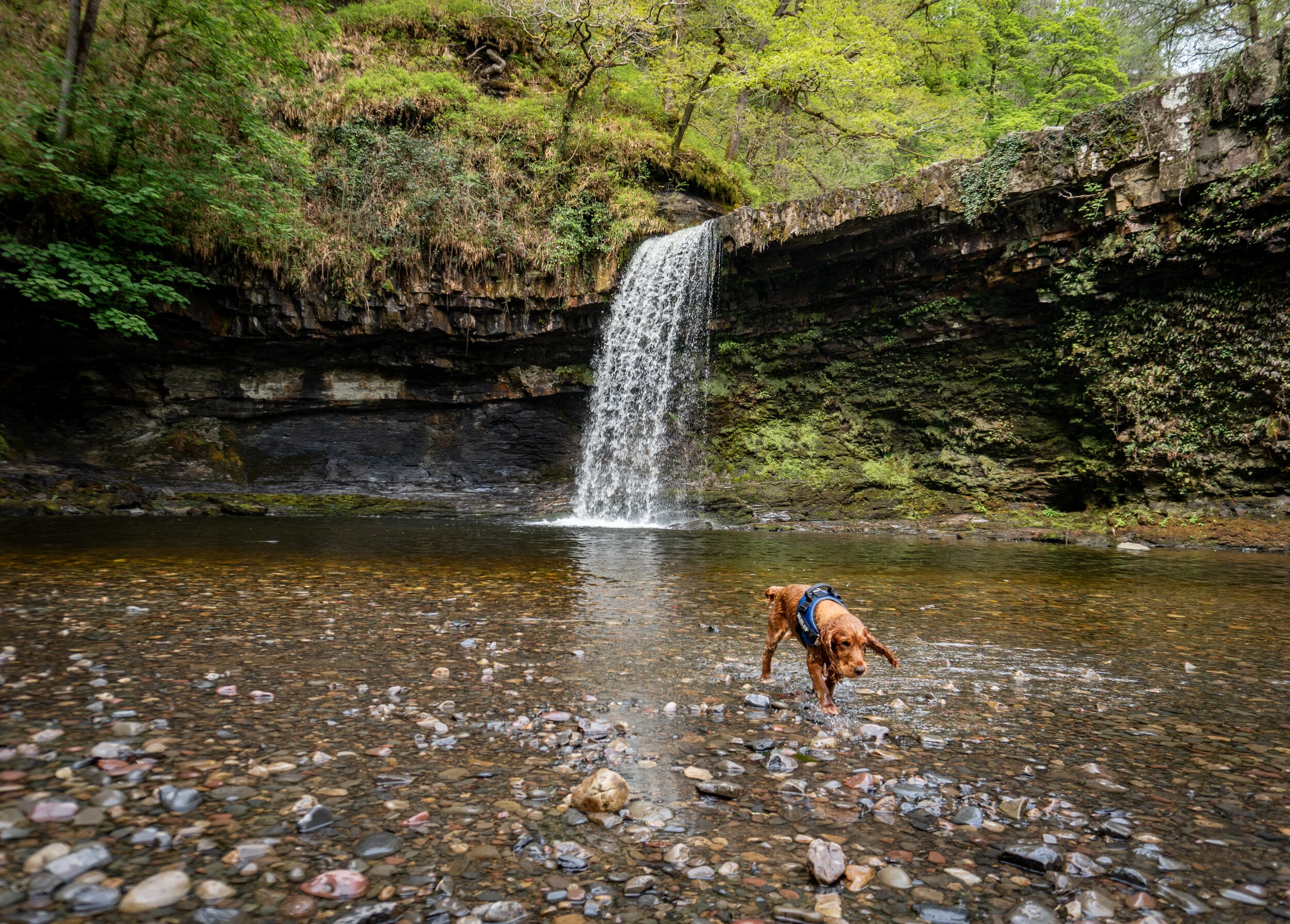
The white lady falls is a spectacular cascade of water which flows 10m over a lip of sandstone. Its also the most popular as it can be easily reached from the main car park in Pontneddfechan via a flat 2km walk.
As well as being able to peer over the edge of the sandstone lip, you are able to walk behind the waterfall but you do run the risk of slipping and falling in (which may actually add to the enjoyment of other peoples walks).
You can also go swimming beneath the falls, however, whatever you don’t jump off the lip into the water. The water depth and what's beneath the surface is constantly changing, with all the fallen trees and deforestation that’s occurred in the area there could easily be a large branch lurking beneath the water.
People have been airlifted away from the site after injuring themselves attempting to tombstone of the edge. Just don’t be that person.
From here you have two options, you can retrace your steps back to the two footbridges, then head 2km downstream on the right hand side of the river Neath back to the village of Pontneddfechan to complete the walk.
Or if you are feeling adventurous you can try and seek out the final waterfall which I have outlined below.
How to reach waterfall 10 - Sgwd Einion Gam
From the sandstone lip of Sgwd Gwladus follow the river upstream, sticking to the right of the bank. There will be a clear path to begin with which ventures slightly away from the river at times.
After about 300 meters as the river bends round to the left you will reach a large overhanging cliff face which will prevent you from continuing on the right-hand side of the river.
This cliff face signals the first river crossing. There is no designated place to cross so you will have to use your own judgement to find the shallowest and safest route which may require walking back downstream.
Upon reaching the other side, either continue to follow the riverbank upstream as it curves around the corner and once again you are forced to cross the river. Again there is no designated place to cross so it’s down to your own judgement.
Once across the river, follow the faint path into the woodland as it ventures slightly away from the river bank. After about 100m the path will begin to rise, continue to follow the precarious goat-like track up and alongside the right-hand bank of the river, taking care on the narrow and sloping sections.
Once navigated and down the other side Sgwd Einion Gam should have come into view. From here continue along the river bank branching slightly off into the forest once more until you reach the set of lower falls.
To access the main falls you will have to scramble up the muddy bank to the right of the lower falls then follow the path down back towards them. You will then be able to walk up to the pool of the main falls on the right-hand side of the river.
Unfortunately, due to the sheer cliff face that surrounds the waterfall, there is no way to access the top of the falls. In order to see the falls from above you would have to take a completely separate route starting from the upper access point.
Hopefully you will have this place to yourself, so take your time here before retracing your steps back past Sgwd Gwaldus towards the two wooden bridges. Cross over the first bridge and walk one mile downstream on the right hand side of the river back to the village of Pontneddfechan. To complete the walk head left and follow the road for 1km back to the car park.
So there we have it, the biggest and best waterfall walk in the Brecon Beacons. If you didn’t fancy a hike of this length or are pushed for time you can tackle the Elidir Trail or Four Falls Trail.
So there we have it, my hike guide to Waun Fach via the Dragons back. Did you find the blog useful and will you be wanting to tackle this hike in the future? Let me know your thoughts in the comments below.
If you did find it helpful, I’d appreciate you giving it a share or giving me a follow on social media, every bit of support goes a long way.
You can find more Welsh hiking inspiration in the following blogs
For more travel, & photography inspiration around Wales check out my in-depth guides to each of my favourite regions below.


