
The 20 best landscape photography locations in the Brecon Beacons National Park
Stretching 45 miles from Carmarthenshire in the west to the English border in the east, the Brecon Beacons national park covers 900 square kilometres of the South Wales landscape.
Established as the third Welsh National Park in 1957, the region can lay claim to being home to some of the finest scenery in Wales and southern Britain. Within the parks diverse landscape you’ll find flat topped mountains undercut by sweeping glacial ridgelines which loom high above intensive cave systems and wonderful waterfalls.

With the majority of the park being located within an hours drive of my home on the Gower, its a region I’m frequently visiting and one that continues to amaze me.
It’s a place of true wonder and one which not only played a huge part in me overcoming the struggles I faced from premature retirement from professional rugby, but inspired me to pick up a camera and venture into the world of landscape photography.
Within this blog I have pulled together a list of some of my favourite, and what I would argue to be, the best photography locations in the Brecon Beacons. I have categorised the locations within the four distinct regions of the National Park and organised them from West to East.
Western Beacons
Central Beacons
Waterfall country
Eastern Beacons
One final thing to note is that I have not explored every inch of this wonderful landscape. Although I have sought out as many of the National parks most beautiful, popular, and photogenic locations, I would have certainly missed out several hidden gems.
There are photo opportunities in all corners of the park and just outside its borders, especially under the right lighting or weather conditions, so get out there and get shooting….

Western Brecon Beacons
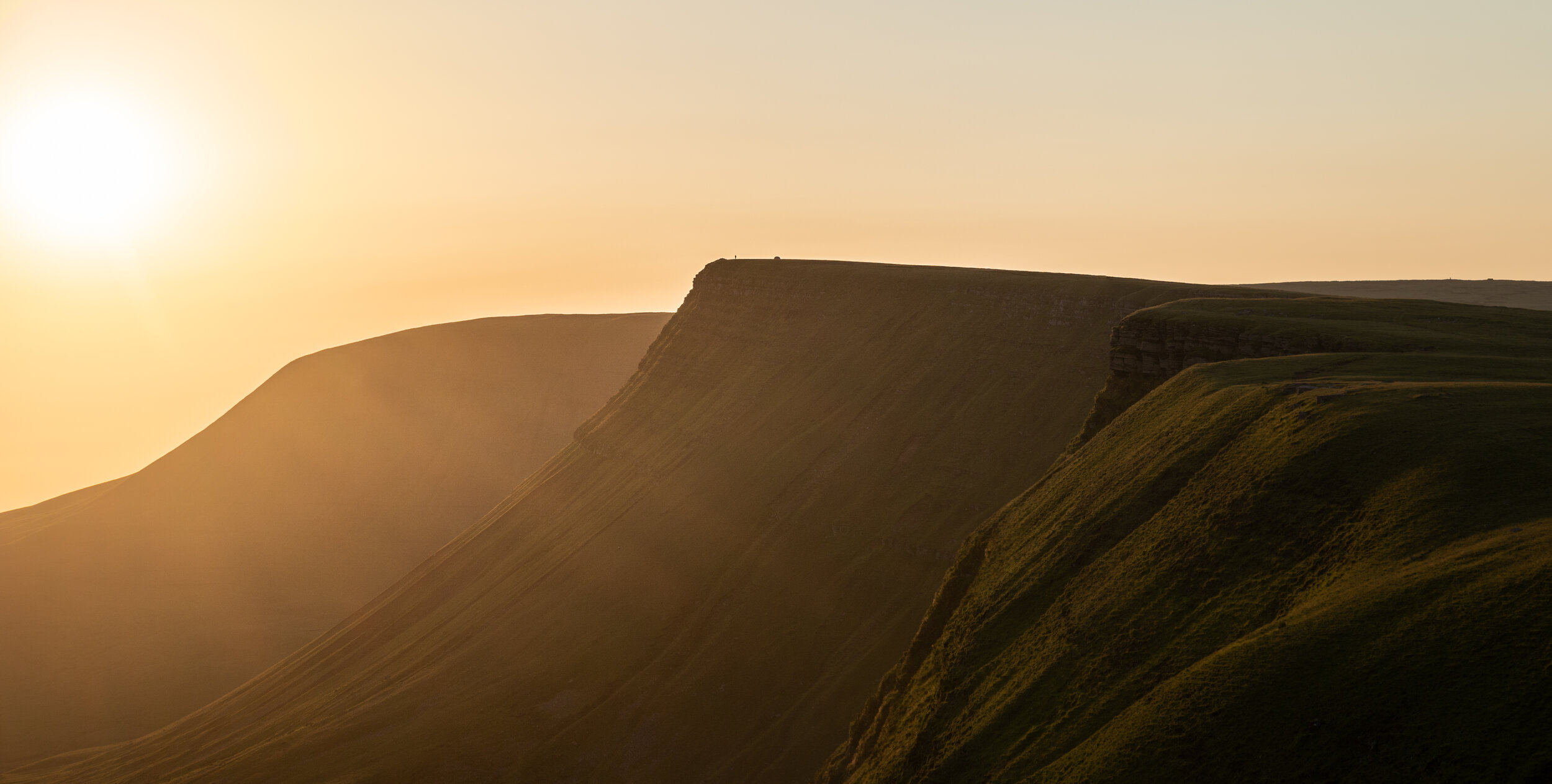
Picws Du
The crown jewel of the Carmarthenshire fans and one of the most dramatic and inspiring peaks in the national park.
At 749m, the prominent snowploughed shaped mountain may not be the highest, but its dramatic sweeping ridgeline and sheer scale make it feel like you’ve been transported to another planet upon gazing upon it.

I can easily say that this is my favourite peak with the Brecon beacons and having experienced it in all four seasons alongside wildcamping on its summit, it holds a special place in my memory.
The peak is best be viewed from either the east on the nearby summit of Waun Lefrith, or the west from the plateau beneath Fan Brycheiniog.
Alternatively you can head up to its peak to get an incredible view of my next location….


The view from the plateau beneath Fan Brycheiniog.
The view from the summit of Waun Lefrith
Llyn-y-Fan Fach
A majestical glacial lake which is situated beneath the precipitous glacial escarpments of the Carmarthenshire fans. This lake is something special, so much so it has been featured in Lonely Planets top 1,000 places on Earth, coming in the top 10 of the lakes category.

When you consider the locations places backdrop, coupled with the fact the prominent Picws du looms directly over it, you can easily see why this place is so special.
Not only are the views magnificent but it’s car park is set deep in the Carmarthenshire countryside, meaning you’ll find a fraction of the crowds here compared to the central beacons.
The best views are from the ridgeline that leads alongside to Waun Lefrith. For more information on where to park and how to reach both Llyn-y-fan Fach and Picws Du, check out my blog post below.

Llyn y Fan Fach from the summit of Waun Lefrith

Llyn y Fan Fach from the summit of Picws Du
Llyn-y-fan Fawr
If Llyn-y-Fan Fach was Serena Williams, then Llyn-y-Fan Fawr is Venus. This bigger but less appreciated glacial lake is located a further 2km east from Llyn-y-Fan Fawr and despite getting a fraction of the spotlight, it has arguably just as impressive views.
Translated to Lake on the big hill, its the source of the river Tawe and sits beneath the highest peak in the Carmarthenshire Fans , Fan Brycheiniog (802m).
The reason it doesn’t receive as much attention is because its a little more difficult to reach, however dont let that put you off visiting.
If you’re visiting Llyn-y-fan Fach you can reach this lake by simply extending your hike. Or if you’re feeling a little more adventurous, you can take up a hike up the Nant-y-Llyn waterfalls to its base.

Carreg Cennen Castle
Situated on the western border of the Brecon Beacons upon a high rocky outcrop overlooking the River Cennen, Carreg Cennen has to be one of the most distinct and impressive castle in Wales.
Built in the 13th century, it has been in a ruinous state for over 500 years and is now under the care of the Welsh government.
Although you can visit the castle for a small fee, the best views of this ancient dwelling are from the surrounding Carmarthenshire hills.
I have driven along the mountain road which runs to its south and captured this epic location at sunset. Even so my images are no where near as impressive as what Astro-photogapher Alyn Wallace has captured…
Central Brecon Beacons
Pen-y-Fan
Standing at 886m in the heart of the Brecon Beacons, Pen-y-fan is the highest mountain in southern Britain and offers magnificent 360 views across the national park.

The view from the summit of Pen-y-Fan towards Cribyn
The mountains distinctive shape and prominent western face can be seen from miles away. However it is the view from the summit which makes the mountain so popular.
Looking east towards Cribyn, the central beacons ribbon like glacial ridgelines weave there way into the distance, creating layers of mountain goodness.
Sunrise is the best time to visit and the quickest route up is via the short two mile path from Pont ar Daf car park on the side of the A470. The fitter folk amongst you will be able to reach its lofty heights in around 45 minutes.
However if you’re not short for time seeking more of a challenge I would recommend tackling the Pen-y-fan horseshoe.
Be warned though, because of its ease of access, Pen y fan is one of, if not the most popular peaks the UK, meaning you will never find yourself alone on the summit even if there was an apocalypse.


Cribyn
Sitting 91m beneath the neighbouring Pen y Fan, Cribyn is pyramidal monolith which protrudes triumphantly from the central Beacons red sandstone ridgeline.

Although slightly shorter than its neighbour, its far from inferior. The angular peak affords spectacular views back towards Pen-y-fan and over the surrounding landscape.
The added bonus of climbing this peak is that you’ll find a fraction of the crowds, and if you’re lucky enough might even get a brief moment of solitude.
I’d recommend heading up here for both sunset or sunrise, with the quickest and easiest way to reach this peak is to walk up the gap from the Neudd car park in the Taf Fechan Forest.
First Light on Cribyn
Looking back towards Pen-y-Fan
Fan-y-Big
The hilariously named Fan-y-Big is the next peak along from Cribyn.
At 717m high isn’t as dramatic as Cribyn or Pen-y-fan but is worthy of the short but steep hike to its summit, even if it is to grab a quick photo of the ‘diving board’, a large flat topped rock which protrudes over the vast glacial hollow below.
The diving board at Fan-y-big
Craig Cwareli
From Fan-y-Big you continue to follow the weaving sandstone ridgeline away from Pen-y-fan, you will shortly reach Craig Cwareli. From here you will be able to look back onto the impressive layers of the central beacons.
Both of these locations form part of the Pen-y-Fan Shire Horseshoe, which is bigger and better version of the original horseshoe. A detailed hike guide to that route can be found below.

The path between Fan-y-Big & Craig Cwareli
Looking back at the Central beacons from Craig Cwareli
Craig Cerrig Gleisiad
The 629m peak of Craig Cerrig Gleisiad may not be the tallest or the most well known the Brecon Beacons, but it arguably has has one of the finest views.

Nicknamed the Eiger of the Beacons due to its extremely steep north face, this dramatic flat topped glacial mountain sits within a nature reserve and offers stupendous views towards the highest mountains in South Wales, Pen-y-fan and Corn Du.
Its status as an unknown gem, combined with the fact that it’s a stones throw away from the start point of Pen-y-Fan, means you’ll probably have this place to yourself.
For more information on how to reach this beautiful peak, check out my hike guide below.


Pontsticill Reservoir
Pontsticill holds back a mammoth 15,400 megalitres of water and was opened in 1927 to supply water to much of the South Wales Valleys.
Sandwiched between the peaks of the Central Brecon Beacons and the town of Merthyr, this large body of water is often driven past by keen hikers without much thought or attention.

The best views of this location are from its southern shoreline. From the mammoth 110ft embankment you can view the plug hole and Valve tower alongside the dramatic backdrop of the central Brecon Beacons.
The best shots are using a drone, however if you dont If you dont own one you can hike up to the hillside to get a more panoramic view.
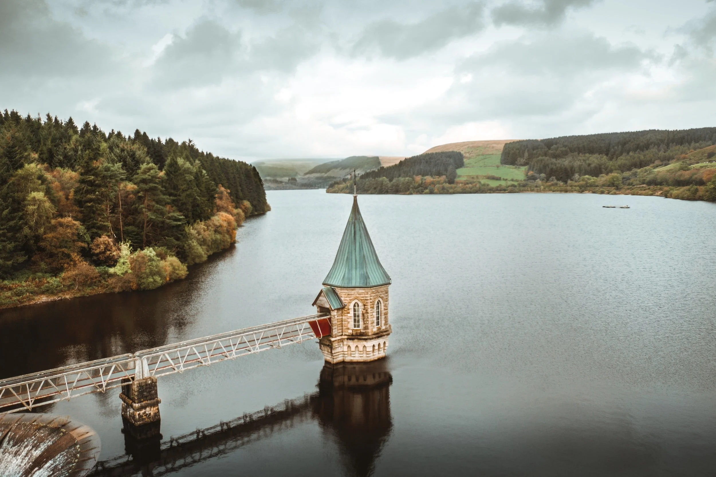
Image by James Ryan on Unsplash
Blaen-y-Glyn Waterfalls
These are a series of beautiful waterfalls situated on the River Caerfanell near Talybont Reservoir.
Often overlooked for the more popular and dramatic falls located within waterfall county, the Blaen-y-Glyn waterfalls are a great stop off point for those who are tackling the popular Pen-y-Fan Horseshoe walk or visiting the reservoirs.
Access between the main waterfalls is via series of quaint woodland trails which links up the two car parks. However if you follow the river upstream you will be treated to some smaller but more atmospheric falls which you will have to yourself.
Finally if you continue all the way upstream you can also reach the wreckage site of the WWII Wellington bomber, details of the hike can be found below.

Waterfall Country
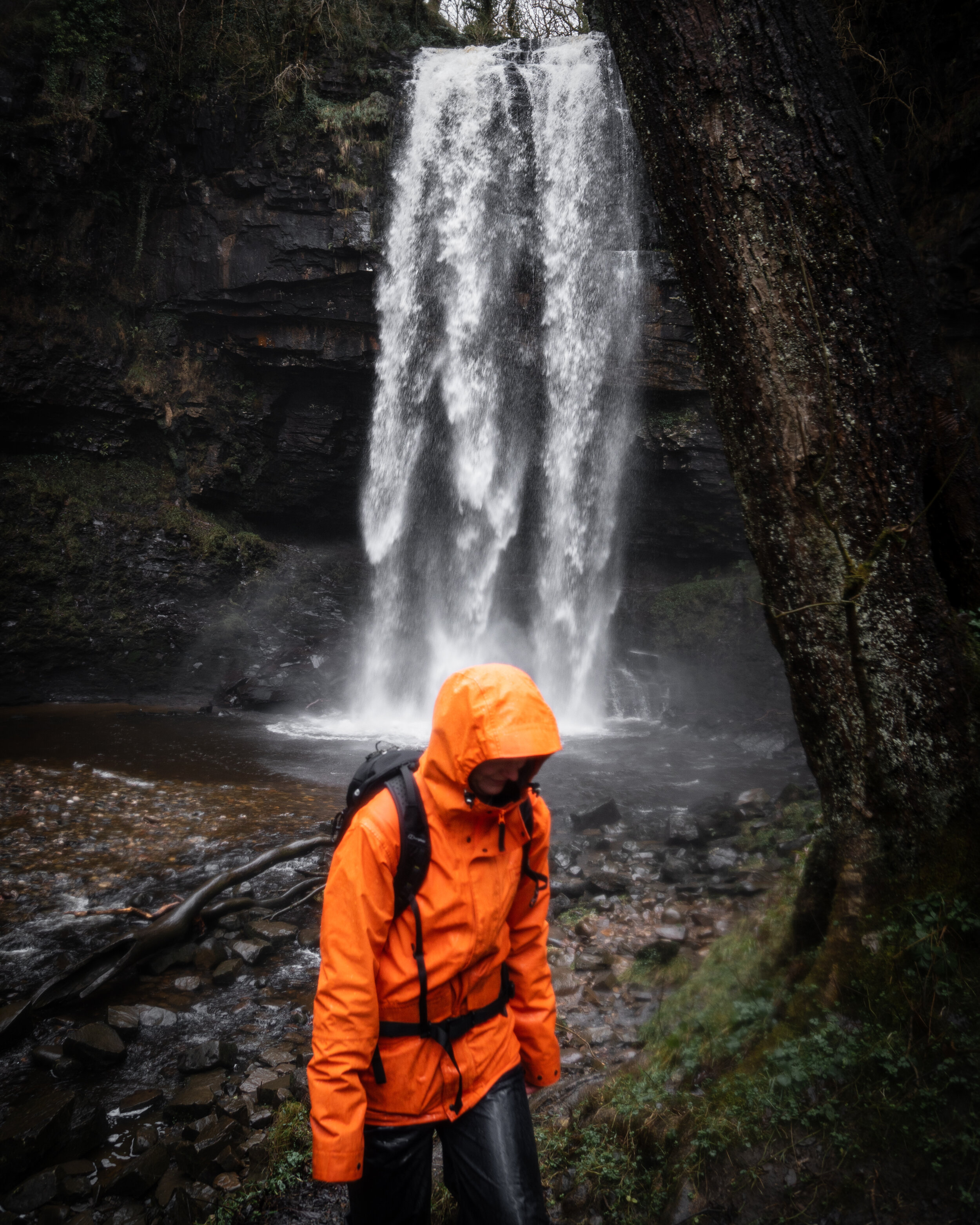
Henrhyd Falls
The crown jewel and the must-visit waterfall in the Brecon Beacons.
At 90ft, it’s the tallest waterfall in South Wales and was used as a filming location for the final scene of Batman: The Dark Knight Rises where it doubled as the entrance for the Batcave.

After picking your jaw up off the floor you have the option to walk directly behind the mighty falls and experience its sheer power first hand. Unfortunately, there is no hidden Batcave behind the waterfall but it is still an incredible experience, just pack some waterproofs as if there’s been heavy rain you’ll get wetter than an otters pocket.
The car park is free and is located a short distance (< 700m meters) from the waterfalls via a well maintained and signposted path.

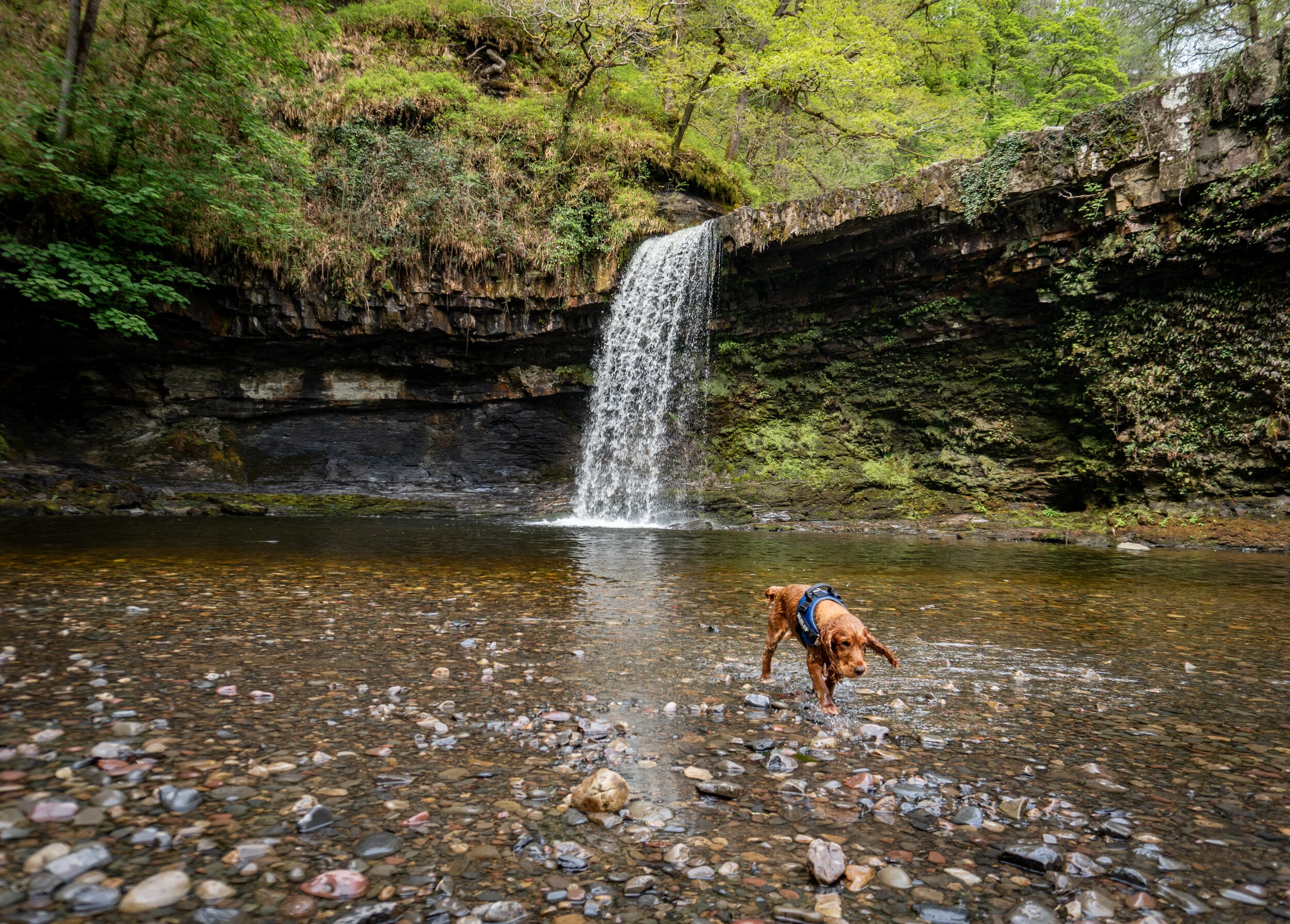
Sgwd yr Eira
The ‘Waterfall of Snow’ is undoubtedly the most popular and impressive waterfall on the four falls trail.
Located within a deep wooded amphitheatre, it plunges around 30ft into a gorgeous emerald pool and resemble a curtain of water after a heavy period of rain.
What makes the waterfall so special is the path which allows you to walk and stand directly behind the curtain of water.
It’s best visited in the wetter winter months after a period of heavy rain. However as it is one of the most popular waterfalls in Wales, it is unlikely that you will have this spot to yourself unless you head there at an unsociable weekday hour.
Sgwd yr Eira is part of the wonderful Four falls trail, a 5km circular loop which route is well maintained, well signposted, and not at all strenuous. For more information on the hike and how to reach the waterfall check out my detailed guide below


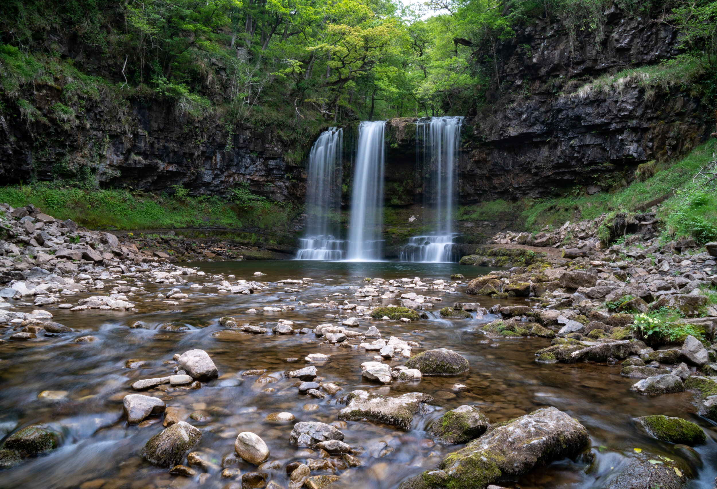
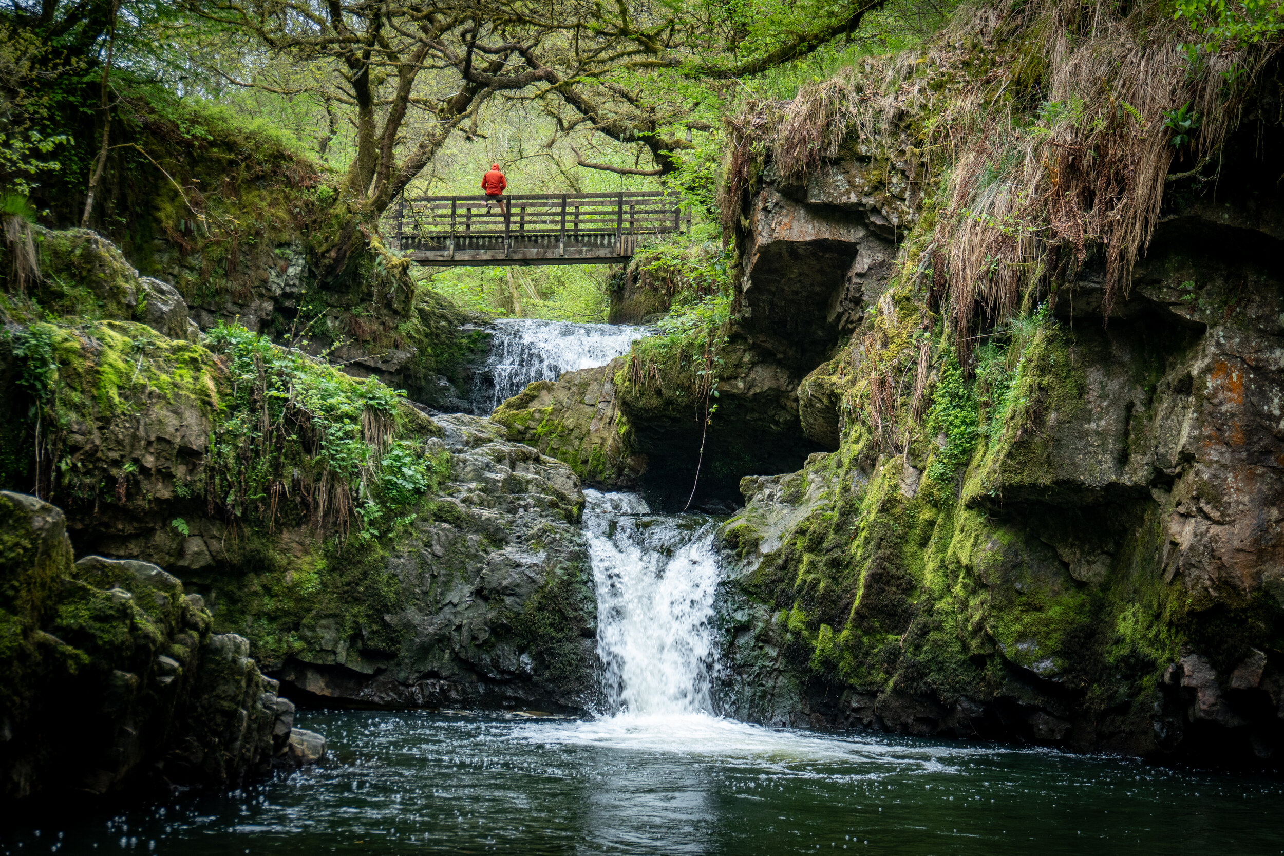
Sgwd Isaf Clun-Gwyn
My favourite waterfall and arguably the most impressive on the four Fall. Translated to the ‘lower fall of the white meadows’ this is actually a sequence of waterfalls, separated by several ledges and deep pools which you can actually swim in.

There are several view point to capture this magnificent set of falls from.
If following the Four falls trail, you’ll initially only be able to see the smaller lower section of waterfalls, however, if you scramble up the bank covered in tree roots to the right of the river you will be able to reach a viewpoint for the upper part of the falls.
However the most impressive view of these falls is from the western side of the riverbank. This is accessed via a short but steep rocky scramble down a series of ledges.
For all the information on how to reach it, check out my guide to the Four Falls trail listed above.

Sgwd Isaf Clun-Gwyn upper viewpoint

The initial viewpoint from the four Falls trail

Sgwd Isaf Clun-Gwyn from the western side of the river bank
Elidir Trial
A majestical woodland walk which passes three beautiful waterfalls, Sgwd Ddwli Uchaf, Sgwd Ddwli Isaf, and Sgwd-y-Bedol alongside a dozen other small cascades on the way to the breath-taking Sgwd Gwladus, a 20ft cascade of water which spills over an overhanging sandstone rock lip.
The entire trail offers dozens of spots to park up the tripod and capture some beautiful images of the woodland wonders. For a detailed guide on the Elidir trail, including the best place to park, check out my blog post below.
Sgwd Gwladus

Sgwd Ddwli Uchaf

Sgwd Ddwli Isaf,
Sgwd Einion Gam
A hidden gem of a waterfall which lies a further half a mile upstream from Sgwd Gwladus and is a bit of a mission to reach.
In fact I actually turned around during the first attempt to find this waterfall as I wasn’t even sure it existed.
In order to get to its base you have to cross the river twice, pass through an unmarked woodland, and navigate an extremely precarious path. The route should only be tackled when water levels are low enough to safely cross the river
For a detailed guide on how to reach the fabled Sgwd Einion Gam and the best place to park, check out my blog post to the Elidir Trail listed above.

Synchryd Falls
Hidden away in the Sychryd gorge is a small secluded set of waterfalls traversed by a quaint wooden footbridge.
This isn’t the biggest or most impressive set of falls in the area but its secluded nature, fairytale-esq surroundings, and lack of other visitors make it a perfect little alternative waterfall to visit.
Be warned, photographing the waterfall from the gorge below will involve a little bit of scrambling and potentially getting your feet wet, so pack some appropriate footwear.
Free parking for this walk is available at Dinas car park. From the car park the waterfalls can be reached via a short 1km walk.
Melincourt Falls
A lesser-known, 80ft high waterfall located just outside of the Brecon Beacons national park boundary near the town of Resolven.
Under-appreciated and under-visited, It’s a beautiful set of waterfalls (there is a smaller waterfall to the right if the main falls) which shares a resemblance to the mighty Henrhyd falls. Unfortunately, you cannot walk behind this waterfall, but its secluded location and lack of visitors certainly make up for this.
The waterfalls are extremely easy to access from the car park. Simply cross the main road and follow the path alongside the eastern bank (right-hand side) of the river upstream for 500m.

Eastern Beacons
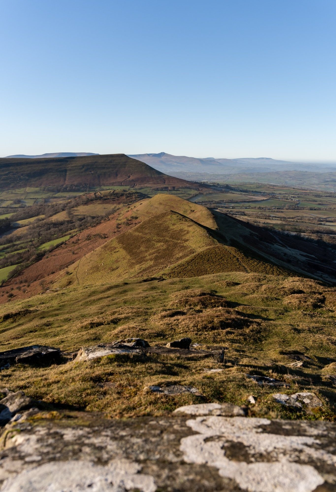
Y Grib ridge (The Dragons Back)
Situated within the black mountains, the Dragons Back ridge snakes and undulates its way up towards the summit of Waun Fach.

The one mile ridgeline is worthy of a visit in itself. However when you throw into the mix Castell Dinas, an Iron Age hillfort which was once the highest castle on mainland Britain, and the distant backdrop of the central beacons. The you have a spectacular piece of topography which is hard not to be impressed by.
The best views of the ridgeline are either from the 450m summit of Castell Dinas, or from the top of the ridge where you will be treated to panoramic views back towards Pen-y-fan.
For more information on where to park and how to reach the ridge, check out my guide below

Llangorse lake
East of Brecon, nestled between the Central Beacons and the Black Mountains, is the largest natural lake in Wales.
This one mile-long freshwater lake not only offers a panoramic mountainous backdrop, but is also a recommended by Visit Wales as a great place to see and photograph the stars.
For the history buffs amongst you, the lake is also home to the only crannog (an ancient artificial island) in England and Wales.
A great spot to visit for both sunrise and sunset, the lake is easily accessible and there’s ample free parking on site.

Photo by Jonny Gios on unsplash @supergios
So there we have it, my favourite 20 landscape photography locations in the Brecon Beacons National park.
If you found the blog useful or have any locations you think I’ve missed, drop us a comment below as I’m always on the look out for new photography spots.
If you did find it helpful, I’d appreciate you giving it a share or giving me a follow on social media, every bit of support goes a long way.
For more travel, & photography inspiration around Wales check out my in-depth guides to each of my favourite regions below.

Find me on Instagram


