
the Ultimate guide to Hiking Pen y Fan

Standing at 886 m, Pen y Fan is the highest point in Bannau Brycheiniog (Brecon Beacons) National park and in Southern Britain.
It is a must do hike if you are visiting the national park, as on a clear day you will also be granted with incredible panoramic views over South Wales.
In this blog I have provided all the details on the main hiking routes up and down Pen y Fan. I have listed the routes in order from easiest to hardest. At the end of the blog I highlight which route is the best, easiest, and most scenic.
You can trust my opinion, as I have hiked every route on this list at least twice, alongside hiking every one of the six main routes (summiting Pen y Fan three times) in five hours.
Overview of the Main Routes
From the West (A470)
Pen y Fan from Pont ar Daf (Out and back)
Pen y Fan from the Storey Arms (Out and back)
A470 Horseshoe
From the North
Pen y Fan via Cwm Llwch Valley (Out and back)
Pen y Fan from Cwm Gwdi via Cefn Cwm Llwch ridge (Out and back)
From the South
You can combine the A470 horseshoe, Cwm Llwch Horseshoe, and the main Horseshoe to create one mega 32km hike which I have coined the Pen-y-Fan six.

What should I wear to hike Pen y fan?
This will be dependant on the weather conditions and season you are hiking in, alongside your own physiology.
Always check the weather forecast for mountain you are hiking. I would recommend using the on the Met Office website and MWIS playing close attention to the following things:
Feels like temperature at the summit
Chance of Rain
Visibility/ Chance of cloud free peaks
Wind speed
These four things will dictate what you wear and carry. While it is only a short hike, it will be colder and windier at the top than at the car park, so it’s better to carry extra layers/waterproofs just incase.
Essentials
Grippy and stable footwear: I recommend Walking boots from Adidas, My favourite being the Freehiker 2 GTX
Layering system: 2-4 layers for your top half and 1-2 for the bottom
Base layer (T-shirt)
Mid layer (hoodie)
Outer shell (Wind breaker or waterproof)
Fourth layer in Winter (Insulated jacket)
A Hiking/ Navigation app with the route downloaded for offline use: I use and recommend OS Maps
Other things
Fluid + snacks
Backpack to carry your spare layers, water, and snacks
Gloves, beanie, and face buff
Head torch (If heading up at sunrise or sunset)
Portable Power bank and charging cable
-
Plan and understand the Route: Make sure you know all the key Information (Distance, Elevation Gain, Route Profile, Terrain, Technical Aspects, Where to park) and that the hike is suitable for you and any other members of your group
Check the weather: Always check the weather forecast for the specific peaks and mountain ranges you are planning on hiking. I use MWIS and Met Office and focus on the four following factors; Feels like temperature, Chance of Rain, Visibility, and Wind speed
Download the route & Use proper hiking app: I use and recommend OS Maps and have the route downloaded for offline use
Let someone know your plans: What route or mountains you are hiking, where you are parking, and roughly how long the hike will take
Give yourself more time than you need
Group Up: If possible, hike with others or consider hiring a local guide for extra safety
Know Your Limits: If the hike is too difficult, technical, you aren’t feeling up for it, or if the weather changes don’t be afraid to stop or change your plans.
Wear and carry the correct kit: see below
-
Base layers
Smartwool Active hoodie - My go for spring, summer, and autumn hiking.
Smartwool Intraknit Thermal Merino Base Layer 1/4 Zip - My choice in winter and colder weather.
Mid LayersColumbia Triple Canyon Hooded Fleece Jacket- Lightweight, warm, comfy, and stretchy. Everything you need from a mid-layer. It also has elasticated thumb loops, a close-fitting hood, and three zip pockets.
Rab Men's Microlight Alpine Down Jacket - Essential for the colder months, wildcamping, and when you are soaking in the views up on the summit.
Outer shell
Columbia Ampli-Dry III Jacket - Waterproof, lightweight, functional, and packs down small. It also has breathable stretch shell fabric with underarm zipped ventilation.
Lower Half
Footwear
Columbia Montrail Trinity Ag II - The comfiest summer hiking and trail running shoes I have ever worn.
Adidas Terrex Free Hiker 2 GTX - My go to for the wetter months of the year
Columbia Men's Facet 75 Equinox – My go to in Winter, incredibly comfortable, waterproof and warm
Socks
Darn Tough Vermont Van Grizzle Boot socks – My winter sock of choice
Backpacks

Pen y Fan from Pont ar Daf
The easiest and shortest route to the summit of Pen y Fan. It is also the busiest and least inspiring route on this list.
Nicknamed the motorway, this follows a stony path up to a saddle before passing around Corn Du to the summit. I’d only recommend this route if you are heading up for sunrise, are a complete beginner hiker, or are in a rush.
Paid Parking is available in Pont Ar Daf car park which is owned by the national trust. It fills up quickly (even at sunrise) especially on weekends.
If you are doing this hike, I’d recommend combing it with the Storey arms to complete the A470 Horseshoe (see below)
Key Hike Info
Hike Type: Out and Back
Difficulty: Moderate
Distance: 6.4km
Elevation Gain: 454m
Estimated Time: 2-3 hours
Terrain: Stony path the entire way
Start Point and Parking: Pont ar Daf Car Park
Pen y Fan from the Storey Arms
The second easiest and shortest route to the summit of Pen y Fan.
Offering a slightly more varied route to the summit than the motorway, it passes up and over the summit of Corn Du before progressing to Pen y Fan. This route has a steep section towards the top of Cribyn which isn’t technical.
Free parking is available in a large layby in front of the Storey Arms. If that is full then you can use the paid parking located several hundred meters down the road at Pont ar Daf Car Park. Both fill up quickly (even at sunrise) especially on weekends.
Key Hike Info
Hike Type: Out and Back
Difficulty: Moderate
Distance: 7.2km
Elevation Gain: 607m
Estimated Time: 2-4 hours
Terrain: Stony path and Gravel
Start Point and Parking: Story Arms Car Park
The view looking north west from Corn Du, the path to the Storey Arms is to the left & Cwm Llwch valley is to the right
A470 Horseshoe
This essentially combines the Storey Arms and Pont ar Daf routes to create a loop.
I would recommend doing this route clockwise ascending via the Storey arms and descending to Pont Ar Daf. It‘s up to you where you park, although this may be dictated by where is free.
Key Hike Info
Hike Type: Loop
Difficulty: Moderate
Distance: 7.5km
Elevation Gain: 539m
Estimated Time: 2-4 hours
Terrain: Stony path and gravel
Start Point and Parking: Story Arms Car Park or Pont ar Daf Car Park.

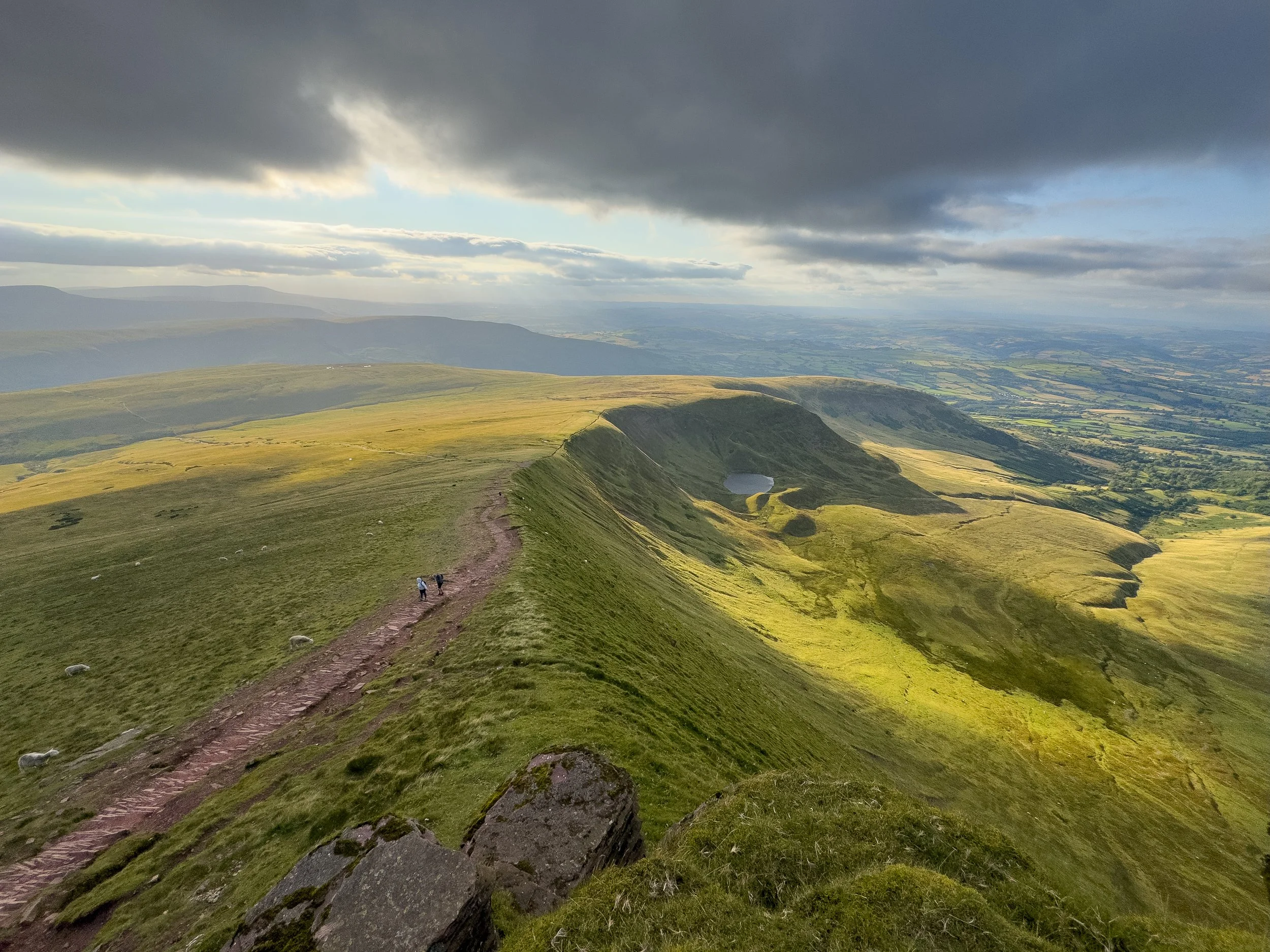
Pen y Fan Via Cwm Llwch Valley
A beautiful and peaceful ascent of Pen y Fan from the north. This takes you up through a sheltered valley, past a lake, and onto a ridgeline which links up with the Storey arms path. From there you pass up and over Corn Du to Pen y Fan.
I’d recommend this route if you are wanting to escape the crowds. If you don’t mind walking a little further, I’d also recommend instead completing the Cwm Llwch horseshoe (see below) as it’s even better.
Parking is available in a rocky and grassy farmers field, it can fill up quickly on weekends and you can also camp here for £5 per person. The roads to the car park are single track and very narrow so take care driving them.
Key Hike Info
Hike Type: Out and Back
Difficulty: Moderate - Hard
Distance: 9km
Elevation Gain: 682m
Estimated Time: 3-5 hours
Terrain: Stony path, Grass, and gravel
Start Point and Parking: Nant Cwm Llwch Car Park


Pen y Fan from Cwm Gwdi via Cefn Cwm Llwch
Another beautiful and peaceful ascent from the north. It’s easily the best out and back route up Pen y Fan. However, if you have more time, I’d recommend the Cwm Llwch Horseshoe (see below).
This follows the Cefn Cwm Llwch Ridgeline and grants incredible views towards Cribyn and across both the eastern and western Brecon Beacons. The sections at the beginning and right at the end are steep, but not technical.
Limited parking is available in Cwm Gwdi National Trust (strangely this isn’t listed on Google). Again, it fills up quickly on weekends so arrive early or in the afternoon. The roads to the car park are single track and very narrow so take care driving them.
Key Hike Info
Hike Type: Out and Back
Difficulty: Moderate
Distance: 7.4km
Elevation Gain: 589m
Estimated Time: 2.5-4 hours
Terrain: Stony path, Grass, and gravel
Start Point and Parking: Cwm Gwdi National Trust

Cwm Llwch Horseshoe
In my opinion the best way up and down Pen y Fan.
I would recommend parking ta Cwm Gwdi and completing this loop anti-clockwise. This way you start with the short section of road walking, ascend via the Cwm Llwch Valley, and descend via the Cefn Cwm Llwch ridgeline.
This is a great choice to do in the afternoon, timing the hike to descend at sunset. For all the information (including parking and maps) check out my Cwm Llwch Horseshoe guide
Key Hike Info
Hike Type: Loop
Difficulty: Moderate
Distance: 11km
Elevation Gain: 700m
Estimated Time: 3-5 hours
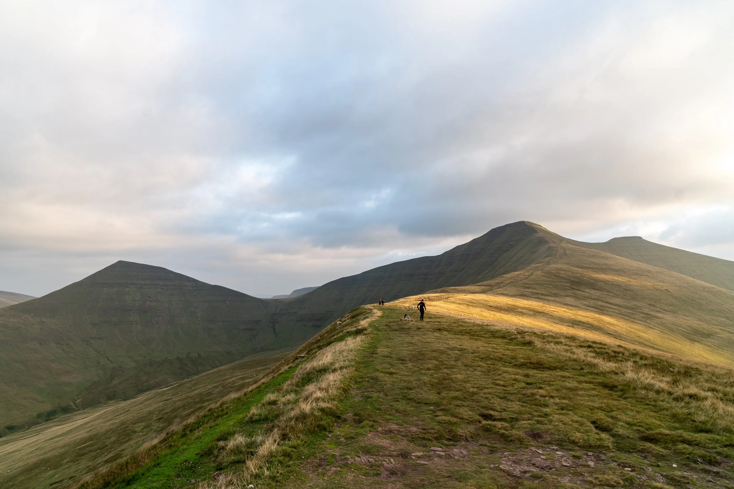
Pen y Fan Horseshoe
I would recommend this route if you are looking to summit multiple peaks alongside Pen y Fan.
This route approaches from the south and also gives you the opportunity to summit the neighbouring peaks of Cribyn and Fan y Big.
I’d recommend hiking it clockwise. This way you can decide if you have the time and energy to summit Fan y Big before descending down the gap back to the car park.
For all the information check out my Pen y Fan Horseshoe Hike Guide
Key Hike Info
Hike Type: Loop
Difficulty: Hard
Distance: 14km
Elevation Gain: 820m
Estimated Time: 4-7 hours

Circuit of the Central Beacons
A longer extension of the Pen y Fan Horseshoe, which I would argue is one of, if not the best day hikes in the Brecon Beacons National Park.
The monster route summits Pen y Fan, Cribyn, Fan y Big, alongside navigating along the flat topped ridgelines of the Central Beacons and passing by a WWII plane wreck and the Blaen y Glyn waterfalls.
For all the info check out my guide: Circuit of the Central Brecon Beacons
Key Hike Info
Hike Type: Loop
Difficulty: Hard
Distance: 20.5km
Elevation Gain: 1,082m
Estimated Time: 6-9 hours


Pen y Fan Six
Are you fit, motivated, and stupid enough to summit Pen y Fan three times in one day? Well this route is for you.
The epic 32km route summits Pen y Fan three times by combining the six main routes up and down the mountain. It’s an epic challenge which involves nearly 1,900m of elevation gain. For all the information check out the guide below:
Pen-y-Fan six Guide
Key Hike Info
Difficulty: Very Hard
Distance: 32km
Elevation Gain: 1,860m
Estimated Time: 8-12 hours
Final Thoughts
If I had to pick a favourite it would be the Cwm Llwch Horseshoe. It’s incredibly scenic, passes a variety of landscapes, and is much quieter than other routes.
If you are looking for the best out and back route then that would be Pen y Fan from Cwm Gwdi via Cefn Cwm Llwch.
If you want to summit multiple peaks (such as Cribyn and Fan y Big) then I would recommend the Pen y Fan Horseshoe or the Circuit of the Central Beacons.
The easiest and shortest route up Pen y Fan is from Pont ar Daf. It is 3.2km one way, climbs steadily to the summit via well-built path, and involves 454 m of elevation gain. Active children can manage it and should take between 45-90 minutes one way.
When is the best time to hike Pen y Fan?
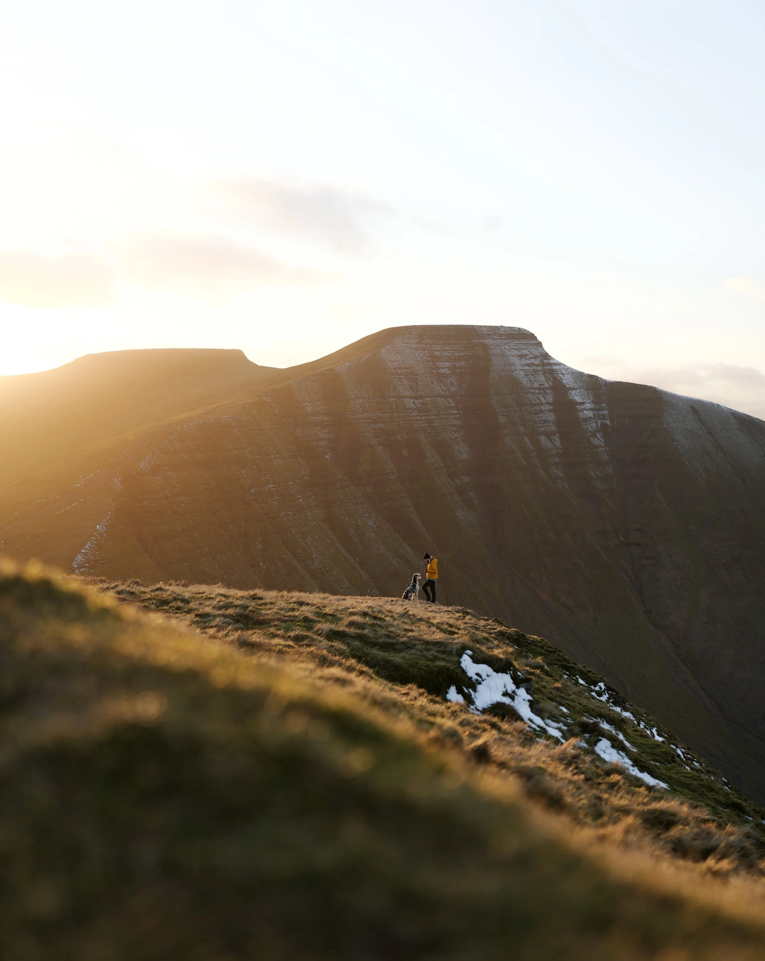
In terms of time of day, sunrise is incredibly beautiful, especially as the sun rises from the east, so you have a view over the ridgelines of the central Beacons. Unfortunately it is incredibly busy at sunrise, with hundreds of people flocking here and the main car park at Pont ar Daf is often full
Because of this I recommend heading up Pen y Fan for sunset, although you dont get as good as a view as sunrise, its still a scenic and beautiful experience. the summit will be significantly quieter (often less than a dozen people) and in my opinion much more enjoyable. Whats more you wont have to get up super early and will easily be able to find a parking space.
If you do head up for sunrise or sunset, pack extra layers and a headtorch.
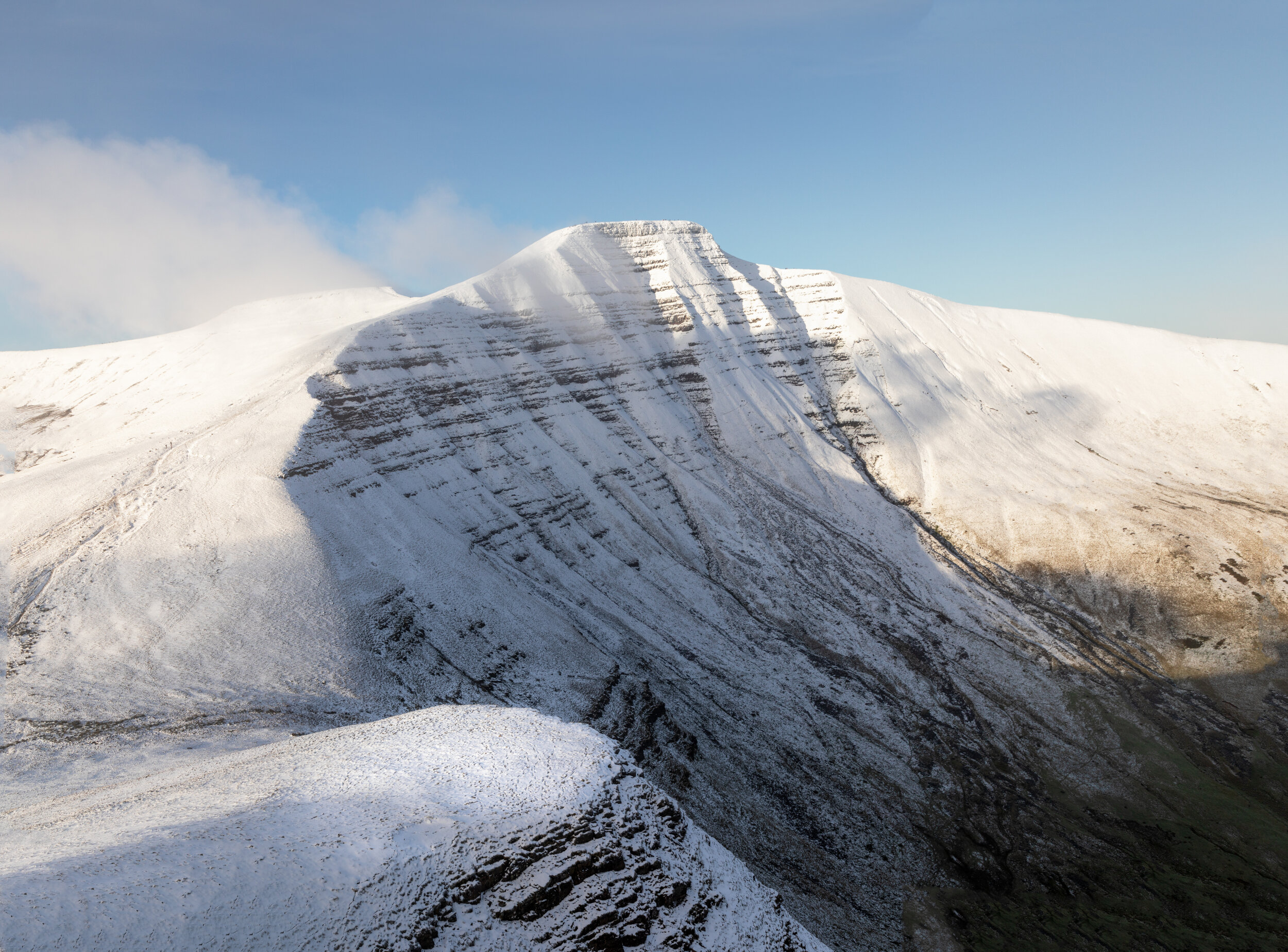
In terms of seasons, Pen y fan is beautiful year round, however is extra special under a blanket of snow., so hikign it in Winter can be a rewarding experience. Always check the weather forecast on MWIS and Met Office, wear and carry the correct clothing and kit, and consider buying Mini Crampons/ Micro spikes.


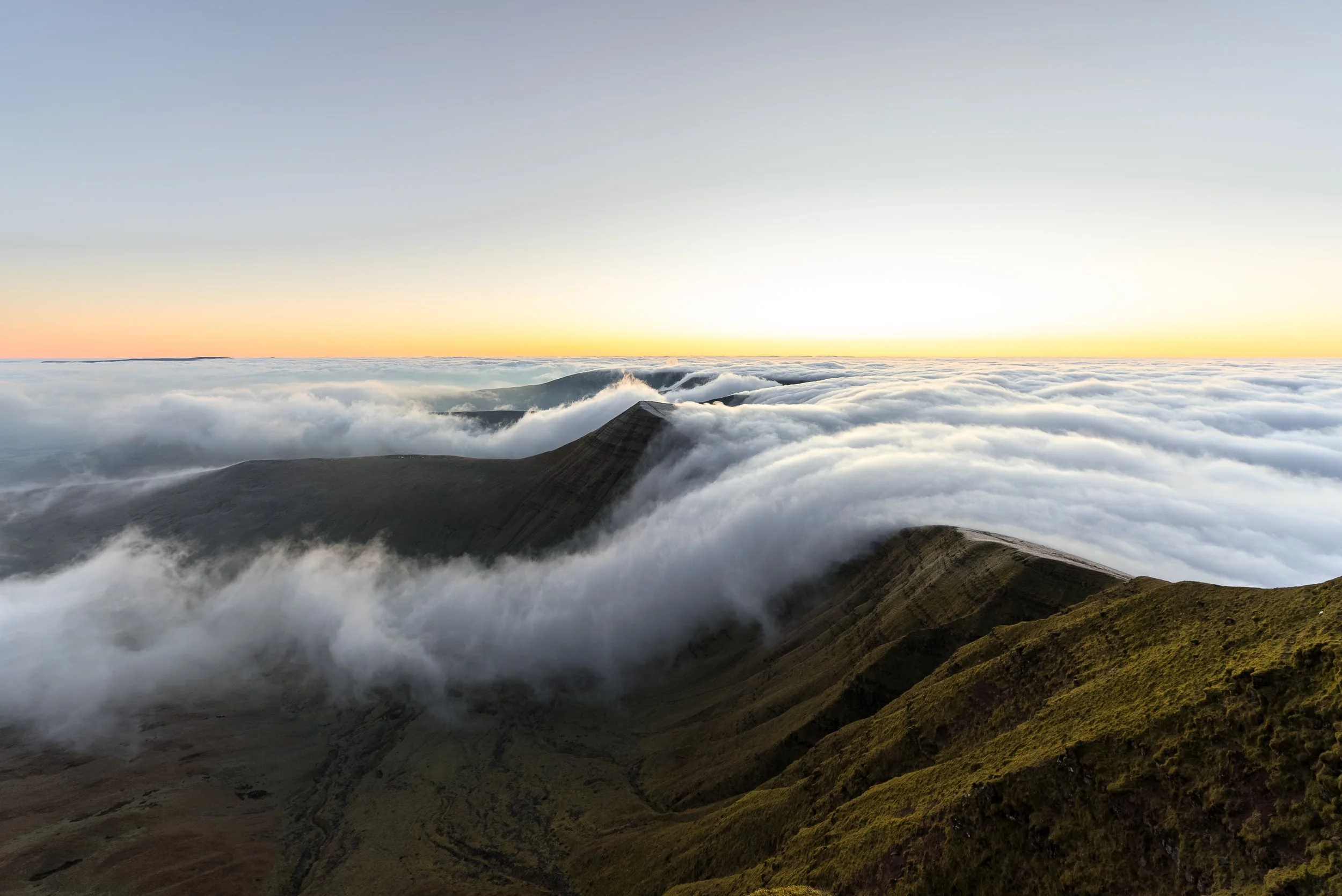
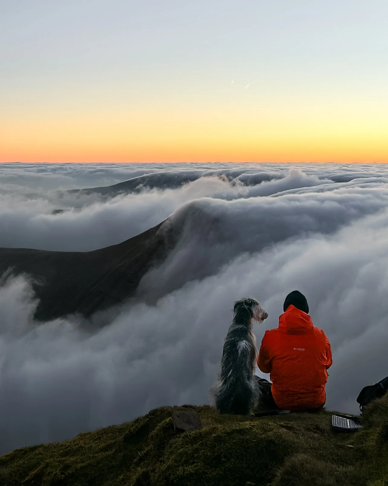
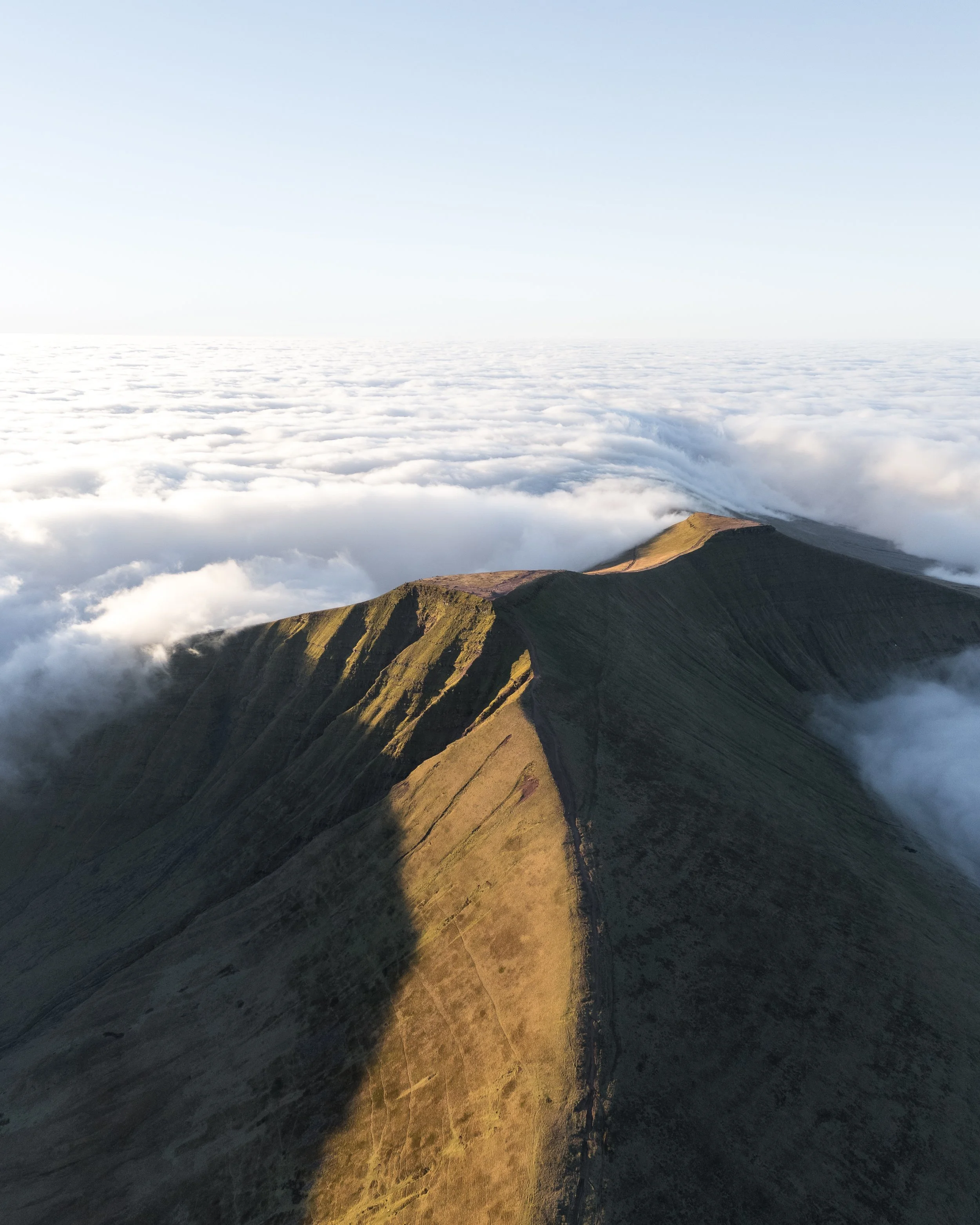
How to see a cloud inversion at Pen y fan?
Cloud inversions are a type of temperature inversion. They occur when the normal temperature gradient is flipped: instead of cold air rising and mixing out, it becomes trapped in valleys beneath a layer of warmer air. This prevents air from circulating normally and often leads to fog or low cloud forming below the warmer layer.
Cloud inversions typically occur during the autumn and winter months, when a period of high pressure (calm, settled weather) is followed by a sharp drop in temperature.
They are most common in the mornings in mountainous or hilly areas after a warm day followed by a cold, clear night. The cold air sinks into valleys, where it traps fog and cloud underneath the warmer air above.
You can’t guarantee when a cloud inversion will happen, but if you understand the conditions that cause them and keep an eye on the weather, you can often predict them. The Met Office and MWIS sometimes show forecasts where the summits are expected to be clear while the valleys are foggy—often a good sign of inversion conditions.
Sunrise is usually the best time to catch an inversion, as the sun often burns off the fog and cloud as the day warms up. However, on occasion, the inversion can last all day!
Pen y Fan is a fantastic place to see a cloud inversion. As the highest peak in South Wales, it often rises above the fog-filled valleys, giving you the best chance of being above the clouds.
Ultimately, it’s about knowing the right conditions, monitoring the weather, and taking a chanc, because if you don’t try your luck, you’ll never know!
Pen y Fan FAQ’s
-
Pen y Fan stands at 886 m (2,907 ft), and is the highest point in Bannau Brycheiniog (Brecon Beacons) National Park and South Wales
-
In my opinion it would be the Cwm Llwch Horseshoe. Its incredibly scenic, passes a variety of landscapes and is much quieter than other routes.
If you are looking for the best out and back route then that would be Pen y Fan from Cwm Gwdi via Cefn Cwm Llwch.
If you want to summit multiple peaks (such as Cribyn and Fan y big) then I would recommend the Pen y Fan Horseshoe or the Circuit of the Central Beacons.
-
That would be Pen y Fan from Pont ar Daf.
It is the shortest route with the least elevation gain. It is 3,2km one way, climbs steadily to the summit via well built path and involves 454 m of elation gain.
Active children can manage it and should take between 45-90 minutes one way.
-
The hardest direct route to the summit of Pen y Fan is from Nant Cwm Llwch, as this has the most elevation gain.
However, the Pen y Fan horseshoe is considered more challenging (14km / 800m of elevation) as it involves summiting other peaks.
If you want a tough day in the hills consider hiking the Circuit of the Central Brecon Beacons (21km / 1,086m of elevation) or the Pen y Fan Six Ways ( 32km, 1,800m Elevation)
-
There are National Trust car parks at Pont ar Daf Car Park and Storey Arms (west), Cwm Gwdi National Trust or Nant Cwm Llwch Car Park (noth); You can also park at the Neuadd car Park in the Taf Fechan Forest for the horseshoe.
-
Allow 3–8 hours, depending on the route and your fitness. The gentle path from Storey Arms or Pont ar Daf is 4 mi/6.5 km involves 454m of elevation gain and takes 3–4 hours; longer circuits via Cwm Llwch or the Horseshoe Ridge take 5–8 hours
-
You can hike Pen y Fan alone. The peak is so busy there will always be another person hiking it. The most popular route is from Pont ar Daf.
-
There are no toilets on the mountain or summit; the only toilets are at Pont‑ar‑Daf car park.
-
Yes, dogs are welcome but must be on a lead and under control.
-
Yes. Pen y Fan is significantly easier than hiking Yr Wyddfa (Snowdon). The routes are musch shorter, less rugged and involve less elevation gain.
-
In dry conditions you can hike up Pen y Fan in trainers, especially if you are hiking from Pont ar Daf However in the wetter conditions and winter I would recommend hiking shoes/boots or trail runners with better grip.
-
Brecon is the nearest town (about six miles north of the main trailheads), offering shops, cafés and accommodation.
Help support my website
I created and run this website in order to help inform, amaze, inspire people (for free) to get outside and explore the adventurous side of the UK.
Although I do run some google ads, I have limited them in order to make your experience on this website far more enjoyable.
If you’d like to support this website, you can use the affiliate links below to book your accommodation or transport. These come at no extra cost to you, but help keep this site running.
Book your vehicle using Discover Cars
Book your accommodation using Booking.com and Sykes Cottages
If you are feeling generous you can also Buy me a Coffee to say thank you, and give me a follow on social media.
Thank you, and if you have any questions, leave them in the comments below or drop me an email!
For more hiking inspiration check out my other guides to the Brecon Beacons below.
Central Brecon Beacons
Cwm Llwch Horseshoe
Western Brecon Beacons
Waterfall Country
Eastern Brecon Beacons
